

|
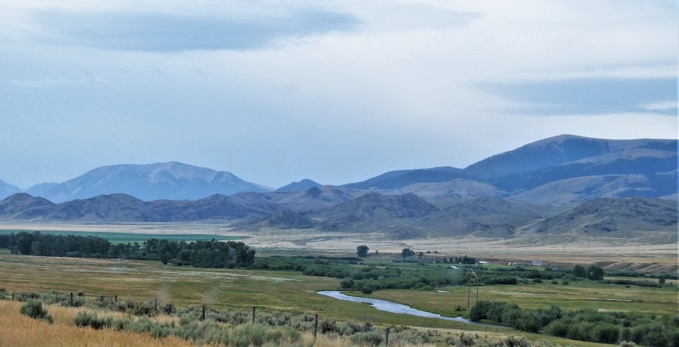
Such a beautiful scene as we continue south. I'm next to the Red Rock River https://www.bigskyfishing.com/rivers/so ... ock-river/. Mountain on the left is Timber Butte and those are the Tendoy Mountains on the right.
Originating at the outlet of Lima Reservoir, the relatively narrow Red Rock River Valley extends for 35 miles in a north by northwest bearing before its river empties into Clark Canyon Reservoir.
Surrounded by impressive natural sights, the valley boasts of lofty summits framing its western horizon… the Lima Peaks, some nearing 11,000 feet, carry the Continental Divide and the Montana/Idaho border, and the Tendoy Mountains have many pinnacles reaching beyond 9,000 feet. The Snowcrest and Blacktail ranges rise from the valley’s eastern side. https://southwestmt.com/specialfeatures ... er-valley/