|
| | | |
| |
|
| Hiking | 11.32 Miles |
2,500 AEG |
| | Hiking | 11.32 Miles | 7 Hrs 47 Mns | | 1.66 mph |
| 2,500 ft AEG | 59 Mns Break | | | |
|
|
| |
| Linked |
|
none
[ show ]
| no linked trail guides |
| Partners |
|
none
[ show ]
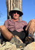
| no partners | | One of the better all-around hikes that I've done. I did this with some relatives a year after my cousin and I were foiled in our attempt to reach the pass by a rapidly melting snow pack that was still deeper than I am tall. The views were tremendous, and we saw plenty of wildlife, but the altitude makes this hike a tough one for a flatlander.
The trail head elevation is about 9,800' so get ready for some serious cardio on every uphill stretch, and we got to experience that almost right away. The initial part of the trail starts at the dam holding back South Lake, then goes uphill through an open forest of lodgepole pine. The mosquitoes weren't too bad, but they were definitely there. We quickly figured out that the best tactic against those awful little vampires was to keep moving because stopping for even a moment meant becoming quite popular with the worst insects on earth.
We reached Bull Lake after about 2 miles and crossed through a marshy area with intense mosquito activity. I vowed to apply more bug juice when we had a packs off break. Long Lake is only a few hundred feet past Bull Lake, and we stopped for a bit to enjoy the breeze that kept the mosquitoes at bay. As we hiked towards the junction with the Ruwau Lake Trail at 2.8 miles in I remembered how this stretch last year was a trail on a very dangerous, rapidly melting ledge of snow and ice hanging over the lake. This year it was a beautiful trail alongside Long Lake with trout all over the place.
The higher we got the better the views we had of the high peaks surrounding the alpine lakes above South Lake. Views of 13'ers Mt. Goode, Mt. Agassiz, Aperture Peak and Cloudripper (best and most appropriate name for a mountain ever) took over for the formidable-looking 12,237' Hurd Peak the higher we went. These mountains look really serious. Hurd Peak is basically a giant ragged fin of granite that stands 1,000 feet due west of Long Lake while 13,525' Cloud Ripper dominates in the east.
Spearhead Lake which was our turnaround point last year was our next stop. There is a sandbar between Spearhead Lake and Long Lake that was teeming with large trout. Unfortunately it was a few hundred feet down a talus scree from the trail, but we could see dozens of fish. The grade had been relatively easy for about 1.5 miles passing Long Lake and Spearhead Lake, but quickly gained a few hundred feet to Saddlerock Lake while the views became more spectacular.
I was enjoying the additional cardio from hiking at high altitude  when I noticed that the trees had disappeared, and there was only a bunch of big, angular rocks as we entered a true alpine environment above Saddlerock Lake. A few of these rocks had yellow-bellied marmots as lonely sentinels along the way, and they're awesome. They're not particularly concerned about you, and just seem to spend their time chilling on top of big rocks while making high-pitched whistling noises. when I noticed that the trees had disappeared, and there was only a bunch of big, angular rocks as we entered a true alpine environment above Saddlerock Lake. A few of these rocks had yellow-bellied marmots as lonely sentinels along the way, and they're awesome. They're not particularly concerned about you, and just seem to spend their time chilling on top of big rocks while making high-pitched whistling noises.
The final 0.8 mile of switchbacks up to the pass from Bishop Lake, the highest lake in the canyon, had a gruesome display of mother nature at her cruelest. Dozens of mule deer died late last fall after slipping on ice in the upper reaches of Bishop Pass, and sliding down the ice field into the boulders below. The winter of 2016-17 was a monster, and there was still a lot of snow left over in the higher passes in the Eastern Sierra in October of 2017. The snow iced over as fall grew longer, and a bunch of deer didn't make it. The bucks all had full racks of antlers. The deer migrate over Bishop Pass from Dusy Valley in Kings Canyon National Park to the Owens Valley every fall. I counted two dozen deer along the trail with many more undoubtedly about to be revealed as the snow continued to melt uphill. The smell was pretty rough, but pretty typical of dead deer. Just a lot of it. Some mammal was crawling around inside of one of the deer gnawing on it. It was probably a large pine marten, but it was definitely a mustelid of some sort. I thought that it was possibly a young wolverine looked broad and bear-like, but this animal was no more than 20 lbs., but it was probably a marten. The exceedingly rare, and possibly extinct, California wolverine has allegedly been spotted in the general vicinity.
The final slog up to the summit had a marmot keeping watch over everything before the trail flattened out for a few hundred yards. We had a pack's off break a ways off of the trail, got a group photo, and headed back down. The trip back was when I took the most pictures because the light just got better and better. The mosquitoes got progressively worse the lower we went with some truly brutal stretches. Like hold-your-breath-bad. That quickened our pace which was a good thing because we were way late.
However, I noticed my first southern foxtail pine on the way down. It was much lower than I expected, and closer to the trail head than the pass. I hope to see every one of the conifers in Michael Kauffmann's book 'Conifers of the Pacific Slope' within a few years. The wildflowers were off the hook. One of the best hikes I've ever done w/ respect to alpine wildflowers. |
|
Wildflowers Observation Substantial
|
|
| _____________________
| | |
|
|
|
 Route Editor


 for leaving her that far behind. I told her not to worry, but "If I was him, I certainly wouldn't leave you behind!" She smiled sweetly, thanked me and started on her way no doubt at a faster pace to put some distance between her and this old weirdo.


