|
| | | Golden Trout Wilderness, CA | | | |
|
|
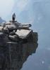
Golden Trout Wilderness, CA
| | |
| |
|
| Backpack | 30.81 Miles |
4,077 AEG |
| | Backpack | 30.81 Miles | 5 Days | | |
| 4,077 ft AEG | | | | |
|
|
| |
| Partners |
|
[ show ]
| partners | | This was a great backpacking trip in the southern Sierra! We altered our plans due to the incredible winter snowfall in the Sierra, moving south and sticking to elevations under 11,000 feet to stay below the snow and avoid dangerous stream crossings.
This trip came together in the few days before we left, and wasn't even mostly finalized until we picked up our permit in Lone Pine. Even then, we made itinerary changes as we went along, which is always nice. I printed maps about an hour before we left, and managed to load 23 tracks into Route Scout with potential options!
Day 1: Horseshoe Meadow to Ramshaw Meadows
10.07 mi (-1210 ft / 998 aeg)
This was a relatively easy first day, despite the heavy pack weight. Trail Pass is a pretty easy climb on a great trail. It's a big drop into Mulkey Meadows, and after a very slight climb, a surprisingly steep descent to Ramshaw. We were all surprised by the amount of hiking in sand, and I was a little annoyed at my decision to leave my gaiters in the car. As it turned out, my shoes filled with sand once too often and I managed to grind a blister on my achilles that would prove to be a nuisance for the rest of the trip. Below 9000 feet, the afternoon sun was warm and we were tired so we found a suitable spot to make camp.
Day 2: Ramshaw Meadows to Tunnel FS Station
5.58 mi (213 ft / 470 aeg)
This was intended to be an easy day and certainly turned out that way. We cut the corner across the northern part of Ramshaw Meadows on a reasonably-well-worn route that isn't marked on maps. The crux was crossing South Fork Kern River, which turned out to be easier than expected, with just a light current and knee-deep water. Upon arriving at the cabin at the old FS station, we saw two tents but no people. We opted to camp at a site a short distance away to avoid the potential popularity of a spot like this on a holiday weekend.
The initial plan to summit the adjacent Kern Peak was quickly shot down and we instead opted for short exploratory hikes around camp. This turned out to be a good idea since a fire south of the area choked the area for a few hours in the afternoon. It would have been tough climbing a mountain with the smoke and visibility dropped to under 5 miles so it wouldn't have been worth it anyway!
Day 3: Tunnel FS Station to Big Whitney Meadow
6.81 mi (833 ft / 1056 aeg)
After Karl got in a 12-mile/3000 foot peak in the morning and 9L and I took a more leisurely trip up Tunnel Meadow, we set out on another easy day with full packs taking us up to our next camp at Big Whitney Meadow. The hike along Golden Trout Creek is beautiful, and a highlight of this loop. Once you emerge from the wooded trail the expansive views in the 1000 acre Big Whitney Meadow are stunning. You aren't allowed to camp in the meadow so it was surprisingly difficult to find a good campsite with easy access to water. Once we found a spot and gathered firewood, I set out to explore the meadow. As was the case the previous day, smoke from the fire south of us moved in for a few hours in the afternoon, obscuring some of the views.
Day 4: Day hike to Rocky Basin Lakes
Separate triplog.
Day 5: Big Whitney Meadow to Horseshoe Meadow
8.34 mi (1431 ft / 1532 aeg)
With the long drive back to Phoenix ahead of us, we kicked off Independence Day with a 7am start. The first two miles across Big Whitney Meadow required several very cold stream crossings and a section of trail that was marshy and wet before gaining elevation and drying out. The next two miles feature immaculate trail that switchbacks and climbs 1200 feet to Cottonwood Pass. From here we rocketed downhill the last four miles to the truck, finishing well ahead of plan in just 3 hrs and 20 min. After a mid-morning celebratory trailhead beer we were on our way back home.
Thanks to 9L for planning and Karl for driving! As a tortoise I know often says, just like HAZ, you rock!  |
|
Wildflowers Observation Isolated
|
|
  |
Stokes Stringer |
Medium flow |
Medium flow |
| | | Good winter runoff all the way to the top of Cottonwood Pass. All crossings required getting wet. | | _____________________
| I'm not sure what my spirit animal is, but I'm confident it has rabies. |
| | |
|
|
|
 Route Editor