username
X
password
register
for free!
help
ArticlesGuidesRoutes
 
Photosets
 
 Comments
triplogs   photosets   labels comments more
Madera Peak - 6 members in 12 triplogs have rated this an average 3.7 ( 1 to 5 best )
12 triplogs
login for filter options
Apr 27 2024
avatar

 Guides 1
 Routes 168
 Photos 384
 Triplogs 161

32 male
 Joined Aug 13 2017
 Tempe
Madera PeakGlobe, AZ
Globe, AZ
Hiking avatar Apr 27 2024
clayncallawayTriplogs 161
Hiking5.76 Miles 2,477 AEG
Hiking5.76 Miles   3 Hrs   23 Mns   1.83 mph
2,477 ft AEG      14 Mns Break
 
1st trip
Linked   none no linked trail guides
Partners none no partners
A couple years ago me and a buddy of mine tried to get out to Madera Peak and ended up not making it to the trailhead. The road looked crazy and we turned around. An important note on this one. Follow the guide posted driving instructions closely. If you see a road going up the mountain and just try it on a whim you may regret it. If you take directions from Google you will regret it. Miami is basically a labyrinth of bad roads. Choose wisely.

I parked the truck where there was some space. I didn't see any signs. The hike itself follows a road the majority of the time and is quite steep. It gets steeper near the top by the tower. From there it is just a little push to the actual peak. This is a stout little hike if you want to be among the trees and not drive too far out of Phoenix.
_____________________
 
Jun 03 2023
avatar

 Guides 99
 Routes 1,485
 Photos 16,072
 Triplogs 1,375

male
 Joined Jan 07 2017
 Fountain Hills,
3 Arizona Fire Lookouts, AZ 
3 Arizona Fire Lookouts, AZ
 
Hiking avatar Jun 03 2023
DixieFlyerTriplogs 1,375
Hiking3.73 Miles 817 AEG
Hiking3.73 Miles   1 Hour   32 Mns   2.51 mph
817 ft AEG      3 Mns Break
 
no photosets
Linked   linked  
Partners none no partners
Route Scout Route Recorded  on Route Scout | Pop | Map | Popup | MapDEX
This day was spent doing 3 short hikes, with each hike going to an Arizona Fire Lookout site:
1) Madera Peak (elevation of 6,647 feet with prominence of 407 feet)
2) Faught Ridge LO (elevation of 7,021 feet with zero prominence)
3) McKay's Peak (elevation of 8,176 feet and prominence of 816 feet)

Madera Peak
This peak is in the Pinal Mountains. I came in from the north side, and drove in on FR 580 as far as I could go, just before a locked gate.

I walked up the road to the peak. The last stretch was on a spur road that was overgrown and had some deadfall across it. I was wishing that I had on long pants instead of shorts.

All that is left of the lookout is some concrete footings that once supported a 40 foot tall wood lookout tower that was constructed in the 1930's.

Faught Ridge LO
It was the third of June, another sleepy, dusty Delta day
I was out choppin' cotton and my brother was balin' hay
...
And then she said "I got some news this mornin' from ChoctawFaught Ridge"
"Today Billy Joe MacAllister jumped off the Tallahatchie Bridge"


Since today was June 3rd, what else could I do but hike on Faught Ridge???

The Faught Ridge LO no longer exists, but a cabin remains at the site. Here is what the surveyors data sheet says about the former lookout tower: THE FAUGHT RIDGE INDIAN SERVICE LOOKOUT TOWER IS AN 8-FOOT
BY 8-FOOT GALVANIZED STEEL CABIN SUPPORTED BY A 4-LEGGED GALVANIZED STEEL STRUCTURE, 120 FEET IN OVERALL HEIGHT.


McKay's Peak
McKay's Peak is over by Hawley Lake in the White Mountains.

I drove and parked at a locked gate below the tower, and walked the rest of the way.

The tower is there and I believe that it is still in active service. The tower is 32 feet tall and has a 14X14 foot wooden cab on it. It was built in 1932, replacing a wooden tower, and the original ground house remains on the site.

No one was at the tower when I was there, and the gate on the chain link fence was locked. However, there was a gap in the fence on the side, and I was able to squeeze through the gap and climb the stairs on the tower up to the locked trap door. This provided some pretty nice views!

Distance and elevation gain for these 3 hikes is below. Stats above are the sum of the 3.
Madera Peak: 1.28 miles with 428 feet of AEG
Faught Ridge LO: 1.52 miles with 116 feet of AEG
McKay's Peak: 0.93 miles with 273 feet of AEG
_____________________
Civilization is a nice place to visit but I wouldn't want to live there
 
Dec 09 2020
avatar

 Guides 1
 Routes 2
 Photos 472
 Triplogs 38

female
 Joined Apr 27 2015
 cave creek, az
Madera PeakGlobe, AZ
Globe, AZ
Hiking avatar Dec 09 2020
thirstylizardTriplogs 38
Hiking4.00 Miles
Hiking4.00 Miles
 no routes
1st trip
Linked   none no linked trail guides
Partners none no partners
Madera Peak was the goal and while I planned to hike up and around to it - my approach used the more road hike option—taking FR 580A to the locked gate

Tree fall made for an earlier trailhead than I anticipated which then made for an elegant hike to the towers and peak. I was actually glad as the longer route made for a nicer workout and engagement. Obstacles sometimes make for better opportunities.

White-tailed deer, Abert’s squirrel and woodpeckers for company, this hike up the road was sublime. Other boot prints leading out from the downed tree advised that others had encountered the same obstacle on the drive.

Views were lovely, with rain falling today, I expect a clear view all to the way to the Sierra Estrellas could be had.

Nice alternative for people looking for a slightly easier hike to the top. Or in my case, sprained ankle therapy pace.
_____________________
  1 archive
May 30 2016
avatar

 Guides 170
 Routes 148
 Photos 5,914
 Triplogs 2,097

48 male
 Joined Apr 12 2004
 Tucson, AZ
Madera PeakGlobe, AZ
Globe, AZ
Hiking avatar May 30 2016
PrestonSandsTriplogs 2,097
Hiking6.60 Miles 1,706 AEG
Hiking6.60 Miles
1,706 ft AEG
 
Linked   none no linked trail guides
Partners none no partners
Mostly this was a day of off trail exploring in the Pinal Mountains, with Madera Peak as a finale. I had been wanting to explore upper Pinto Creek for a number of years, and I decided to go for it. From my campsite on FR 580, south of Madera Peak, I drove closer to Madera Peak, where I parked, and then set off on foot, dropping off the western slope of the Pinals. I made my way off trail across steep, forested slopes into the headwaters of Pinto Creek, which I then began to follow. Saw a few small, collapsed mines along the way as I made my way down Pinto Creek. Upper Pinto Spring box is dry and buried under fallen trees. Off trail bush-whacking along the creek eventually became an off road vehicle path, which led past the remains of an abandoned ranch site that the topo shows as the "Little Ranch". Only some wild vines and decaying fences to be seen there. A few steep and nasty hills later, I came to the Ioli and Madera Ranch gates (both active and occupied), where I turned around to make my way back up. The return was toasty, being late May, and I was thankful for a small patch of water in Pinto Creek, where I soaked my shirt. Once I reached the cool pines of the Pinal Crest, I followed FR 580 up to the top of Madera Peak, where I signed in next to my summit register entry from 2007. I walked back to my truck and then headed down to Globe to check out Old Dominion Mine Park. An enjoyable day!

There is nothing for me to really recommend about upper Pinto Creek, unless you are just curious. I enjoyed satisfying my curiosity, though.
_____________________
"…you never know when a hike might break out" -Jim Gaffigan
 
Feb 13 2015
avatar

 Routes 6
 Triplogs 2

30 male
 Joined Apr 15 2011
 Praha, ČR
Madera PeakGlobe, AZ
Globe, AZ
Hiking avatar Feb 13 2015
andrewrankineTriplogs 2
Hiking5.50 Miles 2,299 AEG
Hiking5.50 Miles
2,299 ft AEG
 
no photosets
1st trip
Linked   none no linked trail guides
Partners none no partners
Made it to the trailhead at the gate in my prius. The gate was not locked, but I parked there and hiked the dirt road to the summit. 8.6 km roundtrip and 775 m gain.
_____________________
 
Oct 04 2014
avatar

 Guides 6
 Routes 13
 Photos 1,377
 Triplogs 184

41 male
 Joined Mar 29 2007
 Reno, NV
Madera PeakGlobe, AZ
Globe, AZ
Hiking avatar Oct 04 2014
sbkelleyTriplogs 184
Hiking6.50 Miles 3,110 AEG
Hiking6.50 Miles
3,110 ft AEG
 no routes
1st trip
Linked   none no linked trail guides
Partners none no partners
I'm a little surprised this one doesn't get more traffic, but no complaints. Great workout and great views, for sure! No warm-up at all involved, and the "road" was rocky and had taken a beating after the recent rains. The steep push and sweat equity makes the summit brew taste that much better, though. We still had some time on the day, so we went for some bonus mileage and dropped off of Madera to the west, then made our way along the ridgeline to Peak 6517'. Only three parties had signed in since 1999, and the paper in the summit register was a bit charred around the edges from a fire, but not a terribly recent one, from the looks of things.
 Fauna
 Fauna [ checklist ]
[ checklist ]  Tarantula
_____________________
 
Aug 26 2012
avatar

 Routes 596
 Photos 9,604
 Triplogs 2,400

58 male
 Joined Jan 30 2011
 Chandler, AZ
Madera PeakGlobe, AZ
Globe, AZ
Hiking avatar Aug 26 2012
JuanJaimeiiiTriplogs 2,400
Hiking5.00 Miles 2,154 AEG
Hiking5.00 Miles   1 Hour   50 Mns   2.73 mph
2,154 ft AEG
 no routes
1st trip
Linked   none no linked trail guides
Partners none no partners
Preston wasn't kidding in his trail description. This sucker is steep. I actually drove the Cherokee halfway up the hill prehike which was fun. There are a couple spots that were a little tricky but overall it did quite well.

The hike has fantastic birdseye views of the mines and beyond. Very enjoyable but watch that footing on the way down and be prepared for a solid workout on the way up.
_____________________
 
Oct 15 2011
avatar

 Photos 15
 Triplogs 2

40 male
 Joined Oct 15 2011
 Mesa, AZ
Madera PeakGlobe, AZ
Globe, AZ
Hiking avatar Oct 15 2011
shemmelg05Triplogs 2
Hiking5.50 Miles 2,299 AEG
Hiking5.50 Miles   2 Hrs      2.75 mph
2,299 ft AEG
 no routesno photosets
1st trip
Linked   none no linked trail guides
Partners none no partners
Took the road that showed the closest way to get in on the navigation map, which was a mistake because it turned out to be pretty much a 4-wheeler trail. However, if I would have had a 4 wheel drive vehicle, I probably would have made it all the way thru that trail to the road. We reached a spot where my truck couldn't make it up anymore and just started walking from there. We were a little over a mile away from the trailhead. Once we actually got started on the real hike, there were lots of nice views of Miami, the mines, and the surrounding mountains. We ended up taking a right at the first fork, and that follows that first mountain around to the west and ends up in a field in between all the other peaks in the area. It was probably about a mile or so into the field. We got there, took a little break, and then started to head back because it was 4pm and was going to get dark in a couple hours. Next, going to take the main road all the way to the trailhead, then hang a left at the first fork to get up to Madera Peak and enjoy that hike. Overall, this was a good hike for a first time getting out in a very long time. Hopefully will have more adventures hiking and will be able to get to know these areas better for in the future.
_____________________
 
Jun 19 2011
avatar

 Guides 1
 Routes 14
 Photos 7,202
 Triplogs 5,208

68 male
 Joined Mar 16 2008
 chandler,az
Madera PeakGlobe, AZ
Globe, AZ
Hiking avatar Jun 19 2011
johnlpTriplogs 5,208
Hiking5.50 Miles 2,299 AEG
Hiking5.50 Miles   2 Hrs   28 Mns   2.23 mph
2,299 ft AEG
 no routes
1st trip
Linked   none no linked trail guides
Partners none no partners
Car camped at the trailhead to get an early start. I didn't get much sleep as the dogs stayed up all night, but we were on the trail before 5 AM. This hike reminds me of a mini Icehouse Canyon trail. Parts of the trail/road are steep with less than perfect footing. Having a trekking pole is definitely a plus on this trail. Coming down wasn't as bad as I thought it might be, although I did a little skiing. The area near the summit is very nice. Tall pines, windy. Views along most the trail are good too. Great workout hike.
 Culture
 Culture [ checklist ]
[ checklist ]  Summit Register Log
wildflower observationwildflower observationwildflower observationwildflower observationwildflower observation
Wildflowers Observation Isolated
_____________________
“Good people drink good beer.” Hunter S Thompson
 
Jul 03 2009
avatar

 Guides 44
 Routes 162
 Photos 24,766
 Triplogs 2,411

75 male
 Joined May 04 2004
 Mesa, AZ
Madera PeakGlobe, AZ
Globe, AZ
Hiking avatar Jul 03 2009
CannondaleKidTriplogs 2,411
Hiking6.40 Miles 2,307 AEG
Hiking6.40 Miles   3 Hrs   29 Mns   1.84 mph
2,307 ft AEG
 no routesno photosets
1st trip
Linked   none no linked trail guides
Partners none no partners
Every time I came out to hike on Pinal Peak I'd see this peak off to the west and think "I'll hike up there someday" but it turned out to be 5 years from the first time before I got around to it. I wasn't quite as prepared as I'd like to have been for what I found. But before I get into that I should start from the beginning.

The first challenge was just getting to the trail head. I see the directions have since been updated, but when I did the hike (I'm posting this log 16 months after-the-fact) there was conflicting information. I decided between the two different ways by turning at road closest to the edge of Miami. It didn't take long to find out that road had since been closed so I turned around and went to try the other directions. All it took was a couple blocks on this set of instructions and again I was perplexed as to where to go next. Luckily I found an elderly couple going for their morning walk and asked if they knew how to get to Madera Peak. Funny, they had never heard of it, but when I described where I expected the road leading to it should be, they said, oh that's the old dump road and proceeded to give me directions.

Ok, no armed with that information I was on the road again. Along the way I could almost see why they called it the old dump road, because there were a number of cars planted in the ravines, ostensibly to stop erosion. Unfortunately, now that I think about it I wished I had taken a photo of the most unique vehicle I saw there, a 1963 Studebaker Lark Wagonaire, which had the rear part of the roof slide forward so the rear section had open air above it.

Onward and upward... as I was continuing of the drive to the trailhead I came upon some horses standing in the road. I approached slowly figuring as I got closer they would move off the road. The first one just turned around enough that I could drive by, but the second one just stood there looking at me. The look he gave was like I was trespassing on his road and I better just turn around. But he looked so docile and I wasn't about to bail on the hike so I slowly moved forward until his head was half-way up my hood, then rolled so the front bumper slightly brushed his knees. And he still would not move, so I just bumped the horn enough for a slight beep. Still nothing, so then I just put it in gear again and gave him just the lightest nudge until he finally moved, but only a few feet toward the driver's side. Then I backed up a couple feet, moved forward again while easing over to the right just enough to get by while still staying on the road. As I was easing by he stuck his head in the window (I had it all the way down) a few inches, let out a loud snort and turned his head back out but still did not move. The left mirror rubbed his rear haunch as I slid by yet he still wasn't about to give another inch. Once past him I realized not only how weird the whole deal was, but that I never thought for a moment he could have turned and given my car a swift kick.

Ok, drama over, on to the hike. This is one of those hike where there isn't a moment to warm up at all before hitting a seriously steep trail. Alright, so it was more of a rocky old jeep road up to the radio tower. Nothing special on the hike up except for burning calves. Somewhat over half way there is a slight respite of a steep downhill, just in time to prepare for the steepest part. Here it was so steep and there was so much detritus of leaves and such on the trail that if I stepped anywhere that wasn't solid ground I'd simply slide back 5 feet with each step. In a couple spots I got off to the side and pulled myself tree to tree. I'm sure at other times of the year the road would be clear and it would be easier, it just wans't now.

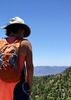
Once at the top I sat down to take a break and I started to hear what sounded like rain drops hitting the ground. Looking up there was no sign of rain so I took a look around trying to locate the sound. What I found was billions of lady bugs... and here I thought there were a lot of them at the summit of Brown's Peak, this one took the cake. They were so thick on the tree branches they were falling to the ground, which is what I heard. I took some photos and with other insects flying around and landing on me I simply up and left.

The hike down wasn't any easier than the hike up. When I'm wiped out I'd much rather climb steep terrain than head down. Between the steepness and arthritis, it was murder on the knees. It felt great once I was back on level ground. On the return trip the horses were maybe 100' from the road so there wasn't another battle of wills.

Hike photos are here:
http://www.changephoenix.com/09/2009-07-03MaderaPeak.html
_____________________
CannondaleKid
 
Jun 08 2008
avatar

 Triplogs 3

male
 Joined Apr 30 2004
 Mesa, AZ
Madera PeakGlobe, AZ
Globe, AZ
Hiking avatar Jun 08 2008
dmillarhaskellTriplogs 3
Hiking5.50 Miles 2,299 AEG
Hiking5.50 Miles
2,299 ft AEG
 no routesno photosets
1st trip
Linked   none no linked trail guides
Partners none no partners
"wickedly steep" says the description and it's not kidding. The views are stupendous but the "trail" is too demanding of attention both up and down because of the treacherous footing. A good one-time hike.
The road from Globe to TH is in good shape for a sedan but requires some sang-froid on account of the fall-offs.
_____________________
 
Sep 21 2007
avatar

 Guides 170
 Routes 148
 Photos 5,914
 Triplogs 2,097

48 male
 Joined Apr 12 2004
 Tucson, AZ
Madera PeakGlobe, AZ
Globe, AZ
Hiking avatar Sep 21 2007
PrestonSandsTriplogs 2,097
Hiking5.50 Miles 2,299 AEG
Hiking5.50 Miles   4 Hrs      1.38 mph
2,299 ft AEG
 
Linked   none no linked trail guides
Partners none no partners
I had noticed this road one afternoon while working in Globe. It looked like a faint streak of dirt generally heading for the top of Madera Peak. After not seeing the road on the USGS topo map, I finally found it on a Google satellite photo.
An unexpected Friday off left me looking for something to do. So off to Globe I went, with the intention of hiking to the top of Madera Peak (sure, there's a drivable road to the top, but that would be too easy :wink: ).
After navigating the maze of residential streets in Miami, I found the correct road into the mountains. I didn't start hiking until noon, which was way too late for the hot and humid weather of the day. I trudged up the steep road, stopping every few minutes to wipe the stinging sweat out of my eyes and to partially cool off in the shade of an oak tree. :sweat: It was nice to finally get into the pines, where the shade offered some relief. Once on top of the ridge, I was in heaven. Deep canyons and mountainsides covered in green forest brought on a case of sky island fever. When I got to the top, I discovered it was a false summit, so I hiked a short distance to the real summit. I had lunch and relaxed in the shade of an oak, where I discovered a summit register. :) I wasn't expecting that. I added my own little entry, then began the hike back down. I figured I'd make better time going down. I did, but the 2 super steep sections were slow going. I got back to my truck in one hour, and proceded to dump ice water on myself :biggrin: Then it was back home to Safford.
So, in summation: this is a great hike, just don't do it when it's hot!
:sweat: :sweat: :sweat:
_____________________
"…you never know when a hike might break out" -Jim Gaffigan
 
average hiking speed 2.18 mph

WARNING! Hiking and outdoor related sports can be dangerous. Be responsible and prepare for the trip. Study the area you are entering and plan accordingly. Dress for the current and unexpected weather changes. Take plenty of water. Never go alone. Make an itinerary with your plan(s), route(s), destination(s) and expected return time. Give your itinerary to trusted family and/or friends.

helpcommentissue

end of page marker