|
| | | |
| |
|
| Backpack | 15.87 Miles |
2,022 AEG |
| | Backpack | 15.87 Miles | 2 Days | | |
| 2,022 ft AEG | | | | |
|
|
| |
| Linked |
|
none
[ show ]
| no linked trail guides |
| Partners |
|
[ show ]
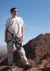
| partners | | This is a lottery draw as you know and Clyde somehow managed to get drawn again after his four year hiatus (you can only apply once every four years) so he put this up on ABC, BCH and So CA Backpackers. We had dispersed camped over by the Doney turnoff and woke to beautiful views  of the snow-covered SF Peaks before driving over to meet up with the Ranger and a Ranger Archaeologist and Forest Service Intern with 12 other people for our backpack into the Wupatki National Monument. After short intros we loaded up in two vehicles for the back country (the road getting there off the main highway wasn't in the best of shape). of the snow-covered SF Peaks before driving over to meet up with the Ranger and a Ranger Archaeologist and Forest Service Intern with 12 other people for our backpack into the Wupatki National Monument. After short intros we loaded up in two vehicles for the back country (the road getting there off the main highway wasn't in the best of shape).
We had all ages on this trip from about 20 with the intern to Clyde at 68. I had a 3 1/2 litre and 2 litre full of water and another bottle as this would be a dry camp. However, that was WAY too much water just as Clyde said it would be despite the explicit Forest Service instructions to bring that much water. The temperatures were perfect so we didn't drink that much water but still...
We geared up and headed on our way walking around a rock formation area toward the Doney Monocline and then veered north. We would stop along the way for various POI including flora. The weirdest thing was dispersed hiking per the request of the ranger. It kind of goes against a hiker's grain but we found it rather fun to just pick our way across the landscape. Soon we would be heading up a mesa to check out our first ruins. Not only were there ruins on the hill, there were ruins below you. And the views were outstanding. Lucky for us we had a Forest Ranger archaeologist on board so she was able to talk about the various kinds of sherds we would see and tell us where they came from since the Wupatki seemed to be a primary trade center.
After spending a good amount of time up there we headed on down, snacked and continued on our way thru the desert landscape toward our next stop. You could see other ruins higher up in the distance to the west. I tried to zoom when I could since we wouldn't be visiting these. After winding around, up and down, we approached the Long Lentil House. The construction was most impressive and once again, the views were really quite something. The rangers talked about the house and the area with the archaeologist saying they don't do preservation anymore UNLESS preservation had already been done. She explained about the process and how tedious it can be at times exclaiming they would love more volunteers. I didn't know there was such a need or that volunteers could do that kind of stuff.
From there it was hiking to our lunch area in this pretty cool rock formation area and then on toward Chaos Wash (not the official name) which looks like it could be a fun place to hike. You hike in and down the wash before veering to the left to get out of it. From there, it is a lot of up and down hiking as the various mesas come into view. Our goal is to hike to camp that is within view of the mesa that holds the Crack in the Rock pueblo. Of course, during this whole time the Little Colorado River and Valley are to our right (eastish). Of course, you can pretty well tell where the river is based on the trees.
We set up our camp and then headed up Crack in the Rock. You follow the road a piece before heading toward and then straight up the north side of the mesa. You circle around to the south side and thru an opening to the other side of the mesa. Before walking this side of the mesa we look SE toward the Valley with the moon rising above; it's a beautiful site  . There are many ruins and glyphs here as we make our way to the other side of the mesa not even realizing we are passing by the entrance to the ruins above. The rangers take us back to this narrow opening to climb up; which ain't easy. But wow, that is pretty cool once you get up there into the Plaza. The sun was setting fast so soon we would have to find our way down; fortunately there was a different exit. . There are many ruins and glyphs here as we make our way to the other side of the mesa not even realizing we are passing by the entrance to the ruins above. The rangers take us back to this narrow opening to climb up; which ain't easy. But wow, that is pretty cool once you get up there into the Plaza. The sun was setting fast so soon we would have to find our way down; fortunately there was a different exit.
Clyde and I got back to camp before the others. I got my wine and enjoyed my piece of pizza. The ranger built a nice campfire and there was a lovely restroom facility not too far; can't beat that for camping in the wilderness... oh, we were on Babbitt land so thanks to them for letting us use it.
The next morning we prepared our gear and hiked back the way we came to a fenced area of the Monument where we crossed and hiked north again to approach the Middle Mesa from the north side and UP we went. We got to see more glyphs and a more lighted view of the area with the morning sun. We investigated around this mesa and headed over to the formidable Horseshoe Mesa. The archaeologist was working on panels here as they are in the process of full documentation of the glyphs. They are using some fancy photography as well that helps bring out the barely able to see glyphs. This one panel she is working on you can't even see except for a few minutes during a certain part of the day. And the panel is huge. Hopefully we'll get to see what she draws out as it involves almost life-size horses.
We headed on down to pick up our packs that we had left at the gate. We continued our way toward Chaos Wash but certainly not the same way so it was fun to see some new territory. We had cloud cover so it certainly changed the ambiance for the rest of the hike. We saw some more remnants of the ancestral pueblo people and Navajo life as well as some really  landscape that we slithered in and around and up and down. We did have a couple good washes to go up and down. Oh I should say, there were times during this hike that the views to the snow-covered San Francisco Peaks were pretty awesome. landscape that we slithered in and around and up and down. We did have a couple good washes to go up and down. Oh I should say, there were times during this hike that the views to the snow-covered San Francisco Peaks were pretty awesome.
We took one last break before the last mile back to the TH. We saw another glyph wall seemingly in the middle of nowhere and we saw a big ole owl fly off a couple times and lots of rabbits (hence the owl  ). Sometimes I thot the breaks were too long; I prefer short breaks and maybe more of them but overall the pace was reasonable considering the amount of people we had and their capability range. Clyde says this group was quite a bit better than the one four years ago as far as hiking ability. ). Sometimes I thot the breaks were too long; I prefer short breaks and maybe more of them but overall the pace was reasonable considering the amount of people we had and their capability range. Clyde says this group was quite a bit better than the one four years ago as far as hiking ability.
The finale was truly unexpected and awesome  . A rock formation framed the snow-capped San Franciso Peaks. It was really quite a scene. We posed for a group shot before piling back into the vehicles for our ride back to Wupatki. We changed and then headed for dinner at Pita Jungle before our drive back to the Valley. It was a great trip and had been on my "I'd sure like to do that" for a few years so sometimes it pays to tell the right people about your wishes. Thank you Clyde! for making the arrangements. . A rock formation framed the snow-capped San Franciso Peaks. It was really quite a scene. We posed for a group shot before piling back into the vehicles for our ride back to Wupatki. We changed and then headed for dinner at Pita Jungle before our drive back to the Valley. It was a great trip and had been on my "I'd sure like to do that" for a few years so sometimes it pays to tell the right people about your wishes. Thank you Clyde! for making the arrangements.
(Day One 7.8 miles, Day Two 8.02 miles) Videos are longer than usual because I included some of the rangers talks.
Crack in Rock Backpack, Day One:
Video 1 to the first ruins - https://youtu.be/oT ... V9Fk
Video 2 at the first ruins and toward the geology talk - https://youtu.be/sU ... vpG0
Video 3 toward the Long Lentil House - https://youtu.be/W5 ... blyU
Video 4 from Lentil to lunch area - https://youtu.be/f- ... r0_g
Video 5 from lunch area toward Chaos Wash - https://youtu.be/MP ... 7RzA
Video 6 Chaos to camp - https://youtu.be/Ul ... PM5M
CRACK IN ROCK:
https://youtu.be/5N ... ZJUU
https://youtu.be/Oi ... jaGc
Day Two - in production (and there was some cool stuff on this day as well with two additional mesas)
Part 1 to Middle Mesa https://youtu.be/gT ... tccs
Part 2 Middle Mesa https://youtu.be/Od ... E24g
Part 3 Middle and Horseshoe Mesa https://youtu.be/pj ... c70M
Part 4 Horseshoe Mesa https://youtu.be/6a ... FUL0
Part 5 back to the TH, part 1 to the Hogan https://youtu.be/qm ... _pXc
Part 6 continuing back to the TH, part 2 https://youtu.be/qm ... _pXc
Part 7 back to the TH, the finale (altho as of 12-23-15, I see I haven't uploaded it yet so I will add the link later) |
| _____________________
For me, sometimes it's just as much about the journey as the destination.
Oh, and once in awhile, don't forget to look back at the trail you've traveled. |
| | |
|
|
|
 Route Editor