|
| | | |
| |
|
| Hiking | 4.41 Miles |
860 AEG |
| | Hiking | 4.41 Miles | 4 Hrs 14 Mns | | 1.37 mph |
| 860 ft AEG | 1 Hour 1 Min Break | | | |
|
|
| |
| Linked |
|
none
[ show ]
| no linked trail guides |
| Partners |
|
none
[ show ]
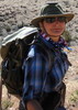
| no partners | | My wife and I planned a great Valentine's 3-day weekend on the Arizona strip, with stops at: Coyote Buttes South, White Pocket, Buckskin Gulch, and a packraft down Glen Canyon.
We had planned to spend Friday night at the Cliff Dwellers Lodge, camp Saturday night near White Pocket, and stay Sunday night at a hotel in Page.
First stop was Coyote Buttes South. We secured a permit a couple months in advance and figured out the rest of the trip from there. My brother in law was going to drive over from Cedar City and meet us on House Rock Valley Road and then pile into his truck for the deep sand drive to CBS. But, he called the night before and had to pull out, leaving us scrambling to figure out transportation. We were able to arrange last minute to rent a jeep from a guy in Page (Lake Powell Jeep Rentals). He even let us pick it up Friday night, so we didn't have to backtrack from Cliff Dwellers on Saturday morning.
We got to Cliff Dwellers late that night and settled in, only to find out that our dinner stop at McDonald's in Flagstaff left me with food poisoning.  After spending an hour or so in the bathroom, I was able to go to sleep, but with the rest of the trip in question. After spending an hour or so in the bathroom, I was able to go to sleep, but with the rest of the trip in question.
I was a little weak in the morning, but feeling well enough that--along with a strong case of FOMO--we powered on.
Renting the Jeep was great. We had no issues driving out to Cottonwood Cove. In part, we benefited from some rain/snow the prior couple of days and the cold time of year.
We arrived at Cottonwood Cove a little after 9 am and were the only ones there. We ended up seeing only one other person.
CBS is an amazing place. Not surprisingly, the formations are similar to CBN, but just without the focal point of a "Wave." That said, we had a great time wandering around and checking out various informally named formations (I marked several on my route). A highlight was the distinct dinosaur tracks.
After a few hours of wandering, my energy was low and we had seen most of the general area, and returned to the jeep.
We thought about camping near CBS, but decided with several hours of daylight left, we would head over to White Pocket and catch the sunset there. Turned out to be a good call.
To be continued in White Pocket triplog .... |
| _____________________
| | |
|
|
|
 Route Editor


 In retrospect January might be a little too cold to explore Coyote Buttes.