|
| | | Desolation Wilderness, CA | | | |
|
|
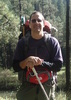
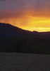
Desolation Wilderness, CA
| | |
| |
|
| Backpack | 22.28 Miles |
3,548 AEG |
| | Backpack | 22.28 Miles | 4 Days | | |
| 3,548 ft AEG | | | | |
|
|
| |
| Partners |
|
[ show ]
| partners | | Day 1: Echo Lakes to Lake Aloha
4.2 miles / 934ft / 1,041aeg / 1:43
After a 2.2 mile / 11 minute boat taxi across the lake, we began our easy peasy entry hike to our first night's camp at Lake Aloha. This trail offered some initial concerns for the weekend. Desolation Wilderness is one of the most visited wilderness areas in the country. Even day hiking requires a permit, and quotas limit overnight visitors in specific geographic zones. This necessitates some advance planning if you wish to visit here. The overnight quotas allow 700 people to spend the night in the wilderness. Seems like a lot to me, and in the first couple of miles of hiking, I feared that all 700 would be camping near us. The trail was very busy and not the kind of experience I had anticipated. It probably didn't help that we weren't on the trail until 10:30am. Thankfully, the crowds thinned after about 2.5 miles, and I don't think we saw anybody else for a few hours! Now we're talking!
While the start of the hike is pleasant and scenic, in retrospect, it's a bit mundane from what slowly presents itself along the way. I wasn't quite prepared for what Lake Aloha would have to offer, but it was simply breathtaking and one of the most stunning landscapes I have ever encountered. We were early enough in the day that we had our pick of spots to camp along the shore and quickly settled in.
Side hike:
After setting up camp, we embarked on an afternoon dayhike to Mt. Tallac. [ triplog here ].
Day 2:
With two nights base camped at Lake Aloha we spent all of day 2 exploring the Desolation Basin and surrounding peaks. [ triplog here ]
It was a Friday now, and there were a few more people camped around Aloha Lake. It was by no means crowded and the permit system seems to properly manage this area with plenty of solitude despite occasionally seeing other campers nearby. I encountered two rangers who were there checking permits, which I would expect is quite common here.
Day 3: Lake Aloha to Camper Flat
8.8 miles / -917ft / 740aeg / 3:27
After two nights at Aloha, it was time to move north to a spot along the Rubicon River. We weren't sure exactly where we would camp and had heard mixed reviews of our intended destination, so we kept our options open. The only real climb on the day was exiting Desolation Basin via Mosquito Pass first thing in the morning. It's the nicest "pass" I've ever had to climb in the Sierra, gaining a whopping 300 feet!  From there, it was a steep descent to the Rubicon and the upper reaches of Rockbound Valley before following the pleasantly wooded drainage of the Rubicon River downstream. From there, it was a steep descent to the Rubicon and the upper reaches of Rockbound Valley before following the pleasantly wooded drainage of the Rubicon River downstream.
There were a few river crossings, including one that required wading. I think that later in the runoff season all the crossings can be done dry. Along the way we passed a couple of backpackers who gave us some advice on a site near Camper Flat that they had found to have minimal mosquito problems two nights earlier. It was pretty much exactly where we wanted to camp, so we took their advice and set up there. It was on a granite slab a hundred yards away from the creek and woods and certainly seemed that it would be away from the prime bug habitat below. But there was no shade which was a bit rough during the middle of the day. And it turns out, that there were plenty of mosquitoes around sunset too! Oh well. It was manageable, but a bit of a nuisance. All reports are that this is pretty typical for this time of year here.
Side hike: With so much daylight remaining and camp set up, we opted for another side hike from camp. [ triplog here ].
Day 4: Camper Flat to Eagle Falls Trailhead
9.4 miles / 1,311ft / 1,794aeg / 3:39
With no shade at camp, we were up with the sun and decided to pack up and get a start on our exit. The first two miles climb about 800 feet on a largely exposed granite slope before entering a beautiful forested area near the PCT junction and the Velma Lakes. I convinced John to add about 1.5 miles and an extra 300 feet to our exit to visit two lakes that looked like they would be sceninc on the topo map. I'm glad we went this way! The trail along the shore of Fontanillis Lake is simply stunning and the views of Ralphie's Red Ryder Lake below the snowcapped namesake peak were a fine reward for the extra effort.
From there it was largely downhill to the trailhead. Views of Lake Tahoe occasionally presented itself, and now mid-morning on a Sunday, we periodically encountered groups of day hikers. The last mile from Eagle Lake to the trailhead was full tourist mode with throngs of people. The scene at the trailhead was an indescribable cf of humanity. A car waited 15 minutes for our parking spot and we shuttled a backpacker to another trailhead while passing miles of cars parked along the highway. The views of Lake Tahoe here are impressive to be sure, but it is absolutely not worth the traffic and I know to avoid this in the middle of a weekend day in the future!
Recap:
There are so many good things to say about Desolation Wilderness! It's amazing. The permit system is simple but there are 45 backcountry zones to choose from, so planning ahead is key. Some permits can be reserved in advance online, while others are held back to be issued from the South Lake FS office the same day. Some zones have designated camp sites, but most feature at large camping anywhere within a given zone. Bring a map, as zone boundaries are not indicated on the trail.
Dogs are permitted in the wilderness, and many of the day hikers were hiking with dogs, and a handful of backpackers too. Campfires are not permitted at any time of year anywhere in the wilderness.
I think we were there at the ideal time of year. Daytime highs were in the 60s with lows around 40. The snowpack had melted in most places, save for some north-facing slopes and sheltered areas which provided dramatic views and the opportunity to chill my beer! But there was enough snow remaining that there was water to be found everywhere and waterfalls and cascades around every corner. I never carried more than 1 liter of water, and often none at all, knowing that I could filter and drink at any time. We encountered some nuisance mosquitoes, especially on night 3 in the wooded valley along the Rubicon River. Others told us that the bugs can be hit or miss in one part of the wilderness versus another on the same dates, and varies greatly depending the season.
There was a strange void of wildlife here. In the high granite landscape, it might make sense, but even in the grassy valleys, we didn't see a single deer, no sign of bear, sheep, goats, elk, or other large mammals. There was a beaver dam on the river, and a ton of marmots, chipmunks, small birds, and I spotted two large birds of prey. But that was it.
For as much visitation as this wilderness gets, like most places, once you get a few miles from the trailheads, it's peaceful and nice.
I’ve realized I hate the PCT. It seems to be funneling people into an amazing place that through hikers couldn’t care less about beyond their goal to get from point a to point b. Undeniable accomplishment aside, I found myself annoyed with most of the encounters we had with them.
This trip came together over months of planning. Lots of routes, proposed destinations, must-see sights, coordination, airline tickets, rental car, permits, etc. Big thanks to 9L for doing a lot of the legwork and prep and huge props to Scott who helped with our logistics in Reno and setting up our shuttle and of course for hiking with us on Day 1. Gracias!
|
| _____________________
| I'm not sure what my spirit animal is, but I'm confident it has rabies. |
| | |
|
|
|
 Route Editor