|
| | | Mount Shasta West Gully Route with Shastina, CA | | | |
|
|
Mount Shasta West Gully Route with Shastina, CA
| | |
| |
|
| Hike & Climb | 16.97 Miles |
11,377 AEG |
| | Hike & Climb | 16.97 Miles | 3 Days | | |
| 11,377 ft AEG | | | | |
|
|
| | |
| Partners |
|
none
[ show ]
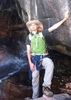
| no partners | | A few months ago in my search to continue adding to my alpine climbing resume I started looking at Mount Shasta. While doing my research I found that over 80% of all summits at Shasta happen from the Avalanche Gulch route, with that in mind I wanted a route with a lot more solitude and a bigger challenge.....with that i found the West Gully route to be just what I wanted for this adventure.
Once I decided thats what I wanted I started my search for teammates, there I thought my friend and all around badass chick Emily to be a fit despite her lack of mountaineering experience, I also found my friend TJ and his experience to be beneficial to the team. Together we tutored and mentored Emily on how to walk with crampons, use of ice axe, self arrest and roped travel.
On thursday afternoon I went to pick up our car rental and quickly headed out of town for the long 14 hour drive up to NorCal. After driving about 7 hours we made our night stop just north of Fresno leaving us only about 400 miles left to go on friday morning. At about 1PM we arrived at Mount Shasta City, a small cozy laid back hippie town {totally my style} took our time grabbing lunch while we got our rented snow shovel taken care of. Then after we started making the quick 11 mile drive to the Bunny Flat TH, there we paid our self-paid 3-day weekend permit for $25 P/P. From this spot we then started heading up Mt. Shasta under cloudy and light wind/ light rain conditions....the landscape was typical NW, lots of trees and wide expansive views. After 2 miles and 1200 ft of gain we reached Horse Camp, from there we continued making our way up to our weekend base camp at Hidden Valley, a beatiful, wide open valley located just below the steep west face of this amazing volcano. As we made our last snow field traverse the winds started picking up and only became stronger the closer we got to Hidden Valley. We took shelter from the cold 50+ MPH winds behind a rock and waited there for about 45 minutes trying to decide our options. Not only after the winds died down a bit we decided to hunt for a suitable campsite to be able to pitch under the still windy conditions......I tell you, it was so much fun (NOT) shoveling a flat patch of snow and try to pitch a tent under freezing windy weather!!
About an hour later the wind completely died off and we went explore the rest of Hidden Valley and came across two good looking ski-mountaineer girls who were just pitching their tent as the sun was starting to set. Their plans were almost the same as ours, climb Shastina saturday, and Shasta on sunday.
The following morning we let the sun wake us up and took our time having breakfast under a clear wind-free morning! We got our gear together and started making our way up to Shastina, as the day went by we crossed paths with the two women ski-mountaineering, we also came across another couple day climbing with their ski touring gear as well.
As the day went on at about noon the winds and clouds started forming on both the summits of Shasta and Shastina, it was then about 500 feet from the Shastina summit when we decided to call it a day and head back to base camp, have a proper lunch and start preparing for our early morning alpine start of 230AM. It was weird being in my tent and sleeping bag already having had dinner and ready to go sleep before 5PM and setting our alarms for our 1AM wake up call.
1AM comes and the excitement quickly engulfed my mind as i made myself some oatmeal and hot cocoa. Right after breakfast we started putting our crampons on our boots and packed our day climb supplies. Exactly at 230AM we started our long and slow walk across Hidden valley where we gradually the started hitting 10, 20, 30 slopes until reaching a 45 degree slope across a gully that would take us above the Cassaval ridge and onto the 35 degree west face. I would describe this climb as being on a stairstepper machine for 5+ hours without stopping while gaining more than 4000 feet. The climb was relentless, a true test of both mental and physical stamina. One of our rewards was to be the only team climbing the west gully under a clear starry night with a full view of the Milky Way and catching glimpse of a handful of shooting stars....magical indeed!!
The sunrise beat us before we could gain the west face saddle but once we got there we had a full view of Shasta's main peak and with that a view of scores of people climbing from Avalanche gulch. Seeing this made me even more grateful we had climbed the route that we did even more. We then started making our way across the Whitney Glacier and onto Missery Hill and joined everyone else making the climb to the summit. Feeling exhausted but with my mind set on to the summit we charged our way to the top reaching the summit at 854AM. What a feeling it was to be there, the high one gets being there never gets old and is the sole reason for my alpine climbing addiction.
After signing the simmit register we started making our way down and the kid fun started......taking our crampons off and making our glissade descent back down.....if you havent glissaded down a 2000+ foot slope before.....i highly recommend, its axhilirating and was the cherry on top of this already magnificent volcano.
We got back to base camp at 1225PM and happily but tired we started taking our camp down and after an uneventful way back to Bunny Flat we got to the car just after 4PM and started our long drive back home. |
| _____________________
| The world is my playground! |
| | |
|
|
|
 Route Editor