|
| | | |
| |
|
| Hiking | 14.94 Miles |
3,400 AEG |
| | Hiking | 14.94 Miles | 4 Hrs 14 Mns | | 3.53 mph |
| 3,400 ft AEG | | | | |
|
|
| |
| Linked |
|
none
[ show ]
| no linked trail guides |
| Partners |
|
none
[ show ]
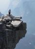
| no partners | | I've seen this track for years, every time I drove west on the I-10. It gave me a minor itch...wondering what that hike would be like. Using HAZ's "AZ Region" hike finder I recently discovered that MikeS has done this hike several times. That itch was taken care of today. Got to the Verrado TH around 4:30am. Still a little dark out, so,I used my headlamp for the first 20 minutes. The trail/"road" is broad and straight so it was more precautionary than anything. The trail heads north for the first 1.25 miles. Relatively flat, with some gradual twists and turns. At about 1.25 miles the trails turns NW and starts a very steady straight climb for the next 1.5 miles. The incline is remarkably consistent (and boring to be honest). There is no wondering "what's around the bend, or what is over the rise" because you can see everything in front of you. I was briefly excited when I reached the "climb" because it broke up the monotony. That lasted all of a minute. I had jogged up to this point, but quickly realized I was jogging no further. The climb didn't look that bad with the naked eye, but my legs/lungs said otherwise. Imagine Shaw Butte ((north side) trail conditions mixed with the pitch of Thompson Peak and you get an idea of what the next half mile was like. The view from the top of this climb was pretty rewarding, though limited to the northwest valley. It was kind of neat seeing some of the "inner valleys" of the White Tanks. Still had a little over 3 miles to go to reach the radio towers. I had forgotten that the road didn't go directly to the towers, but actually passes them on the west side. So I kind of did a semi circle in my approach to the summit. Even though this added mileage to the hike, I'm sure it made the overall climb more gradual. I was still wiped from the climb, so I stayed in hiking mode for most of this segment. This worked out well because it allowed to catch site of a javelina that crossed the road in front of me, as well as a good sized owl a little later on. Sightings like that make even boring trails worthwhile.  Reached the summit and signed in on the register. Surprise to see that there has been little activity this year. Only 4 parties have signed the register this year, the last being in March. The canister holding the register has moved since my last visit - they've added fencing around some of the towers - but the can holding the register is still easy to find. The return trip was part hike, part jog, depending on how my knees felt about the decline. I was again rewarded with seeing 3 deer at almost the exact spot where I encountered the javelina. Encountered 3 hikers and 1 biker on my return journey. This is a nice one to cross off my list. Though the views from the top are nice and seeing the wildlife very rewarding, the trail itself didn't really hold my attention. I actually got bored jogging up and down the gradual incline part of the hike. That's never happened on a hike/jog. Still, if you are looking for a workout, this hike will definitely do that. Reached the summit and signed in on the register. Surprise to see that there has been little activity this year. Only 4 parties have signed the register this year, the last being in March. The canister holding the register has moved since my last visit - they've added fencing around some of the towers - but the can holding the register is still easy to find. The return trip was part hike, part jog, depending on how my knees felt about the decline. I was again rewarded with seeing 3 deer at almost the exact spot where I encountered the javelina. Encountered 3 hikers and 1 biker on my return journey. This is a nice one to cross off my list. Though the views from the top are nice and seeing the wildlife very rewarding, the trail itself didn't really hold my attention. I actually got bored jogging up and down the gradual incline part of the hike. That's never happened on a hike/jog. Still, if you are looking for a workout, this hike will definitely do that. |
| _____________________
| | |
|
|
|
 Route Editor