|
| | | |
| |
| |
| |
| Linked |
|
none
[ show ]
| no linked trail guides |
| Partners |
|
none
[ show ]
| no partners | | My first return to this place since the late 80's. Wow has it changed. The rocks are still there and exactly as I remember them, but what used to look like more of a typical Arizona desert setting, now looks more like a lush green riparian oasis. That is all except for the trash, which is strewn everywhere. Leave it up to the typical losers, lowlifes and scumbags to trash the very nature areas they enjoy. Then, they complain when easy access becomes restricted due to their bad habits.
Anyway, I arrived with my kids, Emma and Justin to a mostly empty parking lot. We jumped off rocks, swam, floated on tubes, and battled the river by attempting to kayak upstream. That was fun. I think we had to portage twice. Two paddlers on a two person kayak pulling a third person on a tube just wasn't working out in the fast rapids. We made it up river to a jungle-like setting with several rope swings. We had some fun there and then enjoyed the easy float back down to the rec area.
When we returned, the parking lot was packed and new arrivals were sent looking for overflow space. Weather was great, partly cloudy, and a small storm cell even passed over us and provided a little rainfall, albeit light and only lasting a few minutes. |
| _____________________
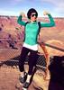
| This is my gym. I have to travel down a bumpy road to get there. There are no treadmillls, no machines, and no personal trainers. I walk..I run..I breathe the fresh air. I can go any time I want, as much as I want and there is no membership fee. |
| | |
|
|
|
 Route Editor


 " is a phrase I actually heard, possibly directed at me...), but the beach area is big enough to avoid the riff raff. We did a little hiking just to climb the bluffs, but most of the day was about water activities. Overall, a fun time.