username
X
password
register
for free!
help
ArticlesGuidesRoutes
 
Photosets
 
 Comments
triplogs   photosets   labels comments more
The Spine - 5 members in 22 triplogs have rated this an average 4.2 ( 1 to 5 best )
1, 2  Next
22 triplogs
login for filter options
Dec 17 2016
avatar

 Guides 3
 Routes 202
 Photos 3,513
 Triplogs 530

male
 Joined Jan 24 2016
 Arizona
The SpineGlobe, AZ
Globe, AZ
Backpack avatar Dec 17 2016
MountainMattTriplogs 530
Backpack5.79 Miles 1,753 AEG
Backpack5.79 Miles   23 Hrs   39 Mns   0.24 mph
1,753 ft AEG50 LBS Pack
 
1st trip
Linked   none no linked trail guides
Partners partners
chumley
JoelHazelton
Jonnybackpack
It was great to finally put this trip into affect and even better that the five of us hooligans were able to get together for a quick overnighter.

Chums covered all the logistics and stats about the trip perfectly so read his triplog for the true beta.

Other than that both sunset and sunrise were wickedly windy but they both produced great visual pleasure and was well worth the whole purpose of this trip.

Great company.
Good conversations.
And spectacular scenery.
Trip well done!
: rambo :
foliage observationfoliage observationfoliage observationfoliage observationfoliage observation
Autumn Foliage Observation Isolated
Nice color in the few Cottonwoods we found in the wash north of "The Spine".

water 1 out of 5water less than maxwater less than maxwater less than max North Spine Spring Dripping Dripping
_____________________
  1 archive
Dec 17 2016
avatar

 Guides 94
 Routes 840
 Photos 22,055
 Triplogs 1,993

52 male
 Joined Sep 18 2002
 Tempe, AZ
The SpineGlobe, AZ
Globe, AZ
Backpack avatar Dec 17 2016
chumleyTriplogs 1,993
Backpack7.41 Miles 2,206 AEG
Backpack7.41 Miles2 Days         
2,206 ft AEG
 
1st trip
Linked   none no linked trail guides
Partners partners
JoelHazelton
Jonnybackpack
MountainMatt
Joel and Matt set up this overnight trip and Team Buford™ decided to join us. :y: This is a short overnight, but the destination is worth it.

I had scoped out a route that climbs at a moderate 1000fpm slope rather than the shorter, more direct route that climbs twice as steeply. I figured it would be more pleasant since we were carrying overnight packs. It also avoided any private property conflicts (note on that below).

The moderate ridge route we took topped out at the highest point on the spine, where we proceeded northward to the patio and set up camp. We each set out on our own, but the amount of daylight left prevented me from doing a trip down to the Gila and back. I wasn't in the mood for rushing back to camp after dark. I settled for a trip to the south end of the spine and back. It's interesting how the geology changes south of the high point. It goes from huge solid boulders on the north to pebbly granite and gravel ground cover similar to the Tom's Thumb area on the south end.

Back at camp, we enjoyed the fire and photos before settling in for a very chilly night. In the morning we set out to descend the northern ridge of the spine, but the fall line was pushing us straight west. So changed plans early and headed straight down the northeast slope working our way directly toward the truck, which was in clear view the entire time. It was very steep, and the bouldery terrain mixed with desert flora made travel slow and deliberate. Though longer in distance, the moderate ridge we had used for the ascent is the much preferred route.

In the wash below we found pools of water from the light rain that fell Thursday, and even a trickle of flow through some slickrock sections. There's a spring marked on the map, and some colorful Cottonwood trees, but due to the surface water from the rain, I wasn't able to identify the spring source. We made quick time up the wash back to the truck.

Private Property Access Notes:
Reading the notes and previous triplogs about this area left me unsure of what our route would be. We started at the Asarco fence along the road in the wash. We headed cross country to the east before turning south toward the ridge we ascended, barely clipping Section 30, which is owned by Asarco in it's entirety. On the return trip, we took the direct route. Besides where we parked the truck, there are no posted signs or fences except surrounding a solar powered water pump, four large enclosed water tanks, and two large troughs along the way that are fenced in (cattle can't drink the water!) and signed "No Trespassing" by Asarco. I didn't know mining companies maintain wildlife tanks! It should be noted that both the Pinal Assessor maps and AZland.gov clearly state that their website mapping can be incorrect and are not official. So there's that.
 Meteorology
 Meteorology [ checklist ]
[ checklist ]  Sunset
foliage observationfoliage observationfoliage observationfoliage observationfoliage observation
Autumn Foliage Observation Isolated
A couple of cottonwoods in the wash and color along the Gila.

water 1 out of 5water less than maxwater less than maxwater less than max North Spine Spring Dripping Dripping
Didn't find spring source. Occasional shallow pools of water and trickle of flow in places may have been result of rain two days prior. A few cottonwoods indicate regular groundwater.
_____________________
I'm not sure what my spirit animal is, but I'm confident it has rabies.
  2 archives
Dec 12 2015
avatar

 Guides 16
 Routes 11
 Photos 1,006
 Triplogs 410

39 male
 Joined Mar 22 2006
 Phoenix, AZ
The SpineGlobe, AZ
Globe, AZ
Hiking avatar Dec 12 2015
JoelHazeltonTriplogs 410
Hiking1.50 Miles 250 AEG
Hiking1.50 Miles
250 ft AEG
 no routes
1st trip
Linked   none no linked trail guides
Partners none no partners
Parked at the corral where there was a rancher working on the concrete tank, loaded up my overnight gear and set off to camp on top of The Spine. After about .75 mile hiking down the wash, I ran into a private property, no trespassing sign, hung by Asarco. It was on a fence that was strung across the wash and appeared to stretch in both directions for a long way. Is it possible this land was recently acquired, or had been private but was recently put to use and fenced off? Regardless, I turned around and headed to Picketpost instead. I'm interested if anyone knows anything about this. I don't recall anything about this in prior triplogs, and I'm fairly certain I was on track.
_____________________
"Arizona is the land of contrast... You can go from Minnesota to California in a matter of minutes, then have Mexican food that night." -Jack Dykinga

http://www.joelhazelton.com
 
Mar 10 2013
avatar

 Guides 1
 Routes 269
 Photos 613
 Triplogs 1,360

50 male
 Joined Dec 22 2003
 Tucson, AZ
The SpineGlobe, AZ
Globe, AZ
Hiking avatar Mar 10 2013
RedwallNHopsTriplogs 1,360
Hiking5.90 Miles 1,890 AEG
Hiking5.90 Miles   6 Hrs   20 Mns   0.93 mph
1,890 ft AEG
 no routesno photosets
1st trip
Linked   none no linked trail guides
Partners 7 partners
HAZ - Group
Floridasunshine
GrottoGirl
MyRudy
outdoor_lover
Pivo
SAMBA
stansber
Really enjoyed the Spine...I love a good ridge.
wildflower observationwildflower observationwildflower observationwildflower observationwildflower observation
Wildflowers Observation Moderate
_____________________
 
Mar 10 2013
avatar

 Guides 3
 Routes 569
 Photos 11,976
 Triplogs 1,634

50 female
 Joined Sep 18 2009
 Tucson, AZ
The SpineGlobe, AZ
Globe, AZ
Hiking avatar Mar 10 2013
GrottoGirlTriplogs 1,634
Hiking5.90 Miles 1,890 AEG
Hiking5.90 Miles   6 Hrs   20 Mns   0.93 mph
1,890 ft AEG
 
1st trip
Linked   none no linked trail guides
Partners 7 partners
HAZ - Group
Floridasunshine
MyRudy
outdoor_lover
Pivo
RedwallNHops
SAMBA
stansber
The camping group and the dayhiker group met up on the road. We had thought about doing the Rincon but changed our minds and headed off to the Spine. The Spine is awesome! We saw a recent posting of a tracklog that looked like a fun way to add a few more miles and we headed off.

The drainage that we departed from was formed of a beautiful slick rock. There was a little water flowing and there were Cottonwoods that hinted of year round water (but maybe underground most of the time). We found a good place to leave the drainage and start heading up! And up we headed. It was pretty steep. But the good thing is that it wasn't as much of a bushwhack as most of the crew is used to.

The top of the ridge is piled with all sizes and shapes of rocks. It was fun moving along them sometimes up and sometimes down. Joseph did awesome, as usual. That little dog is amazing.

The flowers were starting to pop as the day went by. Plus, the sky was pretty clear due to the recent rains. It was a great day for a hike.

The views from along the Spine are awesome. The views from the next ridge we took were also great. I'm so glad we did this hike.

It was nice to meet Outdoor Lover after having traded several comments and PMs on HAZ!
 Fauna
 Fauna [ checklist ]
[ checklist ]  Dog
 Named place
 Named place [ checklist ]
[ checklist ]  The Spine  White Canyon Wilderness
wildflower observationwildflower observationwildflower observationwildflower observationwildflower observation
Wildflowers Observation Moderate
_____________________
 
Mar 10 2013
avatar

 Photos 3
 Triplogs 106

26 male
 Joined Apr 23 2012
 Tucson, AZ
The SpineGlobe, AZ
Globe, AZ
Hiking avatar Mar 10 2013
MyRudyTriplogs 106
Hiking6.32 Miles 1,916 AEG
Hiking6.32 Miles   6 Hrs   39 Mns   0.95 mph
1,916 ft AEG
 no routesno photosets
1st trip
Linked   none no linked trail guides
Partners partners
HAZ - Group
Floridasunshine
GrottoGirl
outdoor_lover
Pivo
RedwallNHops
SAMBA
_____________________
 
Mar 10 2013
avatar

 Guides 2
 Routes 512
 Photos 5,579
 Triplogs 4,277

69 male
 Joined Mar 01 2009
 Aztec, NM
The SpineGlobe, AZ
Globe, AZ
Hiking avatar Mar 10 2013
PivoTriplogs 4,277
Hiking6.32 Miles 1,916 AEG
Hiking6.32 Miles   6 Hrs   39 Mns   0.95 mph
1,916 ft AEG
 
1st trip
Linked   none no linked trail guides
Partners partners
HAZ - Group
Floridasunshine
GrottoGirl
MyRudy
outdoor_lover
RedwallNHops
SAMBA
An absolutely beautiful area. We can't wait to get back. The wildflowers should great in a week or two.
 Fauna
 Fauna [ checklist ]
[ checklist ]  Desert Tortoise
 Named place
 Named place [ checklist ]
[ checklist ]  White Canyon Wilderness
wildflower observationwildflower observationwildflower observationwildflower observationwildflower observation
Wildflowers Observation Moderate
Early afternoon, for the best viewing if the mornings are still in the 30's
_____________________
 
Mar 10 2013
avatar

 Guides 7
 Routes 72
 Photos 14,456
 Triplogs 627

62 female
 Joined Aug 19 2011
 Scottsdale, AZ
The SpineGlobe, AZ
Globe, AZ
Hiking avatar Mar 10 2013
outdoor_loverTriplogs 627
Hiking4.00 Miles 1,300 AEG
Hiking4.00 Miles   4 Hrs      1.33 mph
1,300 ft AEG   1 Hour    Break12 LBS Pack
 no routes
1st trip
Linked   none no linked trail guides
Partners 7 partners
HAZ - Event
Floridasunshine
GrottoGirl
MyRudy
Pivo
RedwallNHops
SAMBA
stansber
So, I wussed out... :sl: The plan had changed to Camping just Saturday night, but with the weather and differing opinions on whether the wet Road in would be passable for a non 4x4, I opted out of the Camping and met up with the Group Sunday morning. The Norbys, and some friends, John and Chong, had Camped Saturday night, but Mark, his companion, and SAMBA had all opted for warm beds under a real roof. :sweat:

1st time out in this area, so all of it was new to me. The Drive in, once you turn off Battle Axe Road was interesting...The Escape got a little bit of a workout and got just a tad muddy... :sweat: I had printed out a Map of the Route in, but I missed an important landmark and sorta lost the concept of how far in I was. I think I figured it out eventually, and ended up stopping at an intersection to wait for Mark. Turns out I was only about 50 yards from where the Camp was at Option 2. I actually mistakenly branded Joel as a Cow on the Hill above me... :sl: I got there plenty early, so I had a little time to waste. It wasn't wasted for long with Photo Ops abounding.... :D

Fairly soon, the Camping Crew showed up with a change of plans. Instead of The Rincon, they decided to do The Spine. So we headed out, with Joel, Belinda and I holding our breath just slightly on an uphill and the Rock...We made it, me with a little tire spinning on the Hill and Joel with about an inch of clearance to spare, in his Subaru, going over the Rock... :sweat: It wasn't the last time I would hold my breath that day... :sl: (But we made Joel lead, so if the Subaru could do it, I knew I'd be fine... :D )

We met Mark and Samba coming in, so we regrouped and headed to The Spine. The Road in to that TH was a bit of a challenge, but we got there. Oh ya, you guys want to hear about the Hike! :sl: It was awesome!

We went pretty much straight up, arriving at the top right at the north end. And then the fun really began as you negotiate the Roller Coaster Ridge of Boulders... :y: I brought up the rear, which I expected, since I have done very little elevation since the beginning of the Year. The Crew was great though and it was a good time!!! Got to the end of the actual "Spine" and had some lunch. John and Chong decided to bail there and go down, and after seeing what else the others had in mind, I elected to join in on the bailout... :sweat: Just didn't think I was up for more elevation on this day.

So we split, and our little Crew of 3 navigated down the slope. We ran into one little area that had some Poppies, but beyond that, they were few and far between, with a few lonely Lupine showing up as well. But the ground was covered with several varieties of blooming ground cover type flora. And there were areas where you might as well have been on a Golf Green... :D

We caught up with the Drainage that takes you back towards the TH. We had followed this Drainage for just a bit going in and the Slick Rock areas were very cool. The 3 of us opted to take it all the way back and I'm glad we did. It was awesome. There was just a trickle of Water through most of it, I think a majority of the Water was running underneath the sand areas we walked through.

Got back to the Vehicles and I followed John out, eventually ending up at the intersection of Battle Axe and 177. I decided to wait for the others so I could say goodbye and make sure they got out. Took a nice nap and then the others rolled up. Said our goodbyes and we went our separate ways. I stopped in Superior at Los Hermanos for a bite and then on the drive out of Superior, I stopped and did a short Hike up Arnett Creek, which had a nice flow for a change... :) I was trying to kill a little time, so I didn't get tangled in the mess of vehicles coming out of the Renaissance Festival... :o

It was a great day! Thanks for the invite Belinda! It was good company and it's always nice to meet some additional HAZers! I definitely need to do more in this area! : app :

Last note: The Ford Escape I had did really well, but I don't think I would attempt either the road to the Spine or the road around Battle Axe in anything lower than the Subaru.... :o :sweat:
 Fauna
 Fauna [ checklist ]
[ checklist ]  Cardinal
wildflower observationwildflower observationwildflower observationwildflower observationwildflower observation
Wildflowers Observation Light
Only a few "groups" of Poppies and some lonely Lupines. In areas though, the ground was covered with tiny blooming foliage...
_____________________
Life is not a journey to the grave with the intention of arriving safely in a pretty & well preserved body, but rather to skid in broadside, totally worn out & proclaiming, "Wow What a Ride!"
 
Mar 07 2013
avatar

 Routes 596
 Photos 9,604
 Triplogs 2,400

58 male
 Joined Jan 30 2011
 Chandler, AZ
The Spine Loop Hike, AZ 
The Spine Loop Hike, AZ
 
Hiking avatar Mar 07 2013
JuanJaimeiiiTriplogs 2,400
Hiking6.09 Miles 1,749 AEG
Hiking6.09 Miles   3 Hrs   12 Mns   1.90 mph
1,749 ft AEG
 
1st trip
Linked   linked  
Partners none no partners
Mike and I drove fairly close to the northern end of "The Spine" and started our hike from there. We went straight up the end to the top. From there we traversed the length of the spine past the patio and took a right down one of the other ridges.

From there we traveled cross country to the wash and then hiked the wash back up to where we parked. This made for an awesome loop hike that wasn't overly difficult.

Along the way we saw a Buck with a nice rack, a tortise shell with the remains of the former occupant, a large sized kitty litter box, and a bull who wasn't happy to see us.

Additionally, there were lots of wild flowers. Overall this was a great hike!
 Fauna
 Fauna [ checklist ]
[ checklist ]  Cow
wildflower observationwildflower observationwildflower observationwildflower observationwildflower observation
Wildflowers Observation Moderate
_____________________
 
Jan 24 2013
avatar

 Guides 5
 Routes 29
 Photos 605
 Triplogs 880

55 male
 Joined Mar 05 2011
 Pocatello, ID
The SpineGlobe, AZ
Globe, AZ
Hiking avatar Jan 24 2013
WoodsnativeTriplogs 880
Hiking2.50 Miles 300 AEG
Hiking2.50 Miles
300 ft AEG
 no routesno photosets
Linked   none no linked trail guides
Partners none no partners
Climbed up part of Copper Butte along an old mining road.
_____________________
If you don't run, you rust.
-T. Petty
 
Jan 23 2013
avatar

 Guides 5
 Routes 29
 Photos 605
 Triplogs 880

55 male
 Joined Mar 05 2011
 Pocatello, ID
The SpineGlobe, AZ
Globe, AZ
Hiking avatar Jan 23 2013
WoodsnativeTriplogs 880
Hiking2.50 Miles 260 AEG
Hiking2.50 Miles
260 ft AEG
 no routesno photosets
Linked   none no linked trail guides
Partners none no partners
Checked out the (upper) dry stock tank, up the wash from the artesian well.
_____________________
If you don't run, you rust.
-T. Petty
  2 archives
Jan 21 2013
avatar

 Guides 5
 Routes 29
 Photos 605
 Triplogs 880

55 male
 Joined Mar 05 2011
 Pocatello, ID
The SpineGlobe, AZ
Globe, AZ
Hiking avatar Jan 21 2013
WoodsnativeTriplogs 880
Hiking8.25 Miles 1,200 AEG
Hiking8.25 Miles   4 Hrs      3.00 mph
1,200 ft AEG   1 Hour   15 Mns Break
 no routesno photosets
Linked   none no linked trail guides
Partners none no partners
Made a loop hike today.
Hiked from the corral down the wash and west through the spring area. Lots of 4 wheeler tracks everywhere today (holiday). West of the rocky spring area, I checked a north-bound side road which hit a dead end near some bamboo (looks like grass on satellite). Back in the wash, I went west until I found the road going northwest over the hill. On the other side I left the road and followed the stream northward in Walnut Canyon, on the east of Battle Axe Butte, up to the artesian well. It was amazing how far the rock crawler tires made it up that stream.
_____________________
If you don't run, you rust.
-T. Petty
  1 archive
Jan 08 2013
avatar

 Guides 2
 Routes 4
 Photos 3,873
 Triplogs 362

51 female
 Joined Feb 12 2008
 Tucson, AZ
The SpineGlobe, AZ
Globe, AZ
Backpack avatar Jan 08 2013
sirenaTriplogs 362
Backpack3.00 Miles 1,100 AEG
Backpack3.00 Miles2 Days         
1,100 ft AEG
 no routes
Linked   none no linked trail guides
Partners none no partners
_____________________
 
Jan 08 2013
avatar

 Guides 19
 Routes 40
 Photos 5,624
 Triplogs 341

52 female
 Joined Nov 22 2005
 Tucson, AZ
The SpineGlobe, AZ
Globe, AZ
Backpack avatar Jan 08 2013
writelotsTriplogs 341
Backpack3.00 Miles 1,100 AEG
Backpack3.00 Miles2 Days         
1,100 ft AEG
 no routes
1st trip
Linked   none no linked trail guides
Partners partners
sirena
Stay away from this place, it's full of stickers, loose rocks and ghosts. Oh, and there's no view at all from the top.

We'd intended to go backpacking over New Year - but the weather just wasn't to our liking. Lets face it, when you live in a place with as many wonderful days in the year, it's just silly to knowingly head out during the lousy ones.
 Fauna
 Fauna [ checklist ]
[ checklist ]  Bald Eagle
 Named place
 Named place [ checklist ]
[ checklist ]  Battle Axe Butte - 3531ft
_____________________
-----------------------------------
Change will not come if we wait for some other person or some other time. We are the ones we've been waiting for. We are the change that we seek.- Barack Obama
 
Dec 19 2012
avatar

 Guides 5
 Routes 29
 Photos 605
 Triplogs 880

55 male
 Joined Mar 05 2011
 Pocatello, ID
The SpineGlobe, AZ
Globe, AZ
Hiking avatar Dec 19 2012
WoodsnativeTriplogs 880
Hiking6.13 Miles 850 AEG
Hiking6.13 Miles   3 Hrs   12 Mns   2.94 mph
850 ft AEG   1 Hour   7 Mns Break
 no routesno photosets
Linked   none no linked trail guides
Partners none no partners
Hiked the beginning of The Spine trail, in order to scout out a future trip. The road to the corral was fine. I drove past the corral up the hillside. The last part of the road was in worse shape than I expected and my 2WD couldn't make it all the way to the top of the hill.

The flowing water in the spring area was cool, but it was also overgrown in parts.
_____________________
If you don't run, you rust.
-T. Petty
 
Nov 15 2011
avatar

 Guides 44
 Routes 162
 Photos 24,766
 Triplogs 2,411

75 male
 Joined May 04 2004
 Mesa, AZ
The SpineGlobe, AZ
Globe, AZ
Hiking avatar Nov 15 2011
CannondaleKidTriplogs 2,411
Hiking4.50 Miles 1,568 AEG
Hiking4.50 Miles   4 Hrs   22 Mns   1.57 mph
1,568 ft AEG   1 Hour   30 Mns Break20 LBS Pack
 
1st trip
Linked   none no linked trail guides
Partners partners
trixiec
Although the road was pretty washed out in a few spots we were able to drive all the way to the north end of the base of The Spine, which cut the hiking distance significantly. Once on foot we followed the wash eastward until the incline up to the ridge was reasonable enough to climb when we turned right and headed up the hill. At the ridge we took a number of photos and set off across the back-bone of The Spine. A number of times when looking ahead of us Tracey would think, "no way, I'm not going there" yet when we got to those sections it was pretty much a piece of cake. Nowhere along the route we took did we encounter any place that gave pause enough to call it quits. Sure there were spots where if you looked down from an out-crop it seemed quite treacherous, but thankfully we didn't have to walk along there.
As mentioned in other triplogs the views were awesome all along the route. When we arrived at the last high point along the contiguous back-bone, rather than descending quite some distance down to a saddle, back up and out to the two "arms" as Eric did, with a longer hike on deck for the next day we decided to head back. Instead of returning via the same route we followed a moderate slope toward the NE down to a knoll where we took more photos, continuing down NNE along another ridge before heading eastward with the thought of checking out what appeared to be a cave that reminded us of various Native American ruins we'd visited in the past. But the closer we came the less it appeared to be a cave let alone ruins so when we came to an old 4x4 road we followed it all the way back to the wash next to where we had parked. We were glad to have taken a different route on the return for a different point of view back over our route.
After the hike we drove out a couple rough tracks that appeared at one time to have been roads to see if any would connect to where I had been from the other side a few days before. At one point the rocky road got so steep I got out and hiked some distance down to make sure if we couldn't get through that there was a place to turn around and come back up. While some distance down where it appeared the road stopped and there was a spot to turn around, before that point the washouts were so bad I didn't feel it was worth the extra 45-60 minutes of crawling down and back up it would take. I'll be out again soon to try driving farther from the west side and see just how close I can get to where we were from the east.
Overall, a great hike with plenty of jaw-dropping views.
_____________________
CannondaleKid
 
Nov 10 2010
avatar

 Guides 2
 Routes 4
 Photos 3,873
 Triplogs 362

51 female
 Joined Feb 12 2008
 Tucson, AZ
The SpineGlobe, AZ
Globe, AZ
Backpack avatar Nov 10 2010
sirenaTriplogs 362
Backpack3.20 Miles 1,100 AEG
Backpack3.20 Miles2 Days         
1,100 ft AEG
 no routes
Linked   none no linked trail guides
Partners none no partners
A Night on The Spine

First of all, big thanks to Eric (ssk44) for posting this route. I figured I would end the trend of mostly dudes with names that sound alike posting triplogs for this hike :D

As much as I enjoyed my recent time backpacking in the Grand Canyon, I was with a large group of people the whole trip and didn't have much opportunity at all to enjoy the wilderness solo. I have primarily been a solo backpacker, and on the Grand Canyon trip there were all sorts of things I did differently from my usual routine on the trail because of the group around me. I had been thinking since I got back that I needed to go on a palate-cleansing solo trip, to a location where I was practically guaranteed solitude. I tossed around a couple of different options, but remembered one location that has been on top of my to-do list for a while now: The Spine.

The Spine runs northwest above the Gila River and south of the White Canyon Wilderness, northwest of the small mining town of Kelvin. I had admired it when I bushwhacked through this area on the Arizona Trail (most of the passage hadn't been built yet) in March 2008 with John Rendall and his friend Paul. I remember thinking that I needed to come back someday and explore further. I'd planned a dayhike out on The Spine once before, almost a year ago, but wasn't able to go. This time I was bringing my backpack and staying the night. The temperatures have finally cooled in the desert, making a crack-of-dawn start unnecessary. I had a two-hour drive up to the spot in the wash at the base of The Spine where I parked my jeep. I packed light, but had to carry all my water for a dry camp. I started to hike away from the jeep, and something told me to go back and get the extra two-liter container of water that I'd left in the car. After taking on even more water weight, I started down the wash. Tomorrow is Veteran's Day and this area will be full of various people camping, driving, and hiking. But today, it is all mine. I see no one on the drive in and hear not a sound made by another human until I drive back out.

I had originally had grand plans of a full hike of The Spine and both arms, as well as an overnight on a patio underneath The Spine that I'd seen pictures of. But a busy work schedule at my very physical job as a massage therapist had left me pretty tired, and I realized that all I really wanted to do was get up to the patio with my copy of Desert Solitaire, and read, write, relax and enjoy the view.

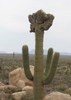
But before I could relax, I had to pay the piper with a rugged off-trail bushwhack to get to my destination. It started out mellow, winding through attractive washes streaked with reds and golds. I turned into a side canyon and passed a copse of cottonwoods with a trickling spring at the base. There were tons of bees, so I hurried along. As I gained elevation in the smooth-rocked drainages, a hint of the amazing views to come tantalized me to the north. Several climbs over and under trees, a bypass of a dry fall, and decisions of which thorny bush would hurt the least, and I was at a saddle where I could see my climb to The Spine. It looked rocky, steep, and a little bit daunting, but I had all the time in the world to get up there and the weather couldn't have been better. This was definitely a hike where I had to concentrate on exactly where I was putting my feet and scanning ahead to see where the best line of travel was through the ever-increasing boulders. At first, I had the help of a ridge that went part of the way up, then it really got interesting.

https://www.youtube.com/watch?v=MCqyKNBPjQ4

I had to use my hands to push and pull myself up at times, I was skirting around loose rockfalls and brush, and it was very slow going, but I was enjoying the hell out of it. The views just got better and better and I could see the boulder I was aiming for getting closer. As I looked down to where I had come from, I could see my jeep way down in the wash, and no one else around at all. Perfect. Almost to the ridgeline, it was the most jumbled, but I took my time and an hour and a half after leaving my jeep, I reached The Spine.

Wow- a great effort paid off with a great reward. The Spine is made up of a hodgepodge of giant red-brown boulders, some with a splotchy white coating that makes them all the more attractive. The big boulders were very sturdy and I was able to hop from one to another along the ridgetop. After a short while, my objective came into view. The Patio is on the northern part of The Spine, about 100 feet below the ridgeline, facing the Gila River. I had to hike along The Spine to find the best way down the jumbled boulders and scree slopes down to The Patio. It was precariously steep and loose in places, much more than my hike up to the ridgeline, but I made it down safely and headed to the north end,to make my camp. I chose the north end because it overlooks the White Canyon Wilderness and Battle Axe Butte, one of my favorite peaks. A bonus of the views from camp was that the ridgeline blocked out views of nearby Copper Butte, its sides all slashed up by the mine.

https://www.youtube.com/watch?v=DFGTVOTVv14

I shed my pack and made myself at home, inflating my air mattress and finding a perch on top of a perfectly curved boulder and ate some lunch. It had taken me two hours to go only 1.6 miles, but it was worth every scratch. After lunch, I went exploring my new digs and was surprised to find a large fire ring with a ridiculous amount of firewood gathered nearby. I think it's funny how people feel the need to have a giant raging inferno when a small fire is easier and less damaging. There were no views from this campsite, so I was not at all interested. At the south end of The Patio, there were fantastic views toward the Catalinas.

I spent the entire afternoon staring at the scenery, watching the wispy clouds roll in, listening to music and getting up every so often to check out the views from different parts of The Patio. My campsite faced the path I'd taken on the Arizona Trail over two years ago, a place I remember well because it is where I overheated trying to keep up with my friend John Rendall. The crazy thing is that John was 73 years old at the time! I bonked and had to elevate my feet above my head, holding my umbrella for shade, while John fed me GU until I felt human again. I wrote in my journal: "The upside was that I had the most beautiful view of these sheer white cliffs while I was recuperating." Men like John illustrate time and time again that if you stay active, you can enjoy all sorts of very physical activities late into life. A definite inspiration.

This trip was just what I needed- solitude in an amazingly beautiful setting. I took out my well-worn copy of Desert Solitaire and alternately read and watched the clouds drift past the bald peak of Battle Axe Butte (someone has to do it) until the sun began to set. The wispy clouds I'd been watching all day made for quite a display as the sun sank between North and South Buttes on the Gila River. The ridge above me lit up a firey red and I moved around the patio, taking lots of shots of the ever-changing light.

The Patio had been somewhat of a wind tunnel all afternoon and I was a little bummed that I wouldn't be able to have a fire, but as the sun set, the air calmed. I made dinner on my little rock perch and then made a fire and read some more. I was going to sleep on the ground, but I was reading and watching the stars on my rock perch and fell asleep up there. It was just big enough and quite comfortable.

The next morning, I awoke to the sound of great horned owls calling out to each other. I spent the morning writing in my journal and lounging around camp and even had a small morning fire to keep away the chill. I don't often have a fire when I backpack, but I really enjoyed it this trip. I even brought some white sage to add to the fire and it smelled wonderful. Around 10 am, I went into my backpack to get something and my hand came out all wet! Not a good feeling, as the rest of my water was in my platypus bladder in my pack. I took the bladder out and saw that I'd lost over a liter to a small hole. I transferred the remaining water into my extra container that I'd gone back for yesterday (I knew there was a reason for me to listen to the little voice that said to bring it along!) and realized that it was probably time for me to pack up and hike back down. Due to the precarious terrain, going downhill wasn't going to be any faster than going uphill. Before I left, I dismantled my fire ring and returned the spot to its original condition, even sweeping away the multitude of footprints I'd made in my camp.

The hike back up to The Spine was easier than the descent, and then it was back to boulder-hopping on the ridgeline. I got a great shot from above of my sleeping boulder- from up here it looked so small. My descent went very slowly because I had to test a lot of my foot placements to make sure the rock I was stepping on wasn't going to roll down the hill once I put my weight on it. Once I got back down to the saddle and into the smooth-rock drainage, I took a break to stretch and snack and and to admire the big, white, fluffy clouds that had rolled in. What a place. I would have stayed longer, but I was down to the last of my water, so I had no choice but to continue on through the pretty drainages back to my jeep. The spring I'd passed yesterday seemed to be flowing stronger and I stopped to listen to the sweet trickling sound over the rocks. When I reached my jeep, I took my GPS out to record my stats and saw that my entire mileage for the trip was only 3.2 miles. Probably one of the shortest backpacking trips I've ever taken, but one of the more challenging, for sure. I adore the sense of accomplishment that comes upon looking where you've been on the drive out and this trip was no exception.

A short list of why I love solo backpacking:

* Quiet. Wonderful all-encompassing quiet.
* What time you do things is all up to you and can be changed on a whim
* No worries about how others are doing (especially valuable after my Royal Arch trip)
* Privacy- no need to tell others not to look while you pee, change clothes, etc.
* Dancing and stretching (two of my favorite camp activities!)are more fun sans onlookers
* No need for earplugs to drown out hiking companion's snoring
* Endless time for reflection, meditation, writing, staring at the scenery, photography
* Sense of accomplishment that comes from figuring out a route on my own
* Not having to worry about what I look like, not even a teeny tiny bit

Though short in both time and distance, this was a perfect trip- a challenging bushwhack, plenty of time to relax and rejuvenate in a beautiful setting, and a healthy dose of solitude. This is the stuff that revitalizes my soul.
 Culture
 Culture [ checklist ]
[ checklist ]  HAZ Rides
_____________________
 
Sep 11 2010
avatar

 Guides 1
 Photos 151
 Triplogs 181

46 male
 Joined Feb 04 2004
 Patagonia, AZ
The SpineGlobe, AZ
Globe, AZ
Hiking avatar Sep 11 2010
airicTriplogs 181
Hiking9.50 Miles 2,477 AEG
Hiking9.50 Miles
2,477 ft AEG
 no routes
Linked   none no linked trail guides
Partners none no partners
Well, the intention was to head to Bonyback, but I kept falling asleep at the wheel en route and decided I didn't feel like a lot of driving today. After a quick nap at Queen Valley and some thoughts on my new destination I decided you can't ever go wrong with The Spine...powerful views up there. So after reading the triplog comments from the previous trip, apologies Chaos.

The hike itself was good as usual. Headed up pretty much the same way. I decided I have to spend a night on the shelf; little wonderland down there. Took the right fork this time at the end. Great views and thoughts about the Gila and all the other wild land down there. I think too I would like to extend this hike out to the Gila one time. Would make it a full day hike. Just amazing up there.

Headed back a different route to get some new exploring in. As soon as I headed off the already off-trail hike I found a deer shed; small. Something cool usually seems to happen on the explores. Solid day.

Standard lizards. Few small birds and quail. 2 zone-tails, good amount of immature tuvus. Wash heading in a real solid wildlife corridor...prints of javelina, coyote, quail, snakes, lizards, mice...seemingly saw everything in there asides from a cat.
_____________________
 
Feb 13 2010
avatar

 Guides 1
 Photos 151
 Triplogs 181

46 male
 Joined Feb 04 2004
 Patagonia, AZ
The SpineGlobe, AZ
Globe, AZ
Hiking avatar Feb 13 2010
airicTriplogs 181
Hiking9.50 Miles 2,477 AEG
Hiking9.50 Miles
2,477 ft AEG
 no routes
Linked   none no linked trail guides
Partners none no partners
I hiked this back in the winter, but since I have been logging lately I wanted to add this so I don't forget it. All I can say about this hike is that it is phenomenal. In fact, any hike ssk44 adds to the database looks like a winner. Good work man.
_____________________
 
Dec 12 2009
avatar

 Guides 20
 Routes 12
 Photos 2,343
 Triplogs 298

51 male
 Joined Mar 31 2008
 Gilbert, AZ
The SpineGlobe, AZ
Globe, AZ
Hiking avatar Dec 12 2009
ssk44Triplogs 298
Hiking7.00 Miles 2,477 AEG
Hiking7.00 Miles   7 Hrs   30 Mns   0.93 mph
2,477 ft AEG
 no routes
Linked   none no linked trail guides
Partners partners
FredKinzer
The Spine (12/12/2009)

I truly love this hike. My periodic hiking partner Fred Kinzer and his awesome Australian Shepard Nicki joined me for this revisit. It was a great day. Things started out real dull and flat due to heavy cloud cover, but at around 3:00 PM everything changed. The heavens opened with beautiful sunlight, clean air, and mixed clouds. The undisputed best part of this hike is heading back. The Spine mostly slopes down heading towards the northwest and the late afternoon sun is stunning. Heading back does not even seem like the same hike. The views are incredible. The photos barely do it justice.

An added bonus to this day was some really nice fall colors along the initial riparian canyon that starts out the hike. The spring was running nice and strong. This segment is a great addition to the overall hike experience. The canyon has nice lush vegetation with many pour-over sections. Much of the canyon is solid rock. Very nice!

On this trip we took some extra time to hike down off the initial jagged ridgeline to the lower shelf that is shown in some of my photos from both trips. This location is indescribably alluring. If feels almost weird to walk around in the sunken area along the shelf. After reaching the bottom, we immediately noticed that there was zero wind or sound of any kind and when you talk there is an unmistakable echo. The location is completely hidden and sheltered from the wind. Although surrounded by rugged rocks and boulders, the shelf itself consists of soft dirt and is actually a large water catchment area. The entire shelf holds water during rainstorms and has an obvious water line! Amazing! I have never seen anything like it!

Throughout the day, I was heavily eyeballing the ominous Teapot Mountain to the northeast. This mountain first caught my attention last year and I still can't get it out of my head. There is a narrow ridgeline route on the northern slope, but it could be a little sketchy. Is it doable? If you don't try you wont ever know. Maybe someday when I'm feeling courageous and ambitious. Someday...

I actually forgot just how much of a butt kicker this hike is. It's a rocky roller coaster all the way out to the river view and rugged boulders keep your eyes glued to the ground most of the day. I was totally blown by the time we got back to the truck. I don't regret it one bit. I love this stuff!


Eric (ssk44) 8)


FYI... Also see nearby hike, "The Rincon".
 Fauna
 Fauna [ checklist ]
[ checklist ]  Dog
 Named place
 Named place [ checklist ]
[ checklist ]  Teapot Mountain
foliage observationfoliage observationfoliage observationfoliage observationfoliage observation
Autumn Foliage Observation Substantial
_____________________
MATTHEW 11:28-30 / PSALM 84:1-2
  1 archive
average hiking speed 1.54 mph
1, 2  Next

WARNING! Hiking and outdoor related sports can be dangerous. Be responsible and prepare for the trip. Study the area you are entering and plan accordingly. Dress for the current and unexpected weather changes. Take plenty of water. Never go alone. Make an itinerary with your plan(s), route(s), destination(s) and expected return time. Give your itinerary to trusted family and/or friends.

helpcommentissue

end of page marker