username
X
password
register
for free!
help
ArticlesGuidesRoutes
 
Photosets
 
 Comments
triplogs   photosets   labels comments more
Goat Mountain - Tonto NF - 4 members in 5 triplogs have rated this an average 5 ( 1 to 5 best )
5 triplogs
login for filter options
Apr 02 2016
avatar

 Routes 27
 Photos 189
 Triplogs 29

52 male
 Joined May 27 2013
 Apache Junction,
Goat Mountain - Tonto NFPayson, AZ
Payson, AZ
Hiking avatar Apr 02 2016
TeamBillyGoatTriplogs 29
Hiking5.47 Miles 2,387 AEG
Hiking5.47 Miles   7 Hrs   35 Mns   0.86 mph
2,387 ft AEG   1 Hour   15 Mns Break
 
1st trip
Linked   none no linked trail guides
Partners none no partners
Epic solo adventure up the Goat. First post in way too long. Been hiking a lot this year, just not posting. I will work on that. I just got into kayaking last summer. While yaking around Apache Lake last august, the east facing cliffs of Goat Mountain really caught my eye. So I searched HAZ to see if there were any routes that I could do during the cooler months. I'm surprised there aren't more triplogs. So I basically followed Chumley's route up.(After kayaking to the trailhead of course). Then decided to return the same way I went up. It just seemed that it would be easier than continuing on the loop around the north side.

The view from the top is awesome. Standing at the cliff's edge is quite a thrill. Perfect launching platform for one of those 'wing suit' loonies. I would definitely recommend this hike to anyone who enjoys a little pain, bruising & bleeding, etc...
 Culture
 Culture [ checklist ]
[ checklist ]  HAZ Rides  Horseshoe
 Named place
 Named place [ checklist ]
[ checklist ]  Apache Lake  Goat Mountain
 Meteorology
 Meteorology [ checklist ]
[ checklist ]  Sunset
_____________________
 
Jan 20 2014
avatar

 Routes 37
 Photos 2,160
 Triplogs 627

43 female
 Joined Mar 01 2010
 Phoenix, AZ
Goat Mountain - Tonto NFPayson, AZ
Payson, AZ
Hiking avatar Jan 20 2014
juliachaosTriplogs 627
Hiking7.16 Miles 2,781 AEG
Hiking7.16 Miles   6 Hrs   33 Mns   1.09 mph
2,781 ft AEG
 no routesno photosets
1st trip
Linked   none no linked trail guides
Partners partners
chumley
clairebear
I really wanted to do something special for my birthday. While looking up info for Bronco Butte, I explored the map just a little more and somehow Goat Mountain caught my eye. I didn't think anything of it at first, but then realized that there was actually a description for it... maybe this hike could be doable! The usual crew assembled and we made a plan. Goat Mountain it was. And this hike more than delivered.

We started off the day a bit later than intended, but being as we were all a bit sore from the weekend, we figured that just so long as we got in a little kayaking and maybe some exploration, all would be good. Just a chill, fun day. We grabbed breakfast and lunch supplies from Einstein's and then started our journey out to Apache Lake.

After driving for a while, the lake began to come into view. It really made our spirits rise and got us more excited about the day. We stopped for some quick pictures, then headed down to the shore. We readied the 'yaks, and then pushed off into the water! The wind was pretty stiff, but somewhat at our backs. We checked out Bronco Butte, remembering last weekend, and then Goat Mountain, hoping that everything would work out and we'd soon be standing at the top.

After an hour, we were within the Indian Spring inlet. We pulled the boats up onto the shore and got our packs ready. Two guys on an inflatable raft then pulled up, and we all discussed Goat Mountain and the route. Then we were on our way. We pushed straight up through the brush to the left of the spring. It was rather brushy for a little while, but once on top of the ridge it thinned out a bit. We found a good crossing point to the other side of the spring, then kept going up. Eventually we made it to the inner basin, making better time than anticipated. We picked out our next route, going straight up a drainage. It was pretty good, but the white rock was rather crumbly and covered in scree. Definitely a bit heady. We got above it and kept working our ways up to the top of the ridge. Once there, we took a quick break in the shade and eyed the next section of mountain.

The interesting thing about Goat Mountain is that the terrain is ever changing. One minute you're working your way through sparse cholla and bushes, and minutes later you realize you're walking on a giant hoodoo. The columns of rock on the mountain face can be soft and flowy, or harsh and angular. All of it is beautiful, but none of what we saw before prepared us for what was on top of the mountain. We pushed up the ridge a little way, following a small draw, then peeked over the terrain as it slowly came into view below us. Our eyes fell upon a giant fissure in the mesa, full of hoodoos. Some of the hoodoos on the plain strongly resembled Easter Island moai. We followed a path through the monolith maze and then began the final push to the top, finally opening up our views to more of the surrounding area.

The top of Goat Mountain is very flat, but reminded me a lot of the top of Geronimo Head. Tall grass, some downed cacti, and lots and lots of prickly pear. There was also a pinyon pine or two. We walked across to the opposite side, and found a nice big rock to settle down on. We looked out to views of Apache Lake, the Superstitions, Four Peaks, and of course the marina below. Chumley began to pull a few things from his bag, and before we knew it, he had set up a chocolate birthday cupcake, complete with candles and balloons! Chumley and Claire gave me a proper birthday serenade, and then we all chowed down on cake, followed by the rest of our lunches. Such an awesome surprise!

Then came time to find another way down. Looking back on our route up, we had already decided that it was far too dangerous to try to go back down the same way (my hands are sweating just thinking about it!), so we headed northeast a bit toward the Ash Creek drainage, picking our way down some brushy boulders before ending up at the edge of an overlook. Below us was the draw, and lots and lots of brush. Still, it was a lot better than the way we came up. We pushed down through the flora and after a while made it into the wide open wash. From there, it was about two miles of rock-hopping, before finally meeting up with the lake. Then came the toughest part of the day: pushing up and over the ridges and draws next to the lake, filled with loose dirt, loose rocks, and lots and lots of prickly things. The boats came into view and slowly got bigger and bigger. Finally, we reached the beach and readied our boats. The sun had disappeared behind the mountains, but it was still somewhat light out. We pushed out onto the water and spent the next hour on the beautiful, serene lake. There was very little breeze, and we quietly paddled back toward the marina as the light ran out. The darkness was actually rather nice and comforting, and there were no other boats out. Eventually we grounded our kayaks and packed up. Exhausted, excited, and happy, we made our way back into town, where beers were had for celebration.

Best birthday adventure I've had in a long time.. and so glad I have friends who are just as crazy as I am to share it with!
_____________________
 
Jan 20 2014
avatar

 Guides 94
 Routes 840
 Photos 22,055
 Triplogs 1,993

52 male
 Joined Sep 18 2002
 Tempe, AZ
Goat Mountain - Tonto NFPayson, AZ
Payson, AZ
Hiking avatar Jan 20 2014
chumleyTriplogs 1,993
Hiking7.16 Miles 2,781 AEG
Hiking7.16 Miles   6 Hrs   33 Mns   1.09 mph
2,781 ft AEG
 
1st trip
Linked   none no linked trail guides
Partners partners
clairebear
juliachaos
Wells, let's finally do this! :)

After a previous Lizzard birthday weekend adventurextravaganza plan got postponed, the mounting of the goat became the decided upon objective. After several sessions of research using SSKs excellent intel and photos in conjunction with some quality MAPsturbating :A1: over the various topo layers and satellite photos provided by the HAZ Route Manager, as well as some help from the Google Earf, we penciled in a planned route, as well as a few alternatives since despite all the research you do, the actual terrain always provides something you didn't fully anticipate. I printed some maps, and loaded some routes into the GPS machine.

In a whirlwind of adventure, I don't even know what day it was. The date posted for this hike is arbitrary. Dates are difficult for me. So...three of us loaded up my truck with kayaks and headed east at the crack of not-that-early. Lizzard sat up front. I know I can be a little bit weird, and some are embarrassed to cavort with me, but this is the first time I've been requested (forced) to protect anonymity. So lets just say that the third musketeer today was Julia*.

After the pleasant drive down the Apache Trail (passed one car ... nobody else on the road), we arrived at the AAA Five Diamond Apache Lake Resort where we paid our dues and prepared to launch. The internet service there is slow, and without the proper Adobe Reader, we were unable to get that extra PDF we needed. I decided to give mine away and risk the crossing without my own PDF, despite being a terrible swimmer.

We launched off the beach at around 9:30 and paddled with a nice tailwind the 2.5 miles to the cove where our hike would begin. This lake is nice in the winter when you don't have to share it with anybody else!

After changing out of paddling clothes and shoes, we finally began to ascend the goat. This hike is absolute perfection. Pristine desert. Not a single cairn. Not a sign of any use at all. No routes, no summit registers. No fire rings. Nothing but desert, rocks, hoodoos, cliffs, and amazing views.

We passed the riparian area at Indian Spring, which was flowing over the little waterfall despite the dry winter we have had. To think that without the Salt River, this spring would be the source of filling Apache Lake! :-k

Above the spring, the flora became somewhat more sparse, but straight-line hiking was still not possible, with a constant zig-zag weave while ascending to the large rock outcropping along the ridgeline at the 2800-foot contour. With the lake level at 1907, it had taken about an hour and 10 minutes to climb these first 900 feet. With just under 1000 feet to reach the 3784-foot summit, this outcropping is close to the halfway point in elevation gain. We could see the poop-laden cliffs above where SSK had previously witnessed the magic of fornicating eagles, but we were not so lucky today. I had forgotten my binoculars, so we couldn't even tell if a nest still existed there, and definitely didn't see any birds soaring or performing for us.

We pressed on into the "inner basin" below the cliffs, and the double-peak ridge that rises out of the basin. We had some fun yelling as the echoes in this basin surrounded by vertical cliffs are pretty impressive. This is where SSK had stopped on his previous trips and where our real exploration began. We pushed forward to the north, heading for the drainage in the corner of the basin, left of the large upside-down triangle rock face. Getting across to it was a loose side-slope traverse with difficult footing, but less vegetation than in the basin below, which would not have been fun.

Once past the triangle rock face, we began to ascend, and this was steep and loose. With many breaks along the way when stable footing could be found, we finally reached the top of the slope where the grade moderated, and a whole new world was presented to us. Wow. Hoodoos and boulders in all directions. Such an amazing landscape. We were awestruck.

We were 200 feet below a prominent peak, which was a similar elevation to the top of the goat, but the goat itself was at least half a mile to the east, according to my rough look at the map. It ended up being 1.1 miles of additional hiking before we reached the turn-around point. Along the way, we dodged hoodoos and boulders, dipped through a very unexpected canyon, with pools of water, and mostly marveled at the views around us.

We were well past our planned turn-around time, since Lizzard had the foresight to invite people to a birthday party in Tempe at 7pm. There was no way we would be back at the yaks by 4, which is what we figured was needed to make the party. But we were too close to completing the goat to turn back, so we pressed on. The plateau on top is a forest of prickly pear and a maze of downed agave stalks. The pricklies make hiking a real hopscotch of non-directness.

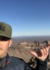
Eventually we reached the jackpot. Goat Mountain is just under 2000 feet above the lake. The entire eastern edge of the mountain features an incredibly impressive 500+ foot sheer vertical cliff, which neither Lizzard nor Julia* was particularly interested in getting very close to. There were nice fissures and slabs on the hillside below that indicated that parts of this cliff calve from time to time. Comforting. Exciting. Exhilarating.

Ok so enough about that. It was Lizzard's birthday and we were waaaaay late. But I had carried birthday supplies up this :pk: goat and I wasn't going to carry them back down, so I quickly got out a huge chocolate cupcake (which somehow had survived the journey quite well), candles, and forks. Julia* and I each blew up a balloon (but not the other 30 I had with me :( ) I lit the candles, we sang a little song, and had cake and washed it down with some help from Oskar Blues.

I managed to get a cell signal (from Globe I think 8) ) and notify the birthday party attendees that the guest of honor wouldn't be there at 7. Or 8. :doh:

Knowing it had taken over 3 hours to ascend, and would certainly take longer to descend by the same steep and screeilous route, (yes, I made that word up), we decided to take a different route back to the boats. I had scoped the Ash Creek drainage, and knew that it was an open drainage free from thick vegetation and catclaw. Getting to the drainage was a little less certain. Traversing the back of the goat proved to be much more difficult than planned.

Not wanting to return through the surprise canyon on the top, we decided to stay east, but the landscape turned into a field of boulders so large and choked with vegetation, that finding a route was very difficult. Eventually we weaved our way out of that maze and found ourselves in a grassy prairie reminiscent of the Cochise area. Again, the landscape was ever changing up here. Next we reached the northern edge of the goat with a view of the Ash Creek drainage below. The decent to the creek was 500 feet, and it was steep. There were lots of cliffs, ravines, and tons of desert scrub on a hillside of loose dirt and rock. We chose a general line and slowly made our way down, re-evaluating the route at a couple of different viewpoints.

Finally we reached the creek, and enjoyed the relative ease of rock-hopping the 2+ miles back to the lake. Thinking we were there was a mistake as the hike back to the boats was nearly a mile of traverse on a steep slope above the shoreline as darkness began to set in. We knew we would be paddling back to the marina in the dark, but somehow just being off the mountain was a welcome relief and a dark lake was not of much concern. We had made it back down in 15 minutes less than our ascent. Not as much of a time savings as hoped for, but still better than it would have been if we returned the same way we came.

Turns out the paddle back was a highlight of the day. Glass-smooth water, a star-filled sky on moonless night. Not a care in the world. No PDF, but no trained instructor to provide a safety meeting either :( which probably would have been welcomed. Luckily, my friend Dale helped me relax a little bit in the face of this amazing serenity.

Back at the truck, I tied up the yaks as Liz and Julia sat in the truck with the heat blasting. It had actually been hot while hiking, but after sunset, the January skies hold none of that heat, and the temperature plummeted. We made it to Tempe by 9, pulling into the Boulders parking lot directly from the lake, yaks in tow, looking like we had been destroyed by the Arizona desert. We had been. But it felt great.

Somewhere along the way I forgot to mention the unicorn and also the wizard. Beautiful rainbow horn, and sleeves, respectively. ;)

Thanks for the fantastic birthday adventure Lizzard and Julia*. I know it wasn't mine, but damn, was that fun! :D

There's no way to encapsulate this day into just 3 minutes, but here's my best attempt: http://youtu.be/d2EILjFyoSs

*Names have been changed to protect the innocent. Julia is not really Julia, but she's also not notJulia. Got that?
 Named place
 Named place [ checklist ]
[ checklist ]  Buckhorn Mountain  Buckhorn Ridge

dry Ash Creek Dry Dry
Not even pools of water in Ash Creek. Dry from the lake to 2 miles up the drainage (and presumably beyond)

water 1 out of 5water 2 out of 5water 3 out of 5water less than max Indian Spring Gallon per minute Gallon per minute
Didn't find the actual source (it is totally dry where the spring is marked on topo maps), but the drainage appears to have perennial water and the waterfall was flowing, with pools both above and below.
_____________________
I'm not sure what my spirit animal is, but I'm confident it has rabies.
 
Mar 13 2010
avatar

 Guides 20
 Routes 12
 Photos 2,343
 Triplogs 298

51 male
 Joined Mar 31 2008
 Gilbert, AZ
Goat Mountain - Tonto NFPayson, AZ
Payson, AZ
Kayak avatar Mar 13 2010
ssk44Triplogs 298
Kayak
Kayak
 no routes
Linked   none no linked trail guides
Partners none no partners
This day was mostly a kayaking trip, although I did hike up Indian Spring Creek for a ways in my paddling shoes. Indian Spring was gushing! I went back to the boat, clicked a few lake pictures and spent the remainder of the day relaxing on the lake.

:D
 Culture
 Culture [ checklist ]
[ checklist ]  HAZ Rides
wildflower observationwildflower observationwildflower observationwildflower observationwildflower observation
Wildflowers Observation Light
_____________________
MATTHEW 11:28-30 / PSALM 84:1-2
  2 archives
Jan 25 2009
avatar

 Guides 20
 Routes 12
 Photos 2,343
 Triplogs 298

51 male
 Joined Mar 31 2008
 Gilbert, AZ
Goat Mountain - Tonto NFPayson, AZ
Payson, AZ
Hiking avatar Jan 25 2009
ssk44Triplogs 298
Hiking3.00 Miles 1,320 AEG
Hiking3.00 Miles   4 Hrs   30 Mns   0.67 mph
1,320 ft AEG
 no routes
Linked   none no linked trail guides
Partners none no partners
Goat Mountain (01/24/2009)

I had so much fun on this trip. The photography conditions were as good as it gets. Apache Lake has always been one of my favorite places to kayak. I arrived at the lake in the dark at around 6:30 AM. The prior weeks storms were just beginning to break down so it was mostly cloudy with the sun periodically peeking in and out during the early morning hours. Haunting fog banks were rolling through the canyon heading down towards the dam at first light. I was the only person at the lake and it was literally silent throughout the morning with almost zero wind. I started paddling to the trailhead at around 7:30 AM. The conditions were like nothing I have ever seen. Moments like this are why I kayak. You really have to experience it to understand. The boat is effortlessly gliding across the still water at around 4 mph with the only audible sound being your paddle coming in and out of the water. Truly magical.

This location may very well be one of the most special places I have ever been. I am already thinking about all of the side trips throughout the basin that I want to explore. The undisputed icing on the cake for the day was when I spotted a Bald Eagle soaring above the upper cliffs riding the thermals. I was hoping I would see him land on the cliffs to get a picture, however he never did and after a little while I stopped watching. About fifteen minutes later I spotted a bright white spot on top of a tall rock spire. I thought to my self, could that be what I think it is? I pulled out my binoculars, which I don't normally bring, and saw that is was the female eagle sitting on the nest. The nest consisted of a mountain of branches sitting on top of jagged rock outcropping towards the top of the upper cliffs. I then noticed the male was still flying around the outer edges of the basin. The next thing that happened completely blew me away and I swear on a stack of bibles is the honest truth. While still on the nest, the female started calling out with a shrieking, cackling like sound that echoed throughout the basin. A couple of minutes later she flew off the nest to a nearby cliff edge and started calling again. The sound bouncing off of the cliffs was so cool. Within less than another minute the male comes soaring in from the top of the mountain and lands next to here. After a short session of what appeared to be foreplay, the male proceeds to mate with her directly on the cliffs above me. I am watching all of this with my binoculars. My jaw hit the rocks in front of me. I might sound a little overly excited by the whole thing but this was the first time I have ever witnessed anything like this. When you combine the encounter with the remote and stunningly beautiful surroundings, it really can't be properly described in words what if was like to be there. I sat on top of the inner basin mountain for about two hours just soaking in the surroundings and watching the eagles. It was definitely a good day!!!

8)
 Fauna
 Fauna [ checklist ]
[ checklist ]  Bald Eagle
 Culture
 Culture [ checklist ]
[ checklist ]  HAZ Rides
 Named place
 Named place [ checklist ]
[ checklist ]  Apache Lake  Goat Mountain
_____________________
MATTHEW 11:28-30 / PSALM 84:1-2
  1 archive
average hiking speed 0.93 mph

WARNING! Hiking and outdoor related sports can be dangerous. Be responsible and prepare for the trip. Study the area you are entering and plan accordingly. Dress for the current and unexpected weather changes. Take plenty of water. Never go alone. Make an itinerary with your plan(s), route(s), destination(s) and expected return time. Give your itinerary to trusted family and/or friends.

helpcommentissue

end of page marker