username
X
password
register
for free!
help
ArticlesGuidesRoutes
 
Photosets
 
 Comments
triplogs   photosets   labels comments more
Tule Creek Ruins - 3 members in 3 triplogs have rated this an average 4 ( 1 to 5 best )
3 triplogs
login for filter options
May 25 2019
avatar

 Guides 11
 Routes 2
 Photos 3,776
 Triplogs 334

48 male
 Joined Jun 09 2009
 Mesa, AZ
China Dam and Fort Tule, AZ 
China Dam and Fort Tule, AZ
 
4x4 Trip avatar May 25 2019
cw50mustTriplogs 334
4x4 Trip
4x4 Trip
 no routes
1st trip
Linked   linked  
Partners none no partners
Headed out on 4 wheels to see the China Dam and Fort Tule. I had gone out to China Dam about a year ago and then spent hours looking for the Tule Homestead. This time I was armed with the correct directions. Last time I turned right one turn too soon.

You would certainly want 4wd to reach these destinations. China dam if closer and easier to get too of the two. Fort Tule Is further out, you need to cross Humbug Creek and the road continues to get worse the further out you go. Its an out and back so you will be coming out the same way you came in.

China Dam is impressive given when it was built. Its much larger in person than it looks in pictures. Interesting part of mining history.

The old Homestead or Fort Tule as it is referred to was pretty cool. I really wanted to check this place out. Its in decent condition which is good since so many of these are heavily vandalized or destroyed. One of the main things I wanted to check out here was that the internal parts of the walls are old cans, very interesting bit of construction. There are a few other smaller structures around the property but they are mostly just ruins at this point. There is a concrete dog grave site there too, but I forgot to look for it. From my reading the man who lived in this place was forced up when the dam went up and Lake Pleasant was created. I guess they thought it would be underwater, but those estimates were quite a bit off.

Video: [ youtube video ]
_____________________
 
Feb 12 2019
avatar

 Guides 1
 Routes 23
 Photos 579
 Triplogs 45

male
 Joined Jan 10 2014
 Fountain Hills,
Tule Creek RuinsPrescott, AZ
Prescott, AZ
Hiking avatar Feb 12 2019
GeeEssTriplogs 45
Hiking2.50 Miles 450 AEG
Hiking2.50 Miles
450 ft AEG
 no routes
1st trip
Linked   none no linked trail guides
Partners none no partners
Fascinating adventure today brought us to the very ruins described. My best guess is that these rock buildings were part of the broader Columbia Mining Camp, erected in the 1890s. Getting to the trailhead is challenging. There is no longer access from the north, as roads are now gated and locked along private property. Access from Columbia Trail via Cow Creek Rd also goes through private property and requires permission from said property owner. I was able to garner permission and decided to try to get my modified Jeep up the old mining road. It was very challenging, and I do not relish the thought of another attempt. Would have been much easier in a small quad.

In any case, we did make it, then experienced the joy of trudging down this challenging wash -- whew, what a workout! But we made it and found a total of four buildings at three sites, with tall walls, elaborate fireplaces, and enormous chimneys. Never seen anything like 'em!

There is a possible third access point, if anyone wants to give it a shot. There is a road about four miles NW of Indian Mesa, which will take you near Fort Tule. From there it would be about a 2.5 mile hike north to the better dwellings.
_____________________
  1 archive
Feb 21 2009
avatar

 Guides 2
 Routes 24
 Photos 3,436
 Triplogs 230

47 male
 Joined Dec 22 2007
 Mesa, AZ
Tule Creek RuinsPrescott, AZ
Prescott, AZ
Hiking avatar Feb 21 2009
skatchkinsTriplogs 230
Hiking3.00 Miles 131 AEG
Hiking3.00 Miles   3 Hrs      1.00 mph
131 ft AEG
 no routes
1st trip
Linked   none no linked trail guides
Partners none no partners
Been going out a good bit recently above Lake Pleasant with the 4wd and the topos. Humbug Creek, Fort Tule, Black Cave, Petroglyphs, connecting Cow Creek through Table Mesa, etc. Another POI on my list were the Ruins on Tule Creek and the old Ghost Town of Columbia. Exploring the trails and tapping into the GPS we made it down a road headed towards Columbia. At a gate a couple miles from target, a man heading the same direction stopped and asked what we were looking for. When I said "Columbia," he asked, "Why in tarnation for?"
I responded, "Because it's on the map."
He chuckled and said he was the caretaker and come on and follow him.
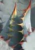
When we reached the Columbia site, he gave us the short story tour and asked if we were going to attempt the hill. From where we were we could see a disabled vehicle half way up the switchbacks glinting sunlight back at us. We s'plored around a bit and then crossed Humbug Creek and began heading up the hill in question towards Tip Top. There were gobs of mines along the way and we stopped near a few for pics of old equipment and the view. The vehicle turned out to be an old Subaru that had pretty much busted all of his front suspension in the rutted old road. We reached the top and then headed down until we reached the beginning of Tule Creek. We ate a nice lunch and then began the hike.
Only a few minutes into the hike, we came upon a ruin almost grown over by brush. As small as it was, it couldn't have been to comfortable but at least it had a chimney.
We continued on through the sometimes vegetation choked creek bed. The constant route finding added a good deal to the time and overall distance. There was still some water in some parts of the creek. We scared up 15+ Javalinas on our way in. We reached one of the main ruins and were happy to spot the other two structures across the creek a little further downstream. After poking around for a bit, we began hiking back since we had evening engagements in town. We would've liked to continue on to Tip Top and down through Table Mesa, but we needed to get back so we drove back down the switchbacks the way we came, smoking brakes and all.
_____________________
May he guide you through the wilderness : protect you through the storm;
May he bring you home rejoicing : at the wonders he has shown you;
Armchair Crisis Design
 
average hiking speed 1 mph

WARNING! Hiking and outdoor related sports can be dangerous. Be responsible and prepare for the trip. Study the area you are entering and plan accordingly. Dress for the current and unexpected weather changes. Take plenty of water. Never go alone. Make an itinerary with your plan(s), route(s), destination(s) and expected return time. Give your itinerary to trusted family and/or friends.

helpcommentissue

end of page marker