Mule Hoof Ruins - 3 members in 4 triplogs have rated this an average 4.7 ( 1 to 5 best )
|
| | | |
| |
|
| Hiking | 1.20 Miles |
712 AEG |
| | Hiking | 1.20 Miles | 2 Hrs 30 Mns | | 0.80 mph |
| 712 ft AEG | 1 Hour Break | | | |
|
|
| |
| Linked |
|
none
[ show ]
| no linked trail guides |
| Partners |
|
none
[ show ]
| no partners | | | Pretty easy off trail hike with less manzanita about than there might have been. Pretty nice ruin, about a dozen rooms, plenty of potsherds about, and absolutely breathtaking views! The drive in was manageable, but interesting. This hike doesn't seem to be getting too much traction, and it really should. |
| _____________________
| | |
|
|
|
|
|
| | | |
| |
|
| Hiking | 3.50 Miles |
|
| | Hiking | 3.50 Miles | | | |
| | | |
| |
| Linked |
|
none
[ show ]
| no linked trail guides |
| Partners |
|
[ show ]
| partners | | Old habits die hard...
I needed a ruin fix. What can I say.. I found this site on Google Earth last year. I love Salt River Canyon and this site showed promise. Being located on the Tonto National Forest also helped. Its just a great setting and the views are amazing! I recruited my old bushwhack ruin hiking partner Hank (Grasshopper) to join me on this one. He took the bait! The plan was to try and check it out this winter. Not an easy task at 4,500-5,200 feet. We got real lucky this month with our recent long warm weather spell. All of the snow from the last big storm had melted and most of the mud along the road coming in had dried up. The weather was perfect! Mild wind, highs in the low 70's, and clear skies.
The hike was fairly straight forward overall for a butte ruin site. Half trail hiking on abandoned road beds and half off-trail. There's only one access route leading to summit. I suspected that ahead of time. The summit is lined with big rugged cliffs on all sides. I got lucky and found a manageable gully scramble route on the west side that took us right up to the top. We literally walked right to it! It doesn't get any easier! Once on top we found a surprisingly large dwelling complex for such a small postage stamp summit. Probably about 10 rooms with defense walls along the west and south cliff edges. Random pottery shards were scattered across the top. Most were small although we did find one hand size piece that Hank got a photo of. None were the cool painted stuff. We didn't see much more than that. I will say though that we didn't take the time to root around under trees and bushes. That's where you find the good stuff that hasn't been scavenged over the years. Remember that none of those big trees and bushes were there 700-1000 years ago.
This was a great classic butte ruin site. Very fun! The easy short access makes it a no-brainer if you're in to stuff like this. The amazing views of Salt River Canyon and Mule Hoof Bend were enough to get me up there. Hank was smiling most of the time.
On the way out we took a short summary tour of upper Phillips Mine. There's a lot going on around there. It was a serious operation in its day. That's a separate trip all in itself. A good excuse to come back amongst other things that this area has to offer. It was just a great day overall with old friend. You can't beat that!
Eric  |
|
Wildflowers Observation Isolated
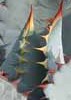
Some small stuff hear and there.. I was surprised to see anything at this elevation in February. A good sign of things to come! |
|
| _____________________
| MATTHEW 11:28-30 / PSALM 84:1-2 |
| | |
|
|
|
|
|
| | | |
| |
|
| Hiking | 3.10 Miles |
979 AEG |
| | Hiking | 3.10 Miles | 5 Hrs 20 Mns | | 1.02 mph |
| 979 ft AEG | 2 Hrs 17 Mns Break | | | |
|
|
| |
| Linked |
|
none
[ show ]
| no linked trail guides |
| Partners |
|
[ show ]
| partners | | There were a number of good reasons why I needed to commit to this one:
..I had not hiked since Nov'15 and I much needed some fresh air and hiking exercise;
..Eric had been to this S/R Canyon area a few times & spoke very highly of it's history, remoteness, & scenic value;
..This was a new area for me and I do enjoy hiking in new, remote, off-trail areas with predetermined destinations;
..Arizona 1950's Asbestos Mining & Homestead history-  ghosttowns.com/stat ... html (buildings are no longer); ghosttowns.com/stat ... html (buildings are no longer);
..An opportunity to hike a Benchmark Peak (Salt 5287) with a lesser know ancient Indian Ruins on the summit;
..A needed opportunity to check-out my new ride igallery/image_page.php?id=5176 on the highway & off-road;
I personally rate this area and hike a 5 of 5 and I was also able to satisfy all the above with a little additional not planned [ photo ] but sometimes part of the game.."no pain no gain".
A most enjoyable day out with one of our resident HAZ Explorerkopelli .. Eric, thank you for the invite |
| _____________________
| (Outside.. "there is No Place Like It!!") |
| | |
|
|
|
|
|
| | | Upper Phillips Mines History Meander, AZ | | | |
|
|
Upper Phillips Mines History Meander, AZ
| | |
| |
|
| Hiking | 0.50 Miles |
73 AEG |
| | Hiking | 0.50 Miles | 1 Hour | | 0.67 mph |
| 73 ft AEG | 15 Mns Break | | | |
|
|
| |
| Partners |
|
[ show ]
| partners | | | A must "meander" on the return drive from hiking to Mule Hoof Ruins/Salt BM 5287. |
| _____________________
| (Outside.. "there is No Place Like It!!") |
| | |
|
|
|
|
average hiking speed 0.83 mph
WARNING! Hiking and outdoor related sports can be dangerous. Be responsible and prepare for the trip. Study the area you are entering and plan accordingly. Dress for the current and unexpected weather changes. Take plenty of water. Never go alone. Make an itinerary with your plan(s), route(s), destination(s) and expected return time. Give your itinerary to trusted family and/or friends.
 Route Editor