|
| | | |
| |
|
| Backpack | 51.10 Miles |
11,477 AEG |
| | Backpack | 51.10 Miles | 4 Days | | |
| 11,477 ft AEG | | 35 LBS Pack | | |
|
|
| |
| Linked |
|
none
[ show ]
| no linked trail guides |
| Partners |
|
none
[ show ]
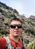
| no partners | | | This was a great hike we did back in June. We started out the day in Death Valley at -200 feet. We drove up to Onion Valley & hiked Kearsarge Pass, taking a north to south route. That 11k feet of elevation kicked our pumpkin. We camped above 10k feet every night, but most of the time we were over 11k. The snow as deep even this late in the year. We spent the mornings with our crampons on and the evenings postholing and wishing we has snowshoes or skis. We camped at just on the west side of Kearsarge the first night. We thought we could make it over Forester the second night, but with a lack of trails and the postholing, we had to camp at the base of it and hit it in the morning. We were able to find two rock outcroppings in the middle of all the snow to make camp. The snow/ice was way too rough to camp in. It was full of these big holes caused by the slow snow melt. Making it up Forester Pass wasn't too too bad. The south side of Forster other the other hand was definitely sketchy. We didn't have ice axes either. Once pass the bad sections it was a fun hike down. We were able to slide down half of the mountain on our butts. We were on snow and ice almost the whole way from Kearsarge to forester, minus some great walking down inthe valley. After forester we had another mile of ice. That was pretty easy going because it was at a slight decline. There was only one or two large snow fields after that. Now came the river crossing. The first crossing at Tyndall we had to get wet. There was no way around it. We heard that there was a chance to jump across down by the ranger station, but we didn't bother. Every single water crossing before and after this one, we were able to find a way across. This was usually accomplished by a down tree. On the slippery trees we used our crampons. What a great idea! Now we are finally covering some ground. We only did about 10 miles that second day, but now we are clocking around 25. With being so far behind our schedule we had to skip summiting Whitney. We heard of people getting up at 4am to do so. The ice is better than the slush I suppose. As far as wildlife, we saw deer and pikas north of Forster and more marmet than I've ever seen in my life south of it. I believe we made camp at Wallace Creek the third night. We met several people telling us that they met a fair amount of PCT'er bypassing Forester. The last night we camped just north of Cottonwood pass and made for a somewhat early high out. I have to say that the one thing about hiking against the flow of PCT'ers was how many of them we got to meet and exchange information with. This was a tough hike with no doubt, but I had a great time. Hopefully next time, there will be a lot less snow. If there isn't, I'm bringing snow shoes. |
| _____________________
| | |
|
|
|
 Route Editor