|
| | | |
| |
|
| Run/Jog | 100.00 Miles |
23,000 AEG |
| | Run/Jog | 100.00 Miles | 33 Hrs 23 Mns 33 Secs | | 3.15 mph |
| 23,000 ft AEG | 1 Hour 41 Mns Break | | | |
|
|
| |
| Partners |
|
none
[ show ]
| no partners | | Decided to try my hand at one of the oldest 100 milers, Wasatch Front, which began in 1980, and runs point-to-point through the mountains from Kaysville to Midway, UT. Didn't get as much training as I wanted due to an achilles issue in late July.
Started up Bair Canyon at 5am, conga line up a super steep trail (I think 1,500 ft the last mile). Tough way to start things out. Bad air quality. The next 12-13 miles to the Sessions Liftoff were "easy".
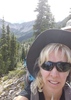
Sessions crest was pretty rough, it was hot up there. Great views, would be nice to see it on a clearer day. Then more ridge down to an aid station at mile 40, then up Alexander Creek in cooler shady temps with waning daylight.
At Lambs Canyon Trail, had to pull out the flashlight. Of course I think this is where the course really starts to get pretty. And also even more difficult; the climbs never ended. At Big Water TH it finally got a little frigid, but the jacket stayed on for just a short time, as it warmed up on the way up to Desolation Lake. I was actually feeling much better at this point, and had no serious doubts about finishing this thing.
Brighton was quite chilly at 3:45am. And the climb after Brighton was pretty brutal, although Lake Mary under the full moon was pretty sweet. Steep descent to aid, then a short but very, very steep ascent up to the Ant Knolls ridge. Sun started coming up at this point. Overall the night portion of this run went pretty well.
The last 20 miles was just way too long. Despite being "downhill", the trail to the Pot Hollow junction was sheer (pretty) misery, with pointless steep climbs and steep, loose descents. Couldn't win either way. Once I started the drop down to Pot Hollow (mile 85), I kicked up the effort a notch and finished pretty solidly (despite a very warm and exposed last 10 miles). Saw a pretty onery looking bull moose at around mile 88.
Was absolutely thrilled to roll into the finish, and at a somewhat reasonable time (i.e. not pushing the cutoff). Pretty sure I was working my way to actual heat illness there, but tempered my effort those last few miles just enough to only feel a little puky after finishing. |
| _____________________
| | |
|
|
|
 Route Editor