|
| | | |
| |
|
| Hiking | 4.80 Miles |
1,959 AEG |
| | Hiking | 4.80 Miles | 2 Hrs 34 Mns | | 2.94 mph |
| 1,959 ft AEG | 56 Mns Break | | | |
|
|
| |
| Linked |
|
none
[ show ]
| no linked trail guides |
| Partners |
|
none
[ show ]
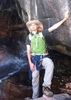
| no partners | | Day 4 in Lassen Volcanic National Park-- We woke up around 3:30am, layered up with warm clothes, broke down our campsite, and headed to the trailhead. The moon was very bright, so no need for headlamps! The trail was recently redone as a park project, and there is a small brick wall blocking off the old trail, or "scar" heading straight up to the summit; the new trail is graded and smooth. The wind was bitter cold and strong, we really had to lean into it, especially as we approached the summit. Once at the top, we hurried over to a large boulder to block the wind, where we almost literally stumbled upon someone in a sleeping bag. I shrieked, Jared laughed, and the stranger looked pretty startled, too. We stayed up top for the sunrise, and then happily scrambled back down to our heated car. 
Note: The sign at the trailhead specified that the trail leads to the "first summit," and it looked like the trail beyond that leading to the true summit is no longer in use. With all the signs asking hikers to stay off the old trail, we didn't want to risk hiking on if we weren't supposed to. |
| _____________________
| | |
|
|
|
 Route Editor