|
| | | |
| |
|
| Backpack | 8.28 Miles |
703 AEG |
| | Backpack | 8.28 Miles | 2 Days | | |
| 703 ft AEG | | | | |
|
|
| |
| Linked |
|
none
[ show ]
| no linked trail guides |
| Partners |
|
none
[ show ]
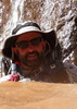
| no partners | | My friend and I tried this just shy of 3 months ago, on June 20th. Here's that trip report. Our objective was the same as before, to find the second stage of geocache, Mad Shartin. Since we were unable to go the distance in a day, we decided to take two days and spend a night in Hells Gate Wilderness.
We had been waiting for the monsoon to end for this trip as we definitely didn't want to worry about flash flooding. We also wanted to get this done before the water cooled off too much.
The water was much more turbid than the first trip. That slowed us down since it was impossible to see the boulders and rocks in the water and we had to feel our way through (i.e. constantly stumbling). The water was cooler than before and the day wasn't as warm either. Except for the initial plunge, the water wasn't bad, we never got cold. I don't know if that would be the case any more this year.
Like a dummy, I figured the trash compactor bag I've used for over 2,000 miles of backpacking would still be water proof. It wasn't. Hey, I blew air into it the night before and it seemed to work. At our first break, I reached down to the bottom of the pack and felt some moisture. My quilt and sleeping pad were a bit wet. I let them dry in the sun for a bit while we ate. My friend had a spare garbage bag, so I put the quilt in it and things were good for the rest of the trip.
Nearing 2:00PM, we found a campsite with lots of abandoned gear. There was an axe, a hatchet, a stove, grill, pots and pans, sleeping bag, tent, and so on. Who would carry all this crap here? While looking around, it sprinkled a bit. This was about .9 crow miles from our target. Camping is limited in the canyon, so we decided this would be a good place to camp for the night. We hoped we could reach our target and return before dark though we weren't banking on it so we didn't leave any of our gear.
We continued on working our way down Tonto Creek, wading and swimming as necessary. There's a sliver of the creek outside of Hells Gate Wilderness which is where the second stage of the geocache was located. Geocaches aren't allowed in designated wilderness, at least physical ones. We were able to find the stage quickly once we got there. We rested a bit and had some food, then headed back up the creek to the campsite. The worst part of the campsite coming from downstream, is that you need to swim to it, so we finished the day soaking wet.
We made it to the campsite just before six. That gave us enough light to take care of all the camp chores, like filtering water and setting up camp, before dinner. After dinner, we had a small campfire and enjoyed a couple of beers we carried in. Just before nine, it started raining so we ran to cover things up. I set up my tarp and then turned in for the night.
We were sore and tired the next morning so took our time breaking camp. That first plunge in the creek is about as wakening as coffee.
The water wasn't as turbid on the way out, but it got worse as we moved upstream and we still couldn't see the rocks and boulders beneath the surface.
We saw two bald eagles on the way out, they flew right past us.
I decided that while I'm glad I spent a night in Hells Gate wilderness, I really have no desire to, say, go from Bear Flat to Gisela. Tonto Creek is extremely difficult to traverse, especially when the water is turbid. There are many pools to swim across and wade through. Travel is slow. Expect to only go four or five miles a day. You will get scraped up, you need to know what poison ivy looks like, chafing is an issue. It is a beautiful setting though. |
| _____________________
| | |
|
|
|
 Route Editor