username
X
password
register
for free!
help
ArticlesGuidesRoutes
 
Photosets
 
 Comments
triplogs   photosets   labels comments more
Arizona Hot Springs via White Rock Canyon - 18 members in 38 triplogs have rated this an average 3.8 ( 1 to 5 best )
1, 2  Next
38 triplogs
login for filter options
Feb 17 2024
avatar

 Triplogs 71

male
 Joined Jan 23 2025
 Seattle, WA
Arizona Hot Springs via White Rock CanyonNorthwest, AZ
Northwest, AZ
Hiking avatar Feb 17 2024
dhelderTriplogs 71
Hiking6.70 Miles 1,135 AEG
Hiking6.70 Miles
1,135 ft AEG
 no routesno photosets
1st trip
Linked   none no linked trail guides
Partners none no partners
 
Feb 21 2023
avatar

 Guides 16
 Routes 81
 Photos 1,269
 Triplogs 1,144

51 male
 Joined Apr 30 2008
 Tucson, AZ
Arizona Hot Springs via White Rock CanyonNorthwest, AZ
Northwest, AZ
Hiking avatar Feb 21 2023
azdesertfatherTriplogs 1,144
Hiking6.59 Miles 1,499 AEG
Hiking6.59 Miles   3 Hrs   8 Mns   2.50 mph
1,499 ft AEG      30 Mns Break25 LBS Pack
 no routes
1st trip
Linked   none no linked trail guides
Partners none no partners
Awesome destination! My favorite hot spring so far in Arizona, and second anywhere only to Gila Hot Springs in NM. Did this loop clockwise, getting the ups and downs and exposure out of the way early in the morning, and taking the slow and steady incline protected by the shade of the canyon walls around midday on the way out. Water in the first pool was probably around 120 degrees, almost too hot where it was first seeping out of the walls. As I expected, we had to endure a couple of older middle aged guys (there’s always at least one) who strip down to show off body parts far from impressive. Water in the Colorado was gorgeous, along the sides a clear, emerald color.

water 1 out of 5water 2 out of 5water 3 out of 5water less than max Hot Spring Gallon per minute Gallon per minute
Nice flow, and hot where seeped out of rock, around 120 degrees.
_____________________
"I went to the woods because I wished to live deliberately, to front only the essential facts of life, and see if I could not learn what it had to teach, and not, when I came to die, discover that I had not lived." — Henry David Thoreau
 
Feb 17 2023
avatar

 Guides 94
 Routes 840
 Photos 22,055
 Triplogs 1,993

52 male
 Joined Sep 18 2002
 Tempe, AZ
Hot paddling, AZ 
Hot paddling, AZ
 
Kayak avatar Feb 17 2023
chumleyTriplogs 1,993
Kayak32.96 Miles 300 AEG
Kayak32.96 Miles2 Days   5 Hrs   1 Min   
300 ft AEG
 no routes
1st trip
I'd never been in this area and the opportunity to paddle here was one I wasn't gonna turn down.

I had never even seen a photo of the catwalk to the gauging station , and that was a fun side trip, despite the signed recommendations discouraging it. It was nice to see emerald cave on a weekday, and positively comical to see 60 floaters waiting in line for hours to get a photo there on our exit day. It's mind-boggling to me what people will do for a photo. :M2C: (if you disagree, ask those people waiting in line if they would be there if they didn't have a camera). To each their own I guess. [-(

We got chased by homeland security at the dam. Apparently I'm considered a "hostile actor" and "appropriate action will be taken". Thankfully, I'm pretty good at paddling :D

I don't really do tourist attractions. Sauna cave was hot, stuffy and meh. Boyscout was insanely overcrowded. Like who enjoys this feces? The canyon and geology was nice though.

There are apparently 14 hot springs along this stretch and we found some of the others along the way and enjoyed the solitude. Go explore. You'll appreciate it. The three named ones are nice too, but only at 4am when they're not overrun with visitors. Can't complain when you're one of them though!

Apparently the mormon church does trips here with their kids. And boy scouts too. There was one beach with 60 (sixty!) canoes and their camp. Seriously WTF? Fun thing though, they weren't allowed to get in the hot springs if there were naked people in there. #winning :DANCE: :sweat:

Favorite moment of the weekend: teenage boy asking dad-type person who had obviously given him instruction to not "look" audibly asking "what am I supposed to look at!?" to which the reply was "the wall! look at the wall!!!" :sweat: poor kid. They're boobs. Your life won't end if you catch a glimpse. :oops:

Straight up pumpkin-ton of people at the beach though we camped there two nights and survived. Brought all the firewood we needed as of course there is nothing natural to burn there. Crowds and popularity not my thing, but managed to make an ok time of it. Might be a one and done for me though. Fun trip nonetheless.
_____________________
I'm not sure what my spirit animal is, but I'm confident it has rabies.
  1 archive
Dec 27 2022
avatar

 Guides 12
 Routes 192
 Photos 863
 Triplogs 356

42 male
 Joined Nov 30 2015
 Phoenix, AZ
Arizona Hot Springs via White Rock CanyonNorthwest, AZ
Northwest, AZ
Hiking avatar Dec 27 2022
ShatteredArmTriplogs 356
Hiking6.17 Miles 1,114 AEG
Hiking6.17 Miles   2 Hrs   13 Mns   2.94 mph
1,114 ft AEG      7 Mns Break
 
no photosets
1st trip
Linked   linked  
Partners none no partners
Quick easy hike with a friend who's currently in Vegas. When I was a teen, we kayaked from below Hoover Dam to Willow Beach, and camped on the beach by AZ hot springs (not sure if it was called anything at the time). It was really cool refreshing my memories of the place; my memories of the campsite were pretty accurate, the hot springs not so much (though they could've changed - I didn't remember a ladder). A bunch of people at the hot springs, as expected (overheard: "I think this is so hot you could boil an egg!").
_____________________
 
Oct 19 2019
avatar

 Guides 1
 Routes 226
 Photos 1,675
 Triplogs 1,867

65 male
 Joined Oct 17 2008
 Phoenix, AZ
White Rock Petroglyphs, AZ 
White Rock Petroglyphs, AZ
 
Hiking avatar Oct 19 2019
rcorfmanTriplogs 1,867
Hiking4.03 Miles 551 AEG
Hiking4.03 Miles   1 Hour   48 Mns   2.35 mph
551 ft AEG      5 Mns Break
 
1st trip
I arrived at the trailhead too late to take in the hot springs, especially since I was hoping to get to Liberty Bell Arch too, as my priority was to see the petroglyphs in the next canyon over.

I was pretty much winging this as I only had a waypoint on my GPSr to the petroglyphs, not the route. Same for the arch. I did look at the satellite view over a week before but my memory was sketchy.

Getting to the petroglyphs was pretty straight forward. A trail headed off to the left that I took and it let me to the canyon. The canyon was a slot for a short bit with some good pour offs I had to descend or go around. One in particular took some daring, but not too bad for this chicken pumpkin. I've heard there's an easier way, but I didn't know where and didn't want to take the time searching, so I went out the way I came. Going up was the simpler task than going down.

The petroglyphs were pretty nice, worth the effort. Unfortunately, there was some vandalism going on. That's always disappointing to see.

On my way out, I got on an old road that I thought was the way to the arch but it soon became obvious I was on the wrong path. As the sun was nearly set, I headed back to my truck. I'll have to come out here and explore more another time, find the arch, and enjoy the hot spring.
 Fauna
 Fauna [ checklist ]
[ checklist ]  Tarantula
_____________________
Go find a LonelyCache
 
Mar 14 2019
avatar

 Photos 59
 Triplogs 8

59 male
 Joined Sep 25 2003
 San Tan Valley,
Arizona Hot Springs via White Rock CanyonNorthwest, AZ
Northwest, AZ
Hiking avatar Mar 14 2019
WoopTdoTriplogs 8
Hiking6.70 Miles 1,135 AEG
Hiking6.70 Miles   3 Hrs   30 Mns   2.68 mph
1,135 ft AEG   1 Hour    Break
 no routes
1st trip
Linked   none no linked trail guides
Partners none no partners
Definitely enjoyed this one, and March is the perfect time. I took the left side for out and back but next time will probably do the loop, but since it was just me and no GPS better stick with the route I came in on. Not much to it mainly a gentle descent but did have some nice views. Did get a bit of scare about midwday through, while down in the canyon I heard some rocks tumbling which made me a little nervous but when I looked up it was a couple of bighorn sheep. I watched them for a while and wish I could move on the rocks like that. I took a few pics and then continued on. It took me about and hour to get to the springs, it was nice when I finally heard some voices and new I was close.

I came around the bend and saw packs and shoes and then the next corner the pools. Found a place to drop my pack and change into my sandals and go in, the first one was very warm, didn't stay in that too long, next one was nice but I wanted to take it all the way to the river so kept on going. The next pool was probably the best temperature but most people were in there birthday suit, all were very kind and enjoying the soak. That's the end of the pools so I followed the canyon till I hit the ladder and just kept on going to the river. It was beautiful and clear but it was cold, if only the springs were a little closer so you could jump from one to the other it would be great. Took a few more pics and then headed back to the pools to get my soak on.

Found a nice spot in the middle pool and just sat down and relaxed and contemplated life for a while, absolutely would of been great to have a cold beer but luke warm water and a snickers was all I had. Did chat with quite a few people as they came through or stopped for a soak but then I decided better head back. Grabbed my stuff and walked bit up the canyon to get into the sun so my feet could dry off and put my shoes and socks back on and then headed back. Did take a few breaks on the way back, walking up hill in the sand makes things a little harder. Did see the Big Horns on the way back also, just wish I would of brought a better camera. Next time I'll do the loop and bring a cold beer to enjoy while I'm down there!
_____________________
 
Mar 13 2019
avatar

 Guides 3
 Routes 632
 Photos 8,235
 Triplogs 604

54 male
 Joined Apr 13 2011
 Gilbert, AZ
White Rock Canyon-Arizona Hot Springs Loop, AZ 
White Rock Canyon-Arizona Hot Springs Loop, AZ
 
Hiking avatar Mar 13 2019
ddgrunningTriplogs 604
Hiking7.24 Miles 1,325 AEG
Hiking7.24 Miles   3 Hrs   43 Mns   2.15 mph
1,325 ft AEG      21 Mns Break
 
1st trip
Partners none no partners
This hike has been on my to do list for several years, but the timing has never worked out ... until now.

With a spring break trip to Provo, Utah and overnight in Cedar City, I decided we would have just enough time to stop and do this hike along the way. Also, this is the prime time of year to do this trail from a temperature standpoint.

We got a little later start from the valley than I would have liked, but my two teenagers were committed to attending their track practice first. Good for them, but it pushed back our start time to a little later than optimal, and we reached the trailhead at 3:30 pm.

I had downloaded the official track--which goes down White Rock Canyon. No one had posted a route up or down AZ Hot Springs Canyon, but Google Maps showed a route, and a couple of the triplogs mentioned the possibility of making this a loop, so I finished out the route on Route Editor and off we went.

The trailhead does not have any bathroom facilities. It does have signage with a decent map and some information about the Hot Springs trail and the trail to Liberty Arch. The sign also says the trail is closed from May 15 to Sept. 30, for heat related reasons. I presume that simply means that the parking lot is closed/locked.

The first mile from the TH is nothing to write home about. We crossed under the highway and wandered down a wide wash. Various routes spider through the area, but all generally funneled us towards the narrower White Rock slot in the distance.

As the drainage begins to narrow, just shy of a mile, a signed fork in the trail denotes the turn off to Liberty Bell arch on the right.

Continuing on, the canyon's namesakes appear in the wash in contrast to the surrounding dark rock. The slot closes in, as we began to meander twists and turns along the bottom of the drainage. Fun views around each corner.

A little over 2 miles in, the slot opens up for a quarter mile or so and then narrows back up again. I read on the description or some triplogs about there not being a lot of places to clamber to safety in the event of a flash flood. I actually saw a lot of places where refuge could be had. I'm not suggesting anyone ignore the risks of a flash, but if you were caught in a flash, I wouldn't abandon all hope. It's no Buckskin Gulch.

Soon enough, we arrived at the river and a fairly expansive beach-ish area. Lots of good camping spots in this area, including one I marked on the Route that sits on a raised shelf with views down to the river.

At this point, the trail heads south and slightly away from the river, as we traversed over to the outlet of the AZ Hot Springs Canyon drainage. The route is pretty easy to follow and is probably unnecessarily marked with some crude yellow spray paint arrows in a few places.

Along the way are some outcroppings that jut out into the river and make for fantastic viewpoints, as well as some solid cliff jumping opportunities into the very clear and picturesque water along the shoreline. It was late in the day (around 5pm), and with the sun already casting shadows across the river--and our desire to finish up before dark--we skipped the cold jump and continued on to the mouth of AZ Hot Springs Canyon. Unfortunately, the late afternoon lighting didn't make for great photos of the clear water, but it was absolutely beautiful!

We descended from the rocky traversed down to the AZ Hot Springs beach. Other than one camper, no one was to be seen on the beach. Lots of camping opportunities here, as well, but not nearly as big as at the mouth of White Rock Canyon.

We checked out the waterline and the bathroom facilities and then headed up the drainage towards the hot springs. Within a short period, we switched from hiking shoes to sandals, as avoiding the water became impossible.

It wasn't long before we reached the 20' ladder up to the springs. From below, I could smell marijuana smoke wafting from above. :x Sure enough, right at the top of the ladder was a guy and his girlfriend subjecting everyone in the area with their joint. Not exactly the kind of experience in nature that I planned for my wife and two teenagers. I was annoyed but moved on.

The first of three established pools was just around the corner. It was empty other than a young couple. With the sandbag barriers, the water was thigh deep at its deepest, and ran for about 20-30 feet to the sandbag barrier for the second pool, which was much smaller (8x8) and warmer. Pool two had only one occupant. Finally, pool three was uncomfortably warm to hang out in for very long, particularly as you continued up another 15-20 feet towards the source of the spring.

We hung out briefly in pools 2 and 3 before drying off and continuing our race against the sun and up AZ Hot Springs Canyon to our exit.

Not too far above the springs are several other camping options, and there were a couple of folks who had set up camp in this area. The canyon is relatively wide through most of this area.

We met up with a couple who hike in the area frequently. The guy was from Newfoundland and was a "retired" speed climber. He said he trains in the area quite often. He suggested an alternative route for our return from the one I had programmed into Route Scout. It included some petroglyph panels and a little rock scrambling, so we were all in.

As were were hiking along, four male bighorn sheep appeared on the ridge directly across from us. It was an impressive sight, and alone, made the trip an A+ in my book.

We then reached a well-tatooed petroglyph rock with some pretty elaborate glyphs that were fairly unique in my uneducated experience. One looked like an elephant. Also a very cool experience. There was another glyph panel another 30 yards or so up.

A little later, we came to the scrambling. Nothing particularly technical, but my wife and daughter benefited from a boost here and there. I marked the scramble on the gps route.

As we continued up the drainage, we came to what appeared to be a dead end--cliffed out at a pretty vertical 15 foot climb. Of course, the "speed climber" went straight up, and my 16 year old son followed. For the rest of us mere mortals, we backtracked 30 yards or so, and there was a bypass on the left, which while still requiring some scrambling was much more doable.

After that it was easy walking till we reconnected with the "official" trail and made our way back to the TH just as the last vestiges of light were descending below the horizon.

This was an excellent hike and we hit it at a great time of year--and actually a great time of day. Other than the unwelcome smoking in the hot springs, I have nothing but great things to say about this one. It would make a great overnight backpack trip, and I look forward to returning to do that next time.
_____________________
  1 archive
Mar 02 2019
avatar

 Routes 386
 Photos 49
 Triplogs 792

43 female
 Joined Jun 23 2015
 Phoenix, AZ
Arizona Hot Springs via White Rock CanyonNorthwest, AZ
Northwest, AZ
Hiking avatar Mar 02 2019
emilystardustTriplogs 792
Hiking8.20 Miles 1,135 AEG
Hiking8.20 Miles
1,135 ft AEG
 no routesno photosets
1st trip
Linked   none no linked trail guides
Partners none no partners
_____________________
 
Sep 28 2017
avatar

 Triplogs 6

49 male
 Joined Jul 15 2017
 Kingman, AZ
Arizona Hot Springs via White Rock CanyonNorthwest, AZ
Northwest, AZ
Hiking avatar Sep 28 2017
scottysnowskiTriplogs 6
Hiking6.70 Miles 1,135 AEG
Hiking6.70 Miles
1,135 ft AEG   2 Hrs    Break15 LBS Pack
 no routesno photosets
1st trip
Linked   none no linked trail guides
Partners none no partners
This is a fairly easy hike to make at least going downhill. It will take roughly 2 hours to get to the hot springs pools. You park at HWY 93 a few miles south of Hoover Dam and hike down to the river. There are basically three routes to the springs. They vary by a few tenths of a mile. We like going over the "middle" route. It won't seem reasonable since you have to go up over a mountain ridge before dropping to river level. We have found though that this "middle" route is by far the easiest. The left option (closer to 93) runs you into some dry waterfalls (10-15 feet) and requires some cliff hugging in steep places. The last option is the right option (river side) is the longest and has you hiking in sandy washes a good part of the way. It wont seem correct, but take the middle fork if you can find it. Once at the spring, you'll find three or four pools. The top pool is quite hot, too hot for most to relax in. They get cooler as you move west toward the river. Culminating with the last pool being pretty cool (like bath water warm) and a long ladder to continue down the wash to get to the river. Hiking back up to you vehicle will tax you more than coming down. Not only are you going uphill now, but you will feel hike a lot more hiking in the sand. Finally, if you have enjoyed a few beers in the springs, it will also make hiking up more difficult. So, have fun, but be reasonable. On a side note, every time we have been there, we have met people who kayaked in from the Colorado River. Perhaps, this may be the easiest way to get to AZ Hot Spring. The river edge is probably only half a mile from the hot springs.
_____________________
 
Apr 23 2017
avatar

 Guides 9
 Routes 118
 Photos 1,079
 Triplogs 118

35 male
 Joined Mar 06 2016
 Salt River Valle
Black Canyon - Hoover Dam to Willow BeachNorthwest, AZ
Northwest, AZ
Kayak avatar Apr 23 2017
arizona_waterTriplogs 118
Kayak13.99 Miles 909 AEG
Kayak13.99 Miles   6 Hrs   49 Mns   2.21 mph
909 ft AEG
 
1st trip
Partners none no partners
We did this route as a day trip with a large group of friends. We worked with Desert River Kayak to obtain access to the put-in at the dam. The morning started out great, but by the early afternoon, we were taking on some pretty significant headwinds. The winds picked up to 25mph, with gusts up to 40mph, according to NOAA. Despite the weather, this is a really fun trip. It would be ideal to do this as an overnight and camp on one of the sandy beaches. This would allow more time to explore the many side canyons. That being said, Boy Scout Canyon was by far the most interesting and unique place we stopped. We avoided Goldstrike Canyon because there were so several boats already parked there, and I don't like waiting in line to hike...
I did make an exception for AZ hot spring, since everyone in my group wanted to see it.

It's getting close to that time of year when humans should avoid the Colorado Main Stem. It gets rather warm, even in April. However, the dam does tend to release more water to downstream users this time of year. And the cold water is a reprieve from the relentless sun.

Awesome trip. Not sure if I will do it again anytime soon. But I will definitely look for a way to get back in Boy Scout Canyon! :D
 Fauna
 Fauna [ checklist ]
[ checklist ]  Bighorn Sheep
 Culture
 Culture [ checklist ]
[ checklist ]  Stream Gauging Station

water 1 out of 5water 2 out of 5water 3 out of 5water less than max Boy Scout Canyon Medium flow Medium flow
The flow really picked up the further you move up into the canyon.

water 1 out of 5water less than maxwater less than maxwater less than max Hot Spring Dripping Dripping
Dripping out over a cliff into the Colorado.

water 1 out of 5water 2 out of 5water 3 out of 5water less than max Hot Springs Gallon per minute Gallon per minute
There are many "hanging garden" style hot springs in this canyon. They drip pretty constantly. There are also a few that flow straight out of the ground, contributing to the creek's flow.

water 1 out of 5water 2 out of 5water less than maxwater less than max Lake Mead 26-50% full 26-50% full
46% full, to be exact!

water 1 out of 5water 2 out of 5water 3 out of 5water less than max Lost Man Hot Spring Gallon per minute Gallon per minute
waterfall hot spring!!

water 1 out of 5water 2 out of 5water 3 out of 5water less than max Ringbolt Hot Spring Gallon per minute Gallon per minute
surprising amount of flow. The hot spring is dammed in places by sandbags.

_____________________
- there's nothing like finding Water in the Desert -
  1 archive
Feb 13 2017
avatar

 Guides 6
 Routes 6
 Photos 1,634
 Triplogs 186

58 male
 Joined Apr 04 2002
 Flagstaff, AZ
Arizona Hot Springs via White Rock CanyonNorthwest, AZ
Northwest, AZ
Hiking avatar Feb 13 2017
squatpukeTriplogs 186
Hiking6.70 Miles 1,135 AEG
Hiking6.70 Miles
1,135 ft AEG
 no routes
Linked   none no linked trail guides
Partners none no partners
My third trip to the springs. Figured it would not be too crowded since it was a Monday, but still had 4-8 people at the springs. Kinda bummed about that.

Val and I returned back to parking lot only to find my Honda Accord with flat tire; 1 large screw thru the back tire tread. Popped on the doughnut and limped into Boulder City to get the flat fixed...Had pizza at Tony's in downtown BC.

Afterwards, Val and I drove down thru searchlight and into Laughlin for some R&R for her birthday.
 Culture
 Culture [ checklist ]
[ checklist ]  Dream
_____________________
squatpuke@gmail.com
 
Dec 19 2016
avatar

 Guides 13
 Routes 38
 Photos 1,651
 Triplogs 577

60 male
 Joined Nov 15 2005
 Jackson, CA
Arizona Hot Springs via White Rock CanyonNorthwest, AZ
Northwest, AZ
Hiking avatar Dec 19 2016
toddakTriplogs 577
Hiking6.70 Miles 1,135 AEG
Hiking6.70 Miles   3 Hrs      2.23 mph
1,135 ft AEG
 no routesno photosets
1st trip
Linked   none no linked trail guides
Partners none no partners
Yet another very cool AZ place, worth stopping for if you're driving by. Did the loop, CCW. Several tiers of sandbags are in place below the springs, creating a series of pools up to waist deep.

There are lots of trails in the area - on the hike out I must have missed the primary trail and ended up in a canyon with two 20-foot dry falls to ascend, 4th class or maybe a move or two of easy 5th class.
_____________________
 
Feb 20 2016
avatar

 Guides 19
 Routes 40
 Photos 5,624
 Triplogs 341

52 female
 Joined Nov 22 2005
 Tucson, AZ
Arizona Hot Springs via White Rock CanyonNorthwest, AZ
Northwest, AZ
Hiking avatar Feb 20 2016
writelotsTriplogs 341
Hiking6.70 Miles 1,135 AEG
Hiking6.70 Miles   4 Hrs      1.68 mph
1,135 ft AEG
 no routes
Linked   none no linked trail guides
Partners none no partners
Returned to this fun hike, starting this time from the parking area off of Highway 93 and hiking down to the springs and back. I was amazed when I drove past the day before how many cars were in the parking lot. It must be a very popular hike now, and I imagine that the parking lot and signs have done a lot to ruin the quiet of this slot canyon.

Hike was still nice, though, and because of the narrow winding character of the canyon, we seldom saw the other people on the trail before and behind us. When we got to the hotspring, however, holy wow what a freaking zoo! We elected not to ascend the ladder (there was a very long wait to anyway) and instead went down to the river and ate our lunch in peace.

I was with my friend Michelle, who has done very little hiking with me, and she loved the canyon. It's a great trip for non-hikers, since it offers some amazing scenery, easy walking and a great payoff at the end (either the river or the spring are worth the trip).

Trash is becoming a real problem in this canyon, and I imagine it doesn't flash often enough to keep things clean. I wanted to make up a brochure about packing out toilet paper and hand it to everyone I saw. It just gets SO FREAKING GROSS after a while.
wildflower observationwildflower observationwildflower observationwildflower observationwildflower observation
Wildflowers Observation Isolated
Looking good for a few weeks from now.

water 1 out of 5water 2 out of 5water 3 out of 5water 4 out of 5 Hot Spring Gallon + per minute Gallon + per minute

water 1 out of 5water 2 out of 5water less than maxwater less than max Ringbolt Hot Spring Quart per minute Quart per minute

_____________________
-----------------------------------
Change will not come if we wait for some other person or some other time. We are the ones we've been waiting for. We are the change that we seek.- Barack Obama
 
Dec 20 2015
avatar

 Guides 26
 Routes 21
 Photos 562
 Triplogs 1,393

female
 Joined Jan 04 2011
 Las Vegas, NV
Arizona Hot Springs via White Rock CanyonNorthwest, AZ
Northwest, AZ
Hiking avatar Dec 20 2015
autumnstarsTriplogs 1,393
Hiking9.52 Miles 1,931 AEG
Hiking9.52 Miles
1,931 ft AEG
 no routes
Partners none no partners
A quick hike out at White Rock Canyon today. First, Liberty Bell Arch, plus enjoyed the views from the overlook. Then, back down to loop through the hot springs. Shocked to find no one at the pools, I enjoyed a solitary soak. As an aside, climbing that ladder with bare feet really hurts! Lesson learned = always bring extra shoes, even though the water-not-optional part of this canyon is so short. There was a group of 3 camping in the wash just above the hot springs.

Looped around to finally climb out the way I had been eyeing last December. A couple reasonably challenging climbs, but knowing I didn't have to worry about possibly needing to downclimb them made all the difference. The climbs lead to a whole additional wonderland of cave and hole-filled canyon walls. Added a fun new dimension to a hike I have done so many times.

Upon returning to the trailhead, there was an emergency vehicle parked and a young man in a SAR vest asked which way to the hot springs? Hmmm...

An update to report for this hike. The park service has now placed a sign at the Liberty Bell turn-off.

water 1 out of 5water 2 out of 5water 3 out of 5water 4 out of 5 Ringbolt Hot Spring Gallon + per minute Gallon + per minute

_____________________
"Let it ride / Let it roll / Let it go"
 
Oct 10 2015
avatar

 Routes 26
 Photos 1,288
 Triplogs 124

66 male
 Joined Oct 28 2003
 Andover, NJ
Arizona Hot Springs via White Rock CanyonNorthwest, AZ
Northwest, AZ
Hiking avatar Oct 10 2015
big_loadTriplogs 124
Hiking3.84 Miles 847 AEG
Hiking3.84 Miles   1 Hour   57 Mns   2.35 mph
847 ft AEG      19 Mns Break
 
no photosets
1st trip
Linked   none no linked trail guides
Partners none no partners
A quick jaunt on the way back to Vegas from Kingman. I stopped short of the spring because my thermometer passed 100 and heat was just getting started. This would be interesting on a cooler day.
_____________________
 
Dec 28 2014
avatar

 Guides 26
 Routes 21
 Photos 562
 Triplogs 1,393

female
 Joined Jan 04 2011
 Las Vegas, NV
Arizona Hot Springs via White Rock CanyonNorthwest, AZ
Northwest, AZ
Hiking avatar Dec 28 2014
autumnstarsTriplogs 1,393
Hiking10.75 Miles 2,700 AEG
Hiking10.75 Miles
2,700 ft AEG
 no routes
Partners none no partners
Hike to Arizona Hot Springs with a few side trips.
A little chilly to start the day off with cloud cover and a breeze, but things warmed up nicely and ended with pleasant hiking temperatures. First was the hike to Liberty Bell Arch and the Colorado River overlook - beautiful as always. No one along this section except a very friendly British couple. We chatted about the area's geology for a bit.

Back in White Rock Canyon, it was cool and damp. After reaching the Colorado, the Park Service has added yet a few more signs to try and keep people on a single trail. Whether this is working, I don't know - some signs only seem more confusing because the arrows only point up, down, or at 90 degrees, but no diagonals.

Met three groups at the hot springs pools. I stayed only long enough to soak my feet briefly - didn't really want to involve myself in their animated argument about which group had hiked in the harder way. On the plus side, skipping a soak gave me "extra" daylight to go wandering and locate some sites I had been wanting to check out up canyon.

A good day and a good hike for my last before our New Year's Grand Canyon backpack.

water 1 out of 5water 2 out of 5water 3 out of 5water 4 out of 5 Ringbolt Hot Spring Gallon + per minute Gallon + per minute
Good flow. Uppermost pool very hot today.
_____________________
"Let it ride / Let it roll / Let it go"
 
Oct 11 2014
avatar

 Guides 26
 Routes 21
 Photos 562
 Triplogs 1,393

female
 Joined Jan 04 2011
 Las Vegas, NV
Arizona Hot Springs via White Rock CanyonNorthwest, AZ
Northwest, AZ
Hiking avatar Oct 11 2014
autumnstarsTriplogs 1,393
Hiking6.30 Miles 2,138 AEG
Hiking6.30 Miles
2,138 ft AEG
 no routes
Linked   none no linked trail guides
Partners none no partners
We had guests in town, and this was their pick for a Saturday hike. The majority of the "trail" is the bottom of a deep gravel-filled wash. Makes it a breeze going down and less so coming up for those who aren't prepared. As on previous trips here, we hiked down White Rock Canyon and looped around out Hot Springs Canyon, then up and over the ridge back toward the parking.

We enjoyed watching the kayaks on the Colorado for a bit, then headed for the hot springs. For once, there was no one else at the hot springs when we arrived, so we had the luxury of enjoying a soak. This was much appreciated by our less experienced companions. The top and second-to-top pools were much too hot for me today, and everyone else seemed to agree.

Signs have been added once you climb up and out of Hot Springs Canyon. Although we never had trouble following the use trail, perhaps this is where people were getting lost? There were 37 SAR incidents in this area during the first seven months of 2014, resulting in three fatalities, and I recall at least one of the people who died and several of the successful rescues were reported as getting lost.

No bighorns spotted today, which is unusual here. But, everyone enjoyed the hike. It is always interesting to go on a hike with new people. Gives you a new perspective because they are amazed by things you are used to and have stopped noticing.

water 1 out of 5water 2 out of 5water 3 out of 5water 4 out of 5 Ringbolt Hot Spring Gallon + per minute Gallon + per minute
Good flow. Very hot in upper pool today.

_____________________
"Let it ride / Let it roll / Let it go"
 
May 24 2014
avatar

 Guides 6
 Routes 6
 Photos 1,634
 Triplogs 186

58 male
 Joined Apr 04 2002
 Flagstaff, AZ
Arizona Hot Springs via White Rock CanyonNorthwest, AZ
Northwest, AZ
Hiking avatar May 24 2014
squatpukeTriplogs 186
Hiking6.70 Miles 1,135 AEG
Hiking6.70 Miles   6 Hrs      1.12 mph
1,135 ft AEG
 no routes
Linked   none no linked trail guides
Partners none no partners
Took the kids for a memorial weekend trip to Vegas (Wet&Wild and Luxor Hotel followed the hike), met up with some Vegas friends (Jeremy, Amy, Maria), Saturday 5/24/14, at Arizona Hot Springs parking lot.

My second time on this trail and it needed a bit planning since we had our 6 kids taggin along - ages 14 down to 6!! We knew we needed an early start because of the heat, so we attempted to start at 8am, but didn't get onto the trail till 8:30ish. THANK GOODNESS it was heavily overcast - made the hike/heat very reasonable.

We met at the parking lot and SAR volunteers were out in full force checking peoples' shoes, handing out maps of the trail, as well as free practical advice. They were expecting large crowds with it being Memorial Day.

Since I was the only one who had previously done the hike, I thought it best to climb UP the difficult canyon section (Class III) rather than down with the kids. For the safety of the kids, I'm definitely glad we did the loop this counter-clockways direction (that is, hiking White Rock Canyon first, and coming out of Hot Spring Canyon).

There was quite a lot of concern among the kids about the "brain eating bug" in the hot spring water. It caused a bit of angst among the kids and of course deep concern with the parents!!

The highlight of the day was watching 5 1/2 year old "Deme" (Demetrea) climb up the ladder, then later climb up the cliff face...REALLY awesome to see such a little kid do that amazing stuff and love the outdoors at such a young age. Jeremy and Amy are wonderful parents!!

After the hike, we headed to Amy and Jeremy's place in Henderson for a BBQ with the kids.

Overall it was a very fun day with a GREAT group of people. This is definitely a hike worth doing if you're headed to Vegas. Plan for the heat!!
_____________________
squatpuke@gmail.com
 
Mar 28 2014
avatar

 Guides 6
 Routes 6
 Photos 1,634
 Triplogs 186

58 male
 Joined Apr 04 2002
 Flagstaff, AZ
Arizona Hot Springs via White Rock CanyonNorthwest, AZ
Northwest, AZ
Canoeing avatar Mar 28 2014
squatpukeTriplogs 186
Canoeing6.70 Miles 1,135 AEG
Canoeing6.70 Miles3 Days         
1,135 ft AEG
 no routes
Linked   none no linked trail guides
Partners partners
azbackpackr
Great trip with the local Flagstaff Meet Up group! Special thanks for Mark S. for putting this all together. Not an easy task with 25+ peeps!

The trip started Friday morning. At 4:30am, Todd and I drove from his house in Kingman to meet up with a several others at the Willow Beach take out area. We loaded our gear onto the guide's trailer and drove back to the Hacienda Hotel to meet the rest of the crew. Just after leaving, I realized I forgot my ID and was not sure I would be able to go on the trip. :( :(

After some anxious time waiting for the BLM guy to arrive, Mark, the trip leader vouched for my identification and they fortunately let through the gates at Hoover Dam.

We all teamed up and made several (hundred yard) trips with each others' gear, and then each team spend quite a while rigging up their canoes. At the dam, the water was extremely smooth and there was NO WIND (yet!).

Several of the group met at the sauna cave (and several accidentally floated on by). We did a quick explore of the cave and sweated off any sunscreen that had just been applied moments earlier. The cave was pretty wild and I'm glad we took our headlamps (see pics) and explored.

As we paddled downriver, Todd and I engaged in many heated altercations on proper team-rowing technique until he finally accepted my (cough!) noob YouTube wisdom and started paddling correctly ( :) hopefully he does not read this...hehe). We had one scary moment in Ringbolt rapid, but made it through unscathed. [Later found out someone from our group did not have such luck and did flip...losing a few bits of gear (and almost a life) in the process.]

We quickly setup camp (after I scurried off the BIGGEST wild lizard (chuckwalla?) I had ever seen) and started up canyon for the springs which were pretty terrific. However, it was hard to relax at the springs with nagging visions of brain-eating amoeba plaguing my every thought...eventually though, I found the SWEET spot, which was flat on my back in the first and shallowest pool, head propped up on a sand bag pillow. I even dozed off a few times!

The next day was a "free day" and we had the entire time to hike and explore the area. I wanted hike the White Rock Canyon hike so I could log it here on HAZ, so off we went! We had heard there was a "loop" back to the springs and we decided that would great as long as we could find the beginning of the split! We came across other hikers in our group with the same intention and between the 7 of us, found the other trail and came to first and most dramatic drop off. Here, we came upon a dad down-belaying his (very scared) 9-year old kid through this 25' shear drop. Another in our group found a walk around just right of this steep pour-off, but it was also very steep and required cautious down-climbing!! We had a couple of hikers from our group turn around here, but 5 of us took this route with any incident!

After that initial pour-off, the slot continues with a few more (easy) downclimbs and we eventually reached the Rock Art area (see pics) and then finally, the top of the hot springs!!

That night, Todd and I enjoyed freeze-dried cuisine as others in our group had to suffer with chicken, pasta and sausages...we all sat around the campfire each evening and enjoyed each other's company.

The next day, Todd and I loaded up and were the first out in our group (being the "noobs" we had the least amount of stuff to pack)! Unfortunately, The wind was freakin' brutal and we had a very difficult time even paddling down river. Other groups had left earlier and experienced several bad flips. One group even paddled back, leaving their boats/gear and hiked out of White Rock.

Todd and I had a few close calls but stayed close to shore as we muscled through all the whitecaps! We had to make several stops to rest as paddling into such a strong headwind was extremely taxing!! Around 11-11:30, the wind died down a bit and we enjoyed the last 1/2 of the trip back to Willow Beach. We were the first to arrive and hung out with some french fries until the rest of the group should up about an hour later!!

Great trip! Very glad I went!!
_____________________
squatpuke@gmail.com
 
Mar 28 2014
avatar

 Guides 27
 Routes 518
 Photos 5,861
 Triplogs 883

72 female
 Joined Jan 21 2006
 Eagar AZ
Black Canyon Canoe/Kayak Trip, AZ 
Black Canyon Canoe/Kayak Trip, AZ
 
Kayak avatar Mar 28 2014
azbackpackrTriplogs 883
Kayak11.98 Miles 829 AEG
Kayak11.98 Miles2 Days   4 Hrs   17 Mns   
829 ft AEG
 
1st trip
Partners partners
squatpuke
This was a two-night kayak/canoe trip down the lower Colorado, launching on the Nevada side at Hoover Dam and taking out on the Arizona side at Willow Beach. I forgot to turn my GPS on until maybe 1/4 mile downstream or so.

If you launch at the dam you have to have an outfitter, since they are the only ones allowed to drive down that road below the dam. We went with Helen Howard's outfit, Desert River Kayak. Since it was spring break for a lot of schools, the outfitter was very busy and we had to get our cars down to Willow Beach very early in the morning. We had stayed at Hacienda Casino Hotel in the Boulder City area. (It was the first time I had set foot in Nevada since 1976!!)

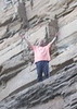
Finally we were unloading our gear and boats at the put-in. I was part of a group with my daughter and a very large outdoor club from Flagstaff. Way too many people for my comfort level, but I dealt with it as best I could.

The thing is, this was also the time when they were letting an unusual amount of water out of the dam, to provide water for the experimental spring flood down in Mexico, in the Colorado River delta. So, the water was coming up very fast as we were rigging. I started with my boat next to the sidewalk and finished rigging 45 minutes later in thigh-deep water. I had to move my boat. My boat was brought down from the van last, and I was starting to rig last, so that when it was time to go, literally no one else was in sight. Gee, thanks for waiting. On the other hand, the current was very strong, so they were likely carried downstream. Many had top-heavy canoes. (Numerous tipovers this weekend reminded me again how much I dislike canoes. We had one tip-over in our group, at Ringbolt Rapids.) I took off paddling, finally, and found them down around the bend visiting an interesting dripping spring. The water level in the river was so high that our trip leader, who had done the trip many times before, said we'd usually be able to get out of the boats, but there were no beaches, no good place to get out of the boats. So, we went on.

The river canyon here, known as Black Canyon, is really pretty, and reminded me a bit of Grand Canyon. It has sheer cliffs, caves, etc.

It didn't take long to reach Arizona Hot Springs beach. Just before the beach is Ringbolt Rapids, which at this high water level was actually sort of a rapids. So, I ran it! Most people kept to the left to avoid it, however!

The beach where we were to camp was already packed with people and their tents, tables, canoes, and a giant sweat lodge made of branches and canvas tarps. More people were coming in, in groups of 20 or so, mostly college outdoor clubs and Boy Scouts. After moving camp twice I found a place that was sort of out of the way. Note to self: Next time do this trip during a slow time of the year (call outfitter to ask when that is.)

During our two-night stay at this beach some did a long hike, but since I have had foot problems I had brought only Teva sandals. I hiked up to the hot springs and soaked. No skinny dipping was going on--too many people. With my daughter and her friend we hiked on a trail upriver and then to a canyon, maybe it is White Rock? I don't know.

I have to say, I usually plan and lead my own trips. Being led, I had not done much research, and not really being a part of this group, I was always out of the loop anyway. I had a map I had printed off the internet, and there was a similar one handed out to us. Not much of a map.

I had a taste of this place, and now I would like to go back and see it when there is no one else on the river. Maybe during the week sometime in January or February or thereabouts. I would like to take several days and camp at the smaller beaches, do more hiking if my feet are better then.

I did enjoy the trip, and there were several in the group who I liked very much. Squat Puke was there, for one thing. His real name is Larry, and he's come on a couple of Grand Canyon backpacking trips I put together, including his first ever backpacking trip!

When we were ready to launch on Sunday it was very, very windy. Four canoes from another group tipped over just after launching. We waited until about 11 a.m. to launch, when the wind had abated a bit. We had a very pleasant run down the river, with only light breezes, no big ugly gusts. My daughter, her boyfriend and myself went first, without the others. It was pleasant to have the river to ourselves for a while.

At the take-out, someone from another group handed out Cherry Garcia ice cream bars. I got one.

Then I headed for Lake Havasu, a motel room, and a 9-mile solo paddle on the lake the next day. It was a great 4 day weekend!
wildflower observationwildflower observationwildflower observationwildflower observationwildflower observation
Wildflowers Observation Isolated
_____________________
There is a point of no return unremarked at the time in most lives. Graham Greene The Comedians
A clean house is a sign of a misspent life.
 
average hiking speed 2.22 mph
1, 2  Next

WARNING! Hiking and outdoor related sports can be dangerous. Be responsible and prepare for the trip. Study the area you are entering and plan accordingly. Dress for the current and unexpected weather changes. Take plenty of water. Never go alone. Make an itinerary with your plan(s), route(s), destination(s) and expected return time. Give your itinerary to trusted family and/or friends.

helpcommentissue

end of page marker