username
X
password
register
for free!
help
ArticlesGuidesRoutes
 
Photosets
 
 Comments
triplogs   photosets   labels comments more
Harquahala Summit - 39 members in 90 triplogs have rated this an average 3.9 ( 1 to 5 best )
1, 2, 3, 4, 5  Next
90 triplogs
login for filter options
May 06 2024
avatar

 Guides 13
 Photos 15,625
 Triplogs 323

male
 Joined Oct 23 2010
 mesa
Harquahala SummitSouthwest, AZ
Southwest, AZ
Hiking avatar May 06 2024
gummoTriplogs 323
Hiking12.10 Miles 3,400 AEG
Hiking12.10 Miles   5 Hrs   38 Mns   2.20 mph
3,400 ft AEG      8 Mns Break
 no routes
1st trip
Linked   none no linked trail guides
Partners none no partners
Route Scout shut down on me toward the end, but I think I got the stats correct. I parked away from the trailhead and hit the 6-mile mark at the top. The trail was much bushier and overgrown than last time I was here. I forgot to insert my camera battery, so I had to revert to cellphone photos. :| I missed a few bird photos along the way. One bird was possibly a yellow warbler, but I couldn't tell.

On the way down, I saw a speckled rattler just past the beehive, but I wasn't quick enough to get the photo. If I had my camera, I would have gotten it.

Toward the end, I spotted a gila monster. Again, I wish I had my camera because he didn't like cellphone photos as much as I and was not cooperating with the cellphone. A few steps later, I found another gila monster. This one was right on the trail. The 1st one was a little off trail. The 2nd one was bigger and sniffing the ground with its tongue. It also approached me and a lot more camera friendly.

I looked for snakes on the road, but it was too cold for them to be out. I also saw a chuckwalla on the trail. The conditions were nice and mild temperatures for May. I wasn't windy during the hike but was windy before the hike and a little windy after the hike.
 Fauna
 Fauna [ checklist ]
[ checklist ]  Gila Monster
_____________________
  1 archive
Mar 29 2024
avatar

 Guides 59
 Routes 1,100
 Photos 1,191
 Triplogs 1,290

male
 Joined Jan 01 2023
 Arizona
Harquahala SummitSouthwest, AZ
Southwest, AZ
Hiking avatar Mar 29 2024
pseudalpineTriplogs 1,290
Hiking10.38 Miles 3,364 AEG
Hiking10.38 Miles   7 Hrs   4 Mns   2.02 mph
3,364 ft AEG   1 Hour   55 Mns Break
 no routesno photosets
1st trip
Linked   none no linked trail guides
Partners none no partners
  1 archive
Feb 23 2024
avatar

 Guides 1
 Routes 168
 Photos 384
 Triplogs 161

32 male
 Joined Aug 13 2017
 Tempe
Harquahala SummitSouthwest, AZ
Southwest, AZ
Hiking avatar Feb 23 2024
clayncallawayTriplogs 161
Hiking10.39 Miles 3,277 AEG
Hiking10.39 Miles   4 Hrs   37 Mns   2.37 mph
3,277 ft AEG      14 Mns Break
 
1st trip
Linked   none no linked trail guides
Partners none no partners
Spontaneous trip. Accepted this hike on about 30 minutes notice. Packed the gear, picked up my crazy friend who proposed it and drove the 2 hours from Mesa.

The road to the actual trailhead is not appropriate for a sedan. You would regret your decision if you gave it the good old college try. 2WD High Clearance truck easily provided access. Started hiking at around 3:30 PM.

Only saw one person on the trail. At about a mile in, we ran into a gruff older man on a horse that was accompanied by a German Shepard. The only words he uttered were to express concern about our decision to start so late. I explained our gameplan and made a gesture towards my vest containing a headlamp. He was not impressed.

Regardless, we made good time up the mountain. This trail design is great. A straight start out of the trailhead running parallel to a dry creek bed hits the mountain and then forms a tilted "Z" shape up to a saddle and eventually to the peak itself. The views of the valley and the enormous rocks suspended on the side of the mountain are scenic and fun to be around. There are some big rocks here and I would bet during a heavy rain you get a bunch of little waterfalls that would pop up.

The saddle is where you get your first view of the 4x4 road to the top. The top itself is cool and different. Big empty parking areas, primitive helicopter pad, a bench or two, a house-like structure, and a GIANT array of solar panels. The sun was getting ready to set so Maricopa County to the East was getting hit with those delightfully orange evening rays of light. You could see all the way to Four Peaks.

Sun set on the trip down. Probably 2 miles in. It got very dark (as expected). Headlamps were used. It wasn't until mile 3 of the down trip that we started noticing differences in light on the surrounding hilltops. All of a sudden, the moon rose over the mountainside from the East and illuminated the valley in front of us. Some areas were still completely dark, others were so well lit that they were traversable without artificial light of any kind. I have never hiked under a full moon like this so I enjoyed it quite a bit.

Overall trip took 4.5 hours. Really enjoyed this area. 8th County HP crossed off the list.
_____________________
 
Jan 06 2024
avatar

 Guides 4
 Routes 491
 Photos 10,890
 Triplogs 1,257

55 male
 Joined Nov 20 2012
 Phoenix, AZ
Harquahala SummitSouthwest, AZ
Southwest, AZ
Hiking avatar Jan 06 2024
BiFrostTriplogs 1,257
Hiking10.48 Miles 3,409 AEG
Hiking10.48 Miles   5 Hrs   4 Mns   2.36 mph
3,409 ft AEG      38 Mns Break
 
Linked   none no linked trail guides
Partners partners
John9L
Quick day hike out and back up Harquahala Summit. Nice trail with some well constructed switchbacks which make the trail not so steep. Made the summit in under 3 hours and just at the top there were even some small patches of snow.

Lunch break on top and it was cold enough to put on the puffy coat and beanie for the break.

After the break headed back down the same way enjoying the nice trail tread. Back to the vehicle by about 2pm for round trip right at 5 hours.
_____________________
  2 archives
Nov 17 2023
avatar

 Triplogs 71

male
 Joined Jan 23 2025
 Seattle, WA
Harquahala SummitSouthwest, AZ
Southwest, AZ
Hiking avatar Nov 17 2023
dhelderTriplogs 71
Hiking10.10 Miles 3,400 AEG
Hiking10.10 Miles
3,400 ft AEG
 no routesno photosets
1st trip
Linked   none no linked trail guides
Partners none no partners
 
Mar 09 2023
avatar

 Triplogs 5

36 male
 Joined Jun 13 2011
 Mesa, AZ
Harquahala SummitSouthwest, AZ
Southwest, AZ
Hiking avatar Mar 09 2023
ncurtisiTriplogs 5
Hiking10.30 Miles 3,334 AEG
Hiking10.30 Miles   3 Hrs   56 Mns   2.62 mph
3,334 ft AEG18 LBS Pack
 no routesno photosets
1st trip
Linked   none no linked trail guides
Partners none no partners
First county high point of the year. Gate is a little hard to notice on the south side of the 60. Easy drive to the trailhead. High-clearance recommended, but road isn't that rough.

Started around 8 and was in the shade for 2/3 of the way up. Starts pretty easy in a rocky wash, but the last three miles probably gain ~2500 feet. trail was easy to follow. There's some cool old mining stuff scattered throughout the hike. Very desolate. Only saw one other hiker. Views on the top are sweet. Dog loved it.
_____________________
 
Mar 04 2023
avatar

 Routes 386
 Photos 49
 Triplogs 792

43 female
 Joined Jun 23 2015
 Phoenix, AZ
Harquahala SummitSouthwest, AZ
Southwest, AZ
Hiking avatar Mar 04 2023
emilystardustTriplogs 792
Hiking10.13 Miles 3,371 AEG
Hiking10.13 Miles   6 Hrs   3 Mns   1.94 mph
3,371 ft AEG      49 Mns Break
 
no photosets
1st trip
Linked   none no linked trail guides
Partners none no partners
Route Scout Route Recorded  on Route Scout | Pop | Map | Popup | MapDEX
Only hikers out there today. What a day of hot and cold temps. Pretty cold and windy at the top, enough to numb the fingers. Glad to have done the county high point.
_____________________
 
Feb 20 2023
avatar

 Guides 16
 Routes 81
 Photos 1,269
 Triplogs 1,145

51 male
 Joined Apr 30 2008
 Tucson, AZ
Harquahala SummitSouthwest, AZ
Southwest, AZ
Hiking avatar Feb 20 2023
azdesertfatherTriplogs 1,145
Hiking10.06 Miles 3,346 AEG
Hiking10.06 Miles   6 Hrs   18 Mns   1.99 mph
3,346 ft AEG   1 Hour   15 Mns Break22 LBS Pack
 no routes
1st trip
Linked   none no linked trail guides
Partners none no partners
Checking off Warren’s 100 Hikes in western Arizona this week, this was next on my list. This was a good desert mountain hike and a consistent steady incline all the way like Mt. Ord between Mesa and Payson. Saw very few people all day, though a lot of Razr riders at the top. Little bit of history thrown in too, though most of the interpretive signs are faded from readability due to sun and rain.lunch at a picnic table up top then back down again. Warm day out there, even for February… can’t imagine doing that in the summer.
_____________________
"I went to the woods because I wished to live deliberately, to front only the essential facts of life, and see if I could not learn what it had to teach, and not, when I came to die, discover that I had not lived." — Henry David Thoreau
 
Aug 13 2022
avatar

 Triplogs 11

51 male
 Joined Sep 04 2017
 Phoenix, AZ
Harquahala SummitSouthwest, AZ
Southwest, AZ
Hiking avatar Aug 13 2022
StachemanTriplogs 11
Hiking10.39 Miles 3,397 AEG
Hiking10.39 Miles   7 Hrs   23 Mns   1.84 mph
3,397 ft AEG   1 Hour   44 Mns Break
 
no photosets
1st trip
Linked   none no linked trail guides
Partners none no partners
Route Scout Route Recorded  on Route Scout | Pop | Map | Popup | MapDEX
Road to TH had recently had water flow so some fresh damage but still doable in a non 4 wheel drive. Hike was a good challenge overgrown in some spots but not enough to lose the trail.
wildflower observationwildflower observationwildflower observationwildflower observationwildflower observation
Wildflowers Observation Isolated
Some desert marigolds and rock daisies
_____________________
 
Mar 12 2022
avatar

 Guides 110
 Routes 2,246
 Photos 8,982
 Triplogs 2,600

45 female
 Joined Dec 24 2007
 Ahwatukee, AZ
Harquahala SummitSouthwest, AZ
Southwest, AZ
Hiking avatar Mar 12 2022
LindaAnnTriplogs 2,600
Hiking10.16 Miles 3,356 AEG
Hiking10.16 Miles   6 Hrs   44 Mns   1.64 mph
3,356 ft AEG      33 Mns Break
 
Linked   none no linked trail guides
Partners none no partners
Route Scout Route Recorded  on Route Scout | Pop | Map | Popup | MapDEX
Decided to head over to Harquahala with a friend. We got started a little before 0630 and had shade for the first 4.50 miles, which was nice. Took a break at the summit and looked around before heading back down. Somewhat warm the last few miles. Zero wildflowers. Zero other people or vehicles until we were finishing up the last quarter mile. Trail is in good shape the entire way. Saw one little snake, but it was too fast for a picture.
 Culture
 Culture [ checklist ]
[ checklist ]  Reference Mark
_____________________
Stop crying and just go do the hike.
 
Feb 12 2022
avatar

 Guides 12
 Routes 192
 Photos 863
 Triplogs 356

42 male
 Joined Nov 30 2015
 Phoenix, AZ
Harquahala SummitSouthwest, AZ
Southwest, AZ
Run/Jog avatar Feb 12 2022
ShatteredArmTriplogs 356
Run/Jog10.20 Miles 3,380 AEG
Run/Jog10.20 Miles   3 Hrs   10 Mns   3.50 mph
3,380 ft AEG      15 Mns Break
 no routesno photosets
1st trip
Linked   none no linked trail guides
Partners none no partners
Didn't have any plans for the day, so decided to summit a new desert peak since this is the time of year for that. Harquahala was on the list for some time. Got to the TH at 9am. First couple miles up the alluvial fan were kinda boring, then when we got to the actual slopes it was actually somewhat interesting. Well-built trail and decent scenery, enjoyed this trail much more than I expected, even though it felt like a really long climb.

Had the summit all to ourselves, no OHV until we saw someone headed up just as we started down. The shade was gone on the way down, but there was still a little lingering coolth. Didn't feel like I had a ton of energy, so didn't push that hard on the way down. It started getting warm in the lower stretches a couple miles from the car.
_____________________
 
Feb 06 2022
avatar

 Photos 5
 Triplogs 1,041

36 female
 Joined Oct 04 2012
 Phoenix, AZ
Harquahala SummitSouthwest, AZ
Southwest, AZ
Hiking avatar Feb 06 2022
WaitingForRainTriplogs 1,041
Hiking6.10 Miles 1,742 AEG
Hiking6.10 Miles   3 Hrs      2.03 mph
1,742 ft AEG
 no routesno photosets
1st trip
Linked   none no linked trail guides
Partners none no partners
_____________________
 
Oct 31 2021
avatar

 Routes 61
 Photos 1,008
 Triplogs 224

44 male
 Joined Aug 19 2009
 The Basin
Harquahala SummitSouthwest, AZ
Southwest, AZ
Hiking avatar Oct 31 2021
survivordudeTriplogs 224
Hiking10.46 Miles 3,252 AEG
Hiking10.46 Miles   4 Hrs   51 Mns   2.46 mph
3,252 ft AEG      36 Mns Break
 
1st trip
Linked   none no linked trail guides
Partners none no partners
Route Scout Route Recorded  on Route Scout | Pop | Map | Popup | MapDEX
2nd attempt to the summit was a success. Shade in the AM on the NW side of the mountains, after that, there is zero shade the entire hike. Pretty uneventful slog to the saddle for a breather and then the finish to the top. One abandoned Chevy Suburban at the summit. The educational signs have been destroyed by the sun. Nice views up top. Views of farther ranges were obscured by haze. Saw a bunch of hawks at the top and a funky centipede on the decent. Not another soul until I got very near the parking lot and met, yup.. a Canadian couple.

Check
#5 of 15
 Fauna
 Fauna [ checklist ]
[ checklist ]  Giant Centipede
 Culture
 Culture [ checklist ]
[ checklist ]  Reference Mark
_____________________
“There is nothing that exists outside the thought of the immediate moment.”
 
Apr 16 2021
avatar

 Triplogs 2

52 male
 Joined Jul 04 2018
 Glendale, AZ
Harquahala SummitSouthwest, AZ
Southwest, AZ
Hiking avatar Apr 16 2021
wanderinarizonaTriplogs 2
Hiking10.97 Miles 3,488 AEG
Hiking10.97 Miles   6 Hrs   35 Mns   1.83 mph
3,488 ft AEG      35 Mns Break
 
no photosets
1st trip
Linked   none no linked trail guides
Partners none no partners
Route Scout Route Recorded  on Route Scout | Pop | Map | Popup | MapDEX
Great day! Not too hot, nice breeze blowing up the canyon as I ascended. Saw three bighorns at the saddle before the final push to the summit. Didn't see a soul all day. Tough hike but well worth the effort.
 
Mar 14 2021
avatar

 Routes 18
 Photos 580
 Triplogs 1,081

42 male
 Joined Nov 16 2010
 Kingman, AZ
Harquahala SummitSouthwest, AZ
Southwest, AZ
Hiking avatar Mar 14 2021
nikorock28Triplogs 1,081
Hiking10.06 Miles 3,425 AEG
Hiking10.06 Miles   4 Hrs   6 Mns   2.45 mph
3,425 ft AEG
 no routes
1st trip
Linked   none no linked trail guides
Partners none no partners
Left Kingman a little after 7:30AM with some local folks. I decided I wanted to drive the dirt road to the trailhead in my Kia Forte and didn't do the greatest job of negotiating it. Just past the horse trailer parking area (0.4 miles from the trailhead), the biggest obstacle of the road was present and I decided to tap out there, parking off to the side. I did negotiate the road better on the return, so I was proud of that.

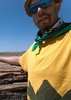
The rest of the group started at 10:38AM, but me, being a night owl and not a morning person at all, it was time for breakfast pancakes and syrup that I brought along. I ate, took my vitamins, rested and started hiking at 12:38PM. The beginning part of the trail, as you approach the base of the mountain, reminded me of Pima Canyon Trail down in Tucson. I enjoyed the climb up the rock laced drainage area and started to feel the hike at the old mining camp signpost. Hit the saddle and encountered the group coming down between the saddle and the summit. I made the top in 1:54, which I feel is respectable. I didn't stick around too long, just a couple minutes, then quickly headed back down to catch up with the rest of group. I hiked the last half of the descent with the group.

I enjoyed this trail. The summit was a little underwhelming, but I really didn't take any time to take in the views and perhaps my opinion was altered due to the wind. I would definitely hike it again, but probably leave my vehicle back at the gate. It got marked up pretty good trying to stay on the high side of the road. Only one other couple on the trail all day. Breezy conditions, but sunny, and I took a hooded sweatshirt that I never really needed. Carried 4-16.9 ounce bottles and drank 3 of them.
_____________________
  1 archive
Feb 27 2021
avatar

 Routes 174
 Photos 471
 Triplogs 184

51 male
 Joined Mar 16 2019
 Phoenix
Harquahala SummitSouthwest, AZ
Southwest, AZ
Hiking avatar Feb 27 2021
AugustWestTriplogs 184
Hiking10.77 Miles 3,557 AEG
Hiking10.77 Miles   5 Hrs   21 Mns   2.37 mph
3,557 ft AEG      48 Mns Break
 
1st trip
Linked   none no linked trail guides
Partners partners
Abs02
Route Scout Route Recorded  on Route Scout | Pop | Map | Popup | MapDEX
Really nice adventure West of the West Valley. Abby lives out West and I am East (at least for another few days). We made it to an empty trailhead at 7:30 AM. The dirt from US 60 isn't that bad and I think a sedan could make it driving really slow. The trail is tucked away on the North Slope of Harquahala and stays out of the sun all morning so it was colder than what I was expecting for the first half of the day.

The trail is really well constructed and the EG and distance never seemed that bad to me. There is almost no brush or obstacles so the going was pretty smooth all day. Once up at the summit it is clear which side of the mountain is Wilderness. It was kind of like finding little green men on the dark side of the moon. Picnic tables, benches, communication arrays, multiple parking areas, and of particular interest the historical structures make up the summit area.

My only wish is that the BLM would redo some of the damaged historical panels that describe the activities of the miners and scientists that had inhabited this area for a very long time. The history of this area is rich and was really interesting to read about where the descriptions on the plaques were legible.

We saw 2 other hikers and three guys who rode up in a jeep together. Once we made our way down the sun had come over the mountain and warmed things up just a little bit. We finished our day with takeout from Old Pueblo in Litchfield Park which turned out to be pretty good!
wildflower observationwildflower observationwildflower observationwildflower observationwildflower observation
Wildflowers Observation Isolated
Some beautiful Ocotillo in bloom in one spot in the lower section of the trail.
_____________________
Wildflower seed in the sand and wind
May the four winds blow you home again
 
Feb 21 2021
avatar

 Guides 2
 Routes 208
 Photos 93
 Triplogs 205

male
 Joined Aug 08 2020
 Phx az
Harquahala SummitSouthwest, AZ
Southwest, AZ
Hiking avatar Feb 21 2021
ScaredyCatTriplogs 205
Hiking10.23 Miles 3,350 AEG
Hiking10.23 Miles   5 Hrs   20 Mns   2.21 mph
3,350 ft AEG      42 Mns Break
 
1st trip
Linked   none no linked trail guides
Partners none no partners
Route Scout Route Recorded  on Route Scout | Pop | Map | Popup | MapDEX
Led an outing to this remote area. The road in had larger drop offs than I remembered. There is but a single trail to follow for the hike. Leads straight back, then to the left and then up.

The switchbacks do a great job of breaking up the EG. Saw just 1 group +1 other lady on the trail. Once u reach the backside of the mtn, amazing views open up. Can get very windy on top. Worth the drive.
wildflower observationwildflower observationwildflower observationwildflower observationwildflower observation
Wildflowers Observation None
Not much to see yet.
  2 archives
Feb 15 2021
avatar

 Guides 4
 Photos 542
 Triplogs 573

46 male
 Joined Oct 19 2010
 Mesa, AZ
Harquahala SummitSouthwest, AZ
Southwest, AZ
Hiking avatar Feb 15 2021
Charger55Triplogs 573
Hiking10.80 Miles 3,380 AEG
Hiking10.80 Miles   8 Hrs      1.35 mph
3,380 ft AEG
 no routesno photosets
1st trip
Linked   none no linked trail guides
Partners none no partners
I've wanted to do this hike for a long time, but it just seems so out of the way. Granted, I've traveled farther for much shorter hikes, but I was still dreading the drive. And it's not a fun one coming from the East Valley. I-10 west of the Valley needs to be expanded, Salome Road has a top speed of 45mph to protect cattle (I counted three carcasses) and the dirt road to the trailhead needs to be graded. But the hike is beautiful, pristine Sonoran desert with a unique reward at the summit and nary a soul around. We went super slow, not just to soak it all in, but because my hiking partner has to stop and sniff every bush on the way up and the way down.
_____________________
"I've driven across deserts, driven by the irony, that only being shackled to the road could ever I be free"
- Frank Turner "The Road"
 
Dec 25 2020
avatar

 Guides 4
 Routes 491
 Photos 10,890
 Triplogs 1,257

55 male
 Joined Nov 20 2012
 Phoenix, AZ
Harquahala SummitSouthwest, AZ
Southwest, AZ
Hiking avatar Dec 25 2020
BiFrostTriplogs 1,257
Hiking10.74 Miles 3,619 AEG
Hiking10.74 Miles   5 Hrs   46 Mns   3.58 mph
3,619 ft AEG   2 Hrs   46 Mns Break
 
Linked   none no linked trail guides
Partners partners
slowandsteady
Looking for something relatively close to town for Christmas Day hike and first time on this summit for us. Others had mentioned it was a good trail and happy to say it still is. Even though it's continuously up the grade stays somewhat mellow the entire way. The switchbacks are well constructed and make the uphill a nice climb. We ran into a group of 3 on the summit but that was it the entire hike. Nice chill Christmas Day hike!
_____________________
  1 archive
Nov 04 2020
avatar

 Guides 73
 Routes 176
 Photos 10,174
 Triplogs 2,324

46 male
 Joined Sep 08 2006
 
Harquahala SummitSouthwest, AZ
Southwest, AZ
Hiking avatar Nov 04 2020
JimTriplogs 2,324
Hiking10.20 Miles 3,380 AEG
Hiking10.20 Miles   4 Hrs   55 Mns   2.31 mph
3,380 ft AEG      30 Mns Break10 LBS Pack
 no routes
Linked   none no linked trail guides
Partners none no partners
Hadn't been out here in 22 months so why not? The air isn't really clean, with smoke or something else very noticeable. It was worse towards the city, but also to the south.

One of the more interesting summits in the western part of the state with some expansive views (normally). Very quiet with only occasional birds, but then coyotes at dusk. Well, except for the military jets low overhead.

Bring pruning shears for the thorn scrub on the trail.
_____________________
🍭
 
average hiking speed 2.12 mph
1, 2, 3, 4, 5  Next

WARNING! Hiking and outdoor related sports can be dangerous. Be responsible and prepare for the trip. Study the area you are entering and plan accordingly. Dress for the current and unexpected weather changes. Take plenty of water. Never go alone. Make an itinerary with your plan(s), route(s), destination(s) and expected return time. Give your itinerary to trusted family and/or friends.

helpcommentissue

end of page marker