username
X
password
register
for free!
help
ArticlesGuidesRoutes
 
Photosets
 
 Comments
triplogs   photosets   labels comments more
Jackass Canyon - 5 members in 7 triplogs have rated this an average 2.6 ( 1 to 5 best )
7 triplogs
login for filter options
Jan 15 2022
avatar

 Guides 3
 Routes 632
 Photos 8,235
 Triplogs 604

54 male
 Joined Apr 13 2011
 Gilbert, AZ
Jackass CanyonNortheast, AZ
Northeast, AZ
Canyoneering avatar Jan 15 2022
ddgrunningTriplogs 604
Canyoneering7.57 Miles 900 AEG
Canyoneering7.57 Miles   3 Hrs   14 Mns   2.44 mph
900 ft AEG      8 Mns Break
 
1st trip
Linked   none no linked trail guides
Partners none no partners
Route Scout Route Recorded  on Route Scout | Pop | Map | Popup | MapDEX
Side trip on our way to the Vermilion Cliffs. It’s been about 35 years since I used to come down here for overnight campouts with my Boy Scout troop. A lot more bouldering than I remember…
_____________________
  1 archive
Jul 02 2016
avatar

 Guides 3
 Routes 569
 Photos 11,976
 Triplogs 1,634

50 female
 Joined Sep 18 2009
 Tucson, AZ
Marble Canyon Tributaries and Jackass Canyon, AZ 
Marble Canyon Tributaries and Jackass Canyon, AZ
 
Hiking avatar Jul 02 2016
GrottoGirlTriplogs 1,634
Hiking6.50 Miles 2,241 AEG
Hiking6.50 Miles   8 Hrs   51 Mns   1.30 mph
2,241 ft AEG   3 Hrs   50 Mns Break
 
1st trip
Linked   linked  
Partners partners
airkewled
John_seJerman
justmike
With rain in the forecast we choose Plan B for Saturday. We drove up to Lee's Ferry Friday night and camped there. I finally got to met Oceanswithin as she was also camped at the campground!

Some people would probably think that we are crazy for hiking in the 90-100 degree range, but when you combine it with water and shade it can be quite pleasant. We started at the Navajo Bridge Visitor Center and hiked across the bridge. It's always fun to check out your route from above!

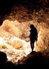
We hiked over to 3.7 Mile Wash and then descended it with one rappel. The canyon was short but pretty! Then we blew up our rafts and floated for a short bit. It was John and Mike's first trip on the Colorado! Boy, were they in for a treat! I hadn't realized that Mike had never paddled before so it was great how well he did!

At 4.4 Mile Wash we stashed our packrafts and hiked up the steep fisherman's trail to the top. Then we dropped down into the canyon by downclimbing and rappelling.

Our next float was the long one. We got to float under the Navajo Bridge and wave at the tourists. We also saw a few of the raft parties that were headed out for several days on the Colorado. Airkewled & Kim broke out water guns and sprayed us down. It's hard to get mad when the water feels really cool!!! Surprisingly, the silt from the Paria had yet to filter down so the River was a pretty green. We also got to see a heron and a mama Big Horn Sheep and a baby.

We got to Jackass and Airkewled & John ran the Badger Creek Rapids. Then we tanked up on water and hiked out. This time we did a different fork of Jackass Canyon. It was ironic because one section after the fork looked just like it did in the other fork and for a while Airkewled and I thought we choose the same route out as we had last year. I was happy to learn it wasn't the same route since the other route had a gnarly route up from under a chockstone. Soon we were at the truck and driving to Marble Canyon Lodge for our Green Chili Stew treat!

Hike from Visitor Center to 3.7 Mile Wash: 2.35 miles, 205 AEG
Float from 3.7 Mile wash to 4.4 Mile Wash: 0.75 miles
Hike up to the top of 4.4 Mile Wash and then descend: 0.70 miles, 428 AEG
Float from 4.4 Mile Wash to Jackass Canyon: 3.9 miles
Hike out Jackass Canyon: 3 miles, 1608 ft elevation gain

Mileage on triplog is only the hiking/canyoneering mileage.
_____________________
  1 archive
Mar 21 2016
avatar

 Guides 1
 Routes 269
 Photos 613
 Triplogs 1,360

50 male
 Joined Dec 22 2003
 Tucson, AZ
Jackass CanyonNortheast, AZ
Northeast, AZ
Canyoneering avatar Mar 21 2016
RedwallNHopsTriplogs 1,360
Canyoneering5.50 Miles 830 AEG
Canyoneering5.50 Miles
830 ft AEG
 no routesno photosets
1st trip
Linked   none no linked trail guides
Partners none no partners
Went down the middle, up South. We were pretty beat after doing Shinumo in a day the day before so this was the perfect amount of effort. Beers and food at Vermillion cliffs afterwards!
_____________________
 
Nov 14 2014
avatar

 Guides 13
 Routes 38
 Photos 1,651
 Triplogs 577

60 male
 Joined Nov 15 2005
 Jackson, CA
Jackass CanyonNortheast, AZ
Northeast, AZ
Canyoneering avatar Nov 14 2014
toddakTriplogs 577
Canyoneering5.00 Miles 1,000 AEG
Canyoneering5.00 Miles   3 Hrs   30 Mns   1.43 mph
1,000 ft AEG
Canyon Hiking - Non-technical; no rope; easy scrambling; occasional hand use
A - Dry or little water; shallow or avoidable water; no wet/dry suit
II - Normally requires a half day
 no routes
1st trip
Linked   none no linked trail guides
Partners none no partners
Down the south fork, return up the middle fork. The south fork is much more scenic and challenging, with several pools and a 25' drop with a bolt for a hand line. The Colorado was definitely raging as the high-flow experiment was still in progress.
_____________________
 
Apr 24 2011
avatar

 Guides 13
 Triplogs 205

38 female
 Joined Jan 29 2009
 Murray, UT
Jackass CanyonNortheast, AZ
Northeast, AZ
Canyoneering avatar Apr 24 2011
SparkyJackieTriplogs 205
Canyoneering5.50 Miles 830 AEG
Canyoneering5.50 Miles   4 Hrs   41 Mns   1.17 mph
830 ft AEG
 no routesno photosets
1st trip
Linked   none no linked trail guides
Partners none no partners
_____________________
 
Mar 09 2009
avatar

 Guides 16
 Routes 123
 Photos 2,810
 Triplogs 140

83 male
 Joined Feb 13 2004
 Mesa, AZ
Jackass CanyonNortheast, AZ
Northeast, AZ
Canyoneering avatar Mar 09 2009
gpsjoeTriplogs 140
Canyoneering6.00 Miles 830 AEG
Canyoneering6.00 Miles   5 Hrs      1.20 mph
830 ft AEG
 no routes
1st trip
Linked   none no linked trail guides
Partners none no partners
Sun_Hiker and I did this one the day after doing Cathedral Wash. Jackass is a very nice canyon to hike but unfortunately we did not make it to the river. Every write-up I read beforehand mentions the 30 or 40 foot drop with ropes installed there. As you can see in the pictures we had no problem with that. About 1/4th mile past that we came to a 10 foot vertical drop where there was once a rope that broke off or was cut that I needed to get down. There also were two possible paths real climbers (not me) with climbing shoes would probably do without much problem. Also taller and younger hikers might be able to negotiate this down climb. If we went back in there we would take some rope and I think that would have done the trick. We still need to go 0.7 miles to reach the Colorado.

Nevertheless it is a nice hike. On the way out we chose a left fork and created a loop (see the map) going out a different wash. This hike is also good to do at this time of year because it will get hot there pretty soon.
_____________________
Become a skilled GPS user and it will set you free!
comments disabled by a moderator
 
Dec 27 2006
avatar

 Triplogs 5

42 male
 Joined Jan 05 2007
 Tucson, AZ
Jackass CanyonNortheast, AZ
Northeast, AZ
Hiking avatar Dec 27 2006
jhibbsTriplogs 5
Hiking5.50 Miles 830 AEG
Hiking5.50 Miles   4 Hrs      1.38 mph
830 ft AEG
 no routesno photosets
1st trip
Linked   none no linked trail guides
Partners none no partners
We have hiked Jackass probably a half dozen times now. I grew up in Page, and this has been a local favorite for many years.
Great hike, gets to be a bit of a scramble over boulders near the bottom. Look for the spray painted arrows, they can save you a lot of trouble. Great to sit and relax by the Colorado river at the bottom.
_____________________
 
average hiking speed 1.49 mph

WARNING! Hiking and outdoor related sports can be dangerous. Be responsible and prepare for the trip. Study the area you are entering and plan accordingly. Dress for the current and unexpected weather changes. Take plenty of water. Never go alone. Make an itinerary with your plan(s), route(s), destination(s) and expected return time. Give your itinerary to trusted family and/or friends.

helpcommentissue

end of page marker