username
X
password
register
for free!
help
ArticlesGuidesRoutes
 
Photosets
 
 Comments
triplogs   photosets   labels comments more
Royal Arch Loop - 21 members in 47 triplogs have rated this an average 5 ( 1 to 5 best )
1, 2, 3  Next
47 triplogs
login for filter options
Apr 11 2025
avatar

 Guides 3
 Routes 632
 Photos 8,235
 Triplogs 604

54 male
 Joined Apr 13 2011
 Gilbert, AZ
Royal Arch via Point HuitzilNorthwest, AZ
Northwest, AZ
Backpack avatar Apr 11 2025
ddgrunningTriplogs 604
Backpack41.00 Miles 9,000 AEG
Backpack41.00 Miles5 Days         
9,000 ft AEG
 
1st trip
Partners none no partners
Thanks to @bifrost and @john9l for recent trip info, and to @chumley and HAZ resources for help/tips in our planning for this very memorable adventure.

Our original plan was to descend South Bass and turn west on the "standard" Royal Arch route, but with a desire to make it to the Arch on Day 1 and our openness to adding a little more spice to an already spicy itinerary, we pivoted to the Pt. Huitzil entry point instead. That ended up slicing several miles off our day 1 travel, and while it definitely enhanced the adventure, I'm not sure it saved us much time. :sweat:

Day 0 (Friday): Travel to Pasture Wash / Shuttle

Our group of 6 travelled up on Friday morning and met in Tusayan, where we caravanned in two vehicles out to the abandoned Ranger Station at Pasture Wash. Access to the short "switchback" across the Havasupai Reservation remains closed. We took the fence-line road.

We set up camp near the Ranger Station, then headed out to the South Bass TH to set up our shuttle and enjoy the sunset on the rim. 4-5 other vehicles were already parked at the TH. A group of 4 from New York was at one of the picnic tables eating dinner. Turned out that they had just finished the Royal Arch loop and were spending one last night on the rim before heading home.

We, of course, pinged them for the most recent intel. Most significantly, they confirmed that water was currently abundant at Copper Canyon, where we planned to spend our third night. (Turned out that "abundant" was probably an overstatement.) They also had entered via Pt. Huitzil, and enjoyed the benefit of one of their group having done the route previously.

After chatting, we walked out through the woods to a point west of the TH for a marvelous view of the sunset. After enjoying the views at dusk, we returned to the TH and headed back to our camp at the Ranger Station.

The night was cold, but not windy, and we turned in early, planning for an early start the next morning. In order to avoid having to repack our packs, we brought separate gear to sleep in for night 0. Worked out well.

Day 1 (Saturday): Ranger Station to Royal Arch via Pt. Huitzil

We awoke to a crisp but clear and windless morning, and after breakfast, were on the "trail" by 6:40 am. Forecast temps were above normal, and we were expecting highs in the 90s below the rim, so we wanted to give ourselves plenty of time to get to the arch, and hopefully avoid some of the heat.

Having the GPS route downloaded on RS helped us generally stay on track, as we made our way cross country over to the rim. There are a handful of "trail-ish" sections, as well as a semi-traveled track or two that tempted us to veer off course (which we did at least once), but we quickly corrected. A mile or two in, we saw a few signs of the defunct phone line that used to be a guide for pre-GPS travel, but remnants were sporadic, at best.

Near the drop-in point, the route descends to the bottom of a shallow drainage which funneled us right out to the edge of the rim, where the drop-in is marked with a couple of obvious cairns and the more "open" views of the western side of the Scenic Divide immediately capture the awe and excitement ahead.

The descent fun begins immediately with a steep drop followed by a steep/loose drop that we found best navigable with one hiking pole (with the other hand free to manage handholds and small downclimbs). The route, which is pretty well cairned and not particularly difficult to follow, contours a bit before the next steep drop, which involved some mild scrambling and points that required handing packs down.

Eventually, we made it to the large, off-camber slab that leads to the rabbit-hole access to the puebloan tree ladder. It is also very well marked with a couple of cairns forming a "doorway" to the right, which seemingly leads to a sheer precipice. This, combined with the fact that we thought the ladder was another level lower, led to us make a navigational error and head to the left, where we descended a tricky crack, which we lovingly named the "Devil's Butt Crack." I stayed on the upper slab while the rest of our group descended with their packs.

After hearing reports from those below that they could see no way to make further progress, I figured we were missing the route. After some additional scrambling around, I spotted the petroglyph panel that I knew was just beyond the bottom of the tree ladder, and eventually we recognized the "crescent-shaped" rock at the edge of the slab through the cairned gateway and figured out where we needed to go. I felt a little sheepish for missing this navigational point. Bottom line: walk through the cairned gateway that seems to lead off the edge of the cliff, and don't go down the Devil's Butt Crack! :lol:

The ladder was fun and not too difficult, and from its base, we realized that the Devil's Butt Crack was part of the same fissure, "around" the corner from the tree ladder (but too narrow to navigate through from above).

Navigational hiccup over, we marveled at the petroglyph panel, which is truly impressive, before continuing our descent. It was steep but pretty straigtforward from there.

Once we made it to the creek bottom, we began seeing numerous potholes of water, which continued until we reached the large pour off to that precedes the Ledge of Death. At the pour off, we took the "Tree of Life" route to the right instead, which involved going through a rabbit hole behind a tree, hugging the cliff face. From there, the descent remains challenging, with at least one section that required handing packs down.

Back on the drainage bottom, we scrambled, bouldered, and downclimbed various obstacles on our way to the Arch, noting the exit point along the way that would be our climb out of the drainage the following morning. The boulder/downclimb problems were fun to figure out and involved at times some exposure and care.

Just before reaching the Arch, the perennial spring begins to bubble up, requiring some creativity to remain dry, but we managed fine. This section of the drainage is beautiful and a fitting warm up to the Arch, which majestically and abruptly appears as the drainage makes a sharp right turn.

With our navigational hiccup, it took us nearly 11 hours to get to the arch, and we were happy to have gotten an early start.

The New Yorkers had told us that there was a group of 2 that were a day ahead of us and who were also planning to camp at the arch on the same night we were. They had taken the traditional route, but with a day's head start had made it to the Arch earlier in the day and set up camp on the edge of the large dryfall. No worries, there were several other magnificent spots and we quickly settled into camp. Our neighbors, Sam and Ryan, were pleasant (though we later learned from the ranger that their permits were actually for a week or two later), and "sharing" the Arch turned out not to be an issue.

That night was a full moon, and it was magical to get up in the middle of the night and enjoy the brightly moonlit arch and giant monolith just beyond (which itself is quite impressive and I'm sure would garner more attention if it wasn't literally right next to Royal Arch).

Day 2 (Sunday): Royal Arch to Toltec Beach + Elves Chasm

After a leisurely start in the morning, which included more amazing views of the Arch and monolith framed in the morning light, we packed up and made our ascent back up canyon to our exit point. Sam and Ryan left a little before us after consulting about the rappel. They had not brought any gear, and had a little trepidation about the downclimb.

We stopped for a quick plunge in the uppermost pool of RA creek, before retracing our route to the exit point. The obstacles were familiar now, but also new, given the opposite direction. After climbing out of the drainage, we made the hairpin turn and backtracked to a nice viewpoint of the Arch from above, before continuing the comparatively flat-ish contour over to the break in the Tapeats where the rappel site is located.

While we had prepared for brutal heat, the weather gods blessed us with some welcome clouds and a periodic nice breeze, which kept things relatively cool.

The rappel is a sight to behold. The rangers had recently installed a brand new dynamic rope for rappelling, along with a new, knotted handline and solidly constructed anchor system. (The ranger we met the following day confirmed that the current system was ranger-installed.) While the rappel involved only a 20' drop, the vantage point from above makes it feel like you are dropping off a 300' cliff. Add to that the fact that the overhang prevents you from seeing your destination from above and it's enough to get the blood pumping for even experienced climbers. Although I would generally trust my descending skills on the handline, I was glad to have a harness and ATC!

Our group made it down no problem. Just below the rappel is another tricky downclimb that has a narrow slot where our backpacks could get wedged. Although it was possible to get through with pack on, there was a risk that the pack would pop free and momentum would send you tumbling off the side. So, we once again opted for handing packs down. (Side note: With all of the pack lowering/handing-up on this trip, our packs definitely put on a few extra miles this trip! We jokingly renamed the trip variously: "Royal [pain in the] Arch Route" and "Royal [beat-the-crap-out-of-your-pack] Arch Route"). :lol:

The descent from there to Toltec Beach was the hottest part of the trip, and we were glad to finally reach the cold Colorado, where we dropped our packs and took a refreshing dip. We saw Sam and Ryan's packs and figured they were over enjoying Elves Chasm. We set up our camp and then left for Elves ourselves around 3 pm. We med Sam and Ryan on their way back; they reported hanging with some rafters and scoring sandwiches and beer. They also indicated that they may not stay the full night at Toltec, as they were planning to go all the way from Toltec to Bass Beach the following day and thought they would use the full moon to do some night hiking. We wished them well and continued on.

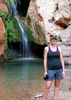
It took us about an hour to get to Elves Chasm. The route is not too bad (I hiked in my Tevas and was fine), but as others have noted, it's good to bring some light gloves for a little bouldering/sharp rocks. We had Elves Chasm to ourselves, and the place is every bit as magical as described. In addition to the main grotto, we explored a beautiful lower grotto. We toyed with climbing above, but I think I spooked everyone out after sharing the entry in the Deaths in the Grand Canyon that occurred here. In the end, we opted not to press our luck, and headed back to Toltec as the shade and magical evening light descended on the canyon walls.

Along the way, we were accompanied by an impressive bighorn sheep, who posed and bounded around the boulders, casting aspersions at our comparatively meager skills.

The evening on Toltec Beach was lovely. While the forecast had predicted some potentially fierce wind gusts, the weather gods once again intervened and we had an extremely pleasant evening. As for Ryan and Sam, while they didn't head out that night, they did decided to set up their camp on a spit of sandy beach another 1/4 mile up-river from us.

Day 3 (Monday): Toltec to Copper Canyon

The following morning, we departed just before 7 with the goal of making it to Copper Canyon. Given reports of plentiful water, we reduced our water load from 7 to about 5 liters each. We knew this day would be our most exposed, but were excited to finally graduate from "route" travel to the relatively smooth and level Tonto. Navigation was not a problem.

On the way to Garnet, we passed through the first unnamed drainage, which had lots of salty pool water (pools lined with salt crystals). Garnet had several pools as well. They weren't lined with salt crystals, but we assumed they were also salty. While we didn't drink, we did soak our shirts, hats, and other coverings for the dry slog ahead.

The final ascent up and out of the drainage and onto the official start of the Tonto involved a couple of spots where we opted to hand our packs up (though could be done with packs on, if you've got the leg strength and balance).

Hiking on the Tonto felt like the scene from Cars when the new pavement is installed. Very refreshing to just hike and go for long distances without having to remove your pack, navigate significant obstacles, or even break stride. :y:

On the flip side, it was hot and exposed. We crossed the unnamed drainage east of Fiske Butte around lunch time and decided to wait out the heat of the day under the shade of a nice overhang. As an added bonus, there was still a small pothole of water there that gave us another dousing opportunity before we left.

At the overhang, I got out my sleeping pad and took a nap. We also played some games and generally relaxed for a few hours. It was lovely. We were not the first to use this overhang though, as there were remnants of a previous occupant (a thermal shirt, sweatshirt, and two t-shirts) and evidence of someone having built a windbreak with some rocks. Clearly a winter traveler--and I assume desperate, having left this all behind.

Having waited for the heat of the day to subside, our late afternoon circumnavigation of the Fiske Butte was relatively pleasant and uneventful. We arrived at Copper Camp with expectations of it being the land of milk and honey, based on the New Yorkers' reports. But, instead, the only thing we found was a single, stagnant pool about 0.3 mi. downstream from camp. A little disappointed, we still were glad for the pothole (and found out later that it saved Sam and Ryan from a pretty desperate situation earlier in the day), and managed to filter a dozen or so liters.

The camp spot, while not as scenic as the beach, was still impressive, surrounded by the Evolution Amphitheater. That night, I slept about as hard as I ever have on a backpacking trip.

Day 4 (Tuesday): Copper Canyon to Bass Beach + Shinumo Overlook

Discussion the previous evening centered on the debate about our night 4 camp: Bass Beach OR the Bass Canyon/Tonto Junction. I advocated for the beach, and ultimately that sentiment prevailed. Although it meant more distance with full backpacks, the beach ambiance carried the day--and all were ultimately happy with that choice.

As a result, our hike mileage was a relatively modest 5-5.5 miles. We took the "shortcut" down from the Tonto to Bass Tanks (pretty well cairned and not too difficult to follow). At Bass Tanks, we met a ranger out on patrol who had spent the night at Bass Beach. We visited a bit and she confirmed that the ropes at the rappel were ranger installed and asked whether the handline was left down, as she and her companion were planning to ascend the route, going in reverse.

The ranger confirmed that permits on the RA route are generally limited to 1 large group and two small groups per day. (At 6, we were the large group.)

There were some good potholes of water at Bass Tanks. After our chat with the ranger, we made quick work of the remainder of the trail to Bass Beach, passing by the Ross Wheeler on the final descent and arriving around 10 am. As expected, Sam and Ryan were there, recovering from their monster day. Two other hikers were also on the beach, having abandoned a RA route loop due to anticipated weather and water concerns, and instead checked down to a South Bass trip with a day hike on the Tonto towards Copper Canyon.

We set up camp and then headed to a nice bowl area at the far end of he beach at the base of a dryfall that provided a flat shaded spot for most of the day. We hung out there, played games, and napped. We also watched a group of kayakers, and two rafting groups pass through the rapids, and gawked at a nicely colored Grand Canyon chuckwalla out sunning himself nearby.

When the afternoon sun waned, a few of us headed out on the trail that heads downstream to check out the location of Bass's tram (which requires a steep, scrambly descent back to the river) and beyond to a nice overlook of Bass Beach Camp (where one of the rafting parties had set up camp) and on to a nice overlook of Shinumo Rapids. The trail peters out at that point, but cross country travel and a descent to Shinumo rapids is possible, though didn't seem worth it to us. Along the trail are the remains of some cabin structures and an old fireplace.

Returning to camp, we enjoyed the evening with frogs and several good-sized fish that swam right up next to the shoreline.

Day 5 (Wednesday): Bass Beach Out

Our final day, we left camp by 6 am. We enjoyed shade all the to just below the Esplanade. I underestimated how beautiful and lush the Redwall section of Bass Canyon is. Truly lovely.

The Esplanade section looks different than what I experienced on Deer Creek/Thunder River--less slick rock. But plenty of cryptobiotic soil. After a break in the shade, we continued our climb out. Near the top, we took some time to explore the granaries and ruins. The granary is in good shape, but the dwellings are largely deteriorated, with some walls remaining and roof timbers strewn about.

We topped out before noon, and crossed path with a couple of hikers and support, who were heading out on a 10 day trek through the Jewels. Someday ....

After collecting our shuttle car at the Ranger Station and enjoying some cold drinks, we headed back to civilization. Hit up NiMarco's in Flagstaff for some celebratory pizza and sides. Delish.

This is an amazing adventure. Definitely agree with the NPS description of this trek as a "challenging five day loop ... considered by many to be the most difficult of the established south side hikes, appropriate for experienced canyon hikers with basic canyoneering skills (ACA rating: 3A VI).... For those yet to acquire off trail navigational skills and the ability to rig a rappel anchor, this hike offers about a million ways to get into serious trouble in a remote part of the Grand Canyon." All the more true if you add in the Pt. Huitzil approach!
 Fauna
 Fauna [ checklist ]
[ checklist ]  Chuckwalla

water 1 out of 5water 2 out of 5water 3 out of 5water less than max Royal Arch Creek Medium flow Medium flow
from the spring on
_____________________
  1 archive
Mar 27 2025
avatar

 Guides 6
 Routes 183
 Photos 5,612
 Triplogs 1,647

male
 Joined Mar 12 2004
 Scottsdale, AZ
Royal Arch via Point HuitzilNorthwest, AZ
Northwest, AZ
Backpack avatar Mar 27 2025
John9LTriplogs 1,647
Backpack41.00 Miles 8,600 AEG
Backpack41.00 Miles5 Days         
8,600 ft AEG
 
1st trip
Partners partners
BiFrost
cmatheez
desertchild
slowandsteady
March 26, 2025
We left Phoenix around 1:45pm and headed up. We would take FR328 to FR2512 and work our way to the abandoned ranger station in Pasture Wash. The final few miles were slow and rocky but fine for any 4x4 with decent tires. We would return via the fence line along the Havasupai Boundary and this option was much quicker and not as tedious. I would recommend the fence line. We met the rest of our group and spent the night car camping.


March 27, 2025
We got up fairly early and started to gear up for the hike. Karl and Chris set the shuttle and we started hiking around 8:30am from the abandoned ranger station. The going is fairly easy as you go cross country towards the start of the Point Huitzil Route. I led the way and checked my GPS Route which kept us on track. We eventually dropped into a drainage and headed towards the rim and the start of the route marked by cairns.

The route starts with a steep and loose descent that requires careful footing but nothing overwhelming. You drop a few hundred feet and then traverse and drop again. Route finding is fairly straightforward as we headed down. We eventually came to a steep off camber downclimb that’s exposed. I dropped my pack and scrambled down and helped the others lower packs. Just below this is the rabbit hole with the tree. I climbed in and checked it out while the others climbed down. I lowered my pack and then climbed down the tree. The top section is a bit tricky but once you reach a tree nob it’s easy the rest of the way. We would lower packs and each member descended the log. I really enjoyed the teamwork aspect. Just below the log is the rock art panel and we took a short break here. From here there are a few more obstacles and the Moki Steps, which are fairly easy. Once below this there is a short traverse and then a long slope leading to the drainage below. Once we reached the drainage, we continued a short way until we reached the water and took a break here.

After our break we connected into Royal Arch drainage and headed down. The going is fairly straightforward with a few pour offs you have to bypass. We eventually arrived at the “ledge of death” and took the bypass on the right that includes the rabbit hole. We would drop back to the creek and continued. The drainage takes a lot of effort as you rock hop and down climb sporadic obstacles. There is always an intuitive way down and there were no swimmers. We eventually turned towards Royal Arch and this final stretch of canyon is challenging and fun. There are several large boulder problems but there is always a way. We eventually arrived at the Bridge and were glad to be done! We would set up camp and relax the rest of the evening.


March 28, 2025
Day two started slowly but we eventually packed up and started our way back up canyon. Again it’s slow going with several climbs and the boulder jam. With much effort we exited the canyon and climbed up to the first real trail of our trip. From here it’s mostly easy going as we head to the NE and make our way to the rappel. I would arrive first and dropped down to the fixed rope. There’s plenty of room to stage and I took a look over the edge. There were two separate ropes already in place. One is doubled over for use with a harness. The second was fairly skinny with a few knots. It didn’t look great so I decided to play it safe and wait for the others with the harness. They eventually arrived and after a break we got situated and started down. Evan went first followed by me. Once we were both down we lowered the packs and the group continued the rappel. I really enjoyed the teamwork and by the time everyone was down, we had the backpacks on the trail and ready to go. From here it’s a short walk to Toltec Beach, our camp for the night.

We spent a couple of hours at Toltec Beach as we relaxed and set up camp. It got to be midafternoon, and we started our walk to Elves Chasm. The going is fairly slow as the “trail” is rocky, loose and off camber. The map said it’s 1.3 miles and it took me roughly 50 minutes to get to Elves. Once there we took an extended break and jumped in the cold and refreshing water. This place is amazing! Once we had our fill we packed up and returned to camp and settled in for night two.


March 29, 2025
We left camp fairly early with a relatively big day in store. We loaded up on water, as we expected Copper to be dry. I left with 7-8 liters of water. The first two miles are along the Colorado River and it’s mostly slow going as you traverse the river and wind your way through the rock slope. We eventually hit Garnet Canyon and started up towards the Tapeats Break. The climb up is fairly intuitive and all of us climbed up with our packs on. Once up top the long grind across the Tonto begins. It was nice being on a real trail but it was hot and fully exposed. We hiked a few miles and took a break. We would continue on as the sun beat down and wore on us. I would eventually arrive at Copped Canyon and I immediately took a break in a shade spot. The others arrived and all of us took a break. The rest of the day was spent relaxing and setting up camp. A few members hiked down canyon and found several pools of water. I would not depend on these as they’re fully exposed to the sun and will dry up.


March 30, 2025
It was another slow morning as we only had to hike 5 miles to South Bass where we planned on camping. I headed over and it’s mostly easy going and I arrived at South Bass and relaxed while the others slowly hiked in. We would set up camp and then day hiked to the river. We found decent water in the Bass Tanks but I wasn’t crazy about it. We eventually dropped down to the River and headed to the beach just past the Ross Wheeler. We spent hours here and relaxed and watched a boating party float through. The Colorado River was mostly clear so I loaded up on water and eventually returned to camp late afternoon. We would spend our final night relaxing.


March 31, 2025
Our final day started early as we packed up camp and started the hike out. It’s fairly straightforward as you follow the trail and make the hearty climb up through the Redwall and the Supai. We took breaks as needed and took our time on the climb out. Once up top, Chris shuttled me to ranger station where I got in Karl’s 4Runner and returned to the South Bass Trailhead just as Karl & Kathy were topping out. We got situated and started the return to Phoenix. It was another memorable trip into the Canyon! It never gets old!
_____________________
  4 archives
Apr 26 2024
avatar

 Routes 5
 Photos 435
 Triplogs 119

female
 Joined Mar 26 2022
 Flagstaff, AZ
Royal Arch LoopNorthwest, AZ
Northwest, AZ
Backpack avatar Apr 26 2024
shelby147Triplogs 119
Backpack45.24 Miles 12,640 AEG
Backpack45.24 Miles4 Days         
12,640 ft AEG
 no routesno photosets
1st trip
Pernell and I have been talking about this hike for a while and (road) conditions finally permitted it. As with most canyon trips, it had its unexpected highs and lows. It was also harder than I anticipated; I thought since so many people did it, it would be a relaxing hike compared to our usual excursions. But as NPS summarizes, “there are about a million ways to get into serious trouble” on this route.

We were graced with cool weather, cloud cover, and showers during the first two days of our hike. It also rained heavily on the first night which meant, besides staying dry during the worst of the downpour, we had ample potholes for the remainder of the trip. Of course, you never bet your safety on a weather forecast and we still packed about 7L each from the trailhead for our dry camp. I don’t think we actually used any pothole water, but it allowed us to be a little more skimpy with our water carries for the remainder of the trip.

We started down South Bass around 10am on day one and the way to the Esplanade was quicker than I remembered. From here we became annoyed by how frequently we had to deal with steep talused gullies and how little pleasant, stereotypical Esplanade walking there was. I guess that’s the difference between contouring between terraces vs. walking out on them. The beat-in Esplanade Trail ended abruptly where hikers can descend into Royal Arch Canyon, although it technically continues to Forster. As we continued west, we found the odd cairn in logical locations, but no continuous track.

We set up camp by 4pm and decided the sky was clear enough for a side trip up to Point Huitzil. It’s a good thing we went this evening, because the rocks would have been wet and slick all the next day. This route is very intricate, and I would never guess it goes from below. After ascending talus through the Hermit Shale, one starts piecing together traverses and short scrambles between Coconino ledges, working back and forth. For once(!!!), this tricky canyon route was appropriately cairned. I really appreciated that I had to use my brain and do some poking around to figure this route out, while having occasional ducks to indicate where to go up ledges. From the rim, we walked to Point Huitzil. Our timing was perfect and we were treated to an incredible view of layered Esplanade terraces below us peeking out of the light rain. We could see the end of Powell Plateau, Apache Point, Stanton Point, and the end of Great Thumb Mesa going around the corner behind Powell Plateau.

The next morning, clouds hung just below the canyon rim and the landscape was saturated. It was gorgeous, and in these conditions our descent of the Supai gorge in Royal Arch was probably about as pretty as it gets! There were several large pools in the bed of the canyon. Here we also noticed a neat cactus which we also found east of Garnet Canyon and on the Esplanade part of Bass trail: it looks like a very fat hedgehog cactus but grows in lone stems, like a pincushion. It had several light purple-pink flowers/ buds right at its top.

The Supai and Redwall gorges included some scrambling and narrow traverses. In the Redwall, a pool necessitates swimming at some times of the year but can be bypassed with some climbing. Of course, we assumed both pouroffs required bypass while only the upper did, so we did some extra downclimbing.

When we reached the exit from the canyon, we dropped our packs and continued downstream to the arch. Just above the spring in the Muav, I heard a lot of rolling rocks. A minute later, a ragged sheep came around the corner on the opposite talus slope, knocking more rocks all the while. It checked me out before continuing upstream.

Below the spring, water trickled in the bed and maidenhair ferns, monkeyflower, and pretty green algae grew. I slowed down to admire the pools but the arch wasn’t far below. We ate lunch here and remarked on a boulder in the creekbed which had clearly fallen from the underside of the arch. Swifts swooped above the cliffs and there were tadpoles in the creek. This area would make an impressive camp, but I only saw one site where I would have felt mostly safe from rockfall.

After returning for our packs, we picked up the trail along the Muav ledges above the creek. At a few places, this trail goes beside impressive drops. Once we turned the corner above the mouth of Royal Arch Creek, there was a surprisingly broad, Tonto-like plateau atop the travertine cliffs. This was fairly nice walking.

The rappel-site is definitely the only break in the travertine cliffs. There is some scrambling and traverses leading to it that look unlikely. Pernell beat me to the rappel and had already descended by the time arrived. I could tell there was a mess of ropes, but Pernell knew even more how big the mess was than I did (“embarrassing”). At least Pernell got a new rope and webbing out of it. After some coaching, I descended one rope hand-over-hand while Pernell semi-belayed me in case of a slip. I was so determined to have a slow, controlled descent and figure out what I was doing that I was pumped-out by about halfway down and had to hurry to touch down before my grip gave out.

From here, the descent to Toltec Beach was quick. We had seen a blue motorboat pass while dealing with the travertine, and now we saw a SAR helicopter flying low past us. Most likely a boater incident, because there aren't many hikers visiting that area. We reached the beach a few hours before dark and just spent the time relaxing and enjoying the canyon view.

The next morning we hiked to Elves Chasm early to beat the boaters. Along the steep, rocky trail we suddenly heard a ram bounding and knocking rocks above us, then a second. This was exciting! We watched them run around the corner then continued along the trail. Shortly after, I rounded a corner to come face-to-face with another ram about 15 ft away on the trail. I gasped and he looked surprised, too! I have to say, he looked like they could pack a punch and the horns were intimidating. Fortunately, he did not charge, and we yielded the trail while this ram and two more ran below us. I wish I could move as quickly and confidently as a sheep in the canyon!

We spent about an hour at Elves Chasm before returning to our beach after 10am. While packing up camp and starting along the trail, seven(!) groups of boaters (all non-motorized) passed us. Hiking to Elves early was definitely the right call.

The trail contours below the Tapeats for a few miles and there are some neat bays and surprisingly level walking in that area. We spotted toads and (salty) pools in Garnet but didn’t pause for any more side trips. Once atop the Tonto we had a slight breeze and we continued hiking through the afternoon. We sure lucked out, having cool enough weather to hike through the day in late April! It wasn’t that hot but we sure enjoyed our shade breaks. At one shady alcove we noticed a dead-animal smell and wondered where it was coming from; as soon as I got up to start hiking again, I spotted a dead lamb 10 feet below our perch.

We were slowing down by the time we reached Copper, and grateful that shadows were lengthening. At the head of Copper, I stepped up and over a large boulder and heard a distinctive rattling. This was my first time actually hearing a rattlesnake and it was exciting! We spotted the snake under the boulder (which was still a few feet from where I had stepped).

We descended Bass’ old trail from the Tonto to Bedrock Tank and by this time we were feeling our tender feet. The beach was a welcome sight: besides having unlimited cold drinking water, we could rinse off!

On the last morning, it was warm enough that getting out of bed was no object. We started up the trail around 7am in the sun and it already felt toasty at the bottom of Bass Canyon. We chugged along until we were just below the Redwall before our first break in the shade. From here, we slowed down and took more breaks; we were both feeling the previous day’s mileage. Once on the rim, we spent about an hour snacking and looking out over the canyon.
 
Apr 26 2024
avatar

 Guides 59
 Routes 1,100
 Photos 1,191
 Triplogs 1,290

male
 Joined Jan 01 2023
 Arizona
Royal Arch LoopNorthwest, AZ
Northwest, AZ
Backpack avatar Apr 26 2024
pseudalpineTriplogs 1,290
Backpack45.24 Miles 12,640 AEG
Backpack45.24 Miles4 Days         
12,640 ft AEG
 
no photosets
1st trip
Route Scout Route Recorded  on Route Scout | Pop | Map | Popup | MapDEX
Over half of the unnecessary bifrost cairns were vaporized in a snap.
  12 archives
Nov 02 2022
avatar

 Routes 8
 Photos 2,243
 Triplogs 204

38 male
 Joined Mar 07 2009
 Colorado Springs
Royal Arch LoopNorthwest, AZ
Northwest, AZ
Backpack avatar Nov 02 2022
ultrazonaTriplogs 204
Backpack35.00 Miles 8,000 AEG
Backpack35.00 Miles
8,000 ft AEG
 no routes
1st trip
Linked   none no linked trail guides
Partners none no partners
Rain two weeks before, provided lots of pools after dropping into the drainage at the Esplanade Route junction (36.16399, -112.43436). Pools continued through Royal Arch Creek. Did not do 'ledge of death' and took bypass. Looking at ledge route from the other side, it appears a boulder has fallen just past the ledge. Not sure if it is obstructing the route or not. Some pools nearing the Royal Arch required bypasses or swimming. Campsites at arch high on East and West walls. Rappel was a mess of anchors and ropes left behind. Removed old webbing and 1 rope before building new anchor. Pools too salty at 36.20404, -112.42526. Campsites high against wall before dropping into Garnett Canyon. Large pools in Garnett. Tonto mostly dry, a few small pools along the way (did not test for salinity). Overall loop and South Bass were thick with brush. Wash outs along Tonto and South Bass. Would recommend wagbags for camping in Royal Arch Drainage and light weight gloves for protection from rocks while rock hopping for hours. The drive is still closed.
foliage observationfoliage observationfoliage observationfoliage observationfoliage observation
Autumn Foliage Observation Isolated
wildflower observationwildflower observationwildflower observationwildflower observationwildflower observation
Wildflowers Observation Isolated

water 1 out of 5water less than maxwater less than maxwater less than max Bass Canyon Pools to trickle Pools to trickle
Small pool .25 miles down canyon from camp. Large pools observed .5 miles downstream from camp.

dry Copper Canyon Dry Dry
Dry at Tonto crossing.

water 1 out of 5water less than maxwater less than maxwater less than max Garnet Canyon Pools to trickle Pools to trickle
Large pools.

water 1 out of 5water 2 out of 5water less than maxwater less than max Royal Arch Creek Light flow Light flow
Plenty of pools starting from where the royal arch route first drops into the royal arch drainage all the way to the Colorado.

water 1 out of 5water less than maxwater less than maxwater less than max Seep Spring Dripping Dripping
Small trickle.
_____________________
 
Apr 03 2022
avatar

 Guides 14
 Routes 9
 Photos 1,378
 Triplogs 287

61 male
 Joined Dec 20 2002
 Phoenix, AZ
Royal Arch LoopNorthwest, AZ
Northwest, AZ
Backpack avatar Apr 03 2022
BarrettTriplogs 287
Backpack42.00 Miles 5,000 AEG
Backpack42.00 Miles5 Days         
5,000 ft AEG
 no routes
1st trip
Linked   linked  
Partners none no partners
It had been 11 years since my brother John had flown out from Michigan to bag Whitney and Langley on a 46 mile loop in California's High Sierra. It kicked my :pk: , but we were due for another trip.
I had eliminated the Royal Arch Loop from my solo Bucket List due to the rappel, but John and I had done some climbing together so it seemed like a good choice.
I had hoped that the closure of the reservation would be over by our permit date, but it was not the case.
Some people have posted that they drove to the trailhead anyway, but those roads are officially closed.
We started on Sunday, knocking off the first easy seven to the dry trailhead for the night. We carried 64 oz for the evening and morning, and cached 32 for the way out.
Day 2 was a monster - our goal was Royal Arch where we knew we would have good water. 14 miles of progressively more difficult trail then route. I've done over 200 miles of trails in the canyon, along with the Utah Flats and Escalante Routes, and this was easily equal to all of the hard parts of them put together. I had never even taken my pack off for an obstacle, and I took it off at least 6 times. We arrived at the Arch at 9:30 pm.
The next morning we talked and decided that a recovery and rehydration day would be a smart choice, and that returning the way we came would make more sense after the loss of a hiking day. This allowed us to spend an entire day at the Arch, kicking back and enjoying the slowly changing light on it's towering architecture.
The gentle sound of running water, the slight echo off the stone walls, and an ever-changing chorus of frogs serenaded us through the day. Bliss.
This plan allowed us two days to cover the 14 mile return to the rim, and we stopped about halfway after replenishing our water at one of the good, clear pools found in the Royal Arch East drainage. John found some Mountain Lion tracks in the sand, and now that we were out of the narrow canyon we had a nice view of the moonless night stars. It's probably been at least 10 years since I have seen the Milky Way - I usually plan my trips for the Full Moon.
We arrived at the rim camp right on schedule, finding a Toyota Tacoma in the parking area that was not there when we arrived, but had not seen anyone on the trial the whole time. Odd.
I had time to wander a bit, and found a nice open view of the canyon about 200 yards west of the trailhead, where we watched the sunset on our last night.
The hike back to the truck was punctuated by free-roaming horses who we kept spooking up the trail. You could feel the vibration of their gallop in the Earth -a wonderful, slightly scary sensation.
I hope the Forest Service opens and improves the "road". I understand the right of the tribes to not allow access to cross their land, but now that an alternative illegal route is developing they might as well make the best of it. As it stands, the road requires high clearance and 4WD is recommended.
We had an InReach Mini, but it did not work almost anywhere in Royal Arch canyon. We had some luck at the ledge pour off below the Arch, but even that was hit or miss. Apparently you need a big piece of sky above you.
Royal Arch is spectacular. It's location deep in a canyon makes it both grand and intimate. The work required to get there was substantial, but experiences like these rarely come easy.
wildflower observationwildflower observationwildflower observationwildflower observationwildflower observation
Wildflowers Observation Isolated

water 1 out of 5water 2 out of 5water less than maxwater less than max Royal Arch Creek Light flow Light flow

water 1 out of 5water less than maxwater less than maxwater less than max Seep Spring Dripping Dripping
_____________________
The past, the present, and the future walked into a bar.
It was tense.
  5 archives
Mar 06 2022
avatar

 Photos 75
 Triplogs 10

54 male
 Joined Mar 17 2014
 Tucson, AZ
Royal Arch LoopNorthwest, AZ
Northwest, AZ
Backpack avatar Mar 06 2022
gunungapiTriplogs 10
Backpack35.00 Miles 8,000 AEG
Backpack35.00 Miles
8,000 ft AEG
 no routes
1st trip
Linked   none no linked trail guides
Partners none no partners
This is probably my new favorite Canyon hike. I've hiked almost all the South Rim established trails, and this one really stands out for beauty and adventure.

I went with my 19-year-old son and my good friend Sam.

It snowed a couple inches in Tusayan the night before we started, and the temperatures were in the teens when we drove to the trailhead. I might have canceled at this point, but this was the third time that I've had a permit (first time canceled for weather, second for illness), so we went for it anyway. The weather was supposed to clear up after a day or two. I was concerned about getting to the trailhead, but now that I've driven to the South Bass trailhead in the rain and in the snow, I can report that snow was easier.

Day One: Trailhead to the head of the first arm of the Royal Arch drainage. This day was easy walking. Hiking on the Esplanade is unusual, and it's great to hike at this level.

We camped on the large shelf just before the trail descends into the drainage. Overnight it started raining, about 2 am. I lay in my sleeping bag for a couple of hours until the rain slowed, then got up to pee. Turning on my headlamp and unzipping the tent fly, I found that it had been snowing, not raining. At least 2" of accumulation already. I got back in the bag and lay awake until dawn, wondering what we should do. Things looked better in the light and the snow started melting almost right away.

Day Two: Royal Arch drainage to Toltec Beach.

We didn't get started until 10 am because I let the other guys sleep, given our rather sleepless night, and then morning preparations were slowed by the snow. We were all packed up and ready to go when another storm rolled through and we got sleeted on for another 20 minutes. When it cleared, we stood around for another 15 minutes trying to decide what to do: go back to the trailhead (how much snow was up there now, could we get out?); wait a day to see if the weather cleared (which we didn't have time for); or go ahead and take a chance that we'd get rained on all day. We could see that the snow cover was gone about a mile down the drainage, so we ended up going forward.

Descending the drainage through the Supai layer was a lot easier than I expected. Lots of long sections of walking on flat rocks, punctuated by boulder fields and detours around pour offs. We used the right-hand bypass around the biggest pour off instead of the "Ledge of Death" to the left.

The going got a little slower in the main Royal Arch drainage as it descended through the Redwall. More boulder jumbles.

We got to Royal Arch by midafternoon. The canyon is really pretty in this area, and the arch itself is a lot more massive than I expected. You need humans in the photos to get the right perspective. We pumped water for the first time, from the creek under the arch, though we had seen plenty of tinajas with water along the way.

We decided to try to make it to the Tonto Shelf past the Arch for camping, but walking on this section of trail was so fast that we made it to the rappel by 5:15. The rappel was scarier than any of us expected -- there's not much room on top to maneuver, and there's a lot of exposure below the landing ledge at the bottom. I had brought a rope along and webbing to tie up into a harness, as the Park Service recommends, so everything went smoothly. My son went down first, then we lowered the packs. As we lowered my pack over the edge, my steel water bottle slipped out a side pocket and fell; it didn't stop at the lower ledge, but bounced and kept going down the shear slope below. Eventually the threaded plastic top popped off with a loud bang, and water pinwheeled out as the bottle bounced into oblivion. My son said "That's what's going to happen to you when you fall!" I love him too.

We had no more rain or snow this day, and it was warm down at the river. We made it to the beach at 6 pm-ish. Camping at Toltec Beach was great.

Day 3: Elves Chasm, then Toltec Beach to somewhere on the Tonto

In the morning we spent almost 3 hours on the Elves Chasm side trip. That is a rough trail. We filled up with water at Elves Chasm. The Colorado was full of dirt, and the water in the puddles in Toltec drainage looked suspect, so this seemed like the best option.

We started off in early afternoon headed upstream from Toltec Beach. The going was slow and tough where the trail runs close to the river, especially since we were loaded down with water for a dry camp that evening. Some of the rocks that you have to climb over are so sharp that it hurts to put your hand on them. The trail got better as it climbed away from the river, and the ascent through Garnett Canyon was really nice.

Walking on the Tonto was easy, and quite a relief after the last 1-1/2 days of rough trail. We made it to within a mile or so of Copper Canyon before camping on the Tonto Shelf.

The sky was perfectly blue on this day without a single cloud. The only bummer was that my son's ankle started hurting, so he was hobbling by day's end. He probably hurt it sometime on the second day with all of the jumping down from rocks in the drainage. He's not nearly as cautious as us old guys.

Day 4: from somewhere on the Tonto to the trail junction on the Esplanade

We hiked the rest of the Tonto in the morning and arrived at the South Bass shortly after noon. We planned to either descend to Bass Beach for the night or climb to the Esplanade for the night, depending upon the water situation. We found water puddles in the drainage below the junction, so we filtered water and headed up the hill.

It was windy and colder by the time we got to the Esplanade about 5:30-ish. It was getting cloudy and looked like it could rain, but we decided to camp anyway rather than climbing out because my son's ankle was really causing him pain. He had been hiking mostly on one leg since midway through the day before.

We made it all almost all the way through the night without precipitation, but it started snowing at 4:45. We waited until it started to get light at 6:15 to assess the situation, at which time there was over an inch of snow on the ground and it was plain that this was not just a passing storm.

Day 5: Esplanade junction to trailhead

We packed up everything in the snow and headed for the rim. Luckily the trail was easy to follow at this point, even in the snow, and we made it out by 8 am. There was only 3 inches or so of snow on the ground at the trailhead.

Driving out from the trailhead was easier than I feared. We had no problems with my 4x4 Sequoia. Again, the snow was better for driving than was the mud on a South Bass trip several years before.
_____________________
 
May 25 2021
avatar

 Routes 4
 Photos 134
 Triplogs 19

54 male
 Joined Jan 07 2004
 Phoenix, AZ
Royal Arch via Point HuitzilNorthwest, AZ
Northwest, AZ
Backpack avatar May 25 2021
louieTriplogs 19
Backpack35.00 Miles
Backpack35.00 Miles5 Days         
50 LBS Pack
 
1st trip
Linked   linked  
Partners none no partners
We entered the Canyon on 5/25 via Point Huitzil and exited via Royal Arch Route and South Bass on 5/29. There are road routes to get to South Bass TH that are perfectly legit that stay off tribal and private land. I have the track we followed to get to South Bass TH and linked it to this triplog. It was circuitous and added an additional 90 minutes of drive time. We ran into two other groups that said there is a road that skirts the Havasupai fence line at the locked gate that stays off private and tribal land and was a quicker route to connect with pasture wash road. Both routes require high clearance 4x4. This is where I get annoyed with the park service as the backcountry rangers were adamant there is no road access to get to South Bass TH and we would need to park at the gate and hike an extra 7 miles!!! But I digress.

This was the most focused I have ever been on a backpack. I lost track of the numerous points along this trip where not being sure footed or sure handed for the scrambles risked death or serious injury. I was out of my comfort zone for a good amount of time on this trip, but had two solid people with me that helped calm my nerves.

We saved time coming down Point Huitzil, but I would never recommend that route for anyone with a fear of heights. There is a lot of exposure on this route...but then again that is pretty much the norm for Royal Arch route as well. A lot of intermittent parts of this route that leave little room for error. The route posted by Bifrost was a huge help and spot on.

There was water just below where Point Huitzil meets Royal Arch route in the tinaja's which is pretty amazing considering the dry winter and lack of measurable precipitation the last few months so I would feel pretty confident there is water here year round other then maybe end of June before the monsoons hit. Might dry up...but IDK the holes were pretty deep and seemed like they would last. Trying to figure out how to add that location to the water report for this hike. The frogs loved them!!! And some of the nastiest water I've ever drank. Tasted like dirty aquarium water. But it's the best you're gonna get this time of year so when in Rome. I hiked in enough water (3 liters plus two 12 ounce Gatorade bottles and my emergency 10 ounce water pouch I drank) to make it to the spring at Royal Arch...well almost...as we ran out maybe a quarter mile before we got to the spring. So my recommendation is to bring four liters and five if coming in South Bass this time of year to avoid the frog water. Or just plan on drinking frog water.

From the river I hiked up 4.5 liters. I used that as my bladder water which got me within a few hundred yards of the South Bass TH on the hike out before I ran out. The frog water was our overnight camp for the hike out and I cooked and dropped orange flavored electrolyte tablets into my nalogen bottle to make it more palatable in an effort to save as much of the river water as possible to drink while hiking.

Absolutely loved Royal Arch!!! Spent the second day and night there to relax and recover from the hike down and had the place all to ourselves enjoying the pools under the arch. I would stay there over Toltec beach this time of year since it's so hot at the river. It's a bummer no camping at Elves' Chasm, but would just as soon not have to drag my gear beyond Toltec beach as the route to Elves chasm has some exposure as well. Tried to get a private raft group to hitch us a ride to Elves, but no luck...but did score three beers. :) .

I don't climb much, but being on belay my partners were able to pull out the slack as I made my moves so I could rest and didn't have too much trouble climbing up the rappel. The trickiest part is the beginning and then as you climb the hand and footholds get better. The young kid (32) with us didn't even harness and just used the rope to climb up and down so it just depends on your comfort, skill level, and physical abilities. I'm a 50 year old man who hates heights with kids and a wife and can't make moves like I could 20 years ago so I'm all about being locked in.

We decided to go back up Royal Arch and avoid the death trap we felt the Tonto could give us with the heat and water reports stating no water until South Bass Beach. We started hiking as soon as there was enough light to see without headlamps day's 2-5 to avoid the heat. On our way out when we got to the redwall climb it was getting hot and knowing there was little shade at the water holes for our camp we bedded down for six hours under an alcove until the redwall had shade then made our way up and through the rabbit hole to get above the big dryfall.

All in all a stellar trip, but would be better I'm guessing to hit this one earlier in the spring or in the fall to avoid the heat and have better opportunities for some decent drinking water, but the water sure felt good to jump in!!!
Here's a link to a video of this madness. Enjoy the 20 seconds of frogs chirping in the darkness. [ youtube video ]

water 1 out of 5water 2 out of 5water 3 out of 5water less than max Amphitheater Tinaja's 51-75% full 51-75% full
A good amount of water here despite the dry winter and lack of recent rainfall. The frogs loved it and it was nasty water, but it kept us alive and we filtered it with a steripen and a sawyer and no one got sick.

water 1 out of 5water 2 out of 5water 3 out of 5water less than max Royal Arch Creek Medium flow Medium flow
There is always water at the spring at Royal Arch to Elve's Chasm. Tastes awesome!!!
_____________________
Not all who wander are lost...
  3 archives
Apr 14 2019
avatar

 Guides 19
 Routes 40
 Photos 5,624
 Triplogs 341

52 female
 Joined Nov 22 2005
 Tucson, AZ
Royal Arch LoopNorthwest, AZ
Northwest, AZ
Backpack avatar Apr 14 2019
writelotsTriplogs 341
Backpack35.00 Miles 8,000 AEG
Backpack35.00 Miles6 Days         
8,000 ft AEG
 no routes
Partners none no partners
Title: Their Leader Was Named Patches...

I haven't done a proper trip report in a really long time, but since I asked so many folks for info on this route, I figured I'd better share back with the results of my recent trip on the Point Huitzil/Royal Arch Route. I was joined by Roger (Scat Daddy), Holly (Prehensile Toe) and Holly (Raggedy Ann).

We had a great 6-7 days in the canyon. Weather was that typical spring mix: starting with sunny and cold, moving to hot, moving to windy and wet, back to hot. Ran the whole gammut from sleet to blistering, windless summer. The canyon was - as ever - both generous with her grandeur and adventure and stingy with her creature comforts. I'll state for the record that the road was almost bone dry going both ways - but the ruts between Pasture Wash and S. Bass are no joke. I'm really not sure my Subaru would have made it without some dings to the front "bumper". Think more "gully" than "rut".

The trip started cross-country to find the put-in for the Point Huitzil descent. Thanks to the track from Bifrost, we were able to find the route easily enough, though at one point we walked past a turn and had to backtrack up over a low ridge. There's just so little left of that "phone line", and the "abrupt turns" described in many write-ups don't feel abrupt on that flat ground. Because I'd done the route before, it was easy to find the keyhole. Though I had to love the looks from my fellow hikers who were TOTALLY skeptical that there could be a route down from that unassuming ledge. My group, experienced backpackers but not climbers or canyoneers, were totally game and never once balked at what we were doing. There was the moment where we stepped down one of the 5' drops onto a loose pile of rocks when I said "from here, guys, it's a one-way ticket - unless you think you can climb back up this with your pack". They all affirmed that they were in-it-to-win-it and we scampered, slid, scurried and scree'd down to the floor of the creek. We set up our first camp at a nice patio on the sandstone where we could walk barefoot to a nice clean pothole.

Saying for the day "That (fill in blank with a damaged stock price) is falling faster than hikers off the Point Huitzil Route".

Also - my newish Khul pants which were supposed to be "performance designed for durability" were blasted out by the middle of the day. This began a nightly ritual of sewing and taping to prevent my underwear from being the star of the show. So disappointing. Also, my new Gossamer Gear Mariposa earned her trail name: Patches.

The path down Royal Arch creek was much as I remembered it - impossibly slow and filled with fun puzzles to solve. Must've taken our packs of 25 times, which slows things down a lot. However, there were no pools blocking our path and the cairns are even better now then they were before - no confusing misdirects, just small cairns that you still have to look for to solve the maze. We spent night 2 at the arch itself, and even though I've been there twice, I still feel deeply moved by the magic of that spot. It's not just the arch itself but the way the creek creates pools and falls, the moss and monkeyflower, the views down the narrow slot of the canyon. I was worried from tales of how many more people had been venturing to the arch that there would be lots of human impact in the area, but it still feels nearly untouched. Weather was blowing in, so we sheltered in the ledge and spent the night listening to frogs making more frogs.

Saying for the day "Wait - packs off...again?"

Day 3 was the descent to Toltec Beach and while I knew exactly what to expect, it was made even more interesting by off-and-on rain and sleet. This was my first time leading on ropes so I was more than a little tense. One of the members of my party did their first rappel ever on that 20' cliff. It was inspiring that they all trusted me with their lives, and I was so excited when we were all safely at the bottom that I seriously floated the rest of the way to the beach. We decided that the weather dictated that we wait until the next morning for the hike out to Elves' Chasm. We were in the middle of a rainy afternoon nap when a couple hikers appeared from downstream. They'd hiked the Tonto from Hermit and though they were a bit past their planned itinerary, had been hoping to make it to Elves' that day (and back to camp near Garnet). The trip from Garnet had been unexpectedly rough, and I let them know that it would remain so all the way to Elves. We decided to share our camp with them (by chance we had 2 extra spots on our permit) and it was fun to talk about the AZT with these seasoned long-trail hikers. Larry and Cosmo were great camp guests.

Saying for the day: "She's so bad-pumpkin her pant's can't contain it"

The next morning we all went out to Elves', and we had the place to our selves for the first part of our visit. It was still cool from the rainy day before, but the falls were calling and I stripped to my skivvies and swam to the base. I'm not much into jumping off of rocks, but Scat Daddy did and was joined by Cosmo (Just as we were finished filtering a bunch of water, a couple boat parties came up and we were happy to vacate and leave them to their own brand of fun at the falls.

While our camp guests were eager to top out and headed out right away, our group rested the heat of the day in the shade at Toltec (wait - there's shade at Toltec?). Then we packed our camp and started across the rocky route to Garnet. In retrospect, this was brilliant - the late afternoon shade made this portion of the trek much easier, and we climbed the fun scramble out of Garnet over sandstone ledges and steps with just enough daylight left. Our camp on the Tonto was like my favorite Tonto camps always are: wide open and scenic. While not really a "point camp" that Sirena might prefer, we were still suspended mid-canyon with those amazing sunsets and sunrises that make so many nights spent in the canyon pure magic.

Saying for the day: "Who knew we'd love a tamarisk so."

Final days found us hot and sweaty crossing the Tonto Trail. We only found some warm potholes in Copper, which weren't sufficient to sustain our whole group. So we hiked on to Bass, where the potholes I've found in the past just below the Tonto junction were also dry. Surprising given the amount of rain recently, but not surprising given Grand Canyon. We did find 2 holes upon more detailed inspection, between the 2 giving us exactly enough for one more overnight and our hike out. We had a final beautiful night under the stars, then thoroughly enjoyed our hike out on the beautiful Bass trail.

Now that I've done the Arch 3 times, I can say without any doubt that there are places in this world that don't get old with repetition. They just get sweeter.
 Culture
 Culture [ checklist ]
[ checklist ]  Throwing a Wendy
wildflower observationwildflower observationwildflower observationwildflower observationwildflower observation
Wildflowers Observation Light

dry Bass Canyon Dry Dry

dry Copper Canyon Dry Dry

dry Garnet Canyon Dry Dry

water 1 out of 5water 2 out of 5water less than maxwater less than max Royal Arch Creek Light flow Light flow
_____________________
-----------------------------------
Change will not come if we wait for some other person or some other time. We are the ones we've been waiting for. We are the change that we seek.- Barack Obama
 
May 07 2018
avatar

 Guides 26
 Routes 21
 Photos 562
 Triplogs 1,393

female
 Joined Jan 04 2011
 Las Vegas, NV
Royal Arch LoopNorthwest, AZ
Northwest, AZ
Backpack avatar May 07 2018
autumnstarsTriplogs 1,393
Backpack41.19 Miles 8,000 AEG
Backpack41.19 Miles5 Days         
8,000 ft AEG
 no routes
1st trip
Linked   linked  
Partners none no partners
I had long wanted to hike the Royal Arch Route, and everything finally aligned to make that happen - and with my favorite backpacking partner! It was well worth the effort, and now we just need to plan a return trip under better weather conditions.


Day 0
Not 100% knowing the status of the road, we gave ourselves all day to drive from Vegas out to South Bass trailhead. We had reports of 5-7" snow on the rim a few days before, so had fingers and toes crossed for the road to be dry. Much to our surprise, the road was actually in really great condition, for what it is. Good clearance needed, but 4WD unnecessary. Some deep ruts in places, but all dry, so an alert driver was all you really needed.
Arrived in time to enjoy lunch at the trailhead, then backtracked a little on foot to check out the road to tonight's campsite - Ruby Point (SE2). Road was fine, just narrow, so we went back for the van and got down to enjoying the views from the campsite and Havasupai Point, a short distance away. Serious relaxation and map study ensued.


Day 1
We started down from the South Bass trailhead a bit later than hoped, after driving over from our night's campsite. To get that really early start, camp right at the trailhead (SE3).
With a plan to set up camp tonight after dropping into the Royal Arch drainage, but likely prior to finding water, we carried 8 L water each in our packs. The weight did slow us down some, but thank goodness for it! It was to be one of those weeks in May where, without warning, it is suddenly high 90s to low 100s :next: need to drink more per day plus unlikely to find much water in puddles. And, indeed, we saw no water today except a very small and rapidly drying puddle in the drainage bottom near our eventual camp spot. Good for wetting bandanas, but not much else.

I really enjoy the descent through the Coconino on South Bass - sloping sandstone ledges where there doesn't seem to be a way from above or below. A great route obviously known long before Mr Bass ever stepped foot in Grand Canyon. Once down, a quick jaunt across the Esplanade brings you to the junction of South Bass and the Esplanade Route, and we turned left into the unknown. :D

The Esplanade Route was just what we imagined it being - a meandering traverse along the Esplanade. This route doesn't go to such lengths as the Tonto Trail to head the many small side drainages it crosses, but that seemed to be more a result of being higher up and already closer to the head of the drainages than by design. Or maybe that IS the design. Regardless, this traverse was pleasant and scenic. We stuck to the use trail, which was easy to follow. Just watch for cairns on the other side as you approach each drainage to avoid potential confusion. Other than the Thunder River / Deer Creek loop, this was my first time doing much hiking west of the Grand Scenic Divide, and there is certainly a different feeling to it. More open, although that is hard to explain to someone who hasn't done much hiking in Grand Canyon east of here.

A little more than half way to our day's destination, we saw 2 hikers heading the opposite direction - they had done a one night out-and-back to Royal Arch only. Said their last trip here had involved doing the rappel in the dark and skipping Royal Arch, so they had to come back. They confirmed no water until shortly before the arch, making us extra thankful for our heavy water loads. These were the only people we saw until reaching South Bass several days later.

More traversing, and the day was really turning hot. At some point, the pace turned into more of a slog than a hike. After dropping into the Royal Arch drainage, we sat in the shade along a ledge (sweet relief!), using a minute puddle to wet our bandannas for neck/head cooling. Deciding this was it for today, we waited until the sun dropped behind the surrounding walls to eat and set up camp. Nice spot under a tree for the night. Didn't really need the sleeping bag, which was to be a consistent trend throughout this trip.


Day 2
Most of this day consisted of limited views while hiking, boulder-hopping, and downclimbing down the Royal Arch drainage. Progress was slowed numerous times by needing to pass packs or find the best way around an obstacle. Our canyoneering experience came in handy for downclimbing, but we also ended up going the harder way several times just because a downclimb looked "doable," so we stopped looking for the easier route. We often didn't go the backpacker way down. Oh well.

Being quite nervous around heights, my husband wanted no part of the infamous Death Ledge route for the major dryfall you must bypass en route to Royal Arch. While I was interested in giving it a go, it seemed smarter to stick together and both use the less nerve-racking RDC bypass. The bypass itself, although narrow and high above the canyon floor, was easy walking. For the climb back down into the drainage, it was good to have a durable pack to avoid wasting time taking it off and passing it down. Some of the "helpful" rock piles hikers had placed as steps were less than stable and best avoided, but we quickly figured out to test them with a pole before applying any weight.

There was a feeling that although we were in an interesting canyon for sure, we could have been almost anywhere in any sandstone canyon. Approaching an innocuous pile of rocks we were abruptly reminded of our location when my husband alertly spotted a Grand Canyon rattlesnake coiled up between 2 rocks. These guys have such a calm personality compared to the Mojave greens we are accustomed to encountering, and indeed the snake didn't move or react when we stopped for photos and to figure a way around. Very small puddles appeared more frequently as we approached the arch, until we reached one final downclimb on ledges LDC with the sound of flowing water below. Stronger flow started slightly down canyon, and remained on the surface all the way to Royal Arch itself.

Royal Arch was pretty interesting, not to mention nice and shady, so we hung out here filtering water and just enjoying drinking as much as we wanted. Walking around without your pack is such a treat when backpacking, not to mention dipping your feet in cool water while enjoying a wonderful view! Eventually, we decided that, although this seemed like an enjoyable place to camp, we would head back up the drainage to camp just above the start of the flowing water. A little less mileage tomorrow with easy access to water for tonight. Camped on flat sandstone - very nice and comfortable site.


Day 3
Today's miles would be short, as we planned to move only to Toltec Beach, day hike to Elves Chasm if the feeling was good, and camp back at Toltec. In retrospect, this may have been a poor plan, as it really upped Day 4's miles, but it was also a good plan as today ended up being the hottest day of the trip (a bit over 100).

The other good thing about today's short mileage was due to my husband's discomfort with hiking, not to mention downclimbing, with exposure. Once you hike up out of the Royal Arch drainage, the route hugs the edge of the cliff band atop the canyon, sometimes mere feet from a potentially deadly fall. There is also exposed downclimbing both before and after the rappel - nothing super technical, just nerve-racking with the pack throwing your normal balance off. The rappel station is nicely tucked back under an overhang (yay, shade!), and we made quick work of such a simple rappel. My husband said on rope was the place he felt most comfortable all day, although I thought it felt strange to be rappelling without a helmet. The rest was easy and we were soon lounging in the only shade at Toltec - a lone tamarisk. The cold water of the Colorado felt wonderful and we spent the day dunking, drinking, and moving as our shade moved. After a brief discussion, in light of the heat and a high mileage day coming tomorrow, we decided against the side trip to Elves Chasm. Oh drat! Will have to plan a return trip now! :D


Day 4
This was one long day in hot temperatures. The first part of the day was pleasant with an early start, and mostly out of the sun until reaching Garnet Canyon. A few of the small drainages you cross before Garnet had a small trickle of water, but were all obviously heavily mineralized, and best avoided as a drinking source. We chose the more direct, but much more difficult, route up out of Garnet, and then spent most of the day Tontouring in and out, on the much more typical trail. Again today, it was hot and we carried heavy water loads, stopping as needed for short breaks when we spotted good rock shade. Upon finally reaching the first arm of Copper Canyon, we found a good rock and waited out the hottest part of the day. Thus ended the last section of the Tonto Trail I had not hiked before. :y:

Unfortunately, by the time we reached the intersection with South Bass, it was fully dark. The overhang campsite just at the intersection was unoccupied except for one very, very, very fat black widow. No matter, as we had to hike to water tonight, and started immediately down canyon. We did come across a group who had hiked down from the rim this day, but they had not looked for water in Bass Canyon nor hiked down to the river, so were not able to provide any information. We quickly left them and booked it down canyon in the dark. Overall, the trail was thankfully easy to follow and, motivated by rapidly declining water reserves, we made good time. At the point where you could just head straight down a rocky ravine as a shortcut to the Colorado, we did just that. The sounds of the water getting closer and closer was amazingly welcoming. At the river, we immediately began filtering water and drinking as much as we wanted.

In the dark, we had missed the cairns indicating the route over to Bass Beach, but probably wouldn't have bothered to move even if we had seen them. We just slept right there on the sloping bedrock by the river. This was strangely restful, even though I ended up getting almost no sleep.


Day 5
Just as we were getting ready to quickly head over to Bass Beach to check out the Ross Wheeler before heading up, a solo west-bound Tonto hiker showed up. She had been planning for water in Serpentine Canyon, which was dry, and had to continue on to Bass. Not sure why she expected water in Serpentine at this time of year, or why she didn't hike down to the Colorado via Serpentine, but the important thing was she had reached water and was okay.

We checked out the Ross Wheeler and Bass Beach briefly, talked with a gentleman heading east on the Tonto from there, and then headed out ourselves. South Bass doesn't offer the most expansive views along its lower reaches, and we trudged slowly ever up. Upon reaching the Supai layer, we found a nice rock overhang, and again waited out the heat. Unlike yesterday, I was the one suffering today, partially from a lack of sleep and also from skipping breakfast to try and save time. Finally emerging from the confines of Bass Canyon, the Supai ledges and traverse on this trail offer spectacular views. Popping up onto the Esplanade back into the sun was harsh, but the remainder of the hike seemed to pass rapidly, and soon we were back at the trail head where a salad and beer awaited. :D

My husband is a very social person, and we soon got to know everyone camping at the trail head. One couple would be heading down to Royal Arch via Point Huitzil in the morning, then back out via the Esplanade route, and wanted water reports. The other 2 were headed down the normal Royal Arch route and wanted input on rope. They had a 60 m rope they were debating carrying because they were not willing to cut it to a more reasonable length. We gave them the 50' 8mm rope we had carried and used, for which they were very thankful.
 Culture
 Culture [ checklist ]
[ checklist ]  Boat / Ship
 Named place
 Named place [ checklist ]
[ checklist ]  Royal Arch - GCNP
wildflower observationwildflower observationwildflower observationwildflower observationwildflower observation
Wildflowers Observation Isolated
_____________________
"Let it ride / Let it roll / Let it go"
 
Apr 09 2018
avatar

 Guides 6
 Photos 346
 Triplogs 225

69 male
 Joined May 13 2002
 Tempe, AZ
Royal Arch LoopNorthwest, AZ
Northwest, AZ
Backpack avatar Apr 09 2018
hikeazTriplogs 225
Backpack35.00 Miles 8,000 AEG
Backpack35.00 Miles5 Days         
8,000 ft AEG
 no routesno photosets
Linked   none no linked trail guides
Partners none no partners
Road: Road is dry and not too badly rutted! We were held up by the 1st Nation guys. $25 R/T.
Water: Pools, some holding quite a bit in the slickrock about 20 +/- minutes after entering the RA drainage from the Esplanade. No other water observed until shortly before RA.
Rappel site has new rigging (we down-climbed/handline).
Roaming around the EB shortcut? intersection with S. Bass trail I came across a gal I had not seen/spoken with in 13 years (Her 1st time in GC in 14 years!). What are the odds.
wildflower observationwildflower observationwildflower observationwildflower observationwildflower observation
Wildflowers Observation Isolated
_____________________
"The censorship method ... is that of handing the job over to some frail and erring mortal man, and making him omnipotent on the assumption that his official status will make him infallible and omniscient."
George Bernard Shaw
 
Apr 21 2017
avatar

 Routes 3
 Photos 134
 Triplogs 3

36 male
 Joined Oct 20 2015
 Phoenix, AZ
Royal Arch LoopNorthwest, AZ
Northwest, AZ
Backpack avatar Apr 21 2017
SlammyGTriplogs 3
Backpack42.00 Miles 8,000 AEG
Backpack42.00 Miles3 Days         
8,000 ft AEG35 LBS Pack
 no routes
1st trip
Linked   linked  
Partners partners
GoatManMike
What a trip! I can't believe we pulled it off in 3 days although my feet, legs, back, hips and shoulders sure can. One of the most grueling trips I have been on but also one of the most rewarding.

We camped Thursday night at the ranger station and managed to stir up around 5 to get moving around 6. It was cold and we were all tired from little sleep but quickly found the telephone line and made it to the rim. The route down was a lot of fun as we worked our way down the obstacles. The stick ladder was a bit tricky to get started on but smooth sailing nonetheless. We found the petroglyphs and were all blown away by the number and quality of them. Moki steps were really cool to see and didn't present too much of a challenge as long as we took it slow. There were plenty of tricky drop offs down this route where precarious stacks of rocks helped to make the final step down. It was pretty slow moving until we hit the red wall and eventually dropped into the wash. We picked our way down through the creek bed hopping boulders and following the pretty well cairned path. Some sections the walls narrowed and provided some nice shade but of course the canyon opened up again and let the sun in. Just when we couldn't take any more boulder hopping we rounded the corner and were greeted by the amazing Royal Arch. :y: It was incredible and lived up to everything I had expected. A nice stream flowed through it and we stopped in it's shade for some hard snackage. We opted for the canyoneering route this trip not only to save time and miles but also because, why the hell not!? We found the rap area pretty quick, trusted the loop of webbing that we found and down we went! A bit tricky to navigate the ledges and wet muddy wall but we all made it down just fine. A small scare as we struggled with the rope pull but down it came and we made our way over to the next rap of ~175 ft. Finding the tree to rap from was a bit tricky but we skirted down the left side of the canyon through some overgrowth and found the spot. A pretty scary free hanging rap this time and with the weight of the pack our ATC's were burning up by the time we hit the ground! From here it was some trial and error route finding as we made our way for Elves Chasm. I think we made a wrong turn because we cliffed out and were faced with a short 15 foot rappel. From here it was switchbacks down the canyon wall that eventually dumped us at Elves Chasm where we took a much deserved swim and jump from the short fall!

Day 2...Long miles and hot sun.. Aside from the stunning canyon views this was a slog of a day with no relief from the sun apart from the shade of a few boulders. The wildflowers were in bloom and the canyon was covered with beautiful greens and yellows. We picked our way along the Tonto before opting for the steep skree filled shortcut down to Bass Canyon. We opted to tack on some additional miles and make our way down to Bass Beach to camp and fill our empty water bottles. Our beach campsite was incredible, cool and secluded with the opportunity for a nice dunk in the might Colorado where we soaked our tired legs in the cold water after a 20 mile day.

Up and at em day 3 as we made the push for the rim. Bass Canyon was amazing! Incredible colors on the canyon walls and lots of green trees to keep the temps cool as we made gains. I was moving slow after our epic trek the day before but eventually made it to the Darwin Plateau where Mike and Mark made a break for Huetawali while I held back, got some shade and hydrated. The final push up South Bass was grueling, the trail was covered in rock fall and incredibly steep. We were all getting hammered but managed to hit the room by two. High fives and fist bumps abound as we trekked down the road back to our car for the long drive back to Phoenix.

A truly incredible trip with some awesome trekking buddies. Not bad for my first trip down into the canyon. I will be back, oh yes I will be back!
wildflower observationwildflower observationwildflower observationwildflower observationwildflower observation
Wildflowers Observation Substantial

water 1 out of 5water less than maxwater less than maxwater less than max Bass Canyon Pools to trickle Pools to trickle
Minimal pools. Stale nasty water.

dry Copper Canyon Dry Dry

dry Garnet Canyon Dry Dry
Salt chunks abound

water 1 out of 5water 2 out of 5water less than maxwater less than max Royal Arch Creek Light flow Light flow
_____________________
  1 archive
Mar 22 2017
avatar

 Guides 37
 Routes 556
 Photos 10,872
 Triplogs 1,052

43 male
 Joined Jan 21 2013
 AZ
Royal Arch LoopNorthwest, AZ
Northwest, AZ
Backpack avatar Mar 22 2017
FOTGTriplogs 1,052
Backpack48.70 Miles 13,900 AEG
Backpack48.70 Miles5 Days         
13,900 ft AEG
 no routes
1st trip
Partners partners
BiFrost
chumley
This route and backpack was everything they say it is and more. It was rugged, awe-inspiring and remote. I feel accomplished and elated to have been able to complete this one.

Day 1:

I did this trip with a couple of nagging ailments, so day one became a bit of a slog for me, but it was generally pretty easy. We took the Esplanade route from South Bass to a "dry" campsite just before Royal Arch Creek. Fast times down South Bass, as one would expect and pretty good moving across the relatively nice Esplanade route. A little boulder hopping, but generally pretty good moving down canyon to camp, then a little hunt for water, a quick dinner and a retreat to the tents to ride out a pretty good little squall.

Day 2:

A little slower moving for me down canyon, but not an overly tough route to the arch. The arch/land bridge area is tremendous and a true wonder of the canyon: A short climb out of Royal Arch Creek and then some nice tread to the infamous rappel. There was already a hand line in place, with some well placed/tied knots at the famous down climb, so we naturally utilized it and made pretty quick work of the modest obstacle. I would probably place it somewhere on the level of the down climb and hand line use needed in Phantom Canyon for frame of reference. From there it was dodging rain, light exploring and the usual camp activities.

Day 3:

Day three was Elves Chasm and a backpack that was pretty light in terms of miles, but a little rugged in nature. The Chasm needs no describing and was as nice as they say. Our movement down the Tonto was relaxed and we played the water gamble game perfectly to the tune of a really nice site among some slabs and high above a no name dry fall in a no name wash.

Day 4:

I thought day four was basically going to be just a movement and rest day for me, but it ended up being packed full of some pretty good hiking and new sites. A cloudy morning made for some perfect conditions along the Tonto and the views across the Colorado and north were superb at times. After setting up camp at the South Bass junction, we hiked to the "boat" and the South Bass Beach. The hike down canyon was very green and pleasant with several opportunities for filtering water. The boat was a cool little attraction and we all took a dip in the Colorado at the beach, overall, I think we all enjoyed the hike to the Colorado and its little attractions. I personally think its one of the nicer final descents to the river in the Grand Canyon. The chance of rain flirted with us at camp, but it ended up materializing on the north rim. As a result, we were rewarded with a nice little weather and cloud show along with a pretty nice sunset.

Day 5:

We only had five miles to complete on the final day, so Karl and I decided to add on one last side trip, Mount Huethawali. We knocked out the modest little summit on the way out. We were both happy to have made the pretty quick little detour to the relatively easy summit that we both really enjoyed. There are some great views from the summit and it felt like a fitting way to end our five day trek in the canyon. Unfortunately, after enjoying our moment on the summit, the realization set in for me that we still had to put on the heavy packs and climb out. The climb out did not go as bad as I thought it would, but it is certainly a grind; after about five hours from leaving camp, I topped out, signaling an end to our trip.

A great backpack and a big thanks to @chumley for putting it all together! In terms of non thru-hiking experiences, maybe one of my best ever. It will take a lot to beat this one. I am very grateful to have gotten a chance to complete this canyon gem.

water 1 out of 5water less than maxwater less than maxwater less than max Garnet Canyon Pools to trickle Pools to trickle

water 1 out of 5water 2 out of 5water less than maxwater less than max Royal Arch Creek Light flow Light flow

water 1 out of 5water 2 out of 5water 3 out of 5water less than max Shinumo Creek Medium flow Medium flow
_____________________
  5 archives
Mar 22 2017
avatar

 Guides 4
 Routes 491
 Photos 10,890
 Triplogs 1,257

55 male
 Joined Nov 20 2012
 Phoenix, AZ
Royal Arch LoopNorthwest, AZ
Northwest, AZ
Backpack avatar Mar 22 2017
BiFrostTriplogs 1,257
Backpack51.13 Miles 14,926 AEG
Backpack51.13 Miles5 Days         
14,926 ft AEG
 
1st trip
Partners partners
chumley
FOTG
The invite for this trip came last minute with someone dropping out but managed to convince my boss I needed time off and made it happen. I've done this backpack before but I missed some cool side trips last time including Elves Chasm so a return trip was a must. Starting from South Bass TH we headed down to the Esplanade and then follow that route over to Royal Arch Canyon. Not a bad trek....longer but easier than the Point Huitzil way to the arch. Eventually we dropped into Royal Arch Canyon and found a spot for the night. No water at camp but was able to find some less than 1/2 mile from camp. Later that night after we had setup camp some good rain and strong winds hit for about 2 hours but it cleared by morning.

Day 2 we headed down Royal Arch Canyon and dropped packs at the canyon exit and day hiked down to the arch. Awesome area as last time so we spent probably 45 mins exploring and taking pics from every angle. Break over we headed back to our packs and started the exit over to the rappel. Rappel was relatively easy because of the solid anchor and rope already in place so we didn't need the rope we brought this time. Quickly down the rope and headed towards Toltec Beach as some rain started to move in. Setup camp on the beach between brief rain showers and tried to stay dry. Fortunately it cleared later in the evening and turned out to be decent night on the beach next to the Colorado.

Day 3 started with fun day hike over to Elves Chasm in the morning. Just like Royal Arch we spent decent amount of time exploring and taking lots of pics. Elves Chasm is very worthy destination and one of the side trips I missed last time. We got back to camp packed up and headed out around noon. First we hiked over to Garnet Canyon and then picked up Tonto Trail where it starts. Once on Tonto it's easy miles and we knocked out quick 6 miles before finding camp on some rock shelves in one of the Tonto Trail side canyons. Pleasant temps this night with no chance of rain and good spot all around.

Day 4 we headed over to South Bass on Tonto Trail finishing up before lunch with a few rain showers rolling through. After quick camp setup that gave us time to head down South Bass Trail to the Colorado and check out Bass Beach and Boat Beach. Cool to see the old boat relic, both beaches and Bass Rapids. Also saw huge boat party stopped just above the rapids. After that headed back to camp and fortunately no more rain but some cool clouds for sunset.

Day 5 only thing left was to hike out. However, @friendofThundergod and I decided to drop packs and day hike Mount Huethawali on the way out. Cool summit to finally get that we bypassed last time....great views from the top for such short day hike. Then it was back down to the packs and the final climb out to the rim. Great 5 days in the canyon and very cool loop! Thanks to @chumley for planning and the invite even if it was last minute :)

water 1 out of 5water less than maxwater less than maxwater less than max Bass Canyon Pools to trickle Pools to trickle
pools in the bedrock

water 1 out of 5water less than maxwater less than maxwater less than max Garnet Canyon Pools to trickle Pools to trickle
some good sized pools in the bedrock

water 1 out of 5water 2 out of 5water 3 out of 5water less than max Royal Arch Creek Medium flow Medium flow
_____________________
  2 archives
Mar 22 2017
avatar

 Guides 94
 Routes 840
 Photos 22,055
 Triplogs 1,993

52 male
 Joined Sep 18 2002
 Tempe, AZ
Royal Arch LoopNorthwest, AZ
Northwest, AZ
Backpack avatar Mar 22 2017
chumleyTriplogs 1,993
Backpack47.62 Miles 13,933 AEG
Backpack47.62 Miles5 Days         
13,933 ft AEG
 
1st trip
Partners partners
BiFrost
FOTG
This one is a winner! :y:

Royal Arch and Elves Chasm were two of the last "must see" Grand Canyon destinations on my wish list, and I was able to secure permits for the end of March. I tend to like spring trips when there are possible issues finding water because I think there's a reasonable chance that winter moisture will fill in the gaps more than some other times of year.

There were some last minute changes to who was going to come along, but it turned out just right. I really think that this is best done with 4 people or less. A larger group and you will really get bogged down in some of the more challenging terrain.

The weather was a question for us, with a forecast calling for rain, wind, and snow to 6000 feet, possibly complicating our trip to the trailhead. In the end, it turned out exceptionally well for us, with rain only causing us to put on gear one time on the trail, and even then, only for about 15 minutes. Other showers fell overnight or at least after we had set up tents. The cold front brought refreshing weather ... a cloudy day in the 50s on the Tonto is one you should never take for granted!

Day 1:
There were numerous drainages along the Esplanade that had a light flow and small pools, and once we started heading down toward Royal Arch Creek, the drainage through the Supai had near constant pools and flow the whole way. In hindsight we should have camped above the dryfall because once dropping down to the top of the redwall, all surface water was gone. It rained overnight, and the spring at Royal Arch was only an hour or so downstream in the morning, but had we not found a small pool a little bit back upstream, night one would have been less enjoyable than it turned out.

Day 2:
Royal Arch is an impressive feature, and next time I'll make sure to camp here. This would be one of the best camps in the entire canyon. Period.

Heading toward Toltec, I was a little anxious about the rappel, but was relieved to find a handline in place with knots and loops which made the descent an absolute piece of cake. We had rope with us, but didn't need to use it. There was another rope already in place that we used to lower packs, and yet a third rope at the bottom that had been left by previous hikers.

There was water in the Toltec drainage which kept us from having to filter the muddy Colorado River water.

Day 3:
We took three hours to hike over to Elves Chasm and explore the area there. This is in the top 3 of all Grand Canyon gems in my opinion. Back at camp, we witnessed a rafting group pass by before packing up camp and heading out on the Tonto. There's a drainage between Toltec and Garnet that has water, but it's very salty. Garnet had numerous pools of good water. These seem like they would last for a good while into spring or after monsoon rains. Farther east things were much less certain, even with the preceding days of rain. Luckily we found a few tiny potholes of water about 6 miles in and decided to camp there.

Day 4:
On a cool, cloudy morning we headed the final 7 miles to Bass Canyon. I really enjoyed passing by Copper Canyon and the reverse view of Huethewali. The highlight of the day are the views along the Colorado across from Shinumo Creek, which was raging with snowmelt/storm runoff. We set up camp before noon and sat through a brief rain shower before day hiking South Bass to the river to check out the Ross Wheeler and Bass Beach, where we all went swimming in the refreshingly cool water. :)

On the way back we spotted a commercial rafting group and were hoping to see them run Bass Rapid but it was 3pm and they settled into the beach on the north side of the river just above the rapids. Karl and I decided to hike upsteam and see if we could get closer to them, ending up just across the river on the cliffs about 300 feet up. It was mostly disgusting to watch this party of 32+ people infiltrate the beach (so much for GRCA being managed as a wilderness lol) .

Day 5:
Having already summited Huethewali, I opted to sleep in for an extra hour and hike out on my own while the others planned to bag the peak on the way up. I didn't see the sun until I got above the redwall, and after that it was borderline chilly. I reached the top in 3 hours and found entertainment in observing three college students from CU Boulder getting ready to head down for a two night trip. (While they did bring a bag of ice to keep their hot dogs fresh, they decided to sacrifice and not bring the 16oz bottle of ketchup they had! [-( )

Despite the rain and snow, the drive out was dry and uneventful. Except for the rafters and college kids at the trailhead, we didn't see another soul for five days. Pretty much just the way it should be! :D

We could have done this in 4 days, but I'm happy we went with 5. It allowed for some leeway with the weather and assured that the side trips to Elves Chasm and Bass Beach could be made without pushing it too much. I also learned that elves really like to be scratched behind the ears. :-$
 Flora
 Flora [ checklist ]
[ checklist ]  Redbud Tree
 Geology
 Geology [ checklist ]
[ checklist ]  Natural Bridge
 Culture
 Culture [ checklist ]
[ checklist ]  Benchmark
wildflower observationwildflower observationwildflower observationwildflower observationwildflower observation
Wildflowers Observation Isolated

water 1 out of 5water less than maxwater less than maxwater less than max Bass Canyon Pools to trickle Pools to trickle
Pools of water 0.3 miles below the Tonto and 1 mile below Tonto.

water 1 out of 5water less than maxwater less than maxwater less than max Copper Canyon Pools to trickle Pools to trickle
Several small pools at the Tonto crossing.

water 1 out of 5water less than maxwater less than maxwater less than max Garnet Canyon Pools to trickle Pools to trickle
Big, deep pools. Light trickle between some of them.

water 1 out of 5water 2 out of 5water 3 out of 5water less than max Royal Arch Creek Medium flow Medium flow
Normal flow from the spring above the arch as well as in Elves Chasm down by the river.

water 1 out of 5water less than maxwater less than maxwater less than max Seep Spring Dripping Dripping
Didn't go to spring, but drainage at trail crossing had light water flow.

water 1 out of 5water 2 out of 5water 3 out of 5water 4 out of 5 Shinumo Creek Heavy flow Heavy flow
Witnessed from Tonto Trail across the river. Heavy flow. Runoff. Adding darker brown water to the Colorado flow.
_____________________
I'm not sure what my spirit animal is, but I'm confident it has rabies.
 
Mar 05 2017
avatar

 Guides 1
 Routes 61
 Photos 604
 Triplogs 79

male
 Joined May 28 2019
 Phoenix, AZ
Royal Arch LoopNorthwest, AZ
Northwest, AZ
Backpack avatar Mar 05 2017
kyleGChikerTriplogs 79
Backpack41.25 Miles 9,633 AEG
Backpack41.25 Miles5 Days   4 Hrs   12 Mns   
9,633 ft AEG
 
no photosets
1st trip
Partners none no partners
For my brother Nathan and I, this was our last trip to complete every trail and route on the South Rim. :y: We were super excited about it, especially doing the Point Huitzal Route and the rappel later in the trip. A couple good friends Nick and Caleb, from Michigan and North Dakota, respectively, came along on this trip as well.

Of course the trip starts with a drive on the Rowe Well road towards the South Bass trailhead. This road can be very sketchy, depending on your vehicle and the current road conditions. I have successfully driven it twice in our Suburban (4x4) and once in our minivan (FWD). The road was muddy once in the Suburban and was dry with the minivan. Your mileage may vary, but generally I wouldn’t recommend taking a passenger car on the road. The ruts are generally very deep (6-12 inches) and the last 1/4 mile is very rocky and rough.

In this case, since it was a one-way loop hike, Nathan dropped off the group at the start of the Point Huitzal route, then drove to the South Bass trailhead and jogged back to where we began. We took some time to explore the old remains of a cabin before heading down.

The Point Huitzal route is actually very straightforward (for someone with a basic set of navigation and route finding skills), except for one section. That’s the part where you essentially have to hike on an ever steepening rock face towards the edge of a cliff, then suddenly this gap appears and you drop down into the chute. I plan to write a complete guide on the Point Huitzal route, as no one has done that yet for HikeAZ.

After that, we enjoyed a good bit enjoying the petroglyphs that meet you shortly after exiting the rock crevice. The rest of the route down to Royal Arch is very easy, mostly just following the drainage down. There was plenty of water in the creek when we went for filtering.

Edit: In the original triplog, I forgot to mention the first night of the trip. We spent the night in the main drainage right after descending down the Supai formation. If you've done the route, you'll know what I'm talking about. You get to a very wide slickrock drainage that if flowing strong would make the most impressive of waterfalls. The trail skirts around near the cliff on the right side of the drainage, then you descend down steeply into the drainage (below the falls). There was super strong wind this night that tried to collapse our tent on multiple occasions (Big Agnes Fly Creek UL4--the best tent ever made for low weight and 4 people!). Also, somewhere on the Point Huitzal Route during the sketchy part, we lost one of our sleeping bags without realizing it. Since we had rock climbing gear for the rappel, as well as 6 days' food, our packs were pretty full, so Nick had a sleeping bag on the outside of his pack. How we lost it without realizing it is beyond me. We got to camp, realized it wasn't there, and then Nathan and Nick hiked back up to search for it while Caleb and I took care of the camp chores like tent setup, water filtering, and cooking. Unfortunately, they didn't find it, so Nick volunteered to go without a sleeping bag for the trip, even though it wasn't his bag that got lost. Thanks, Nick!

Back to the original triplog: The arch itself is very impressive and definitely worth the hike, potentially even as a day hike! After a long break at the arch (and of course climbing up on top of it!), we climbed out of the drainage to continue towards our campsite. We chose to do a dry camp out on the Tonto platform for the best scenery. To this day, it’s perhaps the best campsite we’ve ever had in the Grand Canyon. I’d definitely say don’t be afraid to do a dry camp…it can be very rewarding with stunning scenery! :M2C:

Next morning, we picked up camp and arrived in short order at the rappel. Of course, we were prepared for the worst, so we had brought all the proper gear, including our own webbing and rope. We had also taken classes in rappelling so that we knew what we were doing. That being said, there was already plenty of webbing in place at the anchor point (good condition, too), as well as a static rope placed by the river rafters (with knots tied every few feet for hand and foot holds). We opted to use the existing webbing for our rappel, lowered our packs down, and passed the harness and helmet back up for the next person. But once we all got down, we were like, “we might as well climb back up and get our carabiner.” :lol: So Nathan went up the knotted rope with ease and came back down with the carabiner. But of course the rest of us couldn’t be outdone by Nathan, so we all climbed up (no helmet, harness, belay device, etc.) and came back down just to do it! :)

After the rappel, we quickly arrive at the beach, where we set up camp, then went for a day hike over to Elves’ Chasm. What can I say? Elves’ Chasm is one of the most beautiful places in the Grand Canyon! Thankfully, we had solitude because a large river rafting group had just left when we arrived. We hadn’t brought swimsuits (not worth the weight), but we swam in our hiking shorts nonetheless. To this day, that is the coldest water I have swam in! Of course, there was also plenty of exploration, hiking up the canyon, including some stuff that we really should have had rock climbing gear for. But no one got hurt, and we enjoyed seeing the creek/waterfalls upstream of the lower falls.

We filtered a bunch of water at Elves’ Chasm since it is fresh water and much less likely to clog your filter. Of course the Colorado is fresh water too, but there is so much silt in the water that clogging is likely. Actually, we brought our “Kitchen Sink” [Sea to Summit Brand, look for it at REI if you want to buy one] and some alum to settle the water from the Colorado and that worked super well for filter Colorado River water.

The next day, we hiked a good distance along the Tonto Trail, and camped at a second dry camp (also phenomenal scenery!) here: 36.240124 N, 112.388138 W. Inspired by the Inuksuks we had seen other places while hiking, we built a life-sized Inuksuk of our own on this butte. Its name is officially “Supaiman” named after the Supai rock formation in the Grand Canyon. If you have hiked the Royal Arch Route since 2017, I’d love to hear if Supaiman is still standing! Looking at Google Earth satellite imagery, I think I can see his shadow, but it’s hard to tell for sure.

Our last night we camped at the Colorado River at Bass Rapids. It’s a beautiful place to camp, so if you’re ever hiking the South Bass trail, I’d highly recommend camping on the beach here.

The hike out on the South Bass trail was great as always. The South Bass is probably my favorite of all the Rim/River trails in the Grand Canyon. This is partially due to the trail condition, which is very good, almost as good as the Corridor trails, but without the crowds. In addition, the scenery in the western end of the Grand Canyon is some of my favorite, and the South Bass trail allows for enjoyment of this scenery through its wide side canyons.

In conclusion, this was the trip of a lifetime, and I’m super excited to share it with you, even though it’s so long after the fact.

P.S. I’ll post a photoset eventually, but I took so many photos, it may take a while to choose some favorites to share with you all. : wink :

water 1 out of 5water 2 out of 5water 3 out of 5water less than max Royal Arch Creek Medium flow Medium flow
There was a fair amount of water in Royal Arch Creek.
  1 archive
Nov 04 2016
avatar

 Routes 1
 Photos 356
 Triplogs 31

43 male
 Joined Nov 23 2007
 Tempe, AZ
Royal Arch LoopNorthwest, AZ
Northwest, AZ
Backpack avatar Nov 04 2016
bballardTriplogs 31
Backpack35.00 Miles 8,000 AEG
Backpack35.00 Miles4 Days         
8,000 ft AEG
 no routes
1st trip
Linked   none no linked trail guides
Partners partners
bcollins11
Most likely my favorite backpacking trip ever! But we knew we were in for it when the rangers warned us we were seeking an aggressive itinerary by completing the loop in 3 nights.

Drove up late Thursday evening in the rain (worried about the road) but no problems. Debated the Outback, but glad we had the very high clearance Tacoma for big rutted sections on the reservation. Incredible camp at SE2 on the edge of the rim- a breathtaking way to view the dawn light as we hurried out.

Beginning of the loop was super easy and fast. Cached some water at the junction, which is recommended. We avoided the "ledge" by going to the right and didn't even debate the trickier section. Once down in this area it becomes actual (non-technical) canyoneering = slow going. The potholes were full of water, better the further you went. But our goal was to make it to the arch night one.

Debatable routes, down-climbing and pack-lowering are unavoidable. Again... very... slow... going... we realized why this is not recommended. If we had reached water in the royal arch creek, we would have camped on the spot. But it was dry and the spring is far along almost right next to the arch. After nightfall we finally reached it and camped nearby.

A truly epic location, we slept in and enjoyed the beautiful arch, the water, and inspiring views below the drop-off before carefully backtracking to the trail to head out. The next section down to the rappel is magnificent- sweeping views as you exit the royal arch canyon into the basin of the Colorado with incredible panoramas. The rappel was actually pretty straight-forward, with a perfect anchor carved into the adjacent rock. We tied harnesses out of webbing and were well-prepared.

Toltec was a pristine deserted beach, no humans in sight. In fact we didn't see anyone for almost three days on this trip- a rarity in this age. The route to Elves Chasm is challenging, even without packs. Definitely a very special grotto in an otherwise arid world.

Day three: we loaded our packs with water and picked our way eastward to make it up along the Tonto Trail. Tough going until the plateau is reached, and some very challenging step-ups and scrambling sections to break-out. Once on the real trail everything changes and you can pick up speed, albeit through the long winding and gorgeous route of the Tonto. We set up a dry camp in a saddle directly north of Tyndall Dome. A fantastic view into Shinumo Amphitheater and beyond.

The rest of the trip back to the rim was challenging, but as expected- equally energy draining and magnificent. Route finding everywhere is pretty good once you hone-in your cairn spotting skills. This is an incredible trip that combines many challenging aspects of Grand Canyon backpacking into a breathtaking and incredibly remote journey. In my opinion, the Royal Arch Loop is an example why this is the greatest national park of all, because so many different adventures lie around each and every facet of this other-worldly geography.
 Named place
 Named place [ checklist ]
[ checklist ]  Elves Chasm  Royal Arch - GCNP
_____________________
  1 archive
Nov 04 2014
avatar

 Triplogs 4

49 male
 Joined Feb 11 2011
 phoenix, az
Royal Arch LoopNorthwest, AZ
Northwest, AZ
Backpack avatar Nov 04 2014
lobishomemTriplogs 4
Backpack45.00 Miles 4,500 AEG
Backpack45.00 Miles5 Days         
4,500 ft AEG
 no routesno photosets
1st trip
Linked   none no linked trail guides
Partners none no partners
This was my second time on the Royal Arch loop. This time we rappelled into Elves' Chasm. It was amazing. The road out to the South Bass trail was in better shape than I have ever seen it. We didn't get the res fee either coming or going. Spent 4 nights in the canyon and spent a little extra time at the arch and in Elves Chasm.

https://vimeo.com/112728463
_____________________
 
Nov 09 2013
avatar

 Routes 29
 Photos 1,548
 Triplogs 1,802

49 male
 Joined Jan 25 2009
 Phoenix, AZ
Royal Arch via Point HuitzilNorthwest, AZ
Northwest, AZ
Backpack avatar Nov 09 2013
Dave1Triplogs 1,802
Backpack25.00 Miles 4,800 AEG
Backpack25.00 Miles2 Days         
4,800 ft AEG
 no routesno photosets
Partners none no partners
The Havasupai gate was manned and I got hit for the entry fee. Wouldn't be so bad if they used the money to do some road maint. FR328 through the rez is in the worst shape I've ever seen it. Deep ruts start right where the road turns to the east and continue to the national forest border. High clearance necessary of course. A Subaru, CRV, RAV4, and similar would probably not make it. At one point you have to drive over half of a dead cow.

Started from Pasture Wash ranger station and went down the route south-west of Pt Hootspa. Went down to the Arch and spent the night there. Didn't go down to Toltec. Exited out back up the RA drainage to the Esplanade trail and South Bass trail. Nice weather! Only 53 degrees for the overnight low. Love this route! My 14th trip to the canyon this year :y:
_____________________
 
May 04 2012
avatar

 Photos 106
 Triplogs 88

53 female
 Joined Sep 06 2010
 Tucson, AZ
Royal Arch LoopNorthwest, AZ
Northwest, AZ
Backpack avatar May 04 2012
IHikeTriplogs 88
Backpack45.00 Miles 4,500 AEG
Backpack45.00 Miles
4,500 ft AEG
 no routesno photosets
1st trip
Linked   none no linked trail guides
Partners partners
ElCaminante
Well what can I say... for those of you who have done this route you how beautiful and tough it can be and I am not one for long descriptions. Did this trip as a 4 night 5 day backpack with side hiking to Elves Chasm and to the river at Bass Canyon. Spend the first night just above the Arch, 2nd night at Toltec, 3rd night somewhere along the Tonto and 4th night at Bass. Once again I feel blessed to have seen another piece of this beautiful canyon.

Next trip will be the gems then I will have completed the entirety of the Tonto. :)
wildflower observationwildflower observationwildflower observationwildflower observationwildflower observation
Wildflowers Observation Moderate
_____________________
 
1, 2, 3  Next

WARNING! Hiking and outdoor related sports can be dangerous. Be responsible and prepare for the trip. Study the area you are entering and plan accordingly. Dress for the current and unexpected weather changes. Take plenty of water. Never go alone. Make an itinerary with your plan(s), route(s), destination(s) and expected return time. Give your itinerary to trusted family and/or friends.

helpcommentissue

end of page marker