|
| | | |
| |
|
| Hiking | 0.60 Miles |
200 AEG |
| | Hiking | 0.60 Miles | | | |
| 200 ft AEG | | | | |
|
|
| |
| Linked |
|
none
[ show ]
| no linked trail guides |
| Partners |
|
none
[ show ]
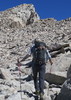
| no partners | | Be aware there are 2 blowholes in this area. And coincidentally there are 2 parking areas off the side of the road to views these. The first parking spot is at mile marker 38 and the other at 38.5. Many people stop at 38 because that is the first one they come to and if you want to do some hiking this is the perfect starting point for you. There are a myriad of unsigned trails that network across the landscape. You have two options: "the high road" or "the low road". My wife and I can in uniformed and we were looking for A blowhole - a single blowhole. We kept to the "high road" and by heading in a direction eventually spied a hole spouting nicely. We saw some people down by the blowhole (probably about .25 miles away. There were multiple options to get to where they were), but my wife had just had a slip and fall and was not interested in navigating the rocky and jagged slope down. We turned from this vantage point feeling mission accomplished. It was only later in the day that we realized that we had seen only 1 of 2 blowholes and the one we saw was the smaller of the two.  Still the blowhole we saw was pretty cool and the geological formations out there are something to see in their own right. Still the blowhole we saw was pretty cool and the geological formations out there are something to see in their own right.
If you want to see the blowholes without hiking go to mile marker 38.5. (To be honest, I'm not sure if you'll be able to see the smaller of the two blowholes, but you'll be able to Nakalele). If you want to do some hiking mile marker 38 is a great starting point. Just realize your mission is to see 2 blowholes. Not having accomplished this mission, I can only speculate that the "low road" is the way to go. If you stay high, you'll have to navigate at least two ridges. (We were on the second ridge and only saw the one blowhole...Nakalele being further to the east never came into view). |
| _____________________
| | |
|
|
|
 Route Editor