Black Mountain Ruin - 3 members in 8 triplogs have rated this an average 2.7 ( 1 to 5 best )
|
| | | |
| |
| |
| |
| Linked |
|
none
[ show ]
| no linked trail guides |
| Partners |
|
none
[ show ]
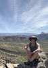
| no partners | | | After reading @prestonsands guide, I took detour on my way home from Payson and found the Black Mountain ruin. I took my truck up the unmarked FSR off the Gisela highway to the gate and began my hike there. It is a short distance from the gate to the hilltop but definitely an uphill climb the majority of the way. There are many interconnecting roads up there that I plan to revisit at a later date. The ruin consists of very large rocks and it is quite impressive both in condition and location. The views are just spectacular! I did find something interesting that was hard to capture in a picture but I will put it in my photo set. In the middle of the ruin ontop of a wall intersection there was a pile of whitish grey ash that I believe to be human remains…The breeze was gently sifting the ashes away and I left the entire area near them undisturbed in case it really was a final resting place for someone. I had a feeling of intruding after coming across the ashes and made my way back down the hill to my truck. I was happy to have been able to enjoy the ancient dwelling and can mark it off of my ever growing list of TNF treasures. |
| | |
|
|
|
|
|
| | | |
| |
|
| Hiking | 3.24 Miles |
571 AEG |
| | Hiking | 3.24 Miles | | | |
| 571 ft AEG | | | | |
|
|
| |
| Linked |
|
none
[ show ]
| no linked trail guides |
| Partners |
|
none
[ show ]
| no partners | | | Don't let anyone kid you it is steeper and harder than you think. Ruins are very poor. |
| _____________________
| All who wander are not lost...just me. |
| | |
|
|
|
|
|
| | | |
| |
|
| Hiking | 0.80 Miles |
571 AEG |
| | Hiking | 0.80 Miles | | | |
| 571 ft AEG | | | | |
|
|
| |
| Linked |
|
none
[ show ]
| no linked trail guides |
| Partners |
|
none
[ show ]
| no partners | | | apparently this member prefers to keep an air of mystery... | | _____________________
| | |
|
|
|
|
|
| | | |
| |
|
| Hiking | 0.80 Miles |
571 AEG |
| | Hiking | 0.80 Miles | 1 Hour | | 0.80 mph |
| 571 ft AEG | | | | |
|
|
| |
| Linked |
|
none
[ show ]
| no linked trail guides |
| Partners |
|
none
[ show ]
| no partners | | We did this hike as a near-trifecta of Upper Tonto Basin ruins that included Jake's Corner Ruins and an attempt at the Gisela Ruins.
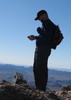
As mentioned in the hike description there is no trail, you just beeline up the side of the hill, dodging hedgehog and prickly pear cactus along the way. The hardest part of the ascent was crawling under the barbed wire fence just above the wash. There doesn't appear to be an easy way around it.
The ruins are much bigger than expected. There are several rock walls still intact and even some gourds growing around the room on the northenmost section of the ruins. Could gourds that were planted several hundred years ago still be growing to this day? Great views of the Mazatzals and down into the Tonto Basin.
On the return we headed west to investigate the smaller peak with the rocky outcropping but didn't see any ruins there. Be careful on the way down. Loose rock caused me to lose my footing and the left side of my body became a human pincushion. Still, it was worth it to take the brief step back in time. |
| _____________________
"I've driven across deserts, driven by the irony, that only being shackled to the road could ever I be free"
- Frank Turner "The Road" |
| | |
|
|
|
|
|
| | | |
| |
|
| Hiking | 0.80 Miles |
571 AEG |
| | Hiking | 0.80 Miles | | | |
| 571 ft AEG | | | | |
|
|
| |
| Linked |
|
none
[ show ]
| no linked trail guides |
| Partners |
|
none
[ show ]
| no partners | | | Nice day for this exploring hike. Great weather,views,and great birdwatching. Dogs had a blast. |
| _____________________
| Life is not measured by the breaths that we take ... but by the moments that take our breath away. |
| | |
|
|
|
|
|
| | | |
| |
|
| Hiking | 1.30 Miles |
571 AEG |
| | Hiking | 1.30 Miles | 41 Mns | | 1.90 mph |
| 571 ft AEG | | | | |
|
|
| |
| Linked |
|
none
[ show ]
| no linked trail guides |
| Partners |
|
none
[ show ]
| no partners | | | Parked truck along road just east of Black Mtn. I followed a dirt road and stream bed to the north side of the mountain and went up. The summit is covered with many rooms. Century plants now occupy most rooms. Although the walls are only a couple of feet high, the layout is pretty obvious. Summit also provides great views of the Tonto Basin and Mazatzals. |
| _____________________
| | |
|
|
|
|
|
| | | |
| |
|
| Hiking | 2.00 Miles |
571 AEG |
| | Hiking | 2.00 Miles | 3 Hrs | | 0.67 mph |
| 571 ft AEG | | | | |
|
|
| |
| Linked |
|
none
[ show ]
| no linked trail guides |
| Partners |
|
none
[ show ]
| no partners | | | I did this hike with a different approach. It made the hike longer but eliminated much of the bushwhack. Just to the east of Black Mountain on Gisela Road you will find FR 554A. A 4 X 4 road, follow this road north past Black Mountain Tank and around the rear of Black Mountain and then it makes a U turn and heads straight for the north side of the mountain. The road ends and a cairned trail takes you the rest of the way up the steep mountain to the ruins. Check out the GPS route. A great day of exploring. |
| _____________________
It's best for a man to remain silent and be thought a fool, than to open his mouth and remove all doubt.
--Mark Twain |
| | |
|
|
|
|
|
| | | |
| |
|
| Hiking | 0.80 Miles |
571 AEG |
| | Hiking | 0.80 Miles | 1 Hour | | 0.80 mph |
| 571 ft AEG | | | | |
|
|
| |
| Linked |
|
none
[ show ]
| no linked trail guides |
| Partners |
|
none
[ show ]
| no partners | | A fun lunch break exploration of the ruin, on the way back home from working in Gisela. The ruin is in good shape. I did see a modern campfire ring in one of the rooms, though  |
| _____________________
| "…you never know when a hike might break out" -Jim Gaffigan |
| | |
|
|
|
|
average hiking speed 1.04 mph
WARNING! Hiking and outdoor related sports can be dangerous. Be responsible and prepare for the trip. Study the area you are entering and plan accordingly. Dress for the current and unexpected weather changes. Take plenty of water. Never go alone. Make an itinerary with your plan(s), route(s), destination(s) and expected return time. Give your itinerary to trusted family and/or friends.
 Route Editor