|
| | | |
| |
|
| Backpack | 8.20 Miles |
1,118 AEG |
| | Backpack | 8.20 Miles | 2 Days | | |
| 1,118 ft AEG | | | | |
|
|
| |
| Linked |
|
none
[ show ]
| no linked trail guides |
| Partners |
|
none
[ show ]
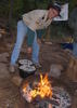
| no partners | | We took a group of 8 scouts and 4 adults down Rogers Canyon. Leaving on Saturday about 8 am in the cool mist it was a cool hike down to the dwellings. We never saw the infamous horse - just smelled it. There was no one else to be seen on the trip. We went past the ruins to Angel Basin and set up our overnight camp. The sun came out early afternoon and dried most everything out.
We took the scouts back up to the ruins - trimmed some of the catclaw on the way back. There was water occasionally all the way down to Angel Basin - sometimes it disappeared - other times it was just a light flow. Pools of water do exist - usually full of algae.
We took an afternoon trip looking for the Hole Spring down JF trail. It is really overgrown and in areas difficult to follow and to find. Most of the trip down we followed the creek bed. And the GPS had the spring on it - I stood right where it was marked - and no spring.
We hiked out early Sunday - trying to beat the heat - and left the trailhead about noon back to Phoenix. We kept a couple of coolers in the car - with iced water and it was great.
When we left on Saturday the temp was about 55 - when we got out on Sunday it was about 85 - quite a difference.
The Rogers trail is very well marked - very little catclaw - thanks to the trimmers - but it appears that it will just grow back.
A couple of cars were at the trailhead Sunday - we never saw them - i suspect they went to Reavis.
A good - no great overnight hike. Angel Basin is perfect - the star gazing amazing.
Enjoy the trip - |
| _____________________
| | |
|
|
|
|
|
| | | |
| |
|
| Hiking | 8.20 Miles |
1,118 AEG |
| | Hiking | 8.20 Miles | 6 Hrs | | 1.37 mph |
| 1,118 ft AEG | | | | |
|
|
| |
| Linked |
|
none
[ show ]
| no linked trail guides |
| Partners |
|
none
[ show ]
| no partners | | Rogers Canyon is probably a fairly popular hike here. But in my 10 years of occasional hiking in the Superstitions this has got to be one of my favorites. And one that I will take by Boy Scouts on for a backpacking trip.
My partner and I started at about 9:30 am on a great sunny and cool day. After the 1 hour bone ratlling ride on the road to get to the trail head. High clearance is definetely required.
We met just a handful of people coming out that had spent the night somewhere. Total population of the hike was about 15 people. Very nice.
Just down from the trailhead check out the stream from the cliffs on the left. There was still some water coming down.
The creek had lots of water running all the way from the traihead. Some small streams coming in from the side canyons. If it had been hotter, it would have been a nice way to cool off. Lots of waterfalls (small) and lots of nice large pools. Did you know that there are 26 creek crossings from the trailhead to the cliff dwellings.
Mostly the trail was easy to follow. I will remember the camping spot about 2 miles down for the scouts. Further down check out the rock formations on your left.
The cliff dwellings are certainly something that should be seen and not touched. Its a shame about the graffati already there. The area makes a great shady spot for lunch and snacks.
But since the hike is all down from the trailhead going back up is a little more of a chore. But the 26 creek crossings make it fun. All the crossings are well marked and easy to get across right now.
Having just gotten done with chemo and raditation made the trek up a little difficult. But with several short rests and lots of energy bars we made it back up in about 3 hours.
Just a great hike if you can get to the trailhead.
If I can figure out how to post the pictures I will. |
| _____________________
| | |
|
|
|
|
|
| | | |
| |
|
| Hiking | 8.60 Miles |
2,780 AEG |
| | Hiking | 8.60 Miles | 7 Hrs 30 Mns | | 1.15 mph |
| 2,780 ft AEG | | | | |
|
|
| |
| Linked |
|
none
[ show ]
| no linked trail guides |
| Partners |
|
none
[ show ]
| no partners | | We took a group of scouts up to Siphon Draw. Of course they wanted to explore all the way to the Flatiron. We were prepared so off we went. Right after the the saddle above the draw I knew that I was going to have a problem. Just looking at the trail across the valley made me winch. Of course just coming off chemo and radiation 10 weeks ago did not help my outlook.
The scouts and two parents went on ahead. I trudged along behind. They made it to the top....I fell short of about 100 yards when they got me on the way down.
I will say as much as i rested that there are spectacular views to the west all the way up. Even if you do not make it to the top, however far yo go it is worth it. |
| _____________________
| | |
|
|
|
|
average hiking speed 1.26 mph
WARNING! Hiking and outdoor related sports can be dangerous. Be responsible and prepare for the trip. Study the area you are entering and plan accordingly. Dress for the current and unexpected weather changes. Take plenty of water. Never go alone. Make an itinerary with your plan(s), route(s), destination(s) and expected return time. Give your itinerary to trusted family and/or friends.
 Route Editor