|
| | | |
| |
|
| Hiking | 3.06 Miles |
1,001 AEG |
| | Hiking | 3.06 Miles | 4 Hrs | | 0.77 mph |
| 1,001 ft AEG | | | | |
|
|
| |
| Linked |
|
none
[ show ]
| no linked trail guides |
| Partners |
|
none
[ show ]
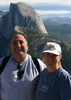
| no partners | | | Beautiful day hike after spending the night in moderately heavy rain. The sky cleared off and we had some sunshine mixed with high clouds. After a few grade changes at the beginning, the trail starts up into multiple switchbacks until reaching a saddle with a nice wooden bench overlooking the head of Estes Canyon. We decided to stop for a breather and have a snack before continuing to the top of the pass. Our original intent was to hike through and try to find the route to the top of Ajo Mountain, but with the skies turning more threatening we decided to head back down through the top of Estes Canyon and complete the loop. The first section of the descent is steep and rocky, but once we reached the canyon floor the terrain became fairly flat and winds through huge cholla and mesquite. We logged four hours for this hike, but at least an hour of that was taken up with pauses to take in the views and taking a a few photos. The views from the bench at the first saddle and the view from the gap at the top of the pass are well worth the time to stay a while. We were treated with a nice cool breeze and managed to stay dry the entire hike. We were about two or three weeks early for the wildflowers, but plan on going back near the end of March for a morning hike up Alamo Canyon and maybe an afternoon at least into Estes Canyon. |
|
Wildflowers Observation Light
|
|
| _____________________
| | |
|
|
|
 Route Editor