username
X
password
register
for free!
help
ArticlesGuidesRoutes
 
Photosets
 
 Comments
triplogs   photosets   labels comments more
1, 2  Next
25 triplogs
login for filter options
Apr 19 2014
avatar

 Routes 3
 Photos 328
 Triplogs 25

55 male
 Joined Jul 23 2012
 phoenix, az
Bull Pen Ranch, AZ 
Bull Pen Ranch, AZ
 
Hiking avatar Apr 19 2014
beterarcherTriplogs 25
Hiking3.00 Miles 300 AEG
Hiking3.00 Miles
300 ft AEG
 no routesno photosets
1st trip
Linked   linked  
Partners none no partners
It's been a while since my last post because I've been working a lot without at least two days in a row off for recreation. I always spend my one day off working on the house. I and some of my family attempted to reach the source of Evan's Spring at Bull Pen. As it turned out I was the only one who could climb the loose, steep, brushy terrain. I searched in vain for a passable trail for the others to follow but came up with nothing. We ended up taking Pop's ashes to the area where the spring reaches West Clear Creek. It is beautiful here. Quite a bit of water was coming out of the red rock cliff but it was spread along about a 20 to 30 yard area. I couldn't estimate how much but it was definitely flowing up at the source. It chaps my hide that the Forest Service has deemed this area unfit for camping and has designated it as "day use only". You now have to camp at least a mile away from the area. This means up on the plateau in the sun and wind. :(

water 1 out of 5water 2 out of 5water 3 out of 5water 4 out of 5 Evan's Spring Gallon + per minute Gallon + per minute
Didn't make it to the source but saw quite a bit of seep down at the red cliffs on the South side of West Clear Creek at Bull Pen.
_____________________
Understand, when you eat meat, that something did die. You have an obligation to value it - not just the sirloin but also all those wonderful tough little bits.
Anthony Bourdain
 
Sep 04 2013
avatar

 Routes 3
 Photos 328
 Triplogs 25

55 male
 Joined Jul 23 2012
 phoenix, az
Patio Area Petroglyph SitePhoenix, AZ
Phoenix, AZ
Scenic Drive avatar Sep 04 2013
beterarcherTriplogs 25
Scenic Drive135.13 Miles
 no routes
1st trip
Linked   none no linked trail guides
Partners none no partners
Mom and I took a trip that My Dad always loved. We headed down to the Petroglyph site at the South end of the Estrella Mountains. This site is located on the Gila River Indian Reservation. I was waiting for my check from work today (which didn't come) so we got a late start. By the time we got there at about 1:00 it was a barely bearable 105 degrees. The road South from Komatke is a bit rough. I wouldn't recommend doing it in a sedan but my stock 4X2 Ford Ranger made it just fine. I had to keep the momentum up in a couple sandy stretches but other than that, getting to the glyphs wasn't a real problem. I haven't been here since the 80s and the glyphs aren't quite as I remember them. There was a lot of thievery and damage to the glyphs. Before I decided to go, I checked out the Description, Officially called Patio Area Petroglyph Site. The description stated that there was a lot of trash at the site but I found it to be relatively clean except for all the broken glass and spray paint. After viewing the glyphs, we decided to continue on around the Estrellas to Rainbow Valley. We turned North off of SR 238 on to 99th ave. A short while later we found the gas pipeline road that I was looking for. This road is not recommended for sedans either. I had my little Ranger acting like a Bronco! A couple times only the two front wheels or the two back wheels were on the ground and I wasn't going very fast. I worked the full range of it's stock suspenssion. As we got deeper into Rainbow Valley and civilization, the roads smoothed out quite a bi. I was able to do about 50 MPH and make some time.We came home through the community of Estrella, Goodyear, Avondale, Litchfield and Glendale back into Phoenix. My Dad would have loved this trip again.
_____________________
Understand, when you eat meat, that something did die. You have an obligation to value it - not just the sirloin but also all those wonderful tough little bits.
Anthony Bourdain
 
Aug 10 2013
avatar

 Routes 3
 Photos 328
 Triplogs 25

55 male
 Joined Jul 23 2012
 phoenix, az
HAZfest 2013 Bike Ride, AZ 
HAZfest 2013 Bike Ride, AZ
 
Mtn Biking avatar Aug 10 2013
beterarcherTriplogs 25
Mtn Biking12.83 Miles 366 AEG
Mtn Biking12.83 Miles
366 ft AEG
 
no photosets
1st trip
Linked   none no linked trail guides
Partners none no partners
http://hikearizona.com/gps=24446

I forgot a loop when I was working it out on route mgr, so I added it and couldn't figure out how to make it all one route. Oh well, that's the learning curve in action on HAZ.
_____________________
Understand, when you eat meat, that something did die. You have an obligation to value it - not just the sirloin but also all those wonderful tough little bits.
Anthony Bourdain
 
Aug 09 2013
avatar

 Routes 3
 Photos 328
 Triplogs 25

55 male
 Joined Jul 23 2012
 phoenix, az
CHUMS Summer HAZfest 2013, AZ 
CHUMS Summer HAZfest 2013, AZ
 
Hiking avatar Aug 09 2013
beterarcherTriplogs 25
Hiking5.63 Miles 127 AEG
Hiking5.63 Miles
127 ft AEG
 no routes
1st trip
Linked   none no linked trail guides
Partners 34 partners
HAZ - Event
Alex
ASUAviator
azbackpackr
Barrett
BiFrost
BobP
chumley
cindyl
ElliotAlford
GrottoGirl
Hikergirl81
Hippy
JoelHazelton
John9L
Jonnybackpack
juliachaos
laurabalaura
LittleKnee
moo
MyRudy
nonot
Oregon_Hiker
outdoor_lover
Pivo
PrestonSands
RedwallNHops
slowandsteady
snakemarks
southpawaz
squatpuke
tibber
Tugger
uphill_junkie
VolcanoCLMBR
I didn't want to bite off too much of a hike while at HAZfest because I hadn't hiked in several months so I decided to keep it to relatively flat ground. After I set up my camp, I pulled out my GPS and started looking at forest roads and found a nice looking route around Wild Bill Hill. I started off by heading North from camp through the pasture, past the west slope of Wild Bill until I came to a ranch gate. Just past the gate I found Fr61 at which I turned East. This part of my hike took me through some fairly lush forest. There were a few very old Ponderosa Pines peaking out above the younger trees. I also saw quite a few different types of wildflowers and some bright orange mushrooms. The pastures along this side of Wild Bill offered some great views. I followed Fr61 until the junction with Fr171 then turned South. There wasn't much traffic since it was a Friday morning. It was nice because I didn't have to breath much dust. I noticed a road labeled "unpaved road" on my GPS that looked like a faster way back to camp. After a little research at home I discovered this "road" to be the Historic Beal Wagon Road. It appeared that there would be only about a quarter mile of bush whacking to reach a section of the Beal Wagon Road that would take me almost directly to camp so I headed off 171 toward the West. I arrived at where the road was supposed to be and there was no sign of a road ever having gone through this area. I had to hop three fences on the way back to camp. Just after hopping the first fence, I looked up and saw a small herd of Elk running almost right at me. I froze, stuck my hand in my pocket where I had my camera and turned it on. I pulled it out just in time to get two mediocre shots of two Elk cows. There were a total of eight, six cows and two yearling calves. The quarter mile bushwhack turned out to be a two mile slog through ankle twisting rock and knee high prairie grass strewn terrain. I ended up with a blister on both heals. I guess I need to get out more to toughen up the feet. http://hikearizona.com/map.php?QX=2928
 Flora
 Flora [ checklist ]
[ checklist ]  American Vetch
 Culture
 Culture [ checklist ]
[ checklist ]  Campsite
_____________________
Understand, when you eat meat, that something did die. You have an obligation to value it - not just the sirloin but also all those wonderful tough little bits.
Anthony Bourdain
 
Jun 16 2013
avatar

 Routes 3
 Photos 328
 Triplogs 25

55 male
 Joined Jul 23 2012
 phoenix, az
Father's Day 2013 Bradshaw Mountains, AZ 
Father's Day 2013 Bradshaw Mountains, AZ
 
Scenic Drive avatar Jun 16 2013
beterarcherTriplogs 25
Scenic Drive
Scenic Drive
 no routes
1st trip
Linked   none no linked trail guides
Partners none no partners
Mom and I decided to head up to Crown King in honor of My Dad on this Father's Day. It had been many years since I had been up there and it hasn't changed much, except the roads aren't in as good of shape. The traffic was good going up the mountain. We only saw three or four other vehicles. When we got to the Crown King General Store, there was almost no parking because there was a wedding taking place. I grabbed a bear and Mom got a soda and we headed off toward Horsethief Lake. When I was 17 or 18, I rode my mountain bike from town to the lake and it didn't seem as far as it did this time driving. There was only one vehicle at the lake when we got there and they were just leaving so we had the whole place to our selves. There was a family of Mallard ducks cruising the shallows and another mom duck that had only one duckling that she was very protective of. every time the older ducklings came near her, she quacked loudly and chased them away. On the back side of the dam where it is leaking a little, there was a small flock of tiny birds that I couldn't get a good look at that were drinking the seepage. While walking around the lake, we came across a bunch of Spring Azure Butterflies that were getting salt from the mud where the water was evaporating. Those little guys are hard to get a good picture of! When we got bored of the lake we decided to drive on up to the fire lookout tower. I couldn't believe our luck, there was someone home! He yelled out the window and invited us up. We sat and talked with him for about an hour. The lookout is a really nice guy named Tony and his family has been in Crown King since the late 1800s. We pointed out landmarks to each other and I think he was a bit surprised as to how many mountains and mesas I could identify (Thank you HAZ!). Our stomachs started grumbling so we climbed down and had a lunch of crackers, Cheddar Cheese and Genoa Salami. Hunger satisfied, we started the long drive down the mountain. By this time, traffic had picked up considerably and we were eating dust from Crown King all the way down to Cleator. I decided to stop, since I had never been in the bar there, WOW what a dump. There is a sign in the restroom that says " If it's yellow, it's mellow. If it's brown, flush it down."! It felt like I was going to fall through the floor in places. Oh well, the beer was ice cold :D . I was contemplating taking Maggie Mine rd to Black Canyon City but after I saw the beginning of the road I decided against it. I figured we had had enough bouncy, dusty road today, so we got back on I-17 and headed home. About half way to Black Canyon City, I remembered PIES! So I pulled off at the Squaw Valley rd exit and cruised through BCC to rock springs. I saw all the cars parked at the pie shop and thought I just might go home but since Mom and I were out celebrating My Father on Father's Day we stopped any way. I couldn't believe it, we got in and out in about five minutes! Traffic was horrible the rest of the way home. We had an AWESOME time today! It's good to feel happiness again. :D
_____________________
Understand, when you eat meat, that something did die. You have an obligation to value it - not just the sirloin but also all those wonderful tough little bits.
Anthony Bourdain
 
May 25 2013
avatar

 Routes 3
 Photos 328
 Triplogs 25

55 male
 Joined Jul 23 2012
 phoenix, az
Apache Trail Drive, AZ 
Apache Trail Drive, AZ
 
Scenic Drive avatar May 25 2013
beterarcherTriplogs 25
Scenic Drive
Scenic Drive
 no routes
1st trip
Linked   none no linked trail guides
Partners none no partners
Mom and I took a drive today. I decided that 20 something years had been long enough since I saw Roosevelt Lake and Apache trail. We went up The Beeline Highway (87) to the 188 towards Roosevelt Lake. The lake had a pretty good bathtub ring. I'm guessing it is about 80 feet of dirt between the water and the foliage. I had never been over the Roosevelt Bridge as one would just drive over the dam the last time I was there. We Turned West on to Apache Trail and stopped at the dam overlook to take a couple pics with my phone since I LEFT MY CAMERA ON THE COUNTER! ](*,) The dam is ugly now :yuck: We got back in to continue our journey. The road was a bit washboardy but it wasn't that bad. I'm glad I decided to do this trip clockwise because the Memorial Day traffic started to get a little heavy but it was going in the other direction :D. I forgot how nice the views of the Mazatzals and the Salt River lakes are from Apache Trail :worthy: 
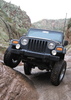
. A few bouncy, dusty miles West of Apache Lake I came around a bend and was blown away by the sight of Fish Creek Canyon. It is MUCH prettier than I remember it. While climbing out of the canyon I came across a ford truck with the driver under it. He said something fell off. We offered him, his wife and two small children a ride out but he said he wanted to work on it for a while :roll:. We got to the top of the climb and were rewarded with views of Lower Fish Creek Canyon and its Soft textured cliffs and boulders covered in green lichen. We were getting pretty hungry by now and I thought we'd stop at Tortilla Flats for some lunch :doh: half the cars in the state were parked there so we kept on driving into Apache Junction. we stopped at a greasy spoon on Apache Blvd :sk: but it was food and I am not ill as of the writing of this triplog :y: . We took Apache Blvd west to the 202 and the 202 to the 101 north back home. It was good to get out since tomorrow is the four month anniversary of my Pops passing and if it weren't for him being afflicted with the "go bug", I probably wouldn't have such a need to go places and see things.
 Named place
 Named place [ checklist ]
[ checklist ]  Tortilla Flat - Hwy 88
_____________________
Understand, when you eat meat, that something did die. You have an obligation to value it - not just the sirloin but also all those wonderful tough little bits.
Anthony Bourdain
 
May 06 2013
avatar

 Routes 3
 Photos 328
 Triplogs 25

55 male
 Joined Jul 23 2012
 phoenix, az
Bull Pen Car Camping, AZ 
Bull Pen Car Camping, AZ
 
Car Camping avatar May 06 2013
beterarcherTriplogs 25
Car Camping
Car Camping3 Days         
 no routes
1st trip
Linked   none no linked trail guides
Partners none no partners
I decided that the cooler weather in the forecast last week would be the perfect time for taking Dad for one of his final trips. I got together with my cousin Cody, who might as well be my brother, and decided we would head up to Bull Pen Ranch for a few days. This was one of my Dad's favorite places to camp. We have been going there since I was born.We drove up I-17 to Gen. Crook trail and turned North on to Bull Pen rd.(NF618).After a few miles the Bull Pen rd veers off toward West Clear Creek Canyon. The road is a lot rougher than I remember it.The place has changed a lot, mostly for the worst. Lots of trash everywhere. Cody has always been the best critter gitter in the family, I think he might be related to Gummo! when we parked he disapeared and cane back ten minutes later with a Pai Whiptail Lizard. We set up camp at the trailhead. We had steak and squash with ranch beans and veggie kabobs and then proceeded to get pretty smashed the first night. At about 10:00 that night I suggested we take a night hike with head lamps. There was no moon and thick cloud cover so it was super dark. I ran into a Pricklypair and got a bit scratched up. When I finally woke up on day two, my legs were VERY sore. It must have been the four mile hike last night wearing my surf booties. Day two, we hiked down stream for about two miles rock hopping the whole way and returned on trails and roads. My legs were still sore but I managed pretty well. On the second night we had country style pork ribs, more grilled squash and Cajun rice. The morning of day three, we got most of our gear back into the truck and hiked up stream toward where a cable car for the USGS is and waded across the stream. There is what I believe to be an unnamed Spring there. 34°32'14.819",-111° 41'46.856" It is not marked on any maps that I could find. It has had at least some flow every time I've been there. It's quite the climb through some pretty thick forest. We left dad at the base of a large Sycamore tree almost at the top of the spring. We headed down and went up stream to try our hand at fishing. Cody caught several tiny Smallmouth Bass and I caught one. I know they are not native but we released them any way.On the way back to camp we spotted some large deer prints crossing the trail. We got back to camp and finished packing and drowning our fire pit, then took off toward Jerome on the 260 and turned West on 89A . I couldn't believe all the roundabouts on the way between Cottonwood and the bottom of Mingus Mtn. I never saw one until I lived in California and now they are everywhere in Arizona! Jerome was as beautiful as ever. As we were coming into Prescott Valley we saw two pair of Speed Goat (Pronghorn Antelope). They must have known they were safe so close to the highway. The new highway into Prescott is HUGE! From Prescott we headed to Kirkland Junction, Yarnell, Congress and Wickenburg. Just before Moristown we turned East on US60 and drove past Lake Pleasant. Then we took Lake Pleasant Pkwy. back into town. This loop was always one of my Pop's favorite escape routs from the drag of civilization. I MISS YOU DAD!
 Named place
 Named place [ checklist ]
[ checklist ]  Bull Pen Ranch  Evan's Spring
_____________________
Understand, when you eat meat, that something did die. You have an obligation to value it - not just the sirloin but also all those wonderful tough little bits.
Anthony Bourdain
 
May 02 2013
avatar

 Routes 3
 Photos 328
 Triplogs 25

55 male
 Joined Jul 23 2012
 phoenix, az
Sears-Kay RuinPhoenix, AZ
Phoenix, AZ
Hiking avatar May 02 2013
beterarcherTriplogs 25
Hiking1.10 Miles 220 AEG
Hiking1.10 Miles
220 ft AEG
 no routesno photosets
1st trip
Linked   none no linked trail guides
Partners none no partners
I finally got out a bit today. It was nice and cool and a little bit windy so Mom and I headed up to Sears Kay Ruins at about 9:00 am and was totally surprised to see that no one else was there. I have been to Seven Springs a million times but never stopped at the ruins. The outhouse was in pretty bad shape and there was trash everywhere at the trailhead. At first I thought that animals had gotten in to the cans but there were water bottles strewn about so, unless the critters have learned there's water in them there plastic thingys, I'm going to blame it on the stupid humans. I headed up the trail and was surprised that there were quite a few flowers still. Brittle Bush, Fairy Duster, Thistle and several others. As we came up to the first evidence of walls, I looked down and saw an Iron Cross Blister Beetle. I looked around and they were everywhere. They are pretty challenging to snap shots of with my cheap phone camera but I managed to get a couple good ones. A little farther up the trail there was a Harvester Ant nest and Mom managed to pick one up on her foot that bit her! I tried out the Goji berries (Wolf berries) and they were pretty tart, so I left them for the Mockingbird that accompanied us on our hike. We saw a few small piles of pottery shards that somebody put next to the trail so I spread them out again. I'm sure I missed a few piles too. All in all, the ruins are pretty clean. I did see a couple of pieces of glass near the largest of the ruins. We decided to take the Eastern trail back to the truck. There is quite a bit of decomposed Granite on the steep parts that Mom slipped a little on but not a really big deal (she should have worn more aggressive shoes). On the way down we stopped for pics of the nice Granite formations. When we were just about back to the trailhead and a Desert Cottontail ran across the trail just about under our feet. I guess he thought he had the place all to himself too. We sat at the picknick tables for a bit and saw a Yellow Warbler and heard the beautiful song. It was about 11:00 by then and we were getting hungry so we decided to hit Dairy Queen on the way home for a cheeseburger and a Orange Julius. While we were eating outside we saw a GIANT piece of Quartz crystal at a new shop across the street and decided to investigate. When we got there we discovered the coolest Minerals and art. We spent about 30 minutes looking and then headed home. Excellent day! No Pics to follow,my SD card in my phone went on the fritz :( .
wildflower observationwildflower observationwildflower observationwildflower observationwildflower observation
Wildflowers Observation Light
Brittle bush, Fairy duster, Thistle, lots of small blue flowers, small white flowers etc.
_____________________
Understand, when you eat meat, that something did die. You have an obligation to value it - not just the sirloin but also all those wonderful tough little bits.
Anthony Bourdain
 
Mar 28 2013
avatar

 Routes 3
 Photos 328
 Triplogs 25

55 male
 Joined Jul 23 2012
 phoenix, az
Reach 11 Recreation AreaPhoenix, AZ
Phoenix, AZ
Mtn Biking avatar Mar 28 2013
beterarcherTriplogs 25
Mtn Biking7.50 Miles 10 AEG
Mtn Biking7.50 Miles
10 ft AEG
 no routes
Linked   none no linked trail guides
Partners none no partners
Tatum to Scottsdale rd and back with lots of connector trails.stopped at the pond for a few pics.
wildflower observationwildflower observationwildflower observationwildflower observationwildflower observation
Wildflowers Observation Light
_____________________
Understand, when you eat meat, that something did die. You have an obligation to value it - not just the sirloin but also all those wonderful tough little bits.
Anthony Bourdain
 
Mar 22 2013
avatar

 Routes 3
 Photos 328
 Triplogs 25

55 male
 Joined Jul 23 2012
 phoenix, az
fishing on the Arizona Canal, AZ 
fishing on the Arizona Canal, AZ
 
Mtn Biking avatar Mar 22 2013
beterarcherTriplogs 25
Mtn Biking6.00 Miles
Mtn Biking6.00 Miles   2 Hrs      3.00 mph
 no routesno photosets
1st trip
Linked   none no linked trail guides
Partners none no partners
I tried to fish the Arizona canal but it was muddy. I wonder if it was from construction up stream or from all the grass carp. Rode from Northern east to 32nd st, stopping frequently to cast at structure and cover.
_____________________
Understand, when you eat meat, that something did die. You have an obligation to value it - not just the sirloin but also all those wonderful tough little bits.
Anthony Bourdain
 
Mar 21 2013
avatar

 Routes 3
 Photos 328
 Triplogs 25

55 male
 Joined Jul 23 2012
 phoenix, az
Reach 11 Recreation AreaPhoenix, AZ
Phoenix, AZ
Hiking avatar Mar 21 2013
beterarcherTriplogs 25
Hiking2.00 Miles 10 AEG
Hiking2.00 Miles
10 ft AEG
 no routes
Linked   none no linked trail guides
Partners none no partners
Went for a walk with my dog Alex. Saw my first rattler of the season. Had to pull Alex off another dog that was off lead(stupid owner). Saw the a few of the usual flowers, lizards, Red Eared Sliders, Rock Squirrels, Abert's Towhees, Great Blue Heron and a Cardinal. The pond was almost florescent green. The pics aren't so great because they are from my phone.
_____________________
Understand, when you eat meat, that something did die. You have an obligation to value it - not just the sirloin but also all those wonderful tough little bits.
Anthony Bourdain
 
Mar 16 2013
avatar

 Routes 3
 Photos 328
 Triplogs 25

55 male
 Joined Jul 23 2012
 phoenix, az
Riparian Preserve at Water Ranch - GilbertPhoenix, AZ
Phoenix, AZ
Walk / Tour avatar Mar 16 2013
beterarcherTriplogs 25
Walk / Tour2.00 Miles
 no routes
1st trip
Linked   none no linked trail guides
Partners none no partners
My first time there and it was crowded, there was some Audubon thing going on plus it was a Saturday. Really enjoyed the place though. I'll have to go back on a weekday before it really warms up. I saw Black Necked Stilts, American Avocet, Northern Shovelers, Malards, Coots, a small black diving ducklike bird that I couldn't ID, Neotropic Cormerants, various pipers, Great Blue Herons, Snowy Egrets, Verdins, Black Throated Sparrows,Costa's and Anna's Hummingbirds and Great Tailed Grackles. The Audubon folks also had a Great Horned Owl, a Burrowing Owl and a Red Tailed Hawk. My battery died half way through the walk so I missed some shots.
 Flora
 Flora [ checklist ]
[ checklist ]  Jojoba
_____________________
Understand, when you eat meat, that something did die. You have an obligation to value it - not just the sirloin but also all those wonderful tough little bits.
Anthony Bourdain
 
Mar 14 2013
avatar

 Routes 3
 Photos 328
 Triplogs 25

55 male
 Joined Jul 23 2012
 phoenix, az
Charles M. Christiansen Trail #100Phoenix, AZ
Phoenix, AZ
Hiking avatar Mar 14 2013
beterarcherTriplogs 25
Hiking2.02 Miles 60 AEG
Hiking2.02 Miles
60 ft AEG
 no routes
Linked   none no linked trail guides
Partners none no partners
Went geocaching with mom and Alex,my dog. Parked at the 40th st. trailhead and headed West.Grabbed three caches before Mom got tired a mile in so we turned around. Lots of folks out hiking for a Thursday.
wildflower observationwildflower observationwildflower observationwildflower observationwildflower observation
Wildflowers Observation Isolated
I could see small fields of Mexican poppies West of Peak 2429
_____________________
Understand, when you eat meat, that something did die. You have an obligation to value it - not just the sirloin but also all those wonderful tough little bits.
Anthony Bourdain
 
Mar 12 2013
avatar

 Routes 3
 Photos 328
 Triplogs 25

55 male
 Joined Jul 23 2012
 phoenix, az
Reach 11 Recreation AreaPhoenix, AZ
Phoenix, AZ
Mtn Biking avatar Mar 12 2013
beterarcherTriplogs 25
Mtn Biking10.50 Miles 10 AEG
Mtn Biking10.50 Miles   2 Hrs      5.25 mph
10 ft AEG
 no routes
Linked   none no linked trail guides
Partners none no partners
Parked at the Horse Lover's trailhead on Tatum and hopped on the bike.
Rode out to the National Memorial Cemetery to talk to admin about getting dad a place there.
Found and signed the logs of five geocaches on the way back to my truck.
Unintentionally frightened a couple horses that were coming around a blind corner in a Mesquite
bosque just as I was going the other way.
No harm, no foul right? ;)
A few Mexican Gold Poppies and Desert Globe Mallow
Nice ride but getting warm fast.
_____________________
Understand, when you eat meat, that something did die. You have an obligation to value it - not just the sirloin but also all those wonderful tough little bits.
Anthony Bourdain
 
Mar 10 2013
avatar

 Routes 3
 Photos 328
 Triplogs 25

55 male
 Joined Jul 23 2012
 phoenix, az
Cave Creek Dam, AZ 
Cave Creek Dam, AZ
 
Hiking avatar Mar 10 2013
beterarcherTriplogs 25
Hiking4.60 Miles 523 AEG
Hiking4.60 Miles   3 Hrs   15 Mns   1.42 mph
523 ft AEG
 
1st trip
Linked   none no linked trail guides
Partners none no partners
First hike since dad got sick and went in the hospital the day after Thanksgiving. Parked at the end of the pavement on Cave Creek Dam rd. which begins as 22 st. North off Deer Valley rd. Wasn't really warmed up until I got to the top of the newer, earthen dam. Turned right and crossed the smaller dam to the East. Followed a dirt road northward just east of a ridge until I hung a left on to Jomax rd. Followed that until I came to the cul-de-sac then hit a road going West over a hill to the old concrete dam. Walked along the downstream side of the dam and stopped at the spillway from which Cave Creek was flowing. Ate my lunch with an adult beverage. While eating I noticed a mine half way up a hill across the dry lake bed. Went up to the mine, I thought it might be the Union Mine but after a little research, the Union is at 16 st. just south of Deer Valley rd. After viewing the mine I decided to continue to the top of the hill. This is where my legs really started to burn. I hiked the ridge line for a bit then decided it was going the wrong direction so I dropped South West toward a drainage to traverse the next hill. After the traverse I came across another gully. I headed for some prospect tailings across the gully that were easier walking for about 25 yards of relatively level travel. Ended up traversing one more hill and ended up about 1/3 of the way down from the top of the West end of the dam, had to climb again. This time I had to sit down for a few minutes to catch my breath. Reached the top of the dam and sat in the shade of a small Palo Verde for a while, enjoying the view. Got to my feet for the trip across the Earthen dam back to the road down on the East end. Walked the last mile or so back to the truck and promptly turned on the A/C. :D
 Named place
 Named place [ checklist ]
[ checklist ]  Cave Creek  Cave Creek Dam
foliage observationfoliage observationfoliage observationfoliage observationfoliage observation
Autumn Foliage Observation None
lots of green
wildflower observationwildflower observationwildflower observationwildflower observationwildflower observation
Wildflowers Observation Substantial
Poppies, Lupines, Dichelostemma capitatum, Caltrop and others. The Brittlebush hasn't popped but will soon.
_____________________
Understand, when you eat meat, that something did die. You have an obligation to value it - not just the sirloin but also all those wonderful tough little bits.
Anthony Bourdain
 
Oct 23 2012
avatar

 Routes 3
 Photos 328
 Triplogs 25

55 male
 Joined Jul 23 2012
 phoenix, az
Spur Cross TrailPhoenix, AZ
Phoenix, AZ
Hiking avatar Oct 23 2012
beterarcherTriplogs 25
Hiking4.70 Miles
Hiking4.70 Miles   3 Hrs      1.57 mph
 no routes
1st trip
Linked   none no linked trail guides
Partners none no partners
Hit the trail at Spur Cross at about 09:30 temp was a nice cool 67 deg. Hiked up to the corral just before the Skull Mtn. trail junction. Ate my sandwich and got going again in the direction I came from. There were a couple of very talkative ravens following me back south. I stopped to listen to them and I realized why they are classified as a song bird. they were making sounds similar to Redwing Black Birds but much lower in tone. Turned right on to Metate tr. and headed down to Cave Creek Wash to explore the bosque. I've always thought it kind of strange that there are so many HUGE Saguaros in this flood plane considering that they mostly grow on a slope at this elevation. I stopped at the Saguaro skeleton that serves as a bench and checked my GPS only to find that I was nearly sitting on a geocache. Signed the log left a small plastic indian and moved on. The metates were right where I left them. It must have been nice to sit in the shade of this giant Saguaro to do the grinding of seeds etc. Tried to snap some photos of flowers and butterflies but the camera wasn't up to the job. It kept focusing on the ground instead of the flowers. Stopped at the Solar Oasis and saw a Garter Snake, a Huntsman Spider and what I believe to be Desert Pupfish and possibly Gila Top Minnows(no pic of the fish because they were kind of skittish). As I left the oasis, I saw a brass plaque that said there were three native fish in the pond but it didn't say what species. Headed south to the crossing and noticed a large white flower growing in a sandy section of the wash. It looked like some sort of Poppy but the plant was similar to Thistle. Got going back up hill to the TH and crossed paths with the third person i'd seen on the trail he said he was going up the Elephant.....he only had half a gallon of water! Made it back to the truck at about 12:30 for the drive home. decided to take Scottsdale rd. home. Bad choice...lots of construction near Dixileta Dr. Other than the traffic delays today was awesome!

dry Cave Creek - SPRCA Dry Dry
Bone dry except a large brown/green pool below Metate/Spur Cross junction
_____________________
Understand, when you eat meat, that something did die. You have an obligation to value it - not just the sirloin but also all those wonderful tough little bits.
Anthony Bourdain
 
Sep 25 2012
avatar

 Routes 3
 Photos 328
 Triplogs 25

55 male
 Joined Jul 23 2012
 phoenix, az
Charles M. Christiansen Trail #100Phoenix, AZ
Phoenix, AZ
Hiking avatar Sep 25 2012
beterarcherTriplogs 25
Hiking3.45 Miles 350 AEG
Hiking3.45 Miles   1 Hour   43 Mns   2.01 mph
350 ft AEG
 no routes
Linked   none no linked trail guides
Partners none no partners
parked at Tatum TH. Found a couple of geocaches stayed on 100 for about a mile and a half then decided to take smaller trails because it was a little crowded for wildlife watching. Headed south just a little past the 40th st. trail to look for another cache. Didn't find it. The person who hid it must not have been a desert rat because the coords put me right in the middle of a fairly large dry wash. Bet it was washed away in the monsoon. After the no find I turned East for a bit of of trail back to 40th st trail. a real climb. managed to reach the trail just before the hairpin switchback. Topped out at 1700 ft started at 1400 ft. Headed back down 40th st trail to 100 and turned right for the home stretch. Good hike, I hope I don't pay the price at work tomorrow. ;)
 Fauna
 Fauna [ checklist ]
[ checklist ]  Brown Recluse
 Culture
 Culture [ checklist ]
[ checklist ]  Fraley Pose
_____________________
Understand, when you eat meat, that something did die. You have an obligation to value it - not just the sirloin but also all those wonderful tough little bits.
Anthony Bourdain
 
Sep 23 2012
avatar

 Routes 3
 Photos 328
 Triplogs 25

55 male
 Joined Jul 23 2012
 phoenix, az
Reach 11, AZ 
Reach 11, AZ
 
Mtn Biking avatar Sep 23 2012
beterarcherTriplogs 25
Mtn Biking14.75 Miles 45 AEG
Mtn Biking14.75 Miles   2 Hrs   40 Mns   5.53 mph
45 ft AEG
 no routes
Linked   none no linked trail guides
Partners none no partners
Awesome ride for a weekend, not too crowded. Started my ride at Tatum and headed North West to Cave Creek rd. Turned back and noticed a large raptor nest under the 51 freeway that I hadn't seen before. Stopped at Horse Lover's Arena. There was a novice riding competition happening. the announcer called the youngest rider class "bobblehead class". Check the photos and you'll see why. After milling around the arena I hopped back on the bike and headed across Tatum to the South East. Took a beer break at the pond and waited for animals for a while. None showed but an Abert's Towhee and some honey bees. Saw a few whiptail lizards but was too slow with the camera to catch them. While waiting for fauna I stumbled across a sad sight, a dog skull with it's zippy leash still attached. :(. Also found a shabby snake skin that had been there a little while. Left the pond headed east toward 56st bridge. On the way I checked a possible Coyote den for sign. It looked like something had moved the loose granite around since last time I looked. Got too the bridge and Inspected a Great Horned Owl nest that I've been watching for a couple years. No one was home. Lots of Coyote, Javelina, rabbit and other small mammal tracks under the bridge. Left the bridge going South East toward Scottsdale rd where I found a nice example of a Crusifiction Thorn bush. Had to go to work at noon so I headed back to the trail head at Tatum.
 Culture
 Culture [ checklist ]
[ checklist ]  HAZ Rides
wildflower observationwildflower observationwildflower observationwildflower observationwildflower observation
Wildflowers Observation Light
_____________________
Understand, when you eat meat, that something did die. You have an obligation to value it - not just the sirloin but also all those wonderful tough little bits.
Anthony Bourdain
 
Sep 19 2012
avatar

 Routes 3
 Photos 328
 Triplogs 25

55 male
 Joined Jul 23 2012
 phoenix, az
Reach 11 Wildlife, AZ 
Reach 11 Wildlife, AZ
 
Hiking avatar Sep 19 2012
beterarcherTriplogs 25
Hiking9.00 Miles 42 AEG
Hiking9.00 Miles   3 Hrs   17 Mns   2.74 mph
42 ft AEG
 no routesno photosets
1st trip
Linked   none no linked trail guides
Partners none no partners
nice day for a hike even though it was a bit warmer than the "weather witches" said it would be. saw quite a bit of wildlife though. coopers hawk, goss hawk, red tailed hawk, abert's towhee, gilded flicker, black phoebe, costa's humming bird, gamble's quail, turkey vulture, verdin, curve billed thrasher, lots of different dragon flies and butterflies, goldfish, mosquito fish, red eared slider, rock squirrel, whip tailed lizard, coyote, cottontail rabbit, black tailed jack rabbit, mud dauber hornet. not bad for being a stones throw from a subdivision. when the weather is too hot it's like being snowed in, I wish there was a way to invent a sun shovel to dig my way out of this heat! :sweat:
_____________________
Understand, when you eat meat, that something did die. You have an obligation to value it - not just the sirloin but also all those wonderful tough little bits.
Anthony Bourdain
 
Sep 14 2012
avatar

 Routes 3
 Photos 328
 Triplogs 25

55 male
 Joined Jul 23 2012
 phoenix, az
Hunters Village - Canon Spring Loop, AZ 
Hunters Village - Canon Spring Loop, AZ
 
Road Biking avatar Sep 14 2012
beterarcherTriplogs 25
Road Biking20.00 Miles
Road Biking20.00 Miles   1 Hour   45 Mns   11.43 mph
 no routesno photosets
1st trip
Linked   none no linked trail guides
Partners none no partners
:y: It's less than 80 degrees when I wake up so I decided to check another urban "spring" called Canon Spring that is on my GPS. Hopped on the road bike and headed East on Thunderbird road. I stopped At the bike shop I work at and did a little tune up on my bike. After that I logged a couple of geocaches that are near work. Hopped back on Thunderbird road Eastbound to 100th st.and turned South for about a mile to the "spring". Looks like it was buried by a house, just like Bad Spring. I didn't expect to really find it but it's fun to post a water report on springs that just don't make sense. Turned West on to Charter Oak rd. There is a house that you can buy fresh eggs, straight from the chickens, for three dollars a dozen at Charter Oak and 98th st. South on 98th st. to cactus and headed home. Pretty good ride other than the wind we had today. No sore pumpkin for a 20 mi. ride, I guess I'm starting to get back in shape. :wlift:

dry Canon Spring Dry Dry
dry, it looks like there is a horse corral where the spring used to be
_____________________
Understand, when you eat meat, that something did die. You have an obligation to value it - not just the sirloin but also all those wonderful tough little bits.
Anthony Bourdain
 
average hiking speed 2.15 mph
1, 2  Next

WARNING! Hiking and outdoor related sports can be dangerous. Be responsible and prepare for the trip. Study the area you are entering and plan accordingly. Dress for the current and unexpected weather changes. Take plenty of water. Never go alone. Make an itinerary with your plan(s), route(s), destination(s) and expected return time. Give your itinerary to trusted family and/or friends.

helpcommentissue

end of page marker