|
| | | |
| |
|
| Hiking | 6.00 Miles |
1,355 AEG |
| | Hiking | 6.00 Miles | | | |
| 1,355 ft AEG | | | | |
|
|
| |
| Linked |
|
none
[ show ]
| no linked trail guides |
| Partners |
|
none
[ show ]
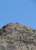
| no partners | | | I,ve only summited this mountain once. I started From my house in Kearny and walked all the way to the summit.Up top there is an anchor from people that have rock climbed the cliffs up there. I do expore the canyon often sometimes there is a small spring that flows near the cottonwood trees on the back side. There is a large number of rattle snakes there. Ive encountered tiger,western diamondbacks, and Mojave rattle snakes in the area. |
| _____________________
| | |
|
|
|
 Route Editor