|
| | | Hackberry Valley and Cholla Tank Wash, AZ | | | |
|
|
Hackberry Valley and Cholla Tank Wash, AZ
| | |
| |
|
| Canyoneering | 5.27 Miles |
472 AEG |
| | Canyoneering | 5.27 Miles | 4 Hrs 56 Mns | | 1.29 mph |
| 472 ft AEG | 50 Mns Break | | | |
|
|
| | Canyon Hiking - Non-technical; no rope; easy scrambling; occasional hand use | | A - Dry or little water; shallow or avoidable water; no wet/dry suit | | II - Normally requires a half day |
| |
| Linked |
|
none
[ show ]
| no linked trail guides |
| Partners |
|
[ show ]
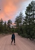
| partners | | I read about a “slot canyon” in the Superstition Wilderness Trails West book and thought, why not check it out? It was supposed to have a hole, chute and dry fall to navigate around, which sounded fun. We started out the day by parking our cars at the Boulder Recreation Area at Canyon Lake (don’t forget your parking pass), stopping off at the Canyon Lake Vista to see the sunrise, and shuttling our third car to the Horse Lot Parking Area before First Water TH.
We started the first third of our hike on the established Hackberry Springs trail, stopping to see Hackberry Spring. It’s a beautiful valley with nice views all around. After climbing the hill and having a snack, our off trail adventure began.
The book referenced an old cowboy trail that travelled cross country toward Cholla Tank Wash. Basically, it was off trail bushwhacking. If you like that sort of thing, you know what to expect: lots of catclaw and cactus to avoid, unstable ground and a bunch of going up and down in small washes that you can’t see on the topo. There were moments we could follow some Carins of an unknown path, but eventually that veered off north and we were back to the brush. Eventually we linked up with a sandy wash that lead into Cholla Tank Wash. We stopped for another snack break once we met up with Cholla Tank Wash and enjoyed the sights of a rock formation with a huge crack in it.
We went left at the wash, our third segment of the day’s adventure. Hiking through Cholla Tank Wash was slow going because it was full of small boulders. My pins for the obstacles are approximate and not long after Route Scout announced we were approaching my pins, we saw the “hole” you crawl through. Crawl is an overstatement because you can walk right through the alcove, with a small bit of maneuvering to avoid the pool of water at the base. From there, the wash boulders get larger and the canyon walls get higher. I’d say compared to Utah slot canyons, this is not a slot. It’s your typical canyon narrows you can find in AZ canyons. The “chute” was up next and a fun one to navigate. We tried to chimney down it like the book suggested, but unless you’re very tall, you’ll likely benefit from some teamwork to not fall down the drop. From there, you can follow the shelf on the right side to avoid the pool of water after the pour off. We found a fourth obstacle to work around further down canyon. I could tell that in dryer conditions that people simply hopped down the next small pour off with how the rocks were stacked below…only problem for us was that we wanted to avoid the pool of water below. We opted to climb along the rock face to the left of the pool.
After the obstacles, we were left with a standard canyon wander for the last ~1/2 mile to La Barge Canyon. We reached the large stone overlooking the lake and climbed up to the left. Up top, we had a nice view looking back at the canyon we just completed. From there, we scrambled down to the social trails that run along the lake that lead back to where we parked. It made for a really nice morning & enjoyable canyon.
Also, as an alternate route, you could also take second water trail to Cholla Tank Wash and continue down canyon from there, but where’s the fun in that? ;) |
| | |
|
|
|
 Route Editor