|
| | | Dyer Ranch trail Laughlin Ranch & Tamcan loop, CA | | | |
|
|
Dyer Ranch trail Laughlin Ranch & Tamcan loop, CA
| | |
| |
|
| Hiking | 6.14 Miles |
1,730 AEG |
| | Hiking | 6.14 Miles | 2 Hrs 18 Mns | | 2.77 mph |
| 1,730 ft AEG | 5 Mns Break | 15 LBS Pack | | |
|
|
| |
| Linked |
|
none
[ show ]
| no linked trail guides |
| Partners |
|
none
[ show ]
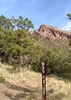
| no partners | | | There's only close by neighbor parking. I started at the Dyer Ranch trailhead and turned right onto the Laughlin Ranch Loop then a right onto the Tamcan Loop Trail, then left onto the Brushy Peak Loop Trail, then onto the Laughlin Ranch trail, then a final right onto the Dyer Ranch trail and finish. A good hike! |
|
Autumn Foliage Observation Isolated
It's pretty bleak but will improve when things get greener |
|
  |
Frick Lake |
51-75% full |
51-75% full |
| | | I could see the seasonal Fricks Lake from the Dyer Ranch trail. A quick stop for migrating Geese | | | |
|
|
|
 Route Editor