|
| | | |
| |
|
| Hiking | 8.75 Miles |
3,200 AEG |
| | Hiking | 8.75 Miles | 8 Hrs 30 Mns | | 1.03 mph |
| 3,200 ft AEG | | | | |
|
|
| |
| Linked |
|
none
[ show ]
| no linked trail guides |
| Partners |
|
none
[ show ]
| no partners | | This is the traditional 4-3-2-1 approach. We hit the trailhead at 6AM and headed out to the Amethyst mine. About two miles in there’s a post with trail descriptions. Continue right. Follow the trail until you’re almost at the base of Brown’s. There’s a campsite and a trail heading south that can be hard to miss. Make your way to the Amethyst mine, go around the ‘no trespassing’ fence and start heading up the chute, left of the building. The chute took us 30-40 minutes to get up. Try and stay right as this will save time once you start heading up to peak 4. Rather than going more so along the eastern side of 4, we headed up early off the chute up a safe route heading south. After we got to the top of the false peak, we simply made our way along the ridge east up to the peak. Either way, getting up to 4 is pretty self-explanatory. This is a great time to study the other peaks and potential routes.
Coming off 4, we advise staying as high as possible along the ridge line. Get to the base of 3 and find a solid route more so along the east side. The west side contains more sheer cliffs. Any route you take up the side of 3 will start to get more technical and into some borderline class 4 spots. Once you’re high enough on 3, the ridge line is simple to follow over to the summit. We made it up to 3 to find another ammo can and a flag. Study peak 2 really good, this is obviously the hardest one. We suggest not taking the distinct Pete’s Reverse Z ramp, as tempting as it may be. You will know the slab when you see it. We decided to try for a safer route.
Coming off 3 can be a bit of a challenge. The east side of it looked pretty sketchy to us so we tried our luck on the northwestern part. Try and come off 3 heading straight north but veer west a bit to avoid some other cliffs. At this point, we headed straight for the bottom of the Reverse Z, at the base of 2. We did not ascend up the Reverse Z, for good reason. We ascended and wrapped around 2 along the east side. Almost exactly halfway around the East side, we felt it was safe enough to ascend straight up to the summit. This part is class 3 & 4 scrambling up rocks with great holds. We went straight up and arrived exactly at the summit of 2 to find another ammo can. We made it up peak 2 in about 1 ½ hours.
Follow the rocky ridge off 2 until it ends with an abrupt cliff northernly. Keep in mind, the east side of this ridge will be about a 50-foot drop, but the ridge is safe to hike along. Make your way off that, descending down the west side and heading directly north. At this point, there will be a few spire formations and small peaks that we avoided going over. It’s best to stay along the base of them along the east side. Spiraling up the east side of peak 4, was almost a clear trail. Well, a clear trail for this kind of hike that is. Similar to our approach on 2, we wrapped about halfway around the east side of 1 and climbed straight up. Any farther east around 1 toward the northern side would’ve offered a sketchier climb. Descend off peak 1 directly west. There will be a distinct chute to descend down. After you get to the bottom, it’s about two miles till the parking lot. Round trip, we made it in about 8 hours and 30 min.
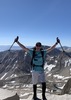
Overall, this hike/climb is a blast if you treat it that way. It can actually be fun route finding if you’re smart about it. Going with two people makes it a lot easier to scope out routes. It would be great if this route was groomed someday and became more popular! |
| | |
|
|
|
 Route Editor