 Route Editor

| Guide | ♦ | 77 Triplogs | 1 Topic |
details | drive | permit | forecast | 🔥 route |
stats |
photos | triplogs | topic | location |
| 482 | 77 | 1 |
Against the Twisted Grain by joebartels  Long Canyon is one of the many alluring escapes within the Red Rock - Secret Mountain Wilderness. It's situated to the east and northeast of the extremely popular Boynton Canyon. Which brought to mind the obvious question. How does Long Canyon compare with Boynton? I'll give my thoughts in a moment. Long Canyon is one of the many alluring escapes within the Red Rock - Secret Mountain Wilderness. It's situated to the east and northeast of the extremely popular Boynton Canyon. Which brought to mind the obvious question. How does Long Canyon compare with Boynton? I'll give my thoughts in a moment.Bug spray proved to be invaluable on this outing. I always carry a little bottle in my pack. I haven't pinpointed the exact conditions. April and May seem to be the bug months in my experiences. In this case, four applications kept me alive.
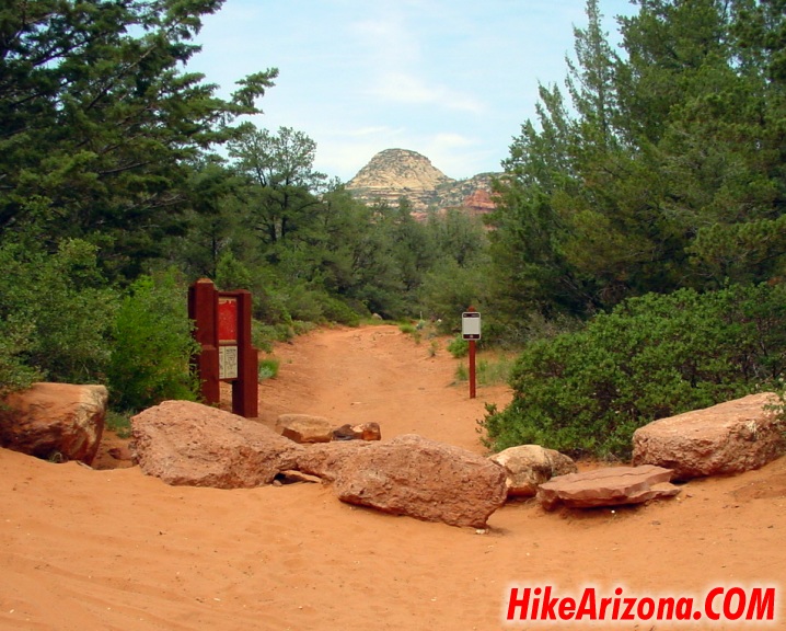
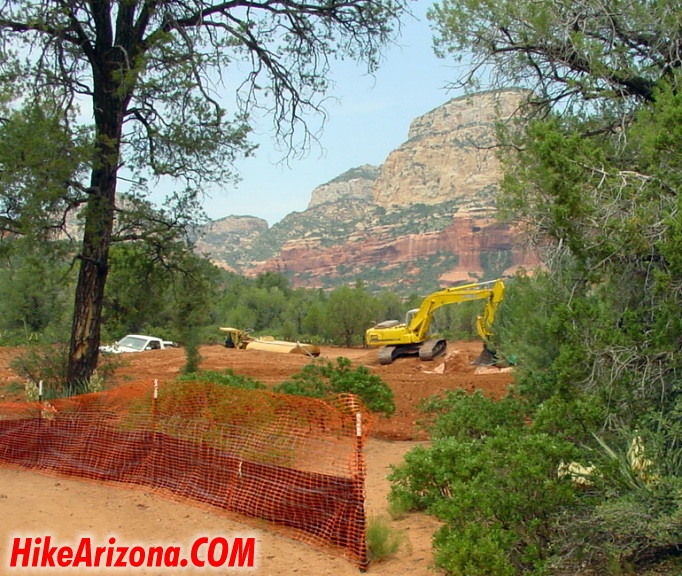
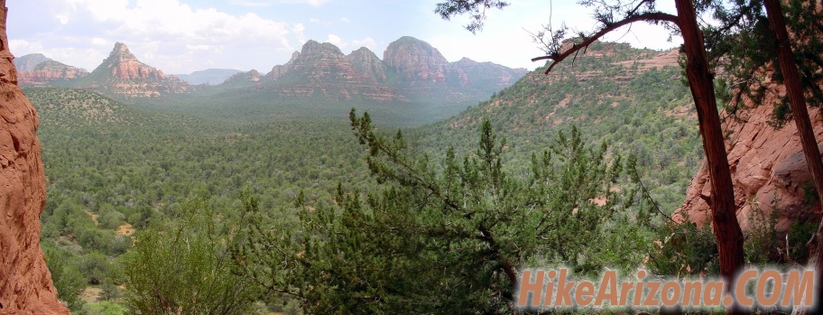
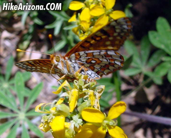
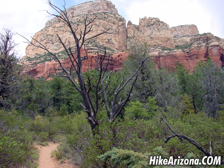
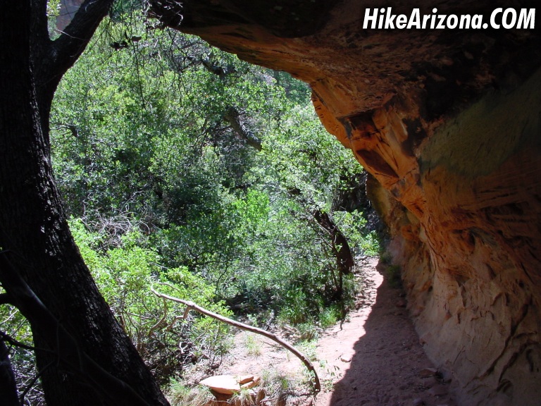
I read in several books the beginning of this trail was on the drab side. Folks, the top of South Mountain in Phoenix is drab. It's pretty tough to find a drab area anywhere close to Sedona in my opinion. Okay, so the trail is wide. Yeah, it's an old jeep road, go figure. The real controversy is the city closing in on the wilderness. This is true. A golf course is being constructed alongside the first mile. The trail doesn't cross into the wilderness until a mile into the hike. I'm wondering how they plan to keep those little white balls from pounding us hikers in the head. Cause I know of one hiker that'll be pounding ye golfer with el' fisto in such case. I'm just kidding, but I do wonder how they intend to keep it safe. Big tall fences or walls do seem out of character with the area. At any rate... Okay, it's not the best first mile but it isn't the worst either. Mescal Mountain first comes into play on your left. Trails are tempting you over to a quick Red Rock fix. I was lured into such. I'm happy to report nothing is exciting over there! One good photo opportunity was about it. There are several tiny alcoves along the east side of Mescal Mountain. I didn't see any evidence of ruins in the two I checked out. Disregard any print before 2001 about which fork of the trail to take. There's only one confusing junction. The far-left goes to Mescal Mountain as described above. On the far right is your ticket. Here's an easy way to remember. There are two thick diameter fence posts with a slanting brace. The slanting brace log points "right" DOWN to the correct trail. A little further in you come to the trail log. Which contained strong superlatives. Most in disapproval of the neighboring golf course. A mile into the trail, you come to the wilderness boundary. If you're mountain biking it's time to turn around or hide the bike. Butterflies played tag from this point on. I guess they were well aware of the wilderness boundary. Don't get too excited. These are Sedona camouflaged butterflies and fairly tiny. Quick little buggers too. Tough to photograph. At this point, I'm thinking this is a decent Sedona hike. But nothing is wowing me as of yet. However, a front section of Maroon Mountain is flaunting it's pearly white cap in the near distance. As you proceed further into Long Canyon the forest begins to take over. Nice red rocks are fairly close. Although not many good viewing opportunities are presented along the trail. One such spot early on is your best bet. I didn't pay much attention thinking it'd only get better. So far the going has been pretty straightforward. Gaining 270 unnoticeable feet of elevation gain thus far. The trail is protected from the sun. I imagine a fair share of folks turning around here after two miles. There doesn't seem to be much hope of the canyon opening up like Boynton does at the end. Nevertheless, I continued. At this point, I had passed enough groups to account for the seven cars at the trailhead. Then came the beautiful fields of poison ivy. Hey, they are pleasing to look at in healthy large quantities. If it has three leaves don't touch it or brush up against it. This isn't gonna save you from poison sumac with seven-plus leaves but it's a good start. Man, I'm itching just writing about it. There was poison ivy in small patches alongside the trail. To date, I've only seen worse cases in Devils Canyon near Superior. For the record, this is no match. It's canyon wall to wall and four feet high in Devils Canyon. I'm proud to report Long Canyon didn't rub me the wrong way. Alligator junipers are always interesting. One, in particular, appears to be ripped open by a bolt of lightning near the base. Some are getting pretty large too. Not to mention one huge pine tree. You'll undoubtedly spot the huge pine as the trail passes to the left. Light lavender wildflowers blanket sections of the trail. By this time you've completely forgotten about any golf course. Though the ending of this trail was perplexing my mind. When I was assuming the trail should be ending soon it just intensified. Dropping into ravines followed by thick forest strolls. Then whammy. A wall, an overhang more precisely turned out to be the end of this journey. There's only one little tiny view of a nice wall through the foliage. Surely this wasn't gonna cure my appetite. Either side of this wall was a full-fledged scramble up to who knows what. I opted for the right side. The left proved easier coming down for the record. It's a short and well-earned scramble to a center pivot point. You won't have any problems finding it. It's pretty much straight up beyond the overhang. Taking only five minutes to conquer. This is the spot to catch a whopping 360-degree view. It's pretty incredible. Now to answer the question. How does it compare with Boynton? It doesn't. It's very different. Boynton is very Sedona with its soft curves and extended views. This is Sedona twisted in with Canyon de Chelly among everything else. I was sweating up a storm, limping from a foot wound and these views eased the pain. Oh my, I wanted to continue. I forged on through terrible bushwhacking conditions. We're talkin' prickly pair and that kind of stuff. A trail does fade in and out. If only I'd started earlier! I'm sorry... I can't say after this one trip if it's possible to make it up to trail #109 which runs atop Secret Mountain. It would be a push and a grunt if possible. Notice the smooth tan walls. Perfect for painting. Not YOU, I'm talking Indians 700-1500 years ago. The forest service says "small Indian ruins and some primitive rock pictographs" can be found... Enjoy the bone! Note: Trail data including mileage is to the pivot rock with the 360-degree views. Camping is not permitted in Long Canyon. Near the 0.6 mile mark by the trail log, Deadmans Trail takes off to the west. This connects with Boynton Canyon in a half-mile or so.
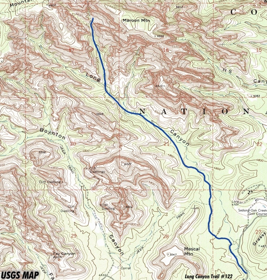
Coconino FS Details Wide and nearly level, Long Canyon Trail provides easy access into Sedona's scenic red rock backcountry. For the first mile or so, the route follows an old jeep trail up an ephemeral streambed. Though this drainage is usually dry, it still supports a community of riparian or water-loving vegetation. Along the trail you'll even find a number of cypress trees, Arizona cypress, which are easily recognizable by their shaggy bark and round, gum ball-size seeds. Providing a scenic setting for this unique habitat are a sampling of the picturesque buttes and cliffs for which the Sedona area is so famous. Steamboat Rock, Wilson Mountain, Maroon Mountain, and a number of unnamed cliffs, spires, windows and arches are visible from this trail. The trail ends at a red sandstone cliff where there are a few small Indian ruins and some primitive rock pictographs. Please don't disturb them. Check out the Official Route and Triplogs. Leave No Trace and +Add a Triplog after your hike to support this local community. | |||||||||||||||||||||||||||||||||||||||||||||||||||||||||||||||||||||||||||||||||||||||||||||||||||||||||||||||||||||||||||||||||||||||||||||||||||||||||||||||||||||||||||||||||||||||||||||||||||||||||||||||


