username
X
password
register
for free!
help


Cactus BM 2676, AZ

Guide 1 Triplog  0 Topics
  2 of 5  
Fav
Wish
0
details
drive
permit
forecast
route  
stats
photos
triplog
topics
location
3 1 0
Statistics
tap row or icons for details
Difficulty 1.5 of 5
Route Finding 1 of 5
Distance Loop 3.52 miles
Trailhead Elevation 1,756 feet
Elevation Gain 911 feet
Accumulated Gain 1,124 feet
Avg Time Round Trip 2 hours
Kokopelli Seeds 9.14
 Interest Off-Trail Hiking & Peak
 Backpack No
unreported if dogs are allowed
editedit > ops > dogs to adjust
feature photo
Photos Viewed All MineFollowing
3  2025-05-17 pseudalpine
Author
author avatar Guides 59
Routes 1,100
Photos 1,191
Trips 1,290 map ( 9,859 miles )
Age Male Gender
Location Arizona
Historical Weather
Trailhead Forecast
Radar Map
Expand Map
Preferred Nov, Dec, Jan, Feb → 6 AM
Seasons   Autumn to Spring
Sun  6:04am - 6:47pm
Official Route
 
0 Alternative


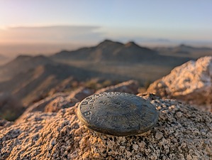
Igneous Inselberg
by pseudalpine

 
Overview
The second highest summit to Sacaton Peak of the arc-shaped granitic Sacaton Mountains located along the Gila River Indian Community's southern boundary.


Hike
After gapping a fence, bear north across the mellow cactus flats, eventually following a wash until its end. At this ½-mile point, the route begins a steep direct ascent of the southern side of the peak. It's one mile total to the benchmark from the SR 387 pull-off.
remove free decal offer
The official route continues by descending the north side of the mountaintop, curving along a scenic ridge before dropping into a wash similar to Box Canyon of SoMo. Once back at the desert base level, the route bears south to eventually merge with an obscure road that returns to the parking.

Synopsis
Notably, a litter-free and mostly undisturbed landscape when compared to many other areas in Arizona that have immense side-by-side pressures and the accompanying beer cans, trigger trash, broken vehicle parts, etc. For the boulderers, a few quality, finer-grained plutons are dispersed here and there in this range.

2025-05-17 pseudalpine


    Check out the Official Route and Triplog.
    Leave No Trace and +Add a Triplog after your hike to support this local community.
    WARNING! Hiking and outdoor related sports can be dangerous. Be responsible and prepare for the trip. Study the area you are entering and plan accordingly. Dress for the current and unexpected weather changes. Take plenty of water. Never go alone. Make an itinerary with your plan(s), route(s), destination(s) and expected return time. Give your itinerary to trusted family and/or friends.

     Permit $$
    Permission from Gila River Indian Reservation is required.
    There is no known way to get said permission at this time.
    Without permission they may impound your vehicle and throw you in jail.


     Directions
    or
     Road
    Paved - Car Okay

    To hike
    Slightly less than halfway across SR 387 going east from I-10 to SR 87.
    page created by pseudalpine on May 17 2025 4:18 pm
     90+° 8am - 6pm kills
    helpcorrectionissue

    end of page marker