 Route Editor

| Guide | ♦ | 39 Triplogs | 0 Topics |
details | drive | permit | forecast | 🔥 route |
stats |
photos | triplogs | topics | location |
| 354 | 39 | 0 |
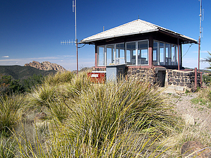
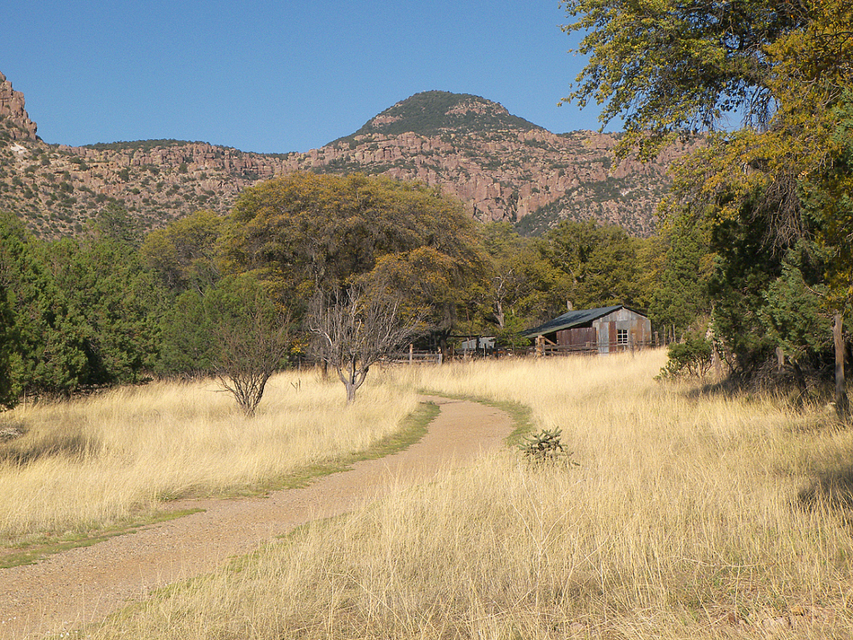
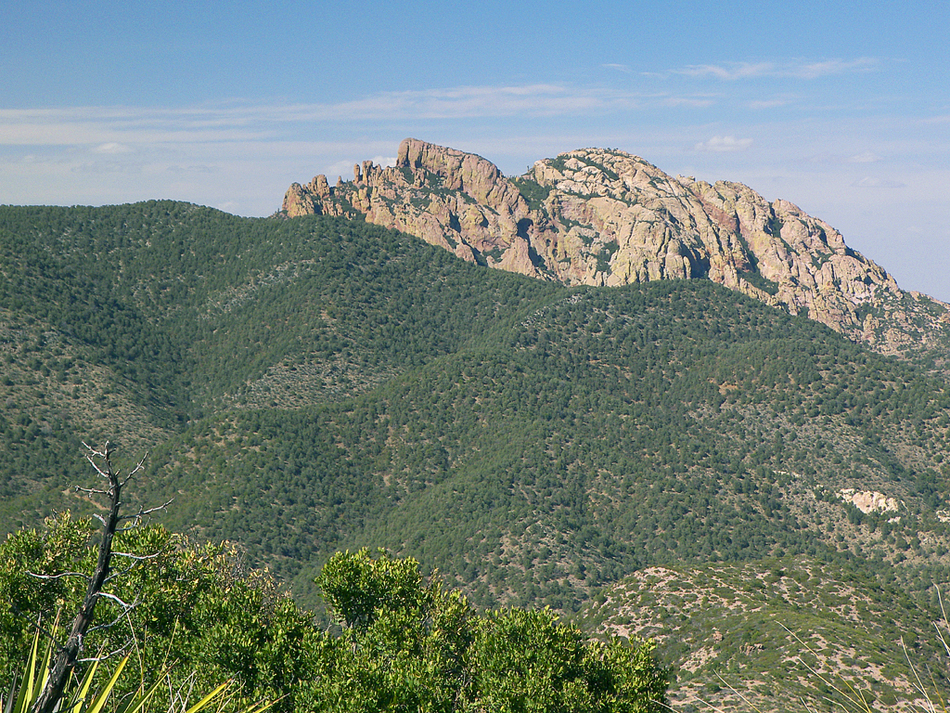
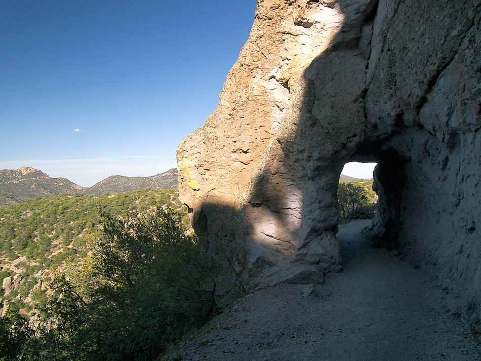
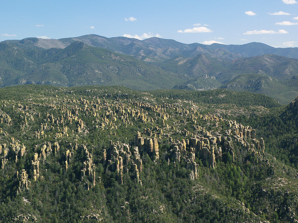
Monumental views by PrestonSands   Sitting atop the heart of Chiricahua National Monument is 7310 foot Sugarloaf Mountain. This prominent peak, which stands in a sea of volcanic hoodoos, can be seen for miles. While not as exciting or as popular as the loop trails in the Heart Of Rocks area, this short hike provides sweeping views of the Monument and surrounding areas. The trails and the Monument itself are open 24 hours a day; backpacking, however, is not allowed. Sitting atop the heart of Chiricahua National Monument is 7310 foot Sugarloaf Mountain. This prominent peak, which stands in a sea of volcanic hoodoos, can be seen for miles. While not as exciting or as popular as the loop trails in the Heart Of Rocks area, this short hike provides sweeping views of the Monument and surrounding areas. The trails and the Monument itself are open 24 hours a day; backpacking, however, is not allowed.From the Sugarloaf Mountain picnic/parking area, the Sugarloaf Mountain Trail heads across a short ridge and begins climbing the northern side of Sugarloaf Mountain. Dos Cabezas and rugged Cochise Head are visible along this stretch of trail, as well as the deep, forested gorge of Bonita Canyon. At 0.2 miles, the Sugarloaf Mountain Trail passes through a short tunnel that was blasted through the cemented volcanic ash of an ancient hoodoo. Beyond the tunnel, the trail traverses a steep slope covered in angular boulders, broken off from the low cliffs above the trail. Soon the trail rounds the mountain to the drier, southern slope. The Heart Of Rocks area comes into view now, amid the manzanitas, yuccas, and plentiful beargrass. On the southern horizon, the rolling, green, 9000-foot summits of the Chiricahua peaks form a backdrop against the Monument's countless rock totem poles. The mosaic pattern from 1994's Rattlesnake Fire is clearly visible among the peaks. The trail now makes a switchback here, and plows through a row of manzanita bushes, before arriving on the northeast corner of the windswept summit. The historic one-room fire lookout, constructed by the Civilian Conservation Corps in the 1930s, greets you here. Roam around the mountain top, and take in the 360-degree views. A series of interpretive signs can be found on the southwest side of the summit, overlooking the infinite desert grassland below.
Check out the Official Route and Triplogs. Leave No Trace and +Add a Triplog after your hike to support this local community. | ||||||||||||||||||||||||||||||||||||||||||||||||||||||||||||||||||||||||||||||||||||||||||||||||||||||||||||||||||||||||||||||||||||||||||||||||||||||||||||||||||||||||||||||||||||||||||||||||||||||||


