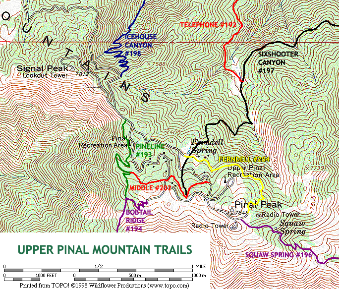
The Middle Trail #202 is one of several short trails on the top of Pinal Peak. The Pipeline Trail #193, Middle Trail #202, and Ferndell Trail #204 serve as connectors between the three major trails that climb Pinal Peak itself. With elevations in the mid-7000s and a beautiful forest mix of pine, fir, and aspen, these trails, although short, offer a cool retreat in summer, and vivid color in the fall.
Use Middle Trail in conjunction with the Pipeline Trail, Ferndell Trail, and the various branches of forest road 651 to create a short, mountain top loop hike on Pinal Peak. Middle to late October would probably be an excellent time to see the aspens change color on this quick and easy hike.
From the trailhead on forest road 651C, the Middle Trail heads west into a dense fir forest on the northern slope of Pinal Peak. Encountered soon are a few exceptionally large aspens, as the trail leaves the road behind. Before long, the Middle Trail enters a pleasant grove of aspen, as it winds around the top of a little draw. Around 0.2 miles, the Middle Trail arrives at the upper end of the Sixshooter Canyon Trail #197, in the heart of the aspen grove. Past the Sixshooter junction, the Middle Trail turns northwest and begins a gentle ascent through the beautiful pine-fir forest. A knee-high, leafy, green groundcover carpets the forest floor along here, adding to the beauty of the area. At 0.35 miles, the Middle Trail arrives at the main branch of forest road 651. Cross the road here, and follow the trail west, as it heads up a short hill. The trail soon reaches a little saddle, then begins descending to the west, around a shallow drainage. The many cut logs along the path here are the result of a forest service tree thinning project. As the Middle Trail continues its gentle descent through the forest, occasional gaps in the trees yield glimpses of Signal Peak to the northwest. At 0.6 miles, the Middle Trail comes to an end, where it meets the Pipeline Trail #193 at a signed junction.
Return the way you came, or continue along on the more primitive Pipeline Trail.
When hiking several trails on a single "hike", log it with a generic name that describes the hike. Then link the trails traveled, check out the example.
WARNING! Hiking and outdoor related sports can be dangerous. Be responsible and prepare for the trip. Study the area you are entering and plan accordingly. Dress for the current and unexpected weather changes. Take plenty of water. Never go alone. Make an itinerary with your plan(s), route(s), destination(s) and expected return time. Give your itinerary to trusted family and/or friends.
At the junction of highways 60 & 188 in Claypool, turn right (south) onto Russell Road
Odometer 0.0
- South on Russell Road for 0.35 miles
- DO NOT continue on Golden Hill, Russell turns right
- Continue to 0.65 miles
- DO NOT continue on Rose Mofford Way, Russell turns left
- At 6.3 miles you reach FR 651
Odometer 0.0
- Turn right (south) on FR 651 ( dirt road )
- Continue to 10.25 mi with FR 651C junction
Odometer 0.0
- Left on FR 651C 0.6 miles
There will be a small parking spot on your right. There is a wooden sign for the Middle Trail just behind the vehicle barricade.
 Route Editor

 The Middle Trail #202 is one of several short trails on the top of Pinal Peak. The Pipeline Trail #193, Middle Trail #202, and Ferndell Trail #204 serve as connectors between the three major trails that climb Pinal Peak itself. With elevations in the mid-7000s and a beautiful forest mix of pine, fir, and aspen, these trails, although short, offer a cool retreat in summer, and vivid color in the fall.
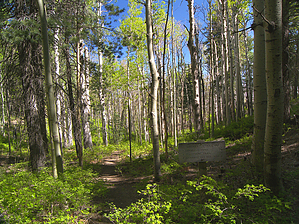


