 Route Editor

| Guide | ♦ | 29 Triplogs | 3 Topics |
details | drive | no permit | forecast | 🔥 route |
stats |
photos | triplogs | topics | location |
| 16 | 29 | 3 |
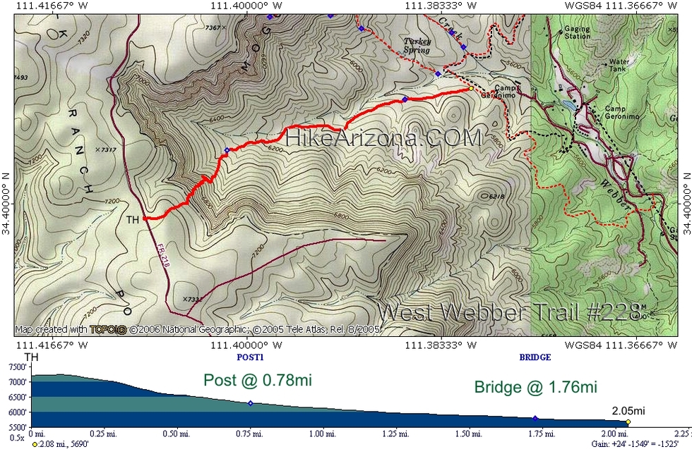
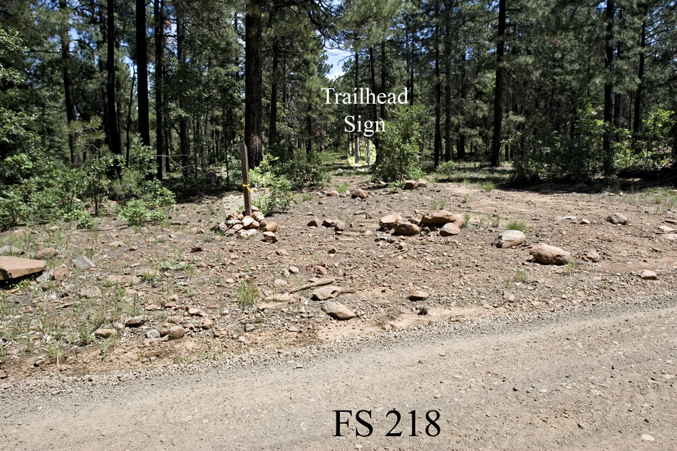
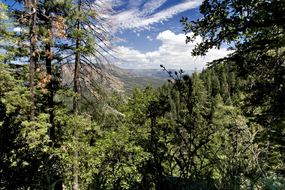
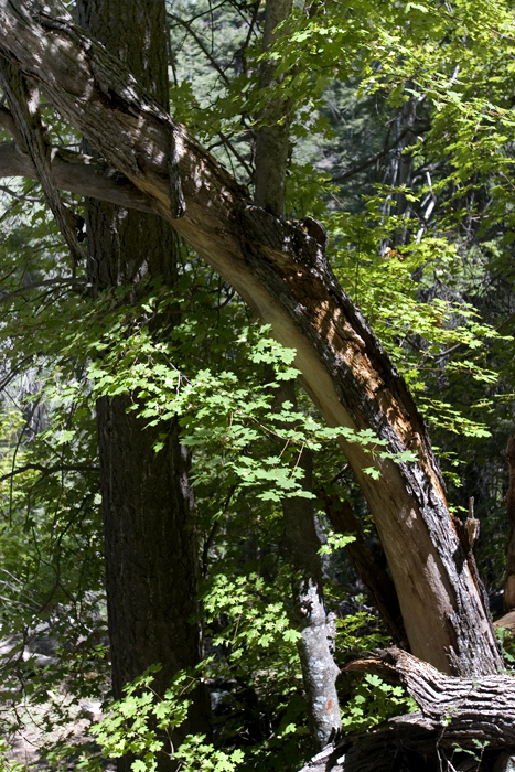
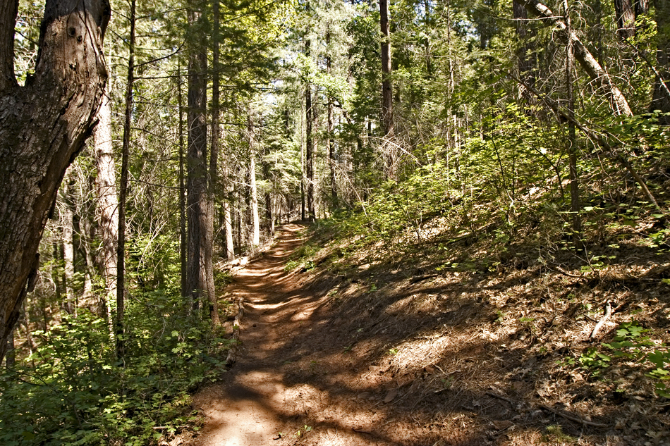
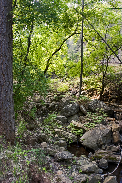
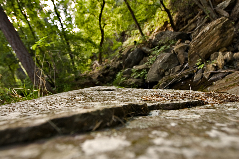
Kari Momiji by joebartels  Aside from Autumn, timing and direction of travel will factor into your experience. West Webber isn't a creekside hike, it's a gift from the maple gods. Aside from Autumn, timing and direction of travel will factor into your experience. West Webber isn't a creekside hike, it's a gift from the maple gods.The trailhead seems somewhat obscured but didn't prove to be difficult to locate. You immediately head into the forest to conquer the slightest hill rise before reaching the rim at 0.28-mi. This is a very light-use trail that might be difficult to follow at night. Unlike the Mogollon Rim most experience at US-260, the views here are blocked by solid tree cover.
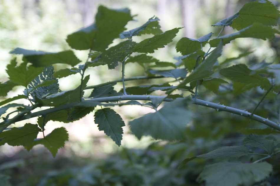
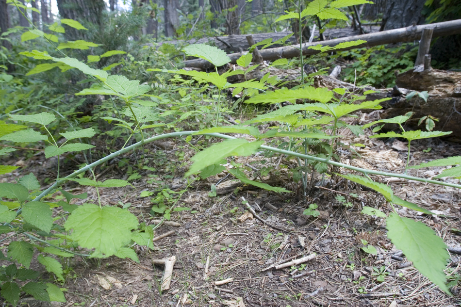
There's a thorned vine ground cover of sorts, I spent several hours (unsuccessfully) trying to identify. The leaves look like wild raspberry, but it's a smooth distinct thorny vine as opposed to hairy-prickly. Its stems are more of a fluorescent green then dark green, which makes me believe it grows fast. I'm leaning towards rose of some sort for now. At any rate, this stuff is thick in places. It grows down in the lower elevations near the creek, but the mind-boggling part is it grows in the upper reaches too. There must be a lot of underground moisture. One thing for sure, it hurts like a mother in sandals if you trip through it! (update, I believe it's baneberry) After the switchbacks ease up, you come to a post at 0.78-mi. As of this writing, there was no sign, just a post. Left is the continuation for West Webber #228 directly to Turkey Spring, 1.1-mi. As of this writing, that portion of the trail is rough to follow with downed trees and debris. Keep right on the better-maintained path and continue. Further down you will find some very large Gambel Oaks and Bigtooth Maples. With so much of Arizona subjected to wildfires over the past decade (including very nearby), I'm grateful to witness some old growth. The trail only comes to the edge of a seasonal creek once in its journey. There was a trickle flow in this relatively "active" monsoon season, which probably means it's normally dry. I did see a flex pipe that appeared to have been tapped into a spring long ago. It appears to be an abandoned working for whatever cause. The trail rarely levels out keeping a fairly constant incline from top to bottom. At 1.76mi comes a makeshift bridge. It spans maybe eight feet over a ravine that's cutting through rock-free earth quickly. If it decays or washes away, you'll have to negotiate the ravine. For a short section, the shade gives. I was reminded, August is a furnace in Arizona. Thankfully it was short-lived. Just before the trail connects with Geronimo Trail #240, it widens up into an old, extremely rutted jeep road. The only sign as of this writing was a long narrow sign reading "Milk <- Ranch <- Point <- West." Most would likely do this as a loop with Turkey Springs Trail or a longer loop on the flip side of the mesa. Coming down, I was in la-la land but wanted to experience the flip side perspective going up. I was somewhat lucky with afternoon shade and a passing cloud now and then, coupled in with a breeze or two. Heading up, I felt the hike is less exciting without a flowing creek. If I had only hiked this trail in a loop going up, I wouldn't think much of it. Starting at the top, I'm pretty much hooked and will be back. The creek although non perennial pack a wallop of flora and deserves attention. I explored some of the easier lower sections saving the upper explosion for Autumn!
Check out the Official Route and Triplogs. Leave No Trace and +Add a Triplog after your hike to support this local community. | ||||||||||||||||||||||||||||||||||||||||||||||||||||||||||||||||||||||||||||||||||||||||||||||||||||||||||||||||||||||||||||||||||||||||||||||||||||||||||||||||||||||||||||||||||||||||||||||||||||||||||||||||


