 Route Editor

| Guide | ♦ | 32 Triplogs | 2 Topics |
details | drive | no permit | forecast | 🔥 route |
stats |
photos | triplogs | topics | location |
| 228 | 32 | 2 |
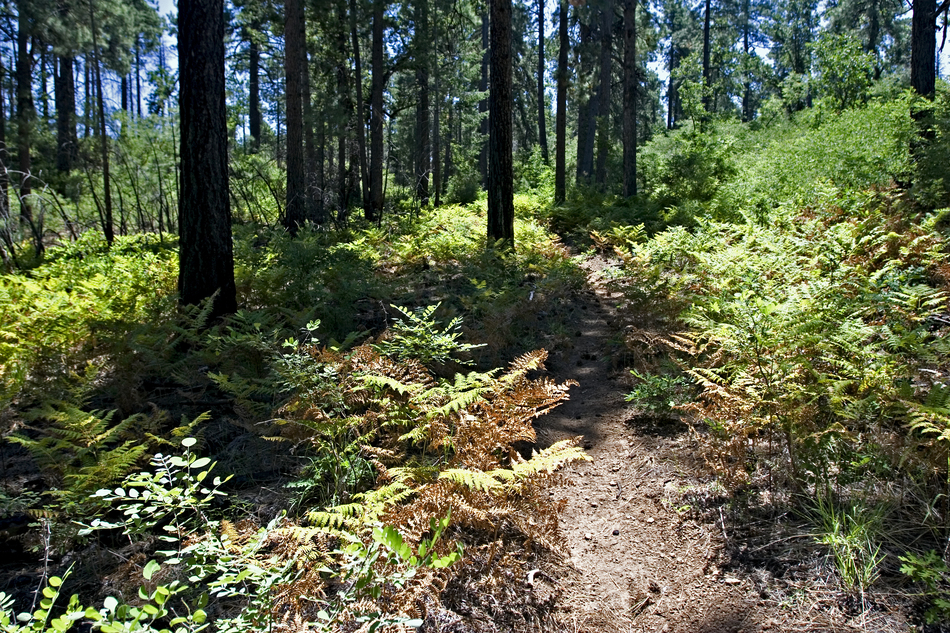
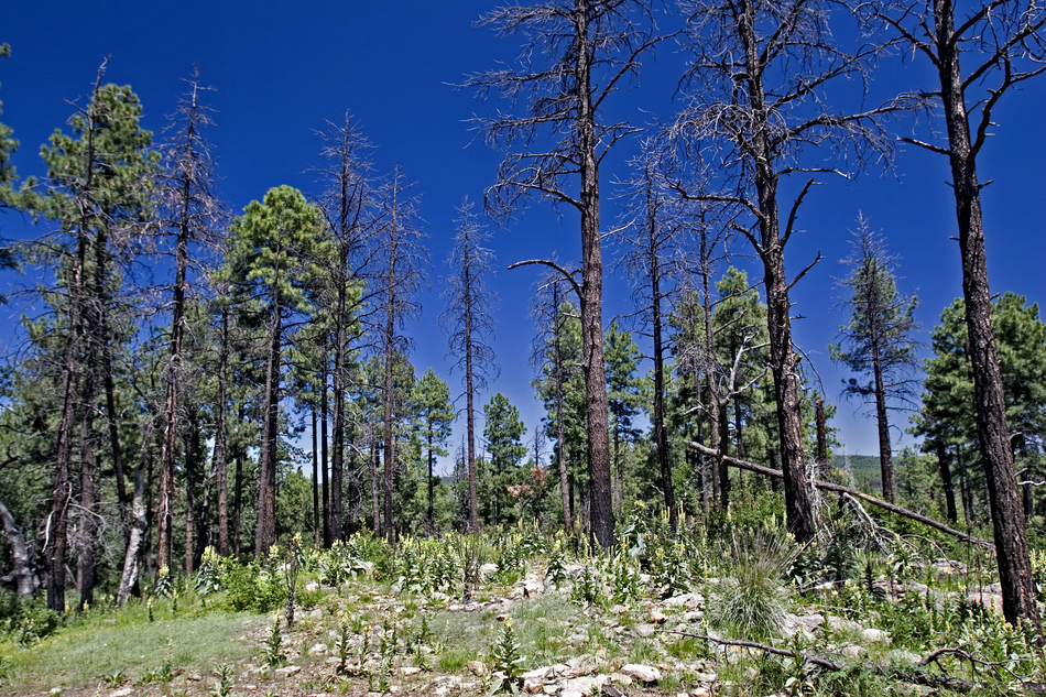
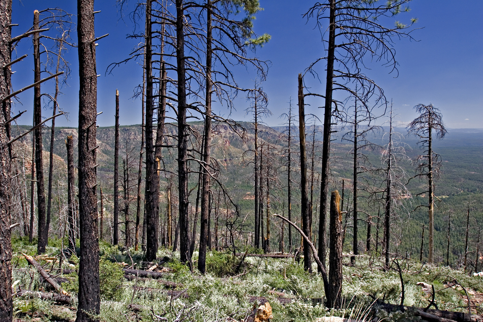
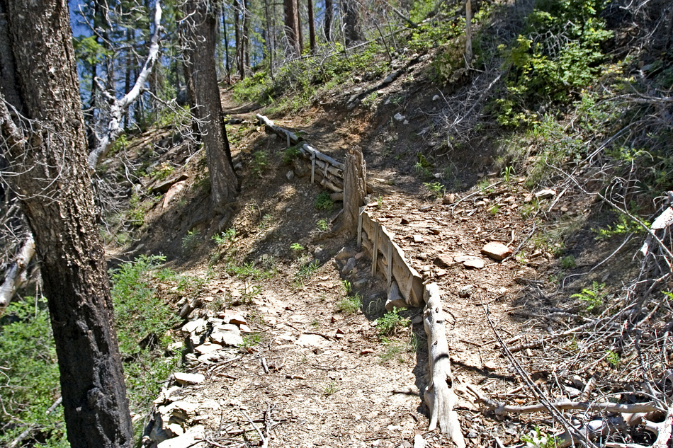
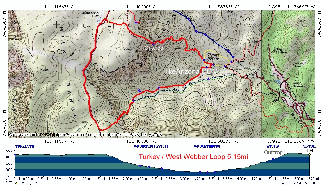
Tryptophan Summer Dayz by joebartels  Overview Overview1.95mi hike from Milk Ranch Point peninsula/mesa down 1513ft to Geronimo Trail #240. Distant rim views dominate the upper stretch. Low Down Due to lack of shade in the upper reaches stay out of the mid-day summer sun. As of this writing, the trail is a debris mess and difficult to follow.
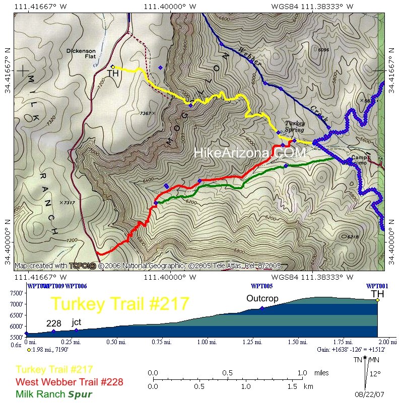
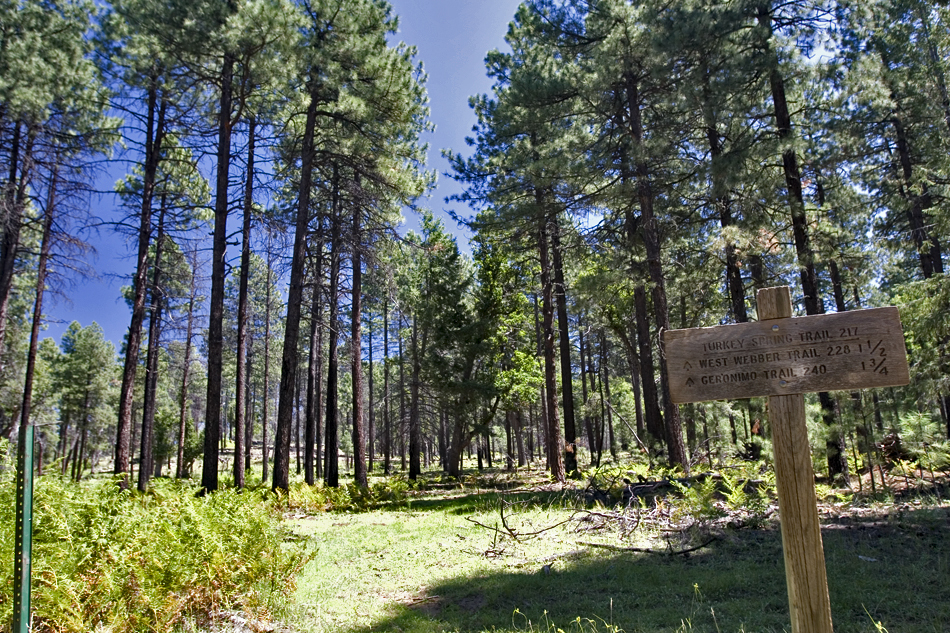
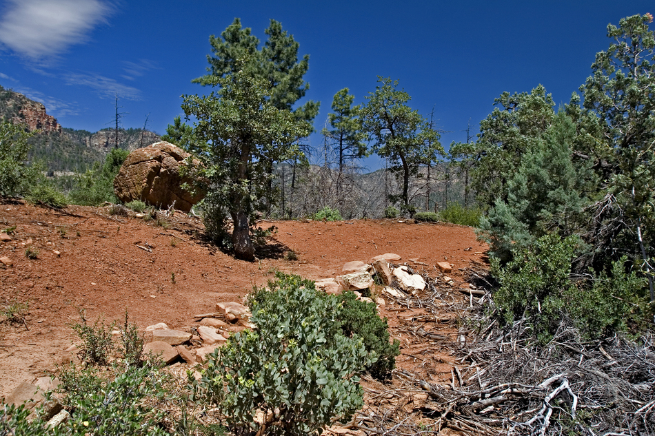
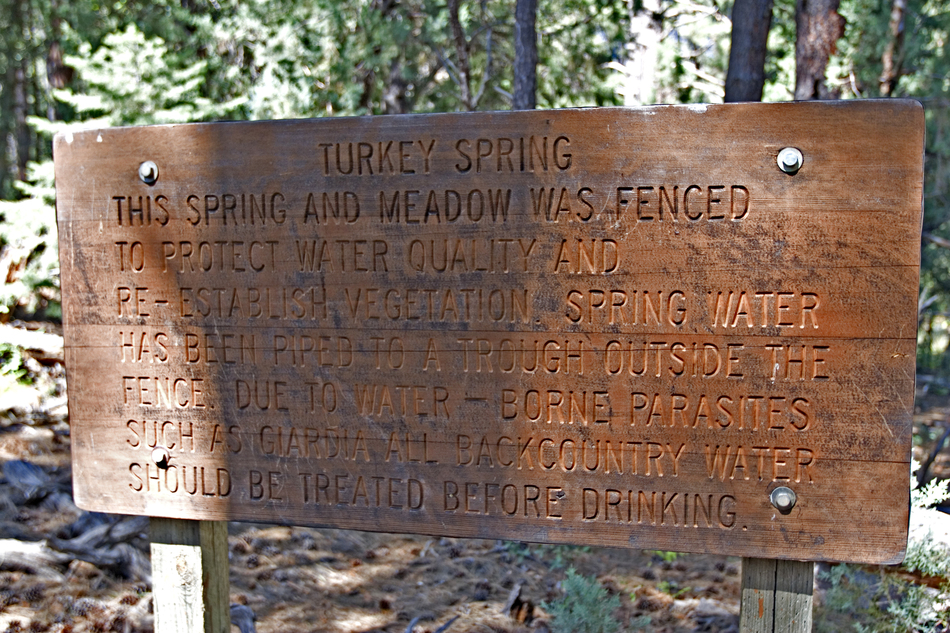
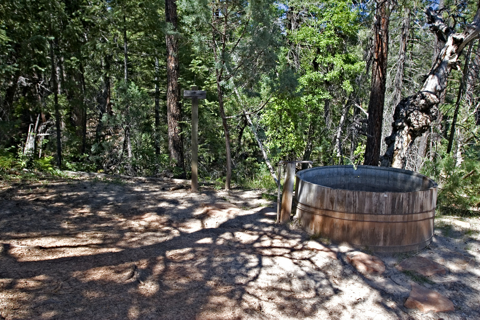
It's a trail again. Switchbacks are in place so there are no route-finding issues or loose soil issues as noted in 2007. Hike The trailhead is a quarter mile away from current FS maps. Judging by the weathered look of the sign it's been a few years too. The hike to edge of the rim albeit rarely used is pleasant. You walk through tall pines into a lush fern section. Just after that you enter a field of common mullein which generally grows in disturbed areas such as graded roadsides. In this case it's the even more common occurrence, the healing process of a mountainside wildfire. 0.4mi the trail starts to disappear and cairns come into play. You can't help but notice the views opening up in front of you. Heading down isn't too steep. Unfortunately, the trail has been seriously affected by the wildfire and starts to make you think around 0.6mi. Here you are heading down a slope to a nice outcrop. The FS mentions a balanced rock as a feature of the hike. I didn't see it concentrating on trail-location but this must be the area. Bushwhacking, log jumping and cairn spotting continue until you reach ~1.25mi. It isn't horrible but it does become a nuisance at times. When the trail gets back into longer switchbacks you're home free. Nice views continue through some Sedona esque landscape. Soon the trail turns into an old jeep road. At 1.7mi you come to an intersection. Keep right and you'll soon come to a left that takes you down a fence line. The fence is protecting the Turkey Spring Meadow. Further down the fence line is the junction with West Webber Trail #228. This is also the location of a round wooden trough. Continue another 0.13mi to Geronimo Trail #240. The trail officially ends at the Geronimo Trail #240, 1.9mi from the Geronimo Trailhead. This trail is often hiked as a 5.15 mile loop with West Webber Trail #228: GPS Route / Map (might also consider) Longer loop with Donahue & Highline: ???
Check out the Official Route and Triplogs. Leave No Trace and +Add a Triplog after your hike to support this local community. One-Way Notice This hike is listed as One-Way. When hiking several trails on a single "hike", log it with a generic name that describes the hike. Then link the trails traveled, check out the example. | ||||||||||||||||||||||||||||||||||||||||||||||||||||||||||||||||||||||||||||||||||||||||||||||||||||||||||||||||||||||||||||||||||||||||||||||||||||||||||||||||||||||||||||||||||||||||||||||||||||||||||||||


