 Route Editor

| Guide | ♦ | 24 Triplogs | 0 Topics |
details | drive | permit | forecast | 🔥 route |
stats |
photos | triplogs | topics | location |
| 135 | 24 | 0 |
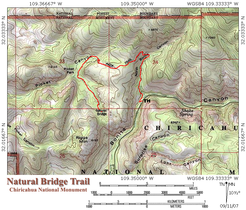
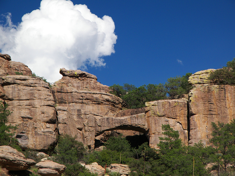
Chiricahua rock concert by PrestonSands   The highlights of this lightly traveled trail at Chiricahua National Monument are a natural bridge, a pine-filled valley hidden between fascinating rock formations, and a wilderness experience a world away from the crowds at Massai Point. The highlights of this lightly traveled trail at Chiricahua National Monument are a natural bridge, a pine-filled valley hidden between fascinating rock formations, and a wilderness experience a world away from the crowds at Massai Point.You might want to avoid this hike if heavy rain or monsoon action is imminent, as there is the possibility of getting stranded on the wrong side of Bonita Creek if it flash floods. The trail gets a little faint near the south end of Picket Park, but route finding isn't an issue. The Hike:
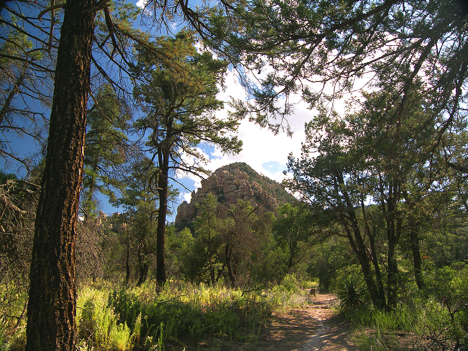
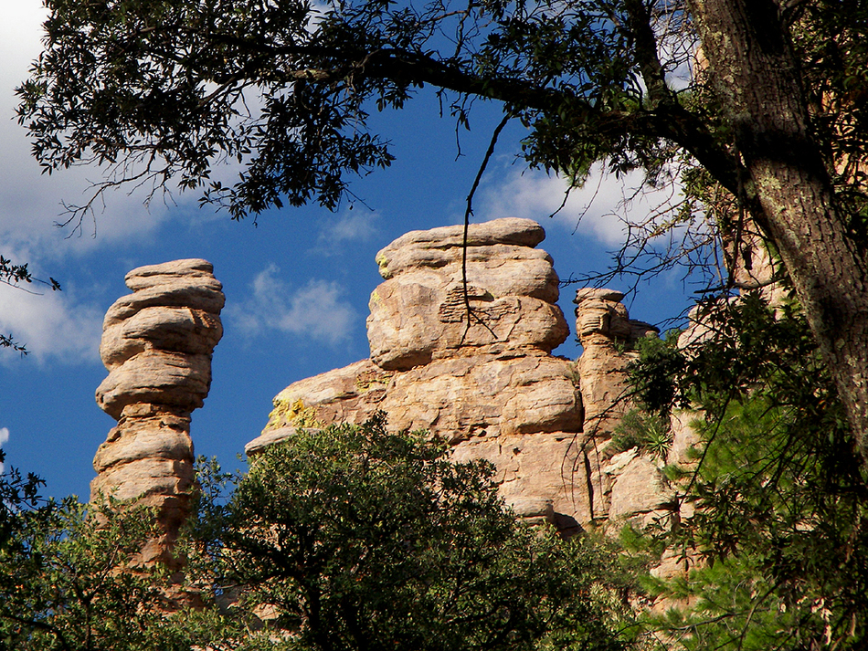
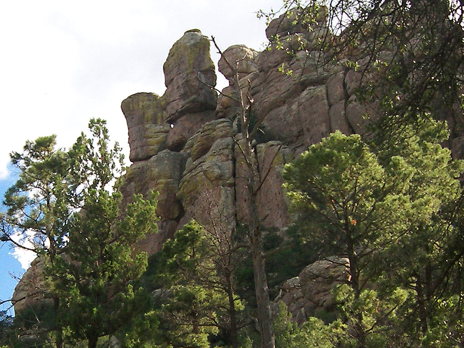
Once across the creek, the trail begins a steady climb up the oak and cypress-filled bottom of North Bonita Canyon. Around 0.6 miles, the trail begins climbing a rocky slope out of the canyon. Now free from the tree cover, you'll get your first good views of hoodoo-filled Bonita Canyon. After a short climb, the trail reaches its high point on top of an oak and manzanita-covered mesa, where the trail levels out for a time. The high point of the Monument, Sugarloaf Mountain, rises behind you, while the Sulphur Springs Valley comes into view to the west. The trail gently descends to the west across the mesa before encountering a short series of switchbacks that take it into the upper end of Picket Canyon. Now in Picket Canyon, under a canopy of silver oaks, the trail begins to curve to the south and enters the hidden valley of Picket Park. This Chiricahua jewel is indeed park-like, with its open stands of apache pines and carpets of summer wildflowers. The tiny cones of chihuahua pines litter the ground, and the whole area emits a rich pine fragrance. Bizarre totem pole spires and abstract stone faces reminiscent of Easter Island tower high above the park, as you make your way south through this hiker's paradise. As the trail heads south out of the park, it emerges from the pine forest and begins climbing up a sandy wash. The entire canyon soon comes into view, revealing an endless array of oddly shaped pinnacles that stretch into the distance. The Natural Bridge Trail soon comes to an end on a rocky shelf on the canyon's west side. Native bedrock provides seating at this tiny overlook. A sign points to the canyon's sheer eastern wall, where a stout, arching, natural bridge of volcanic rock is nestled high above among the lichen-covered cliffs. Unfortunately, the trail doesn't go up to it, but one needs only a telephoto lens to get close. Claim a slab of rock for yourself, kick back, and rock out with nature!
Check out the Official Route and Triplogs. Leave No Trace and +Add a Triplog after your hike to support this local community. | |||||||||||||||||||||||||||||||||||||||||||||||||||||||||||||||||||||||||||||||||||||||||||||||||||||||||||||||||||||||||||||||||||||||||||||||||||||||||||||||||||||||||||||||||||||||||||||||||||||||


