 Route Editor

| Guide | ♦ | 10 Triplogs | 3 Topics |
details | drive | no permit | forecast | 🔥 route |
stats |
photos | triplogs | topics | location |
| 121 | 10 | 3 |
Canyons are inherently risky. Flash floods occur without notice on sunny days. Technical skills & surrounding topography knowledge required yet does not eliminate risk.
Pleasure and Pain by nonot  Note NotePage data is specific to the upper canyon only. To get there, hike on the trail approximately 4 miles on Peter's Trail #105 from Tortilla Ranch. Just until you are about to leave Peters Creek and climb up Peters Mesa, this is your starting point for a counterclockwise loop. Foreword Looking at your trail map of the Superstitions, you may have noticed that Peter's Canyon extends far past Peter's Cave and the waterfall mentioned in those trip logs. There are two old trails on some maps, both named "Peters Canyon Trail", that split from Peter's Canyon. One follows the creek to the headwaters of the canyon and Peters Trail, the other heads up a short but steep unnamed canyon. This trip attempts to take advantage of both halves of these trails, so that one can spice up the journey from Tortilla Ranch to Charlebois. The first leg of this trip will be a real treat, but you'll have to pay for it somewhat on the second leg if you make the full loop. Remember, nothing comes for free!
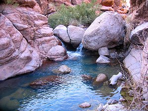
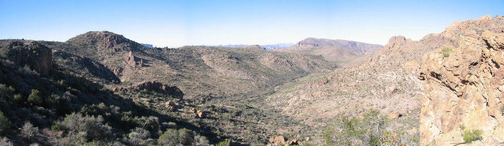
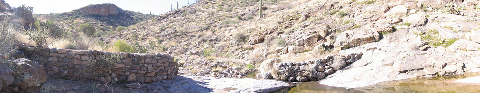
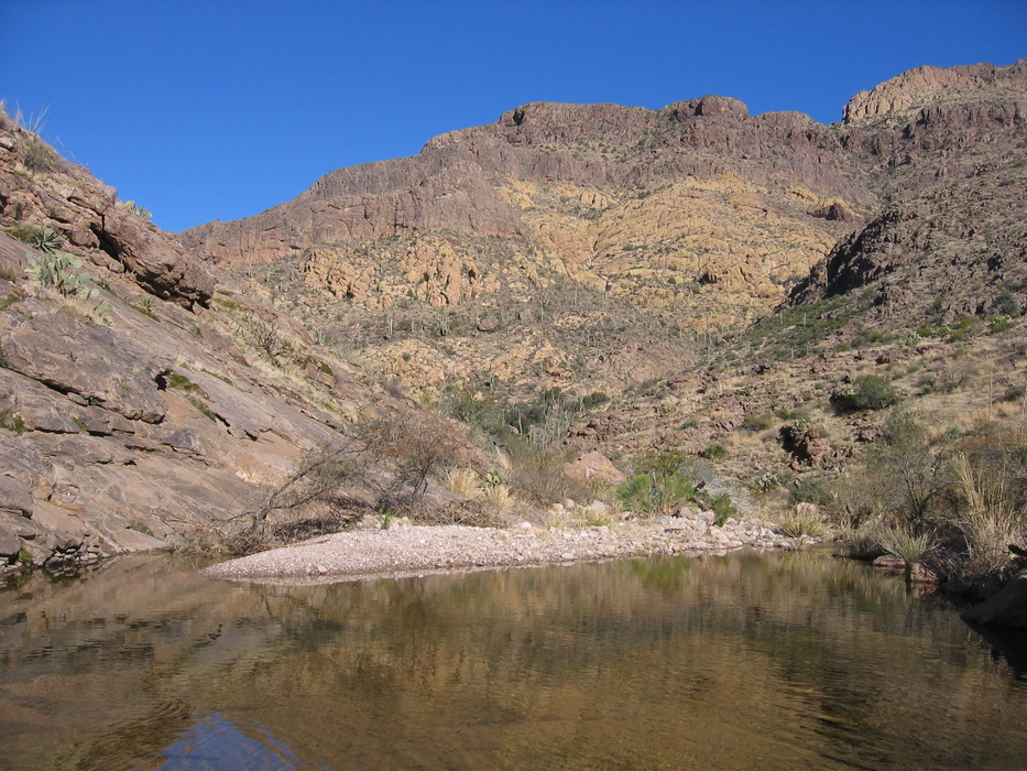
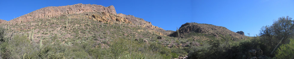
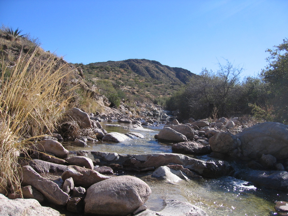
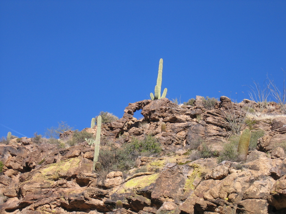
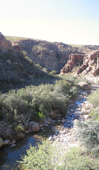
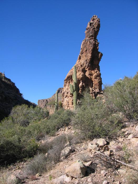
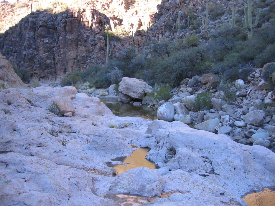
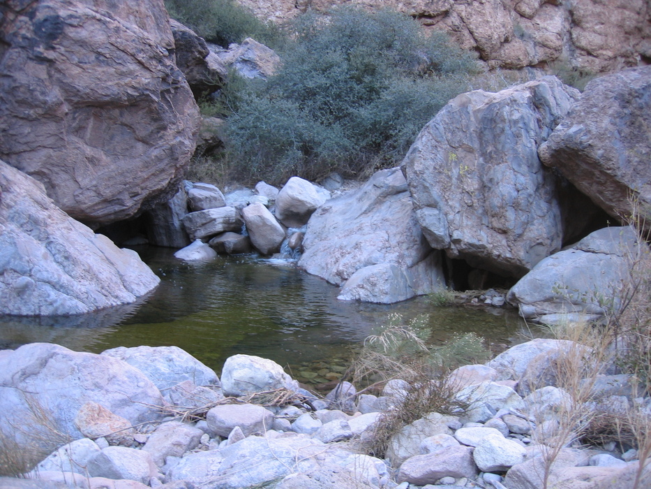
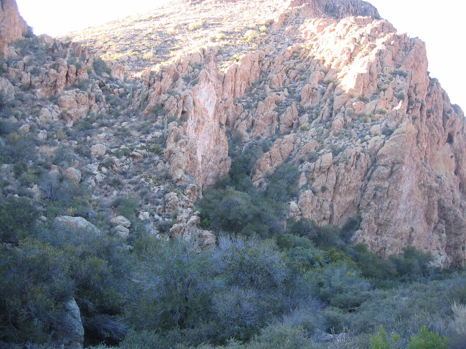
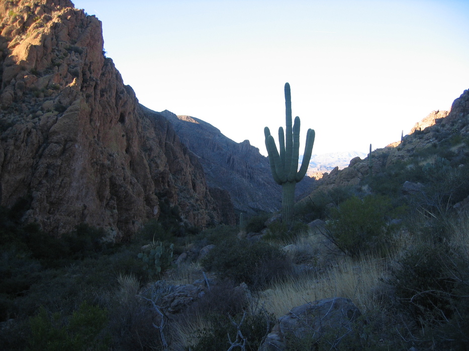
Crossing over the 2nd Saddle, Peters Trail follows Peters Creek downhill until it suddenly takes a southwest turn, climbing for Peters Mesa on the way to Charlebois Canyon. Hike This is the point you will want to take advantage of your knowledge of this area. Head north, following the creek. It twists and turns but is gradually sloping. With as much water as there is following the recent winter rains, you may have to contemplate a bit at a few creek crossings, but it is very easy and level for the most part. Since the recent rains have replenished the Superstitions water sources and vegetation is thriving, you may see that signs of deer are everywhere. Keep your eyes open, and you may spot as many as a half-dozen whitetails grazing on these seldom-traveled trails. Within 10 minutes of leaving Peters Trail, you should arrive at a rather impressive cowboy dam. Cowboy engineering isn't quite up to snuff, as the dam has failed, but the structure that remains is still fairly impressive. It is also a magnificent area to grab lunch. Once on the move again, follow the creek, admiring the impressive scenery and take notice that the once open landscape continues to tighten up into a canyon. Continue, staying in or next to the creek. What may look like impassable obstacles without getting wet may make you want to climb around, but you should find an easier route if you are persistent. You will soon find yourself among white, red, and gray vertical rock walls full of boulders and waterfalls. The final quarter mile until the merge is the most difficult as there are car-sized boulders blocking the path, distracting scenery, and wall-to-wall water obstacles. Rather impressively, we managed to get through the area without getting our feet very wet. At the junction, I was expecting to see, or at least hear Peter's Canyon waterfall, but the other waterfalls in the canyon drown all other sounds out. It appears the waterfall I was in search of was a bit further downstream. At this trail junction with the unnamed canyon, you will finally see that what appears on the map to be a trail in the creek of a steep canyon is an absence of trail in a canyon devoid of water but harboring a jungle. Henceforth this canyon will be named "Bushwhack Canyon". The first 0.4 miles from the creek up the canyon is some of the most gnarly, impenetrable vegetation you will encounter in your travels anywhere. If you wanted to hone your bushwhacking skills, this is the place. I can't comprehend a trail that originally went up this canyon. Things sure have changed. I was reminded of Joe's Iron Mountain trip log of what a trail could turn into when it isn't maintained. The good news is that the vegetation is mostly all a type of thorn-less bush so that you won't get clawed to death. After getting through this brief unpleasant section, attempt to maneuver to the eastern side (hiker's left going uphill), and you will find a much easier path through the grasses and sparse bushes. Topping out on Peters Mesa, take the trail east, and then skirt around the drainage slightly to your north, getting over on the north side. Conserving your elevation, you should reach Peters Trail right on the top of the saddle you see after following the contour around the edge of the peak. Look back and admire the gorgeous view. Rather than climb back onto Peters Mesa, one could probably elect to make this a shuttle trip to Tortilla Flats. If you elect to take Peters Canyon all the way downstream, however, I am not aware of anyone who has attempted this yet. Check out the Official Route and Triplogs. Leave No Trace and +Add a Triplog after your canyon trip to support this local community. | |||||||||||||||||||||||||||||||||||||||||||||||||||||||||||||||||||||||||||||||||||||||||||||||||||||||||||||||||


