 Route Editor

| Guide | ♦ | 22 Triplogs | 1 Topic |
details | drive | no permit | forecast | 🔥 route |
stats |
photos | triplogs | topic | location |
| 154 | 22 | 1 |
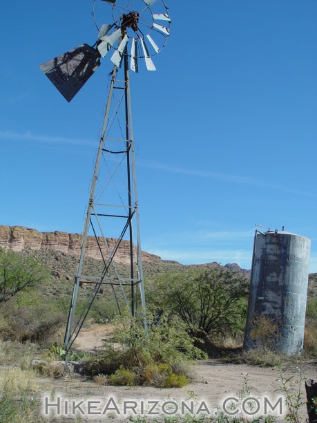
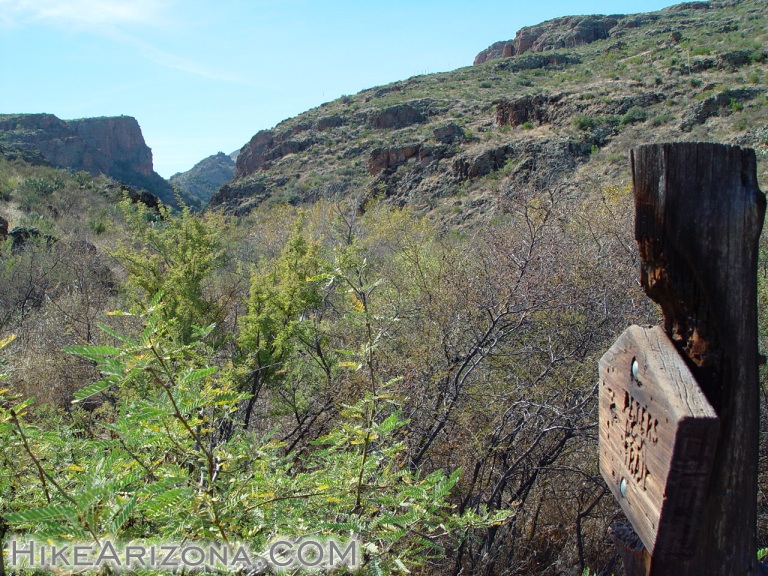
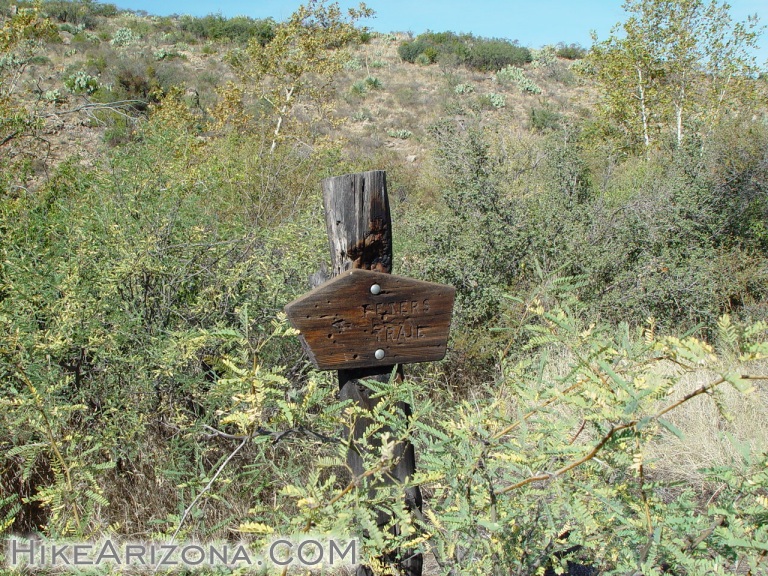
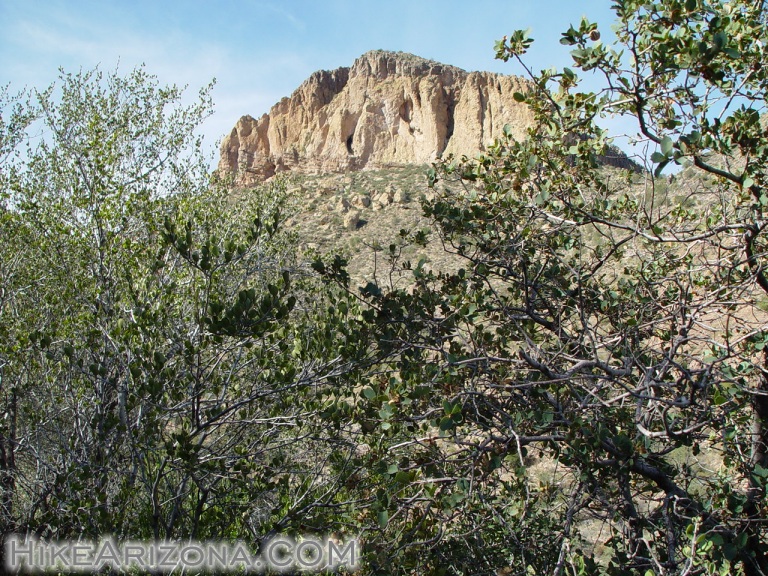
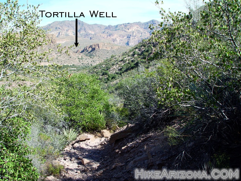
Brutal Beauty by joebartels   This was my introduction to the Tortilla Trailhead. The road coming into the trailhead is FS213. Best consider this a 4x4 route. However, on the HAZ Forum, it was debated to be doable in a pickup. I guess there's no harm in trying. ( as it's going up and you could get back down ) In the past, I snickered at the suggestions of hiking the three miles to the trailhead. The three-mile approach is very scenic. Tortilla Canyon drops down steeply on the west. The road slithers a ridge down into Tortilla Canyon, which is cool in itself. It would probably only take an hour each way as there are no obstacles in hiking a road. Personally, I'd mountain bike the stretch if I couldn't drive-in. This was my introduction to the Tortilla Trailhead. The road coming into the trailhead is FS213. Best consider this a 4x4 route. However, on the HAZ Forum, it was debated to be doable in a pickup. I guess there's no harm in trying. ( as it's going up and you could get back down ) In the past, I snickered at the suggestions of hiking the three miles to the trailhead. The three-mile approach is very scenic. Tortilla Canyon drops down steeply on the west. The road slithers a ridge down into Tortilla Canyon, which is cool in itself. It would probably only take an hour each way as there are no obstacles in hiking a road. Personally, I'd mountain bike the stretch if I couldn't drive-in.About a half mile before the end of the road, you'll pass Tortilla Ranch. It's just a slab of concrete now. The road ends at ( a fence ) the unsigned trailhead for the JF Trail #106. There's an old sign stating end of motor vehicle road. Just before the end of the road is a fork to the right. At the end of this road is Tortilla Well. Which is the trailhead for Peter's Trail #105. The old windmill has taken a beating from gunfire in the past eight years. Page 234 of the Hiker's Guide to the Superstition Wilderness shows the 1993 full bladed version. The mini water tower now has a slight lean too.
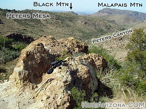
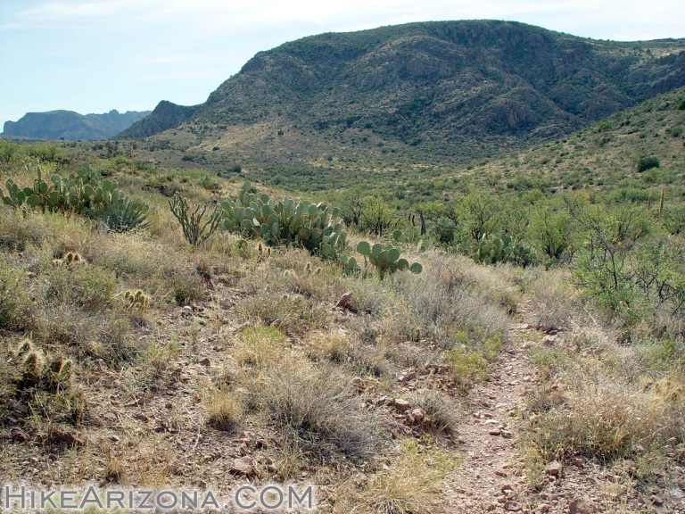
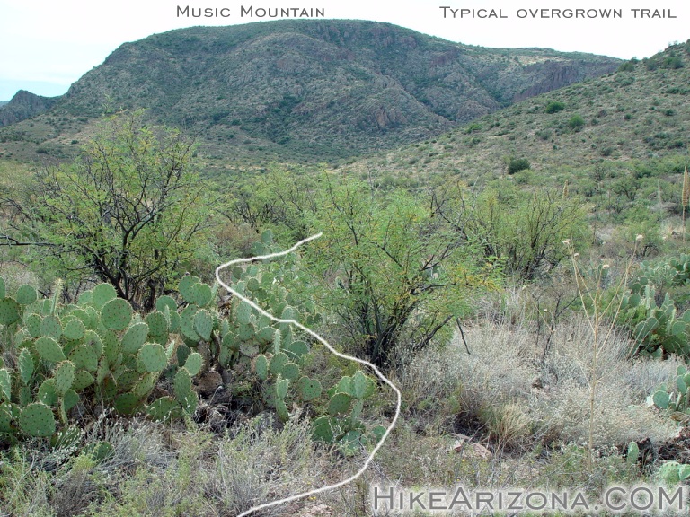
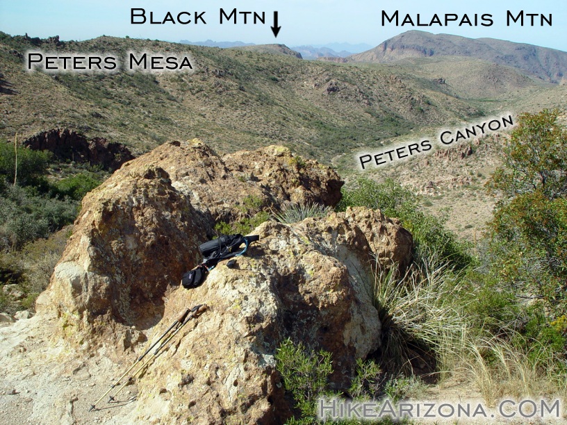
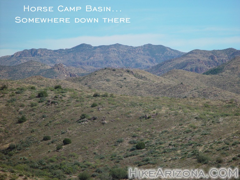
Okay, coming out of the last hoo-ha, you're in a wide-open basin. It's unnamed as far as I could find out, so I'm calling it the Indian Spring Basin. I was thinking, cool, I like basins. Nice easy strolling, taking in the views, not! The trail, although obvious, was beginning to get overgrown. Not so bad usually, except here it's all catclaw. The tallest mountain towering above on your right or west is Tortilla Mountain. Since I live in the valley and travel the western Superstitions more, I consider this the backside of Tortilla Mountain. The trail crosses the basin then heads up a canyon to a low pass. It's steep but nothing like Camelback or Squaw Peak. Midway up, you'll pass some lush grass in the creek. Kane Spring is in the area, causing the mini oasis. I was surprised to find the ground damp after an extended hot summer. This October, it's been in the upper nineties, about 10-15 degrees above normal all month. Even Charlebois seemed dry a couple of weeks ago, which is considered a reliable spring. A bit further up I took a photo looking back at the trailhead. It's a little over two miles to the low pass. On the other side the trail and surrounding area looks great. Unfortunately, it quickly gets overgrown and painful in sections. The big mountain ahead of you is Music Mountain. You are headed for the stubby knoll south end of Tortilla Mountain. So from the low pass, you drop about 180 feet. Then come back up about half that to Peter's Pass. This wasn't my original or even second option for this trip. However, I believe this is a good moderate distance for some breaking views. From Peter's Pass you have great views down into Peters Canyon. I'm not familiar enough with the eastern views to name off the landmarks. Horse Camp Basin is in there somewhere. Peter's Pass is the turnaround point for this trip. Peter's Trail continues 4.4 miles down to the Dutchman Trail, which is very close to Charlebois Spring. Hikers Guide trip 41 on page 226 offers an idea for an 8.2-mile loop with the Hoolie Bacon Trail. This was my second option coming into the day. My first thoughts were for a super loop down to Red Tanks Trail. Neither of which appealed to me much. The area is beautiful but the catclaw is horrid around these parts. Hikers Guide trip 41 talks about shortcutting over to the Hoolie Bacon Trail. On the old topographical maps, Peter's Trail used to go that way. Hikers Guide trip 41 warns of serious catclaw on the shortcut. Then goes on to mention Peter's Trail as a superhighway. If they call Peters a superhighway, I don't want to experience that shortcut, period. Check out the Official Route and Triplogs. Leave No Trace and +Add a Triplog after your hike to support this local community. | |||||||||||||||||||||||||||||||||||||||||||||||||||||||||||||||||||||||||||||||||||||||||||||||||||||||||||||||||||||||||||||||||||||||||||||||||||||||||||||||||||||||||||||||||||||||||||||||||||||||||||||||


