 Route Editor

| Guide | ♦ | 41 Triplogs | 0 Topics |
details | drive | permit | forecast | 🔥 route |
stats |
photos | triplogs | topics | location |
| 232 | 41 | 0 |
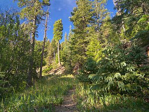
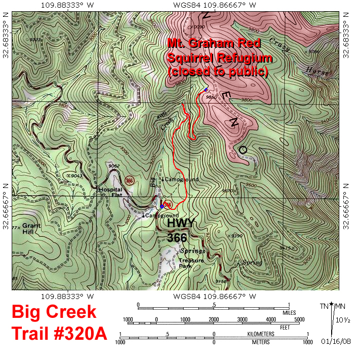
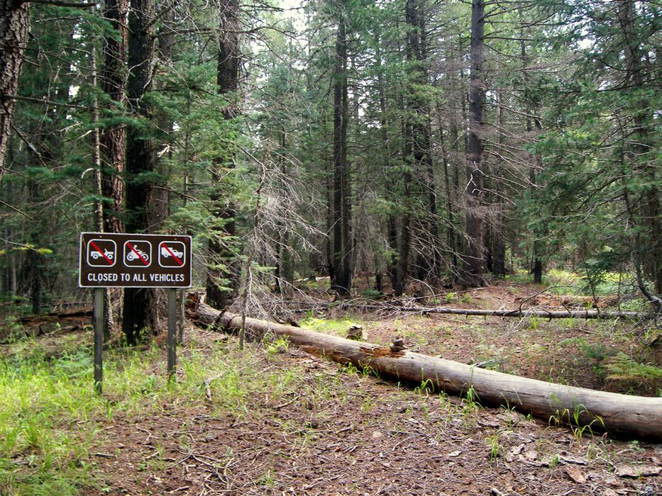
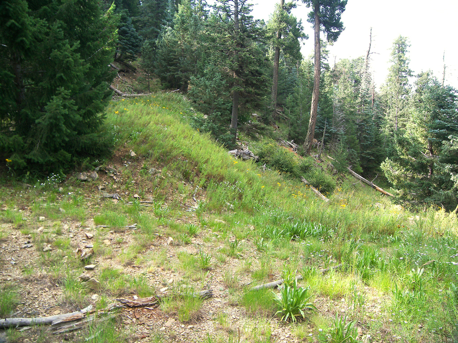
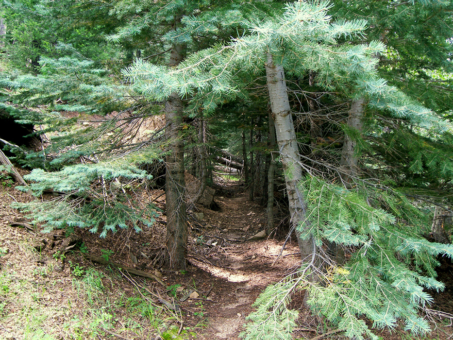
Big trees, little creek, and squirrel envy by PrestonSands  The Big Creek Trail (trail #320A) is an old logging road that runs up the Big Creek drainage to the Mt. Graham ridgeline. It has no official name, yet it is in better shape than many of the "maintained" trails in the Pinaleno Mountains. The Mt. Graham Red Squirrel Refugium closure affects the last couple of hundred yards of the trail, where it joins forest road/trail #507 (see Graham Ridge #507 hike description). The Refugium closure area (above 9800 feet) prevents one from legally making a lovely loop hike by connecting with the Graham Ridge #507 trail. The Big Creek Trail may be a trail to nowhere, but the lush forest it travels through makes up for it. The Big Creek Trail (trail #320A) is an old logging road that runs up the Big Creek drainage to the Mt. Graham ridgeline. It has no official name, yet it is in better shape than many of the "maintained" trails in the Pinaleno Mountains. The Mt. Graham Red Squirrel Refugium closure affects the last couple of hundred yards of the trail, where it joins forest road/trail #507 (see Graham Ridge #507 hike description). The Refugium closure area (above 9800 feet) prevents one from legally making a lovely loop hike by connecting with the Graham Ridge #507 trail. The Big Creek Trail may be a trail to nowhere, but the lush forest it travels through makes up for it.The most difficult part of the hike is locating its starting point, marked by a closed to all vehicles sign. This sign is surrounded by trees, and is barely visible from the Swift Trail highway. To the right (south) of the sign, an ancient logging road is blocked by a fallen log. A couple of small cairns lie in the road. Follow this old road into the forest. It soon becomes a narrow footpath, although the grade of the logging road is still apparent beneath the overgrowth.
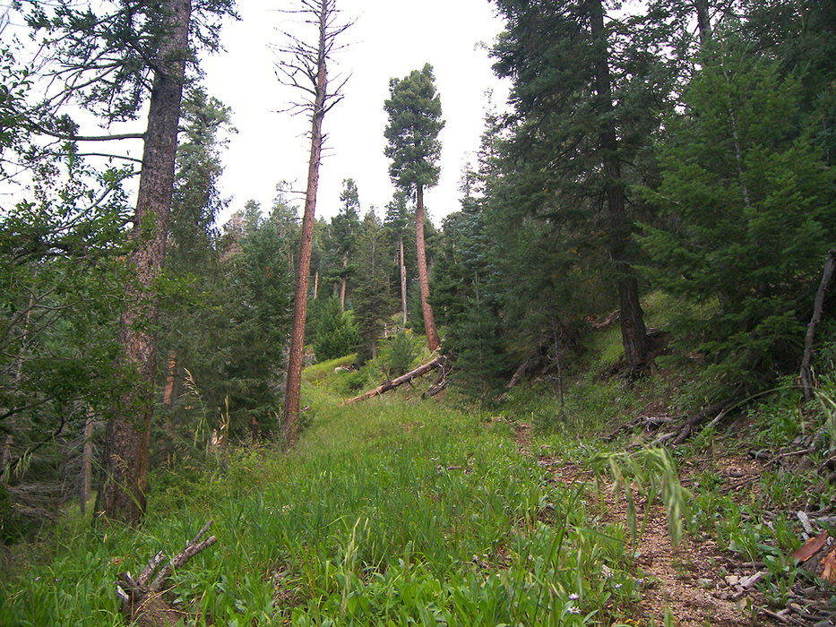
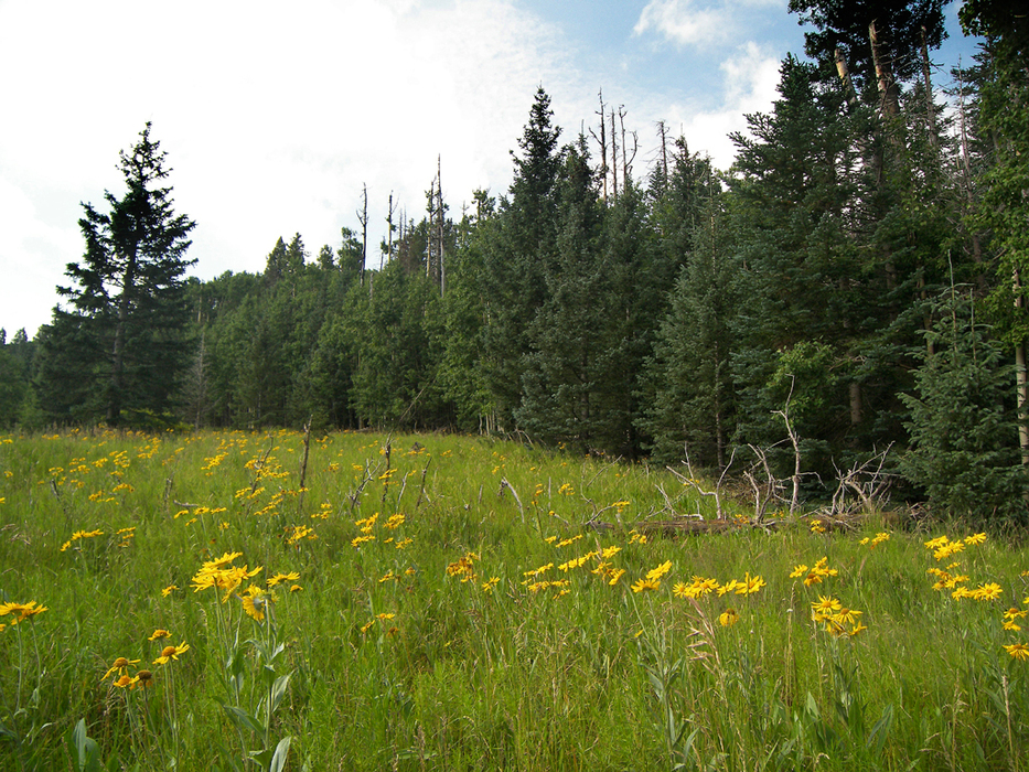
The trail passes through a tree tunnel on its way to a small saddle at 1.25 miles, where it makes a 180-degree turn to head north. There are some limited views and a small campsite at the saddle. Another overgrown logging road leads downhill to the east. However, the main logging road (trail #320A) continues north. After gently climbing for a third of a mile, it turns east and enters spruce forest. As the old logging road nears the 9800-foot contour, another overgrown logging road splits off to the left and heads downhill. Keep going straight. At about 1.6 miles the forest suddenly opens up into a beautiful meadow. It's quite a treat and tempting to enter, but, unfortunately, it is in the forbidden Red Squirrel Refugium! Law-abiding hikers should turn around here and return the way they came.
Check out the Official Route and Triplogs. Leave No Trace and +Add a Triplog after your hike to support this local community. | ||||||||||||||||||||||||||||||||||||||||||||||||||||||||||||||||||||||||||||||||||||||||||||||||||||||||||||||||||||||||||||||||||||||||||||||||||||||||||||||||||||||||||||||||||||||||||||||||||||||


