 Route Editor

| Guide | ♦ | 48 Triplogs | 1 Topic |
details | drive | no permit | forecast | 🔥 route |
stats |
photos | triplogs | topic | location |
| 505 | 48 | 1 |
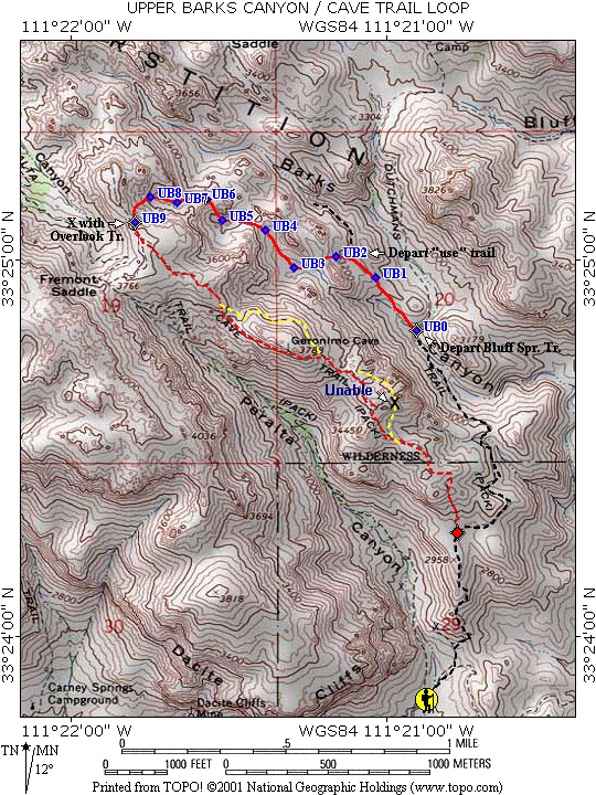
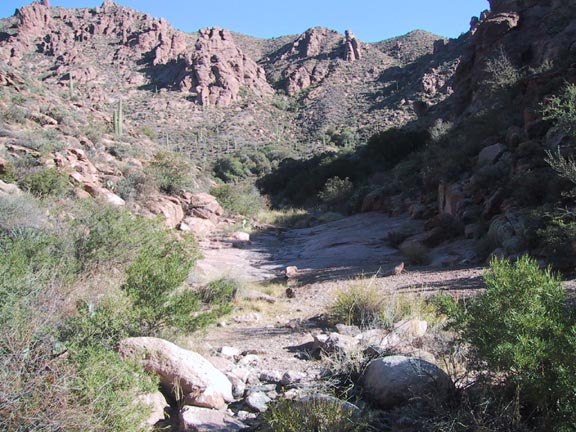
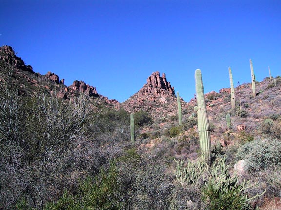
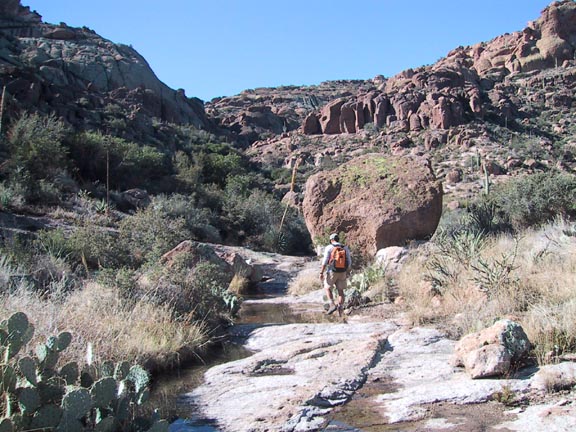
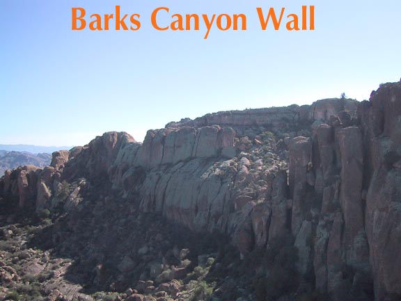
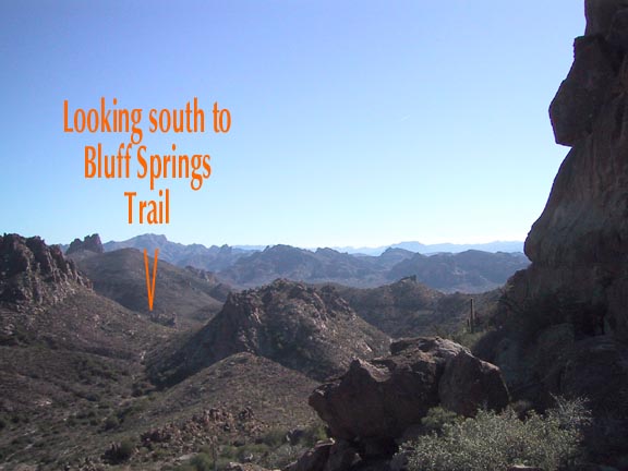
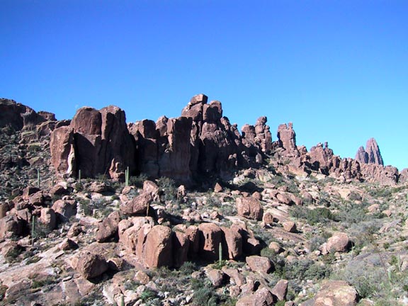
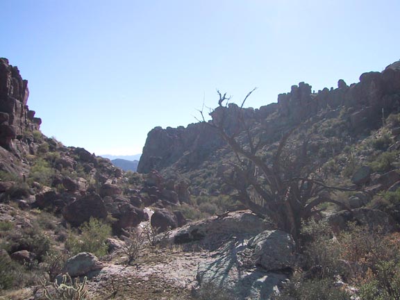
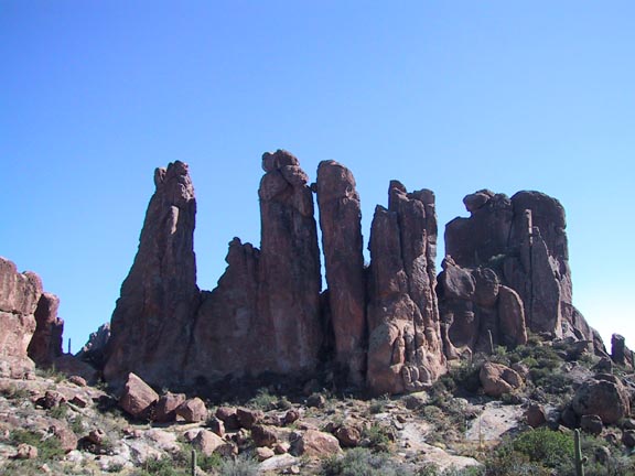
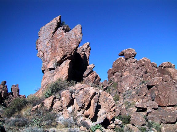
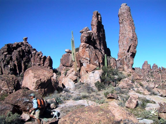
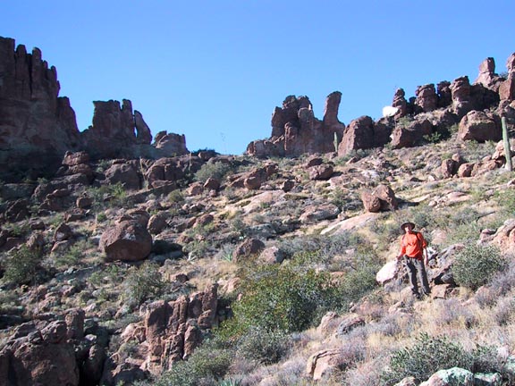
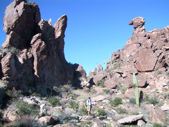
Alice in Hoodoo Land by Fritzski  Although this description of Upper Barks Canyon "proper" covers not much more than one mile of distance, the total hike is done as a loop starting on Bluff Springs Trail #235 out of Peralta Trailhead. You then depart Bluff Springs Tr. for the off-trail / Upper Barks portion then hook up with Peralta or Cave Trails for the completion of a 5.5 or 6 miles loop. Although this description of Upper Barks Canyon "proper" covers not much more than one mile of distance, the total hike is done as a loop starting on Bluff Springs Trail #235 out of Peralta Trailhead. You then depart Bluff Springs Tr. for the off-trail / Upper Barks portion then hook up with Peralta or Cave Trails for the completion of a 5.5 or 6 miles loop.Why the analogy to "Alice in Wonder Land"? Because between your map, your GPS, and your line of sight, absolutely nothing seems to make any sense!
This hike could also easily be described as the "longest mile". When executed closely to Carlson's prescribed route in his book "Hiker's Guide to the Superstition Mountains", a distance of slightly over one mile may take as much as three hours. The real irony lies in the fact that the balance of those hours will be spent on only the last half mile! The good news is the adventure and stunning scenery make it all worthwhile. I would jokingly recommend you do this hike with only one other partner. It's too remote and inaccessible to safely go alone, yet with any more than two opinions on which way to go, you'd end doing more debating than hiking. Two factors make this a difficult hike. First, it is very rugged, requiring quite a bit of scrambling and occasional bouldering, and second, route finding is about as difficult as it gets. Even with the deck stacked in my favor with as many as ten waypoints programmed into my GPS within only one mile's distance (about one every 500' if you do the math), it was still very questionable at times on which route to take. The deep, tight, canyon terrain never really allows you to get your bearings. As Carlson mentions in his book, there is no one right way to do this hike, but since he's "The Man" in my book, I'll describe it as done by his published route. To begin you set out by ascending "Cardiac Hill" on Bluff Springs Trail to the top then down the other side till you are paralleling a creek. At about the 1mi point on the Bluff Spr. Tr. it makes a sharp turn to the right to cross the stream bed into a smooth rock area, instead you want to continue straight and look for a "use" trail that goes up along the right slope of the drainage. This trail is quite well defined and easy to follow, but at about the UB/0.3mi point, you must depart the trail to the left and head west through a low saddle. If you chose to remain on the trail you would swing wide, the trail eventually fades, and although the going is easier, the scenery is not as good. Anyway, with the vegetation being fairly sparse and a clear wash area, the going isn't too bad for a while. As you gain elevation, take some time to turn around and check out the great views behind you. At the UB/0.7mi. point you will top a saddle and be rewarded with some breathtaking scenery. You'll find yourself on the edge of a large smooth rock basin literally surrounded by fantastic hoodoos, walls, and rock formations in all directions. This is easily one of the most awe-inspiring spots I have ever seen in the Superstitions. Because the hike definitely becomes more difficult from here, I would highly recommend an out and back hike to this point for those not up for anything harder. From here you head out across the basin and up the right side of the drainage ahead (of course there are always at least three drainages to chose from, so good luck!). It is at this point that things tighten up - the boulders get bigger and more concentrated and the vegetation starts to choke down. It was at the top of this ravine that my GPS was telling me to scale a 12' sheer wall that had to be at least a 5.7 climb difficulty with no telling what was on the other side. Keeping to the theme of a hike rather than a technical rock climb, we chose the closest ravine to the left and slowly worked our way to the top. It is at the top of this ridge that you will finally view Weaver's Needle Overlook - your ultimate destination. The trouble is that it looks like just about any other of a myriad of rock walls surrounding the area. A good familiarity with its topography and a distinct yellow coloration near the top will help you identify it. The battle is far from over yet. Despite the fact you are looking right at your finish point, it just so happens to be at the top of a rather ominous cliff wall looming high above you. The trick lies in the fact that the route to the top still lies hidden from view. Proceed toward the base of the cliff till you can get beyond an outcropping on your left. You can then bear left up the wash behind it at the immediate base of the cliff. If done correctly, you will come upon a "use" trail emanating from the top and thus avoiding any bouldering. Once you come out on top you will merge with the Overlook Trail. From here you can choose to go down Peralta Trail #102 or Cave Trail#233. Either way, I think you'll find it a rather concentrated dose of hiking in a distance no longer than six miles total. If you consider yourself a bit on the hardcore side, this one should satisfy your weekly fix! Check out the Official Route and Triplogs. Note This is a moderately difficult hike. Leave No Trace and +Add a Triplog after your hike to support this local community. One-Way Notice This hike is listed as One-Way. When hiking several trails on a single "hike", log it with a generic name that describes the hike. Then link the trails traveled, check out the example. | |||||||||||||||||||||||||||||||||||||||||||||||||||||||||||||||||||||||||||||||||||||||||||||||||||||||||||||||||||||||||||||||||||||||||||||||||||||||||||||||||||||||||||||||||||||||||||||||||||||||||||


