 Route Editor

| Guide | ♦ | 352 Triplogs | 3 Topics |
details | drive | no permit | forecast | 🔥 route |
stats |
photos | triplogs | topics | location |
| 3.2k | 352 | 3 |
What Trail? by joebartels  06/14/03 Update 06/14/03 UpdateThis trail has gained considerable popularity over the years. Cairns may keep you on track if you pay attention. Like the Flatiron & Ridgeline, you may be able to complete this trek with fewer route-finding skills than mentioned below. Warning The route is difficult to follow & potentially dangerous
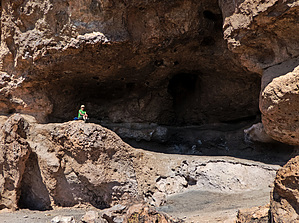
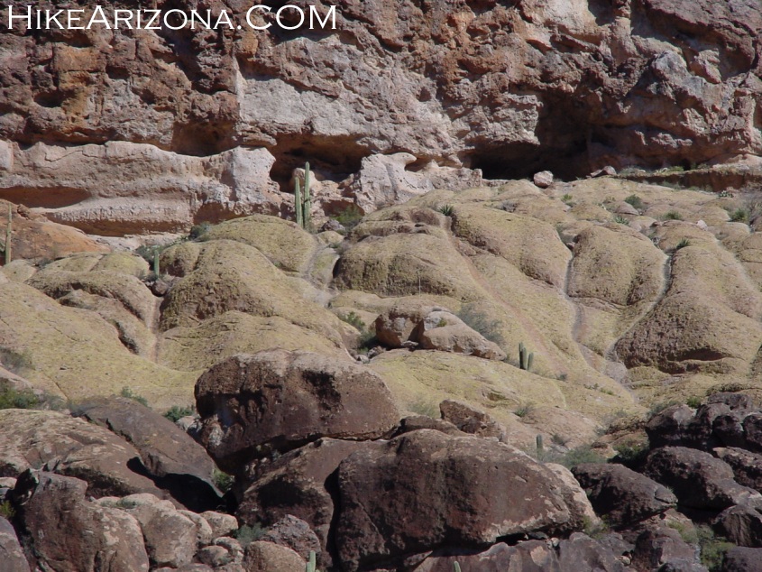
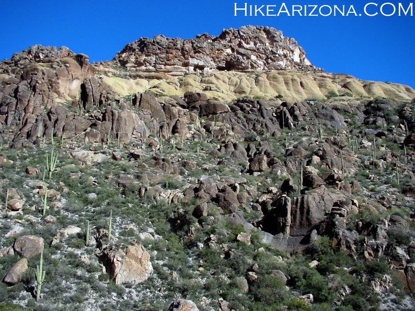
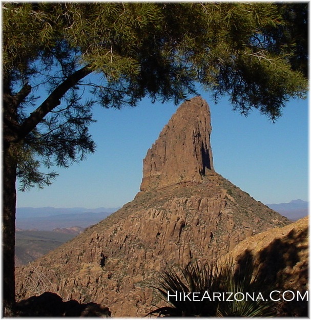
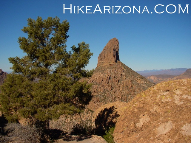
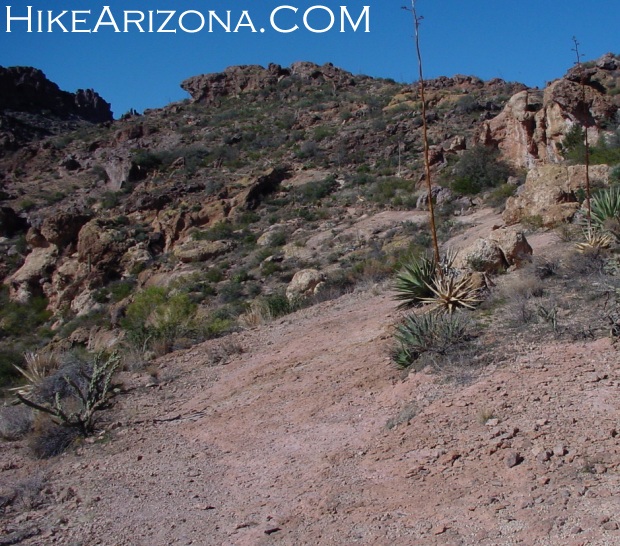
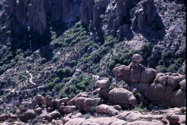
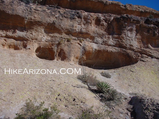
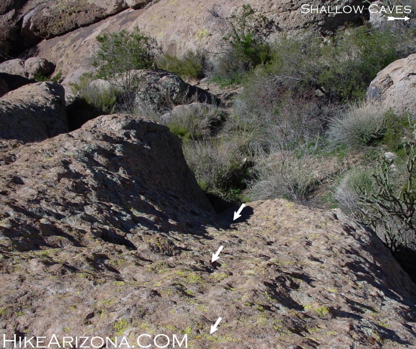
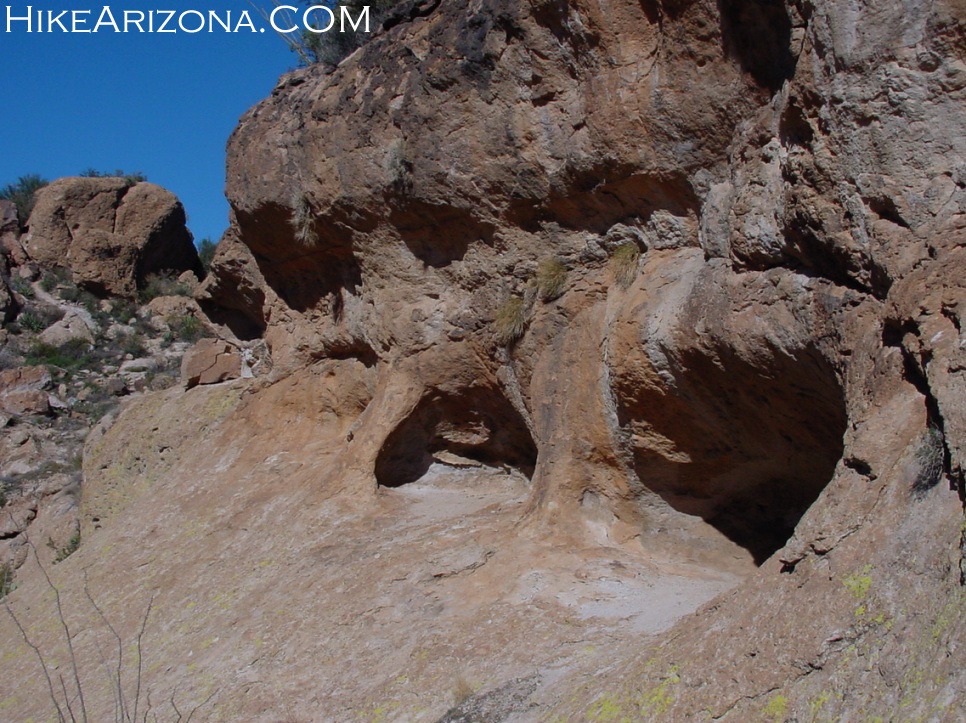
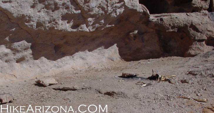
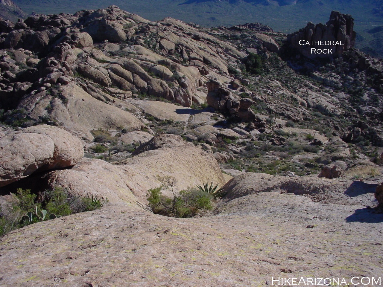
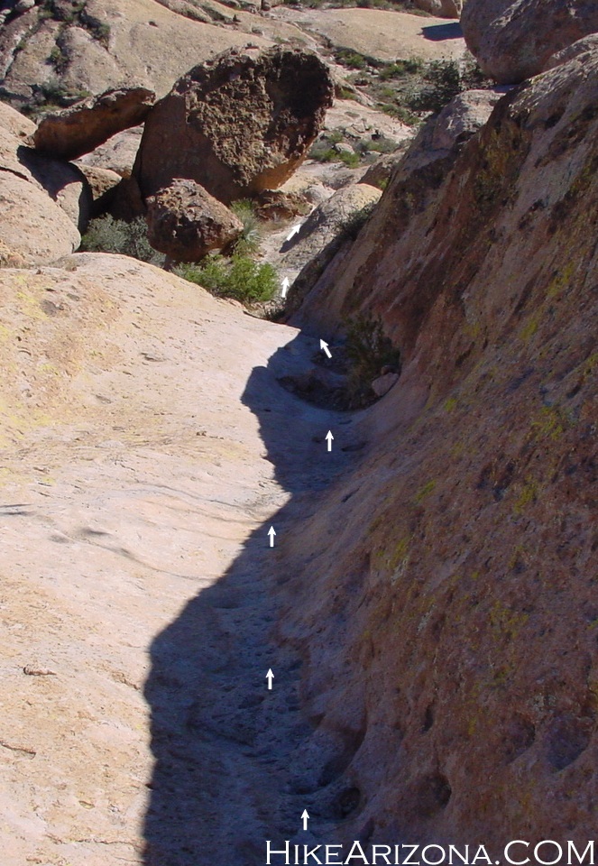
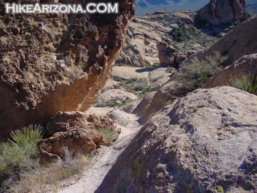
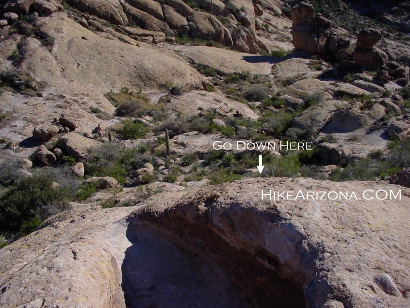
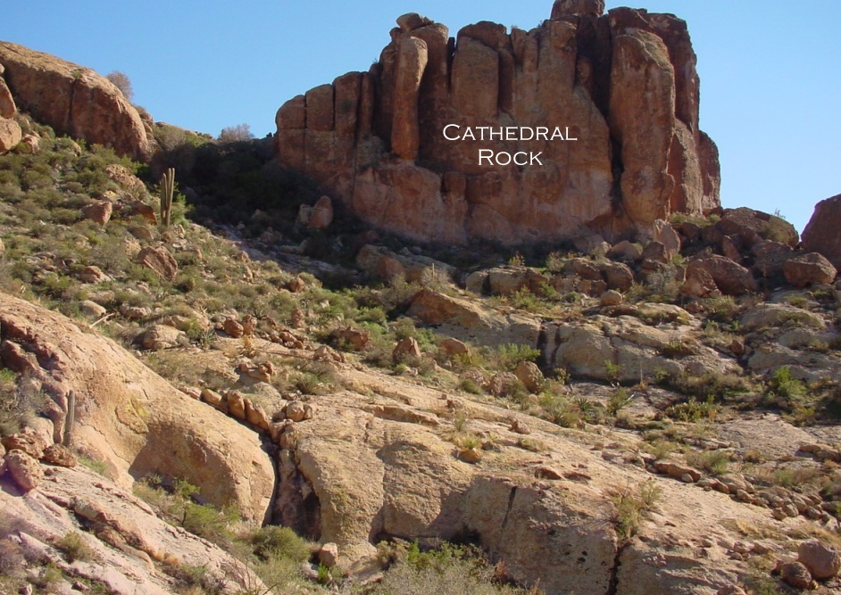
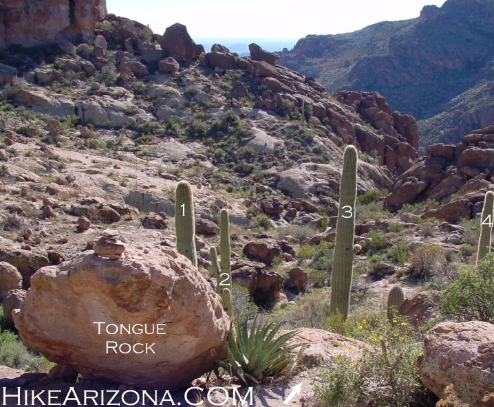
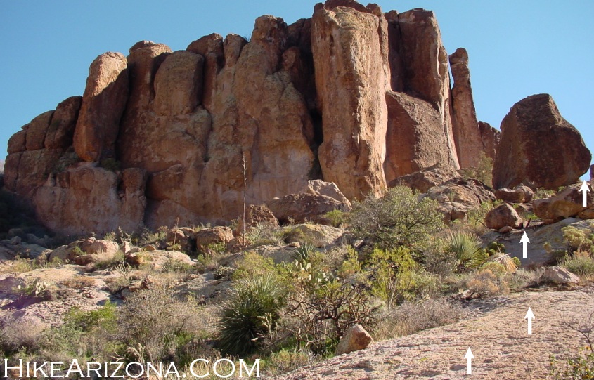
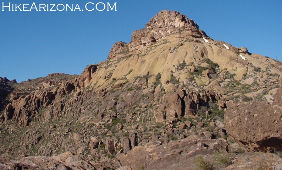
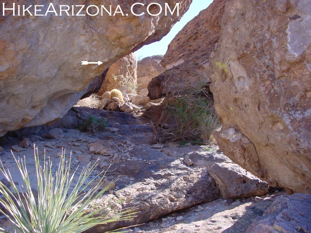
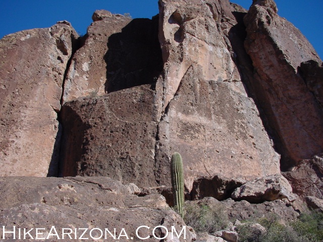
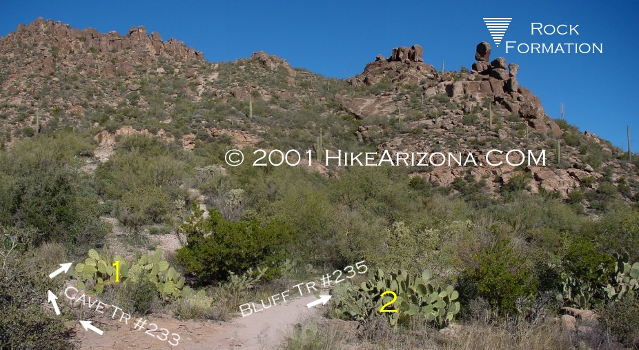
Welcome to the most talked-about trail, that doesn't exist. Yep, it's the Cave Trail. Several sections are bare rock, which makes it difficult to follow. You need to be familiar with Peralta Canyon and pay attention to your line of travel. If you've hiked the Peralta Trail, you've seen the caves to the east on the yellow ridgeline. Although it's possible in theory, nobody goes up this trail on their first attempt. Therefore, you'll need to hike up to Fremont saddle via the Peralta trail to come back down, on this, the Cave trail. Once you've mastered coming down the Cave trail, then you can think about going up, but not before! Start out hiking the Peralta up to Fremont Saddle. On the way up the Peralta Trail, notice the caves up to your right. From Fremont Saddle take a right, which takes you in a northeast direction. You're heading over to the ridge that extends out to Weavers Needle. It's easy to identify. There is only one pine tree at the end. Arizona Highways loves to photograph this tree. This is inline with the Cave trail ridge. The cave trail sits on a ridge with Peralta Canyon on the southwest and Barks Canyon on the northeast. To make it easier I'll refer to the ridge as if it runs perfectly north and south. There is no signage indicating the turnoff for the Cave Trail. I find it easier to head out onto Weavers Outlook Ridge. Coming back you're naturally inline with the Cave Trail. Now onto the Cave Trail. You're hiking on the west side of the ridgeline that overlooks Peralta Canyon. You should be hiking on a slanted slab of rock. Within a couple of minutes you should be able to look back at Fremont Saddle and down into Peralta Canyon. Hike a short distance to where the ridge drops off. You should be parallel with Pivot Rock. Here the ridge in front of you drops off and it seems impossible to continue. What you need to do is cross over to the east side of the ridge that overlooks Barks Canyon. You need to hike back north again. Now you can catch a switchback that will bring you back to the lower ridge. You'll encounter an anvil. Here you have two options. If you take a left, you'll follow the Barks Canyon side and miss the caves. Either route works, but I'm explaining the Peralta side here. So take a right, it's more exciting. Soon you'll see two shallow caves. At first, you'll be thinking these look awfully tiny. They are, and they aren't the caves you see from the Peralta Trail. Hike down and in front of the shallow caves. The trail appears to end abruptly. You're either looking down into Peralta Canyon or looking up a very steep rock face. Believe it or not, you need to climb up this rock face. It isn't that difficult. But, looking back down it seems impossible to return. So basically, you're committed to continuing. Also looking straight back, you'll notice you're level with the shallow caves. Many years ago, on my first trip, I didn't think this was possible. I ended up taking the Barks Canyon route. It is possible. Just make sure you take the right gully going up. Keep hiking south along the ridge to the caves. Along the way, you'll need to switchback to gain elevation. There is no distinctive trail. Cairns usually help lead the way. It's unlikely you'd ever take the exact same approach. You can't wander off too far without jumping off into Peralta Canyon, so don't worry about getting lost. You come to the caves, which are medium-size alcoves. The first is unimpressive. The next two step up consecutively. There is a heap of gold back in the corner. Just kidding, these aren't very impressive either. The trail is more about scrambling and route finding than the actual caves themselves. Now past the caves, you come to the Fortress. Looking down and out things begin to seem a little scary. Now would be a good time to write a will. Fold it into a paper airplane and launch it towards the trailhead. Well, that won't work. The forest rangers tell you to pack out whatever you pack in. So, let's get you're carcass outta here and head on down. It's important to find the right gully, which is called the Devils Slide. In all honesty, the Devil's Slide isn't the bad part. So head on down. Soon you'll be at the Tub. Now you have a reason to be scared. The fact that climbers have bolted here gives you an idea of the pitch. You need to go over the edge. You'll be hiking on your butt. So get on your butt and shimmy on down. Avoid the loose cracked surface, which I call chip plates. Your body has four points of contact, your hands, and feet. Make sure you have a secure footing or grip before proceeding. This area here is a good reason to never do this hike when it's wet or raining. Teva sandals work best on this surface in my opinion. It's no worse than playing around on the Papago Buttes in Phoenix. Well, with the exception you're out in the middle of nowhere! I got a leg cramp mid-way down. Luckily, I survived. Continuing down you'll see a little section of trail. In the distance you can see your next destination, Cathedral Rock. You need to go through a small valley to get there. The idea is to make it the right side of Cathedral Rock. The key is to follow the trail to Tongue Rock & the Four Saguaros. Go down on the right side of Tongue Rock, just to the right of the century plant. Continue down into the valley. You come to a point, at the bottom, where you almost drop into Peralta Canyon. Countless cairns on a boulder let you know to turn and head back up. Next, work your way up to the right side of Cathedral Rock. Look back at the Fortress and see what you've accomplished. Now, pass through a small maze of boulders going around Cathedral Rock. When you come out of the maze, look up to your left for an awesome view. I noticed climbers have recently bolted to this wall. Keep in mind it's illegal to bolt in the Superstitions. Past Cathedral Rock things start looking easier. You'll be hiking away from Peralta Canyon. Miners Needle can be seen in the distance. At one instance you can see the parking lot in the distance. It's still a good half hour away. The trail, although not maintained, is fairly obvious. There is one last hurrah through a low-lying boulder field. It seems like it would be much more difficult to follow this area going in the opposite direction. Life seems good when you hook up with the Bluff Springs Trail #235. Note the surroundings, for those that wish to run the trail in opposite direction. It's 0.7 miles, about twenty minutes, back to the trailhead.
Check out the Official Route and Triplogs. Leave No Trace and +Add a Triplog after your hike to support this local community. One-Way Notice This hike is listed as One-Way. When hiking several trails on a single "hike", log it with a generic name that describes the hike. Then link the trails traveled, check out the example. | |||||||||||||||||||||||||||||||||||||||||||||||||||||||||||||||||||||||||||||||||||||||||||||||||||||||||||||||||||||||||||||||||||||||||||||||||||||||||||||||||||||||||||||||||||||||||||||||||||||||||||||||||||||


