 Route Editor

| Guide | ♦ | 65 Triplogs | 2 Topics |
details | drive | permit | forecast | map |
stats |
photos | triplogs | topics | location |
| 178 | 65 | 2 |
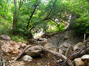
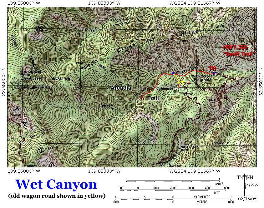
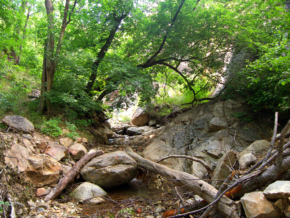
Arcadia's back alley by PrestonSands  Southeastern Arizona's Pinaleno Mountains contain many riparian treasures. One of the most easily accessible is Wet Canyon. Why hike up this trail-less canyon to nowhere? Because summer wildflowers next to a shady, perennial creek can't be beaten! Southeastern Arizona's Pinaleno Mountains contain many riparian treasures. One of the most easily accessible is Wet Canyon. Why hike up this trail-less canyon to nowhere? Because summer wildflowers next to a shady, perennial creek can't be beaten!The Wet Canyon picnic area is the most convenient place to enter the canyon. From the parking area, a use trail heads up the right side of the creek. This trail soon dies out near some picnic tables. From here it is a boulder hop and log hurdle adventure up the creek bed. Wet Canyon creek tumbles over variegated boulders, forming tiny pools here and there, while bigtooth maples and box elders keep the canyon well shaded.
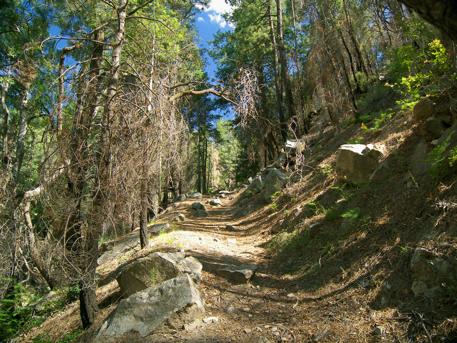
At 0.4 miles, a small side canyon comes in from the left. Just above its confluence with Wet Canyon is where the wagon road left the creek bottom. From where the old wagon road meets the creek (32.65131 N, 109.82066 W), you can choose to follow the wagon road south for 0.25 miles up to Arcadia Campground, or continue further up Wet Canyon. Returning to the Wet Canyon picnic area via the wagon road and the highway makes a 2.5 mile loop. Continuing on, Wet Canyon now becomes increasingly steep and narrow. As you near the Arcadia Trail, gigantic white firs begin to appear. Large columbines and other wildflowers crowd the creek bed, hemmed in by nearly vertical, grass-covered slopes. Wet Canyon crosses the Arcadia Trail at about the 1-mile point. For those looking to exit the canyon and return via the highway, this is the last reasonable place to do so. Returning to the Wet Canyon picnic area via the Arcadia Trail and the highway makes a 3.6-mile loop. Have fun, and tread lightly through this fragile riparian zone.
Check out the Triplogs. Leave No Trace and +Add a Triplog after your hike to support this local community. | ||||||||||||||||||||||||||||||||||||||||||||||||||||||||||||||||||||||||||||||||||||||||||||||||||||||||||||||||||||||||||||||||||||||||||||||||||||||||||||||||||||||||||||||||||||||


