Ventana Canyon is one of the most beautiful canyons in the Santa Catalina Front Range, and one of the least visited. The main reason for that, most likely, is because getting to the trailhead requires deciphering a set of access instructions that would challenge Sherlock Holmes (see below)! Another reason may be the fact that this Front Range trail includes several sections of steep and rocky switchbacks.
Ventana means window in Spanish. The window in this case is a 15 by 25 foot opening in solid rock that tops one of the peaks in the Santa Catalina Front Range. The route up Ventana Canyon leads to "The Window", presenting memorable views of sheer canyon walls and a steadily broadening panorama along the way. The stream that the trail follows for much of this route is dry most of the year, but you can usually find water in some of its pools during the spring and early summer. The riparian habitat it nourishes provides good birdwatching.
The trail becomes steadily more difficult to follow as it climbs farther from the trailhead and higher up the canyon. As you climb, occasional pools and widening vistas provide reasons to stop, take a breather, and look around. The Window comes into view well before you get to it, as does the 100-foot drop at its base.
Attractions: Desert canyon, waterfalls (in season, access to The Window, and magnificent views!
When hiking several trails on a single "hike", log it with a generic name that describes the hike. Then link the trails traveled, check out the example.
WARNING! Hiking and outdoor related sports can be dangerous. Be responsible and prepare for the trip. Study the area you are entering and plan accordingly. Dress for the current and unexpected weather changes. Take plenty of water. Never go alone. Make an itinerary with your plan(s), route(s), destination(s) and expected return time. Give your itinerary to trusted family and/or friends.
Permit $$
no fees or permits reported
if incorrect tell us about it
Coronado Forest MVUMs are rarely necessary to review unless mentioned in the description or directions Coronado Motor Vehicle Use Maps (MVUMs)
Directions
Road
Paved - Car Okay
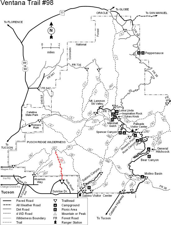
To Ventana Trailhead 1) From I-10 head east on W Ina Rd for 6.9 mi
2) Continue onto E Skyline Dr for 1.9 mi
3) Continue onto E Sunrise Dr for 3.2 mi
4) Turn left onto N Craycroft Rd and follow 2.5 mi
5) Turn left onto N Resort Dr and follow 0.1 mi
6) Ventana Trailhead Parking is on your left. It is a large slender lot. Trail takes off from the end.
If you continue to far on N Resort Dr you will quickly enter the resort on Flying V Rd, turn around.
From PHX (I-10 & AZ-51) 117 mi, 1 hour 57 mins From TUC (Jct 1-10 & Grant) 15.4 mi, 29 mins From FLG (Jct I-17 & I-40) 260 mi, 4 hours 6 mins
 Route Editor

 Ventana Canyon is one of the most beautiful canyons in the Santa Catalina Front Range, and one of the least visited. The main reason for that, most likely, is because getting to the trailhead requires deciphering a set of access instructions that would challenge Sherlock Holmes (see below)! Another reason may be the fact that this Front Range trail includes several sections of steep and rocky switchbacks.
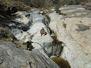


