Overview
Used to access Elephant Mountain Trail or as a loop with Spur Cross Trail.
Hike
From the northeast junction with Spur Cross Trail, you immediately head up a gentle slope. Soon you top out on a small deck with nice views north of Sugarloaf Mountain. On this trip, Sugarloaf was covered in yellow brittlebush blooms.
As noted in the elevation profile the trail soon heads right back down to a usually dry ravine. Here I encountered a Parks & Recreation truck. Signs remind you that going off-trail is not allowed. Perhaps they were enforcing park law. Maybe somebody tried to shortcut the 250 feet down to the Spur Cross Trail... who knows!
Across the ravine, you head up a huffer slope. Even at its worst, it's only a 150-foot climb. Perhaps no worse than the first switchback of Piestewa. All the lower trails up to this point could practically be negotiated in flip flops. Here the footing gets loose. The good news is the old jeep road is beyond Parks & Recreation cruiser negotiable. Especially because there are a couple of boulders lined at the top as a mammoth waterbar.
Soon you'll find yourself at a junction with Elephant Mountain Trail. Take a left and head south onto the ridge-of-views. On this trip, the ground was literally covered in green flora and wildflowers. The views are top-notch all around. Looking ahead/SSE, Black Mountain dominates the horizon. Even in this above-average rainfall year, the ground sports deep drought cracks.
A half-mile down this subtle sloping ridge, you come to the southwest junction with Spur Cross Trail. New River Mesa shaded a majority of my late afternoon hike. Talk about a bonus!
When hiking several trails on a single "hike", log it with a generic name that describes the hike. Then link the trails traveled, check out the example.
WARNING! Hiking and outdoor related sports can be dangerous. Be responsible and prepare for the trip. Study the area you are entering and plan accordingly. Dress for the current and unexpected weather changes. Take plenty of water. Never go alone. Make an itinerary with your plan(s), route(s), destination(s) and expected return time. Give your itinerary to trusted family and/or friends.
Permit $$
Spur Cross Conservation Area $5 per person
Directions
Road
FR / Dirt Road / Gravel - Car Okay
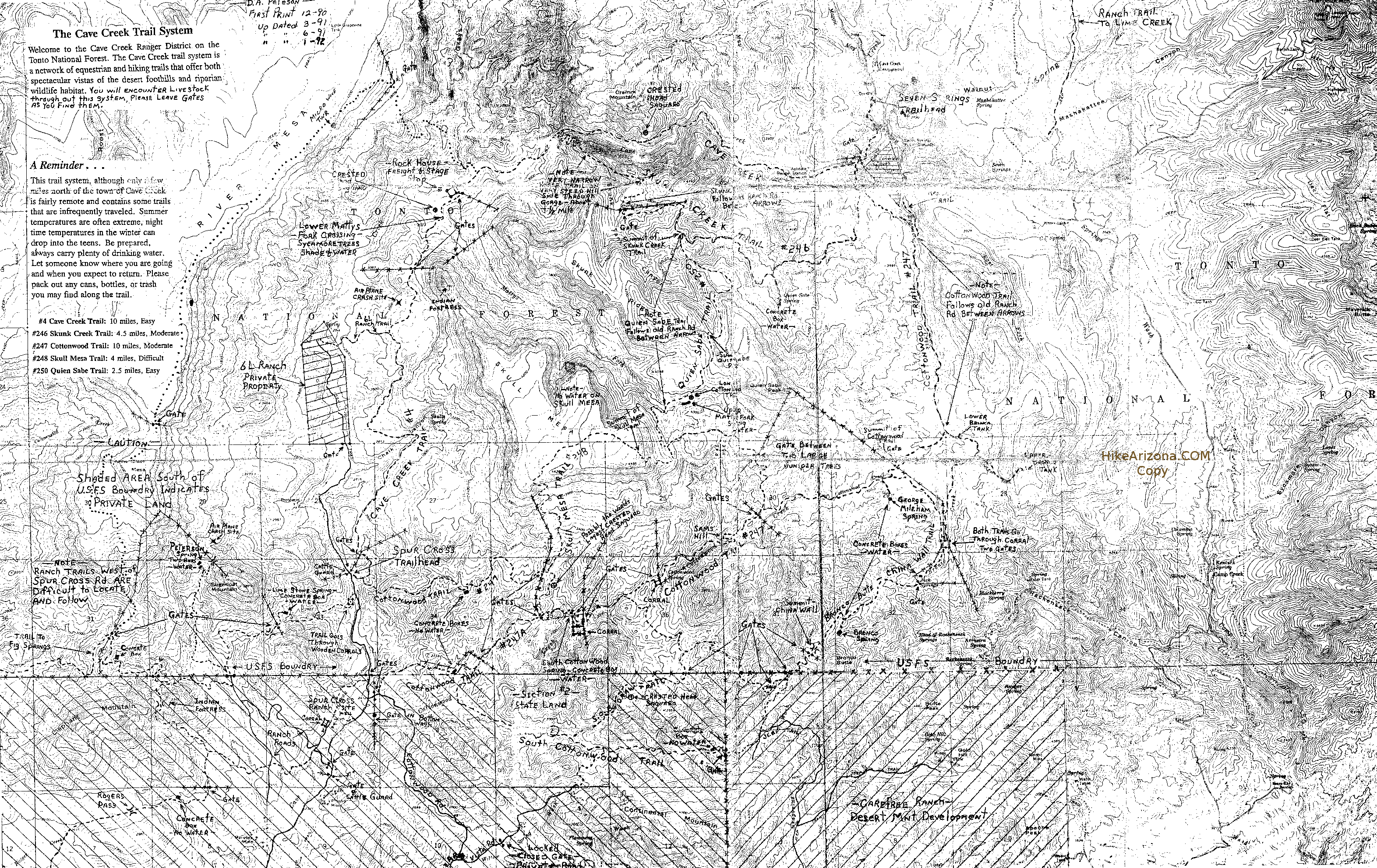
To Spur Cross Trailhead I-17 North & Exit 233, which is SR-74 the Carefree Highway. Head east on Carefree Highway 9.9 miles to Cave Creek Road. Head North on Cave Creek Road 2.6 miles to Spur Cross Ranch Road. The road jogs a bit here but you go 4.0 miles to the parking lot.
It is a well-graded dirt road. As it nears the parking area, the road leads past a large green house, through a tall gatepost and past a corral. There is a large signed parking area. Along the road about 75 yards northeast of the parking area, there is a self-pay station and a small informational kiosk with rudimentary maps. Pay the fee and carry the stub with you.
From PHX (I-10 & AZ-51) 35.8 mi - about 57 mins From TUC (Jct 1-10 & Grant) 144 mi - about 2 hours 26 mins From FLG (Jct I-17 & I-40) 133 mi - about 2 hours 10 mins
 Route Editor

 Overview
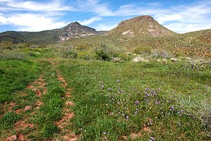


