username
X
password
register
for free!
help
   🔥

Metate Trail - Spur Cross, AZ

Guide 185 Triplogs  0 Topics
  3.4 of 5  
Fav
Wish
0
details
drive
permit
forecast
🔥
route  
stats
photos
triplogs
topics
location
2.5k 185 0
Statistics
tap row or icons for details
Difficulty 1 of 5
Route Finding 1 of 5
Distance One Way 0.8 miles
Trailhead Elevation 2,304 feet
Elevation Gain -75 feet
Accumulated Gain 75 feet
Avg Time One Way 0.5 hour
Kokopelli Seeds 1.05
 Backpack No
feature photo
Photos Viewed All MineFollowing
Will recalculate on button tap!
10  2024-12-14
Spur Cross Dragonfly Loop
Nightstalker
9  2024-06-06 mt98dew
15  2024-03-19
Trail 1533 Loop TNF
Oregon_Hiker
1  2024-03-03 WilliamnWendi
28  2023-12-25
Trail 1533 Loop TNF
LosDosSloFolks
6  2023-12-10
Cottonwood Trail 247-247A Loop
Oregon_Hiker
5  2023-05-14
Cave Creek Trail #4
trekkin_gecko
12  2023-05-14
Cave Creek Trail #4
johnlp
Page 1,  2,  3,  4,  5 ... 17
Author
author avatar Guides 264
Routes 2,797
Photos 14,494
Trips 5,894 map ( 29,783 miles )
Age 55 Male Gender
Location
Associated Areas
list map done
Phoenix Region
Historical Weather
Trailhead Forecast
Radar Map
Expand Map
Preferred Jan, Feb, Mar, Nov → Early
Seasons   Autumn to Spring
Sun  6:04am - 6:48pm
Official Route & 7 Rts
 
47 Alternative
 
Historic Fire Perimeteracres
🔥 2005 Cave Creek Complex169.4 mi*


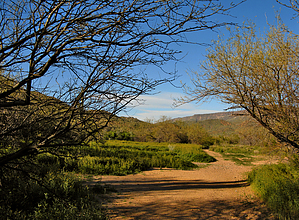
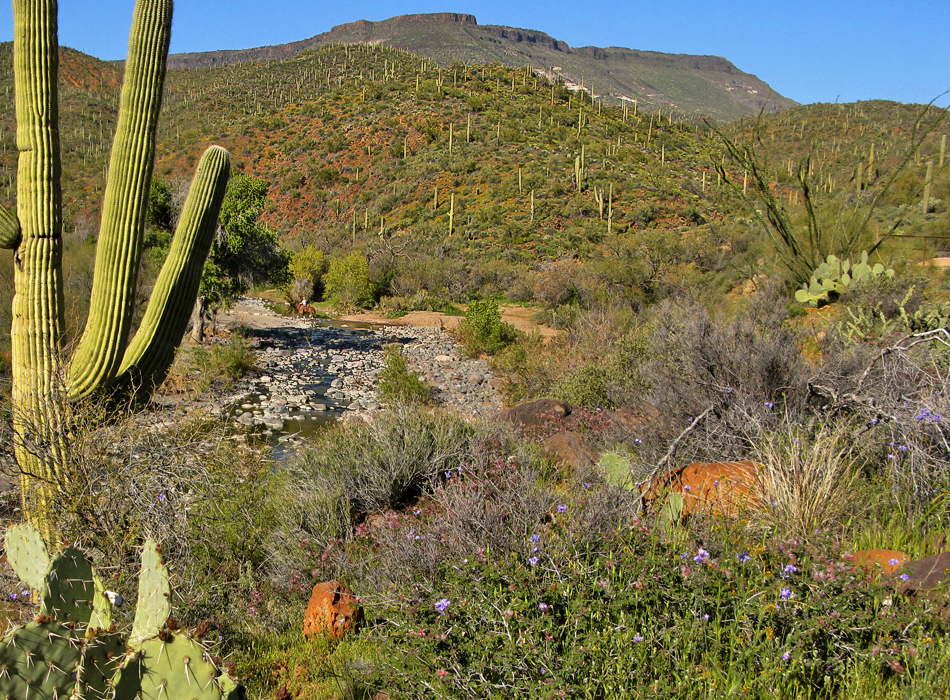
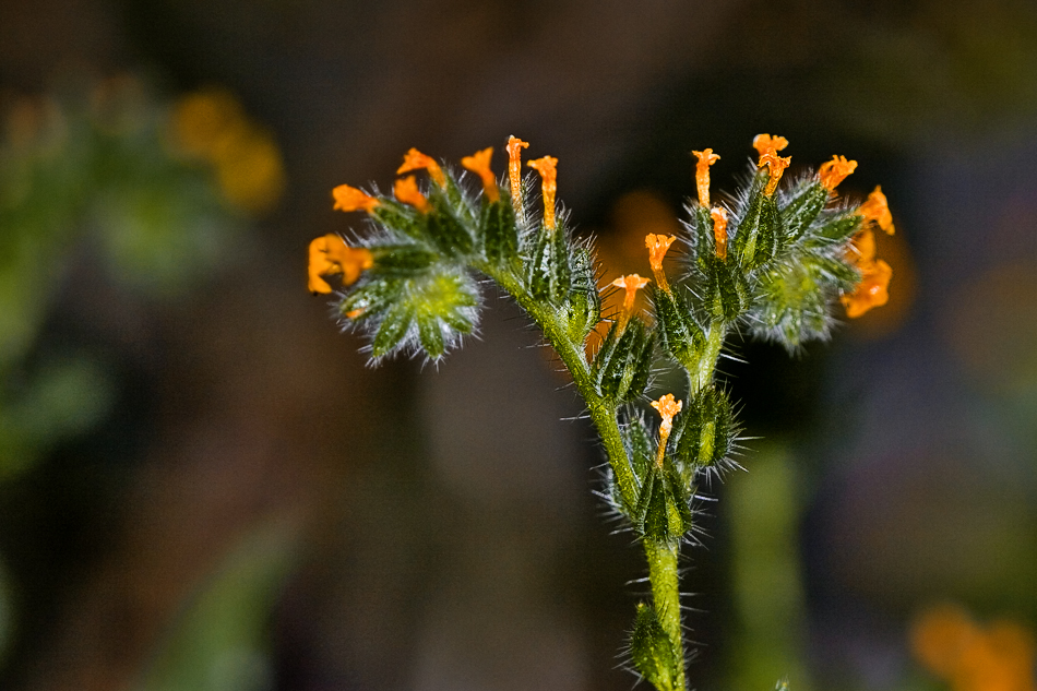
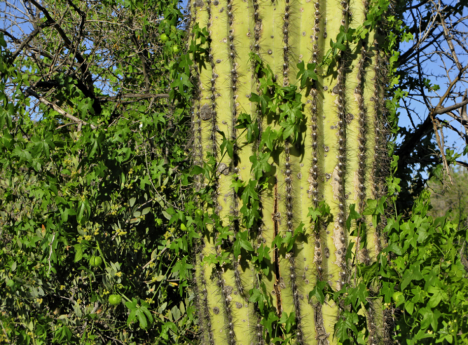
Culture Rich Flora Explosion
by joebartels

Overview
Single-track shortcut (of Spur Cross Trail) that mingles with Cave Creek.


Hike
From the northeast junction with Spur Cross Trail, you head southwest. The overhead views of Cave Creek are immediately pleasing. What makes this particular stretch oh-so-special is the mix of saguaros, mountain views and a running creek(in season). This vision may float in the minds of tourists. In reality, the experience is rare in the Sonoran desert. The occurrence here is the fringe where it meets the chaparral-covered mountains.
remove free decal offer
Not wanting to but continuing on the flora is rich. Without the trail, you'd be deep in a nasty bushwhack. The trail meanders about to the mesquite kingdom. In season this is an incredible experience. Mesquite trees canopy the trail. On my visit (peak season) fiddleneck wildflowers covered the ground in a two-foot blanket. The idyllic setting is amazing in itself. What's more amazing is the history of this trail. I don't know the history but the facts are busting at the seams. Other trails in the conservation area are made up of old jeep roads or modern cut trails. This single-track trail is listed on the 1978 New River Mesa topographical map and likely older versions too. Old cement foundations line the trail in places (further down). Tag in the proximity of the creek and the name of the trail. A metate is a ground stone tool used for processing grain and seeds by Native Americans. The stone is rubbed back and forth over a mano. It'd be one thing to come in here with a chainsaw and cut a quick path. This place goes back in time.

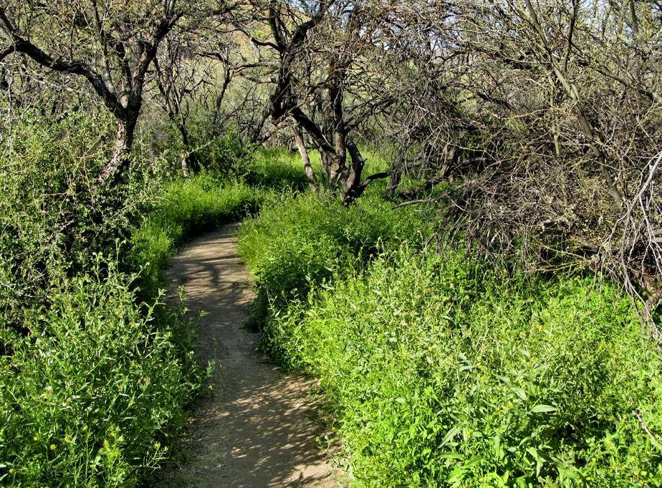
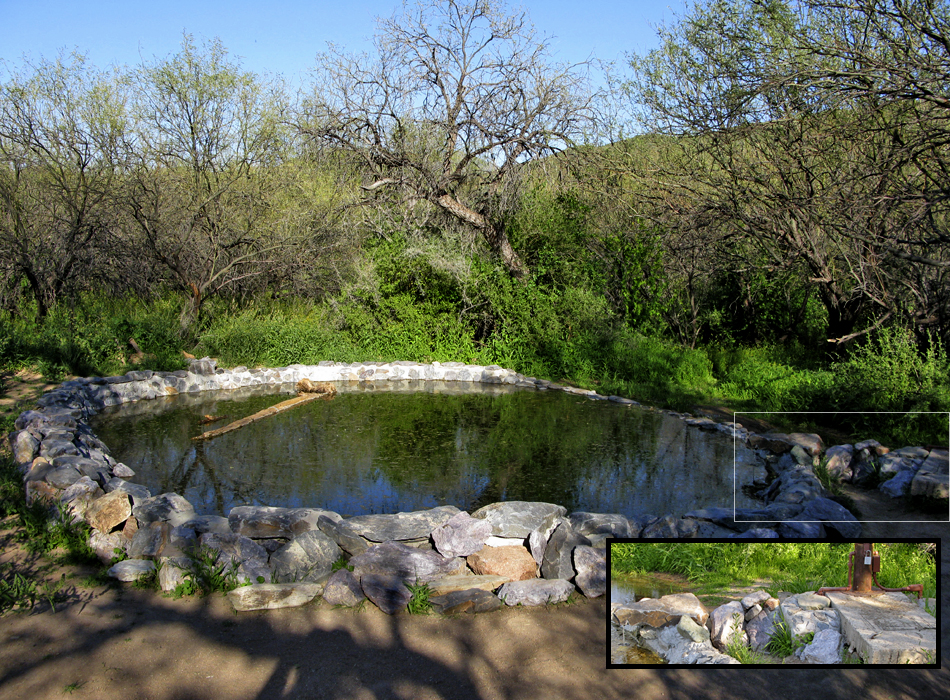
The exquisite mesquite kingdom is short-lived. Soon you cross Cave Creek. On the flip side, the flora surrounding closes inward and up. Wild cucumber thrives through the bushes, trees and cacti in early spring. You pass the Towhee Trail junctions twice as it is a short spur trail that hugs Cave Creek.

Soon after the second Towhee Trail junction, the intense trail-lined flora gives to wider views. Here you pass several old cement foundations of yesteryear. In the spring owl clover blankets the meadows with backdrops of saguaros against Sugarloaf Mountain.

It should be noted that the entire area flaunts "Do Not Enter" signs often. You're pretty much confined to the trail. There is one section lacking the signage that leads to a human-made pond. It's almost heartbreaking to see the electric conduit feeding the electric pump. Nevertheless, I'm sure it's appreciated by the local fauna.

The trail ends soon at the southwest junction with Spur Cross Trail.

2008-03-21 joebartels
  • 2022 Map
    area related
    2022 Map
  • map
    area related


Check out the Official Route and Triplogs.
Leave No Trace and +Add a Triplog after your hike to support this local community.

One-Way Notice
This hike is listed as One-Way.

When hiking several trails on a single "hike", log it with a generic name that describes the hike. Then link the trails traveled, check out the example.
WARNING! Hiking and outdoor related sports can be dangerous. Be responsible and prepare for the trip. Study the area you are entering and plan accordingly. Dress for the current and unexpected weather changes. Take plenty of water. Never go alone. Make an itinerary with your plan(s), route(s), destination(s) and expected return time. Give your itinerary to trusted family and/or friends.

 Permit $$
Spur Cross Conservation Area $3 per person


 Directions
or
 Road
FR / Dirt Road / Gravel - Car Okay

To Spur Cross Trailhead
I-17 North & Exit 233, which is SR-74 the Carefree Highway. Head east on Carefree Highway 9.9 miles to Cave Creek Road. Head North on Cave Creek Road 2.6 miles to Spur Cross Ranch Road. The road jogs a bit here but you go 4.0 miles to the parking lot.

It is a well-graded dirt road. As it nears the parking area, the road leads past a large green house, through a tall gatepost and past a corral. There is a large signed parking area. Along the road about 75 yards northeast of the parking area, there is a self-pay station and a small informational kiosk with rudimentary maps. Pay the fee and carry the stub with you.

From PHX (I-10 & AZ-51) 35.8 mi - about 57 mins
From TUC (Jct 1-10 & Grant) 144 mi - about 2 hours 26 mins
From FLG (Jct I-17 & I-40) 133 mi - about 2 hours 10 mins
 90+° 8am - 6pm kills
helpcorrectionissue

end of page marker