 Route Editor

| Guide | ♦ | 10 Triplogs | 0 Topics |
details | drive | permit | forecast | 🔥 route |
stats |
photos | triplogs | topics | location |
| 63 | 10 | 0 |
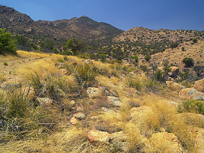
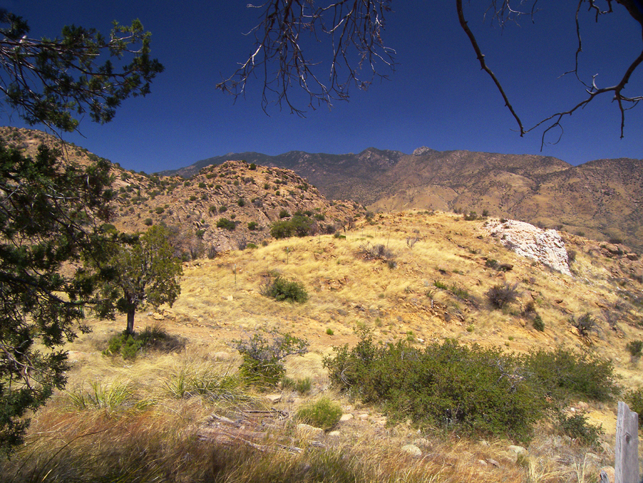
set sail for the Cove by PrestonSands   Overview OverviewThis hike up Cove Canyon follows an old jeep trail into the southern half of the Pinaleno Mountains (also known as the Greasewoods). Cove Spring, located in a high, hidden valley below bouldered peaks, is this hike's destination. This old trail does not have a name or number, yet it follows Cove Canyon, hence the name "Cove Canyon Trail". Whether day hiking or backpacking, Cove Canyon's scenic, hidden valley offers a secluded destination. Hike The hike begins on the south side of state highway 266, where an unmarked jeep trail meets the highway, at milepost 111.5 (trailhead GPS coordinates: 32.55986 N, 109.78652 W). Proceed to follow this jeep trail, which heads west for a short distance, paralleling the highway. The jeep trail soon makes a sharp turn to the south to start climbing a grassy mountainside.
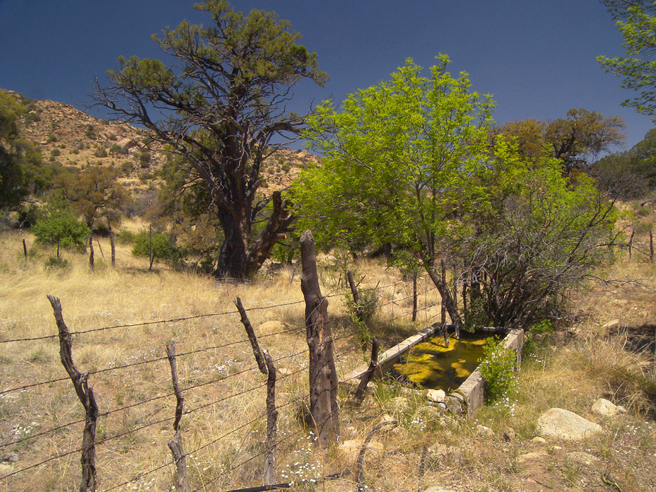
The trail reaches a high saddle at one and a quarter miles, near a large outcropping of milky white quartz. At this point you will cross through a green metal gate, and enter Cove Canyon's hidden valley. One-tenth of a mile past the gate, a side trail branches off to the left; stay right on the increasingly primitive jeep trail. As the hike progresses through the valley, granite boulders and shady oaks increase in number. There are ample opportunities for primitive, dispersed camping throughout the area. The rough, boulder-clad promontories of Kane Spring Mountain keep watch above, hemming the valley in on three sides. As the trail continues west, it climbs over a low saddle, which offers a nice view out the mouth of the valley. Now west of the saddle, in the western half of the hidden valley, the jeep trail deteriorates into a faint ATV trail. At this point, which is about 1.9 miles from the trailhead, there is a large meadow to the right, behind an opening in a barbed-wire fence. A couple of hundred feet past the opening in the fence, the main trail bends to the left (32.55007 N, 109.80676 W), while a faint side trail goes straight ahead towards a creek bottom. Follow this side trail for a short distance. After crossing over a side creek, it will arrive at Cove Creek, where Cove Spring (32.54981 N, 109.80757 W) is located. The Cove Spring area consists of a few ash trees, a small campsite, and a concrete water trough, which looks like it might hold water year-round. The water should be filtered and purified before drinking. Check with the Safford Ranger District Office for water availability. Back at the side trail junction, the main trail heads south up a side drainage, and soon peters out among the trees. Return the way you came. Gate Policy: If a gate is closed upon arrival, leave it closed after you go through. If it is open, leave it open. Leaving a closed gate open may put cattle in danger. Closing an open gate may cut them off from water. Please be respectful, leave gates as found. The exception is signage on the gate directing you otherwise. Check out the Official Route and Triplogs. Leave No Trace and +Add a Triplog after your hike to support this local community. | ||||||||||||||||||||||||||||||||||||||||||||||||||||||||||||||||||||||||||||||||||||||||||||||||||


