Route Editor

| Guide | ♦ | 9 Triplogs | 0 Topics |
details | drive | permit | forecast | map |
stats |
photos | triplogs | topics | location |
| 45 | 9 | 0 |
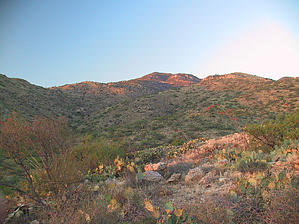
...But Rincon Peak is right there!! by Jeffshadows   Overview: You won't find the Aliso Spring trail on the Rincon Peak topo or other newer recreation maps of the area; I assure you, however, it's still there. The spring itself has been outfitted with a cistern, large steel holding tank, and windmill pump. It was presumably built to provide year-round water to livestock that once grazed the area, before it became part of the Wilderness. The trail appears on the 6th edition of "Rincon Mountains, AZ: A Trail and Recreation Map" published by Rainbow Expeditions, Inc. The course described by this map is still completely accurate, although the trail is now overgrown and does not receive maintenance. The trail appears to see its most use by equestrians. It starts out at Papago Springs as a jeep trail and eventually becomes rocky and narrow as it winds its way down to Aliso Spring, roughly 2.8 miles away and into the Rincon Mountain Wilderness. To reach the the initiation point for the Aliso trail, one must first negotiate the Papago Springs Trail (A continuation of FSR 3541). Hiking the Papago Springs trail will add 3 miles (round trip) to the hike. Overview: You won't find the Aliso Spring trail on the Rincon Peak topo or other newer recreation maps of the area; I assure you, however, it's still there. The spring itself has been outfitted with a cistern, large steel holding tank, and windmill pump. It was presumably built to provide year-round water to livestock that once grazed the area, before it became part of the Wilderness. The trail appears on the 6th edition of "Rincon Mountains, AZ: A Trail and Recreation Map" published by Rainbow Expeditions, Inc. The course described by this map is still completely accurate, although the trail is now overgrown and does not receive maintenance. The trail appears to see its most use by equestrians. It starts out at Papago Springs as a jeep trail and eventually becomes rocky and narrow as it winds its way down to Aliso Spring, roughly 2.8 miles away and into the Rincon Mountain Wilderness. To reach the the initiation point for the Aliso trail, one must first negotiate the Papago Springs Trail (A continuation of FSR 3541). Hiking the Papago Springs trail will add 3 miles (round trip) to the hike.Hike: A vehicle barrier stands in the middle of the jeep trail that is the end of the Papago Springs trail at Papago Springs, just near the large metal tank. The trail beyond this vehicle barrier is the Aliso Spring trail. Just after leaving the mesquite bosque at Papago, the trail begins to climb with a sharp grade. This climb persists for roughly three-fifths of a mile and the trail seems to be trying to reach the summit of the unnamed peak it is climbing towards. After three-fifths of a mile, the trail is flanked by "Wilderness Boundary" markers, take roughly five steps beyond these markers and look left (east) as the trail breaks away from the larger Jeep trail that continues up the unnamed peak. Turn onto the overgrown foot trail to the left; do not follow the more defined Jeep trail that continues towards the peak.
After climbing over the rock pile that marks this highpoint on the ridge, the trail drops onto a little grassy meadow. The fence appears to curve in slightly, and Shaw Canyon to the East will now be closer to the trail than it has yet been, up until this point. Immediately begin to look for a sandy trail that makes a fork with the trail the continues up the ridge. The sandy trail is the continuation of the Aliso Spring trail, and the ridge trail continues on following the entire course of the fence, presumably for maintenance. Do not continue up the ridge, instead turn right (east) onto the sandy trail which quickly becomes rocky, as before. The trail climbs over a small hill and Aliso Spring becomes visible in the canyon bottom. After passing the hill, the trail begins to descend steeply into Shaw Canyon and approaches Aliso Spring. The trail passes by two horizontal tanks before arriving at a large, heavily-weathered steel tank. The Aliso Spring concrete cistern is situated just to the rear of this tank. A functioning windmill sits just up-canyon from the cistern. By following the canyon for roughly a quarter-mile, a set of scenic waterfalls can be reached. Return by the same route to Papago Springs. Gate Policy: If a gate is closed upon arrival, leave it closed after you go through. If it is open, leave it open. Leaving a closed gate open may put cattle in danger. Closing an open gate may cut them off from water. Please be respectful, leave gates as found. The exception is signage on the gate directing you otherwise.
Check out the Triplogs. Leave No Trace and +Add a Triplog after your hike to support this local community. | ||||||||||||||||||||||||||||||||||||||||||||||||||||||||||||||||||||||||||||||||||||||||||||||