username
X
password
register
for free!
help
 This is likely a great time to hike this trail!  Check out "Preferred" months below, keep in mind this is an estimate.
  🔥

Los Caballos Trail #638, AZ

Guide 4 Triplogs  0 Topics
  3 of 5  
Fav
Wish
0
details
drive
no permit
forecast
🔥
route  
stats
photos
triplogs
topics
location
16 4 0
Statistics
tap row or icons for details
Difficulty 1.5 of 5
Distance Round Trip 16 miles
Trailhead Elevation 6,348 feet
Elevation Gain 555 feet
Accumulated Gain 1,650 feet
Kokopelli Seeds 24.25
feature photo
Photos Viewed All MineFollowing
2  2018-09-25 larbrad
12  2015-09-23 topohiker
2  2013-09-08 TrekSafari
Author
author avatar Guides 7
Routes 24
Photos 16
Trips 14 map ( 58 miles )
Age Male Gender
Location SunCity,AZ
Associated Areas
list map done
Payson Region
Historical Weather
Trailhead Forecast
Radar Map
Expand Map
Preferred Oct, May, Apr, Sep → 8 AM
Sun  5:56am - 6:43pm
Official Route & 2 Rts
 
0 Alternative
 
Historic Fire Perimetersacres
🔥 2019 Bagnal Fire2.2k
🔥 2002 Rodeo-Chediski Fire233.5 mi**
🔥 View (All) - over Official Route 🔥
*perimeter length in miles
**possible voids inflate figure


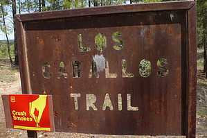
grab the reins of the old west
by TrekSafari

 Likely In-Season!
The entire trail is a loop about 16 miles long. But it can be done in segments. From the west trailhead, I have walked along the north leg and also along the east leg.


The trail is generally along tall Ponderosa pine trees. In some areas, fire has eliminated the trees and their shade. On the north leg, I recommend parking a vehicle at the east trailhead and starting the hike where the trail crosses Joe Tank gravel road.
remove free decal offer
Walking along Joe Tank Road is okay, with very little traffic; but often not much shade.

This trail may not be comfortable to walk in the heat of July. During the early fall months, it may rain daily, especially in the late afternoon; the rain can be accompanied by thunder and lightning.

2013-09-10 TrekSafari


    Check out the Official Route and Triplogs.
    Leave No Trace and +Add a Triplog after your hike to support this local community.
    WARNING! Hiking and outdoor related sports can be dangerous. Be responsible and prepare for the trip. Study the area you are entering and plan accordingly. Dress for the current and unexpected weather changes. Take plenty of water. Never go alone. Make an itinerary with your plan(s), route(s), destination(s) and expected return time. Give your itinerary to trusted family and/or friends.

     Permit $$
    None


     Directions
    or
     Road
    FR / Dirt Road / Gravel - Car Okay

    To hike
    West Trailhead
    From Show Low drive about four miles west on AZ-260 to Joe Tank Road. The first section of this road is paved; then it becomes gravel. Drive one mile to the trailhead.

    East Trailhead
    From downtown Show Low, drive two miles west. Turn right on State Highway 260 towards Payson/Heber. Drive 2.9 miles. After crossing Bagnal Draw, turn left onto Forest Road 136. Forest Road 136 is not marked. Drive 0.6 miles to the trailhead on the right.
    page created by joebartels on Sep 10 2013 10:44 am
     90+° 8am - 6pm kills
    helpcorrectionissue

    end of page marker